October Opposites
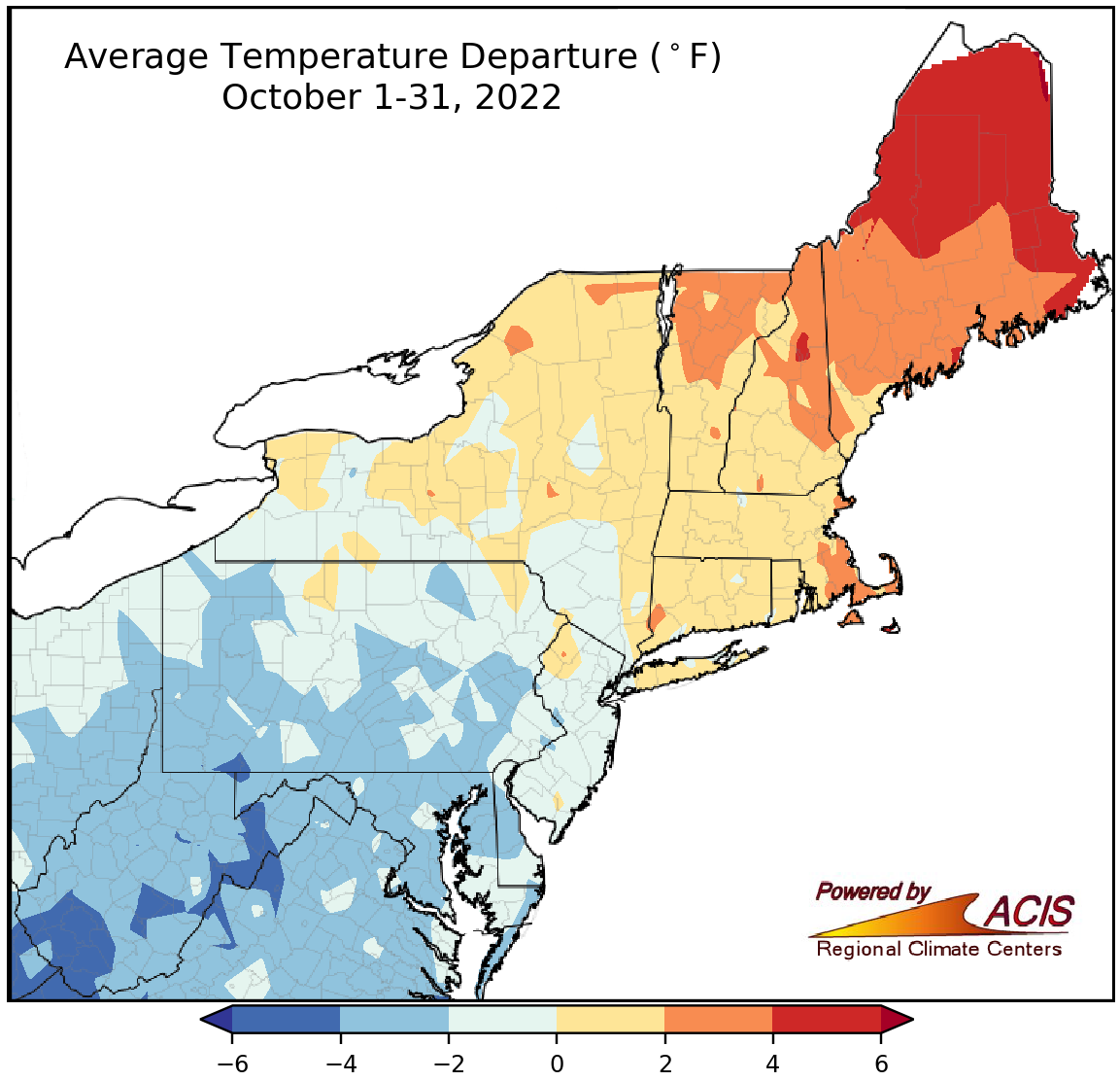
October temperatures ranged from more than 4°F below normal to more than 4°F above normal.
There were a wide range of temperatures in the Northeast during October, spanning from more than 4°F below normal in West Virginia to more than 4°F above normal in Maine. Generally, Pennsylvania and areas south were cooler than normal, New England was warmer than normal, and New York saw a mix of below- and above-normal temperatures. October average temperatures at the 35 major climate sites ranged from 4.0°F below normal in Elkins, WV, to 4.8°F above normal in Caribou, ME, with 22 of the sites seeing below-normal temperatures. This October ranked as Charleston, WV’s 12th coolest but was among the 20 warmest for four other sites.
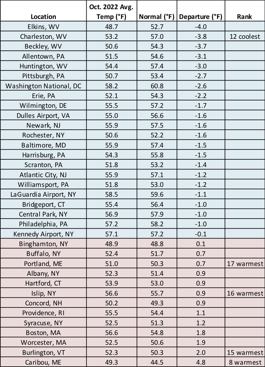
This October was Charleston, WV’s 12th coolest but ranked among the 20 warmest for four other sites.
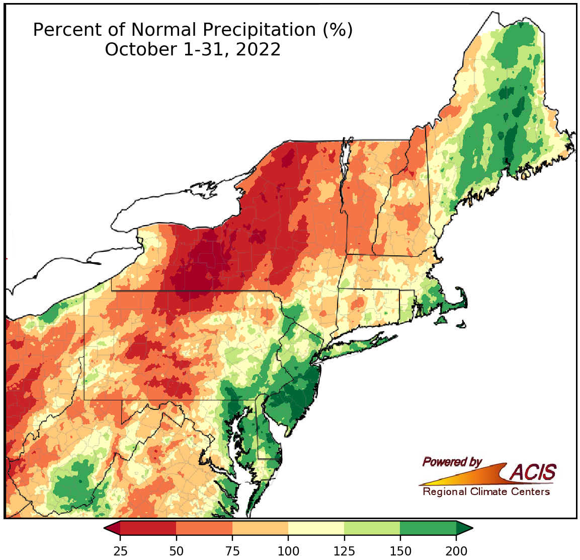
October precipitation ranged from less than 25% of normal to more than 200% of normal.
Similar to temperatures, October precipitation varied widely, ranging from less than 25% of normal in areas such as central New York to more than 200% of normal in areas such as central and southern New Jersey. Generally, interior locations tended to be drier than normal, while areas closer to the coast tended to be wetter than normal. October precipitation at the major climate sites ranged from 28% of normal in Syracuse, NY, to 188% of normal in Atlantic City, NJ, with the sites nearly split between below normal and above normal. This October ranked among the 20 driest on record for four sites but among the 20 wettest for nine sites. During October, drought and abnormal dryness eased or contracted in many parts of the Northeast, particularly New England. However, abnormal dryness expanded or was introduced in drier areas such as central/northern New York and southwestern West Virginia.
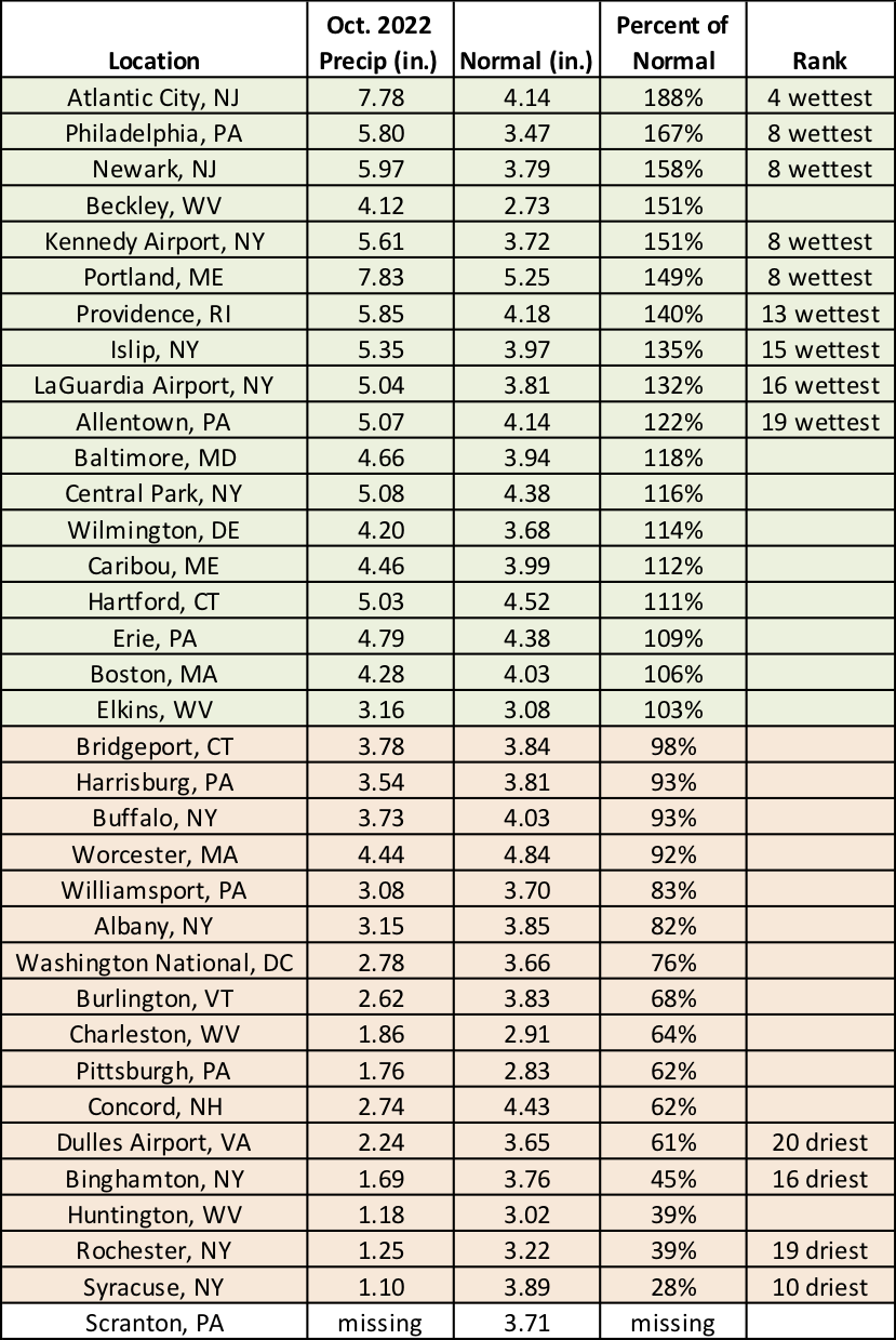
October 2022 ranked among the 20 driest on record for four sites but among the 20 wettest for nine sites.
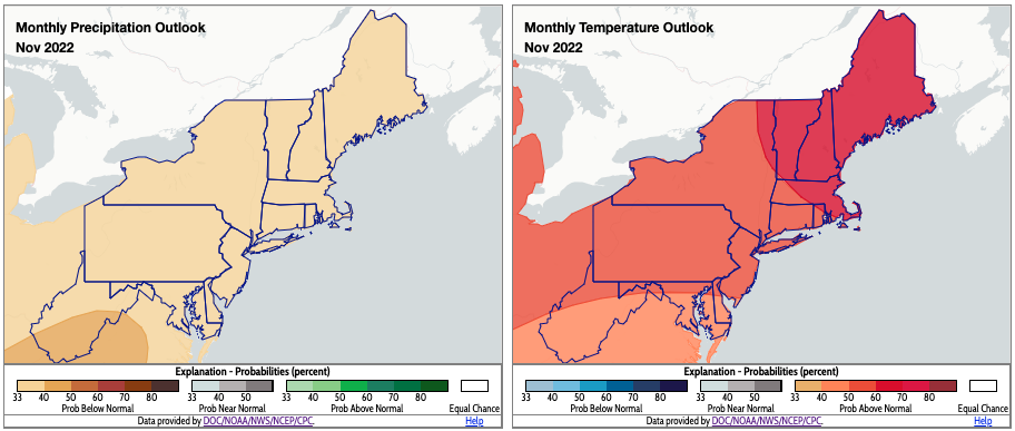
There is a tilt toward below-normal precipitation and above-normal temperatures for November in the Northeast. Click to enlarge.
NOAA’s Climate Prediction Center favors a drier-than-normal and warmer-than-normal November for the entire Northeast. An elongated area of high pressure, called a ridge, is expected to set up over the eastern U.S., which could usher warmer air into the Northeast and limit the number of storms moving through the region. In addition, climate trends and warmer-than-normal sea surface temperatures further increase the likelihood of above-normal temperatures in New England.