Mid-April Showers
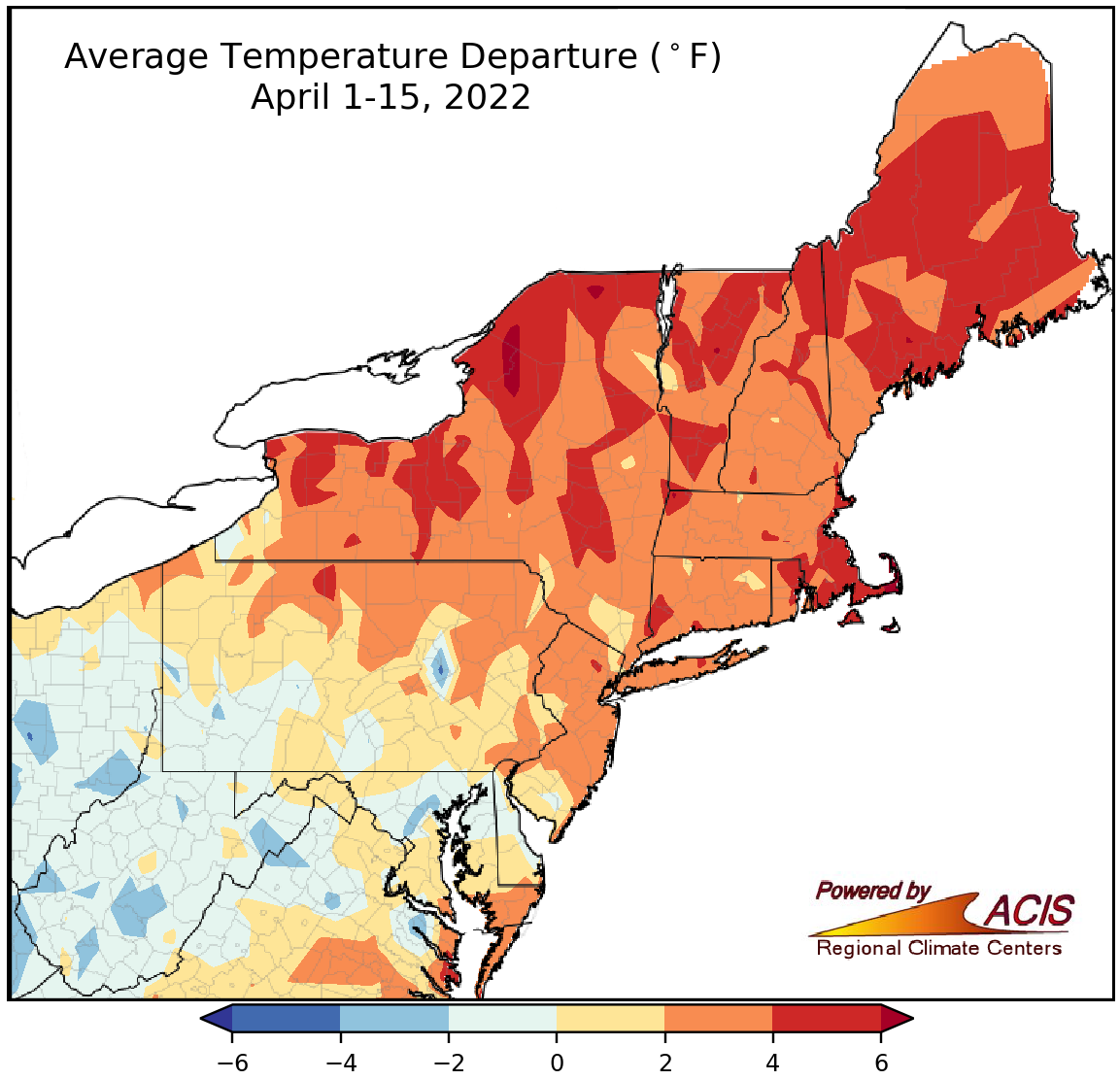
April 1-15 average temperatures ranged from 4°F below normal to 6°F above normal.
Average temperatures during the first half of April ranged from 4°F colder than normal in parts of West Virginia and Maryland to 6°F warmer than normal in parts of New York and New England, with a majority of the Northeast on the warm side of normal. Thirty of the 35 major climate sites were warmer than normal during the April 1-15 period, with average temperatures for all sites ranging from 2.5°F below normal in Charleston, WV, to 4.6°F above normal in Providence, RI. This first half of April ranked among the 20 warmest on record for 23 of the sites.
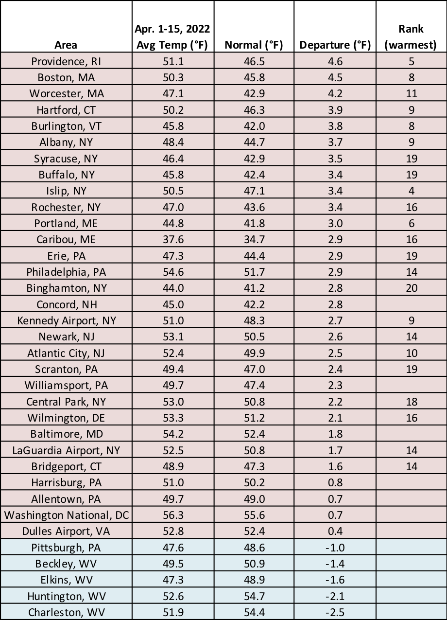
This first half of April ranked among the 20 warmest on record for 23 major climate sites.
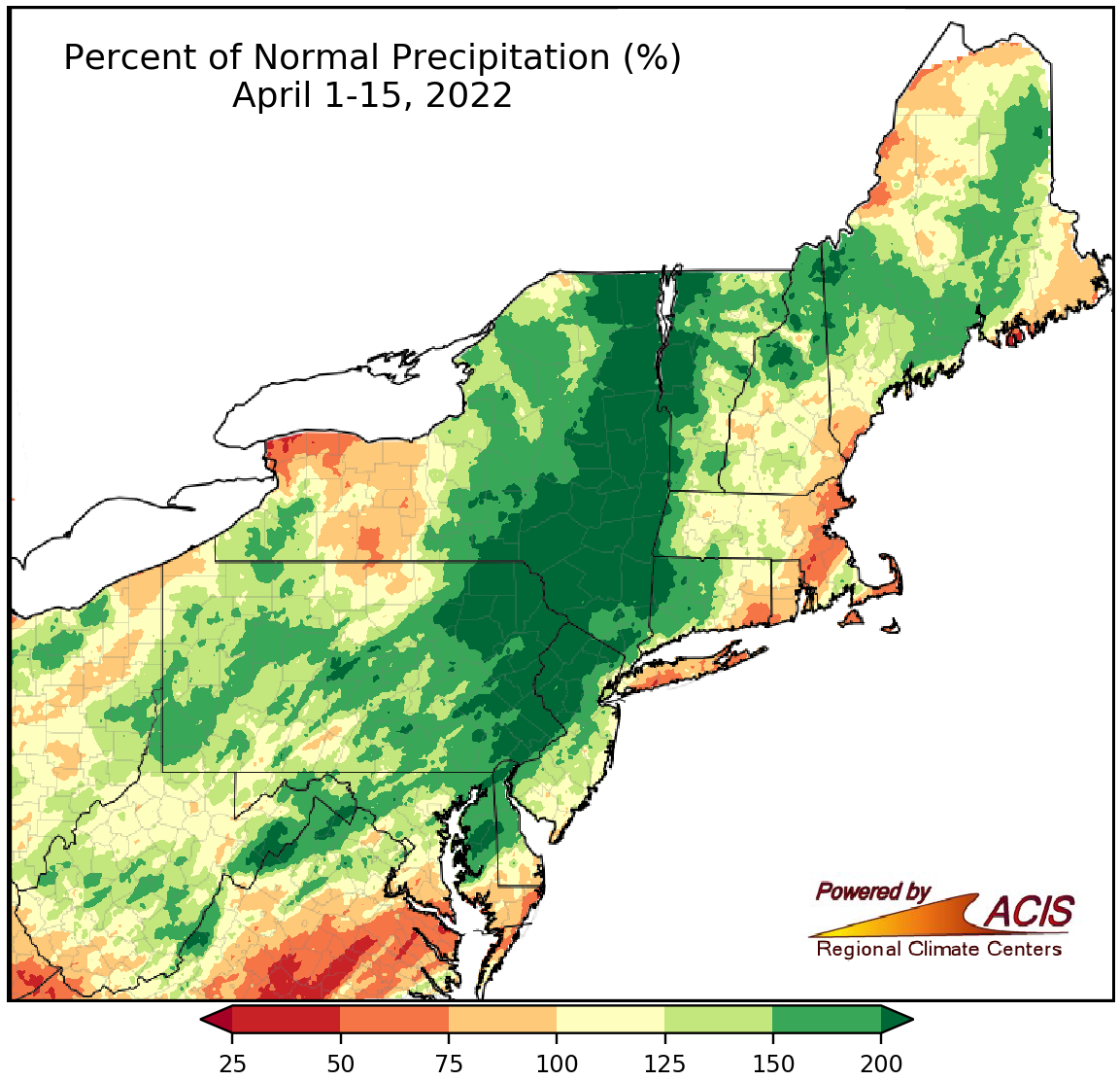
Precipitation during the first two weeks of April ranged from 50% of normal to more than 200% of normal.
April 1-15 precipitation ranged from 50% of normal in areas such as western New York and coastal southern New England to more than 200% of normal in places such as eastern Pennsylvania, northwestern New Jersey, eastern New York, and northwestern Vermont, with a large portion of the Northeast being wetter than normal. During the April 1-15 period, 22 of the 35 major climate sites were wetter than normal, with precipitation for all sites ranging from 53% of normal in Buffalo, NY, to 225% normal in Scranton, PA. These first two weeks of April ranked among the 20 wettest on record for 10 of the sites but as Islip, NY’s 16th driest. The above-normal precipitation helped alleviate pockets of drought and abnormal dryness in southern parts of the region.
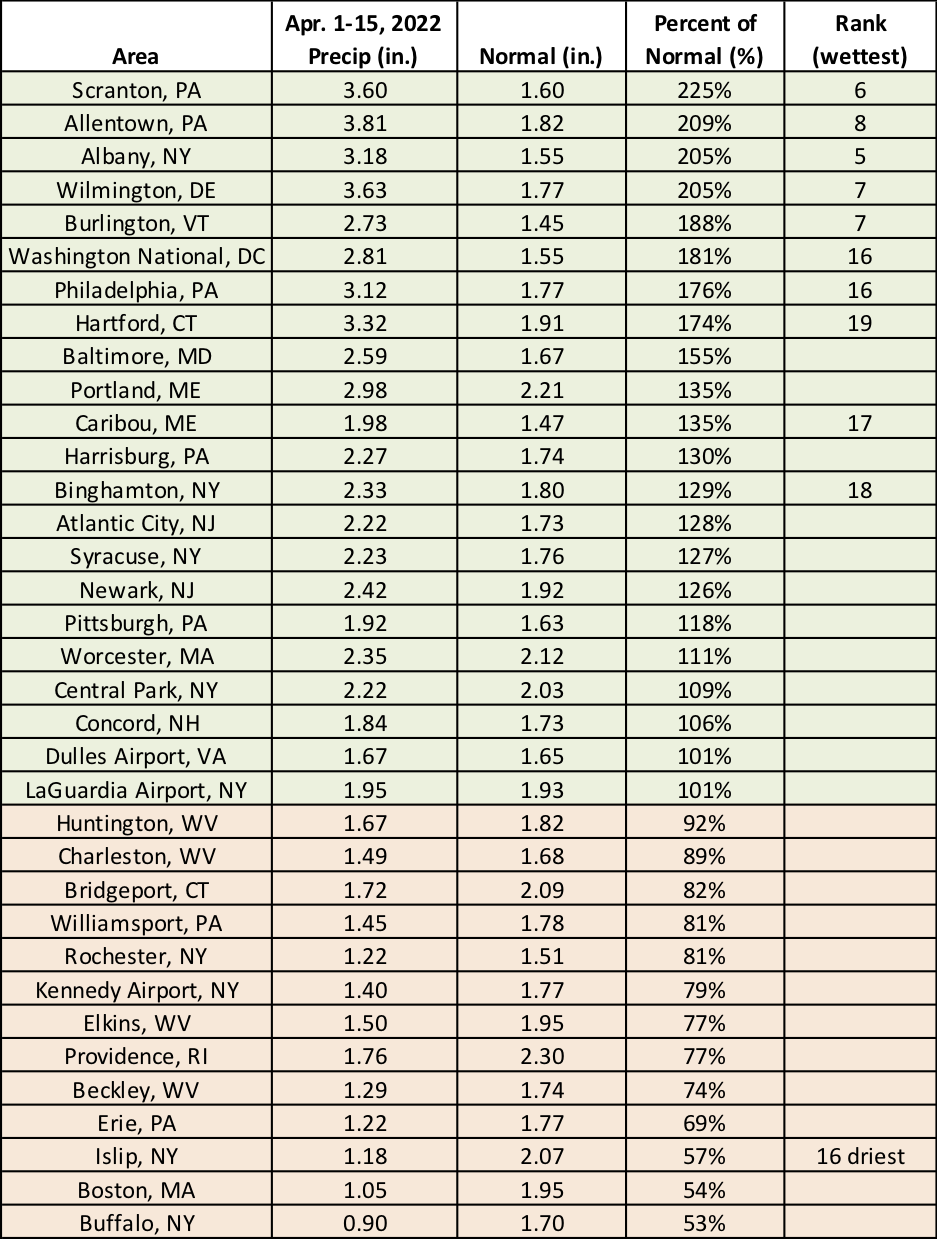
These first two weeks of April ranked among the 20 wettest on record for 10 major climate sites but as Islip, NY’s 16th driest.
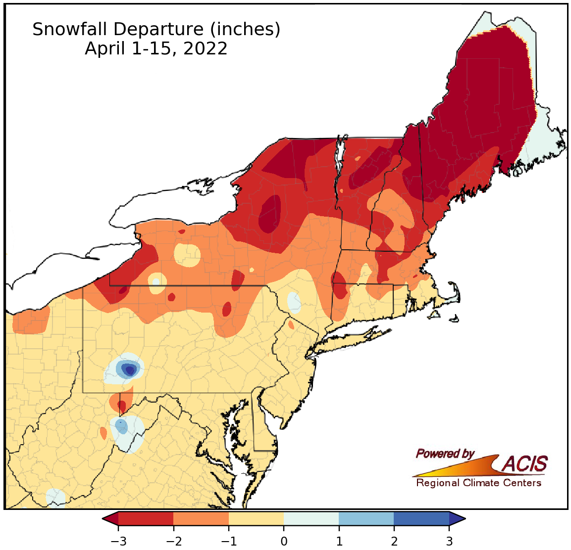
Snowfall from April 1-15 generally ranged from more than 3 inches below normal to near normal.
The first half of April featured little, if any, snowfall for much of the Northeast, with the largest deficits of at least three inches in parts of northern New York and northern New England. April 1-15 snowfall at the 35 major climate sites ranged 4.8 inches below normal in Caribou, ME, to normal in Baltimore, MD, and Washington, D.C. This April 1-15 period ranked among the 17 least snowy on record for Caribou, ME, and Binghamton, NY. However, a late-season nor’easter is expected to bring snow to mostly interior parts of the Northeast Monday and Tuesday (April 18 and 19), potentially shifting some areas to the snowier side of normal.
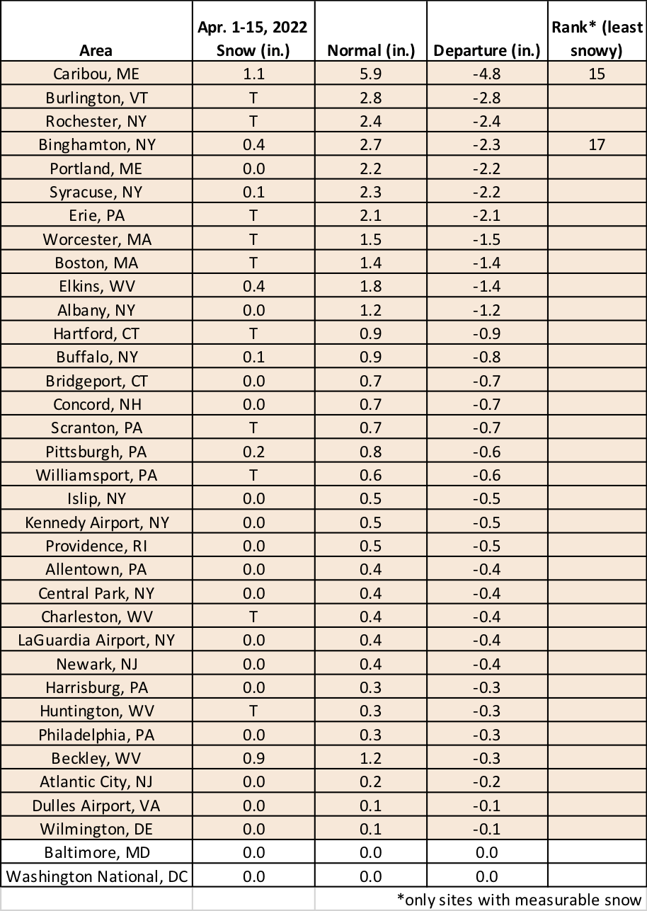
This April 1-15 period ranked among the 17 least snowy on record for Caribou, ME, and Binghamton, NY.