An Assortment of Conditions in April
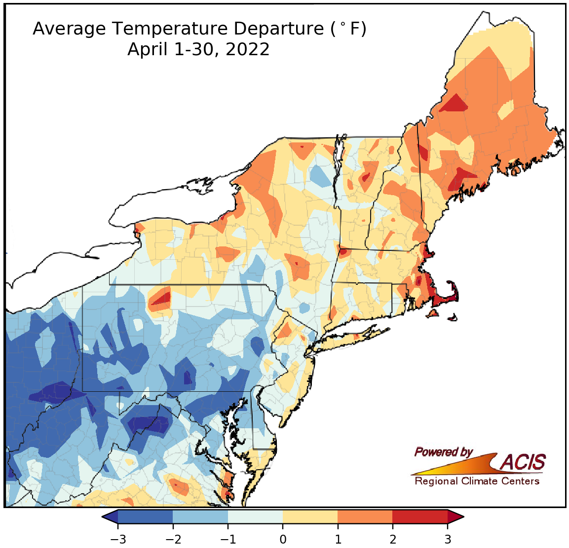
April average temperatures ranged from more than 3°F below normal to 3°F above normal.
April temperatures ranged from more than 3°F colder than normal in parts of West Virginia to 3°F above normal in parts of Maine and Massachusetts. The dividing line between below and above normal generally ran near the Pennsylvania-New York border, with areas to the south being cooler than normal and areas to the north being warmer than normal. April average temperatures at the Northeast’s 35 major climate sites ranged from 2.7°F below normal in Charleston, WV, to 1.5°F above normal in Boston, MA. Overall, 24 of the sites were colder than normal; however, three sites experienced one of their 20 warmest Aprils on record.
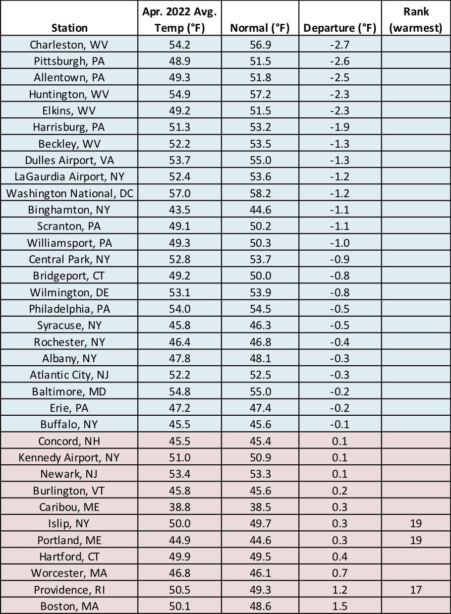
While 24 of the major climate sites were colder than normal, three sites had one of their 20 warmest Aprils on record.
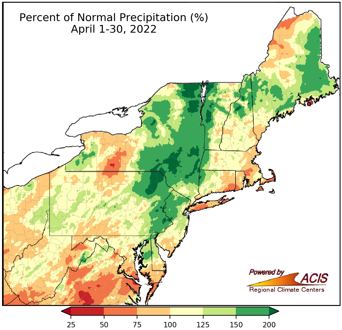
April precipitation ranged from 50% of normal to more than 200% of normal.
April precipitation varied, ranging from 50% of normal in locations such as southern West Virginia, Long Island, and Cape Cod to more than 200% of normal in areas such as northeastern Pennsylvania, eastern New York, and western Vermont. April precipitation at the 35 major climate sites ranged from 61% of normal in Islip, NY, to 189% of normal in Scranton, PA, with 17 sites being drier than normal and 18 being wetter than normal. This April ranked among the 20 driest on record for two sites and among the 20 wettest for seven sites. In some areas, the above-normal precipitation chipped away at drought and abnormally dry conditions.
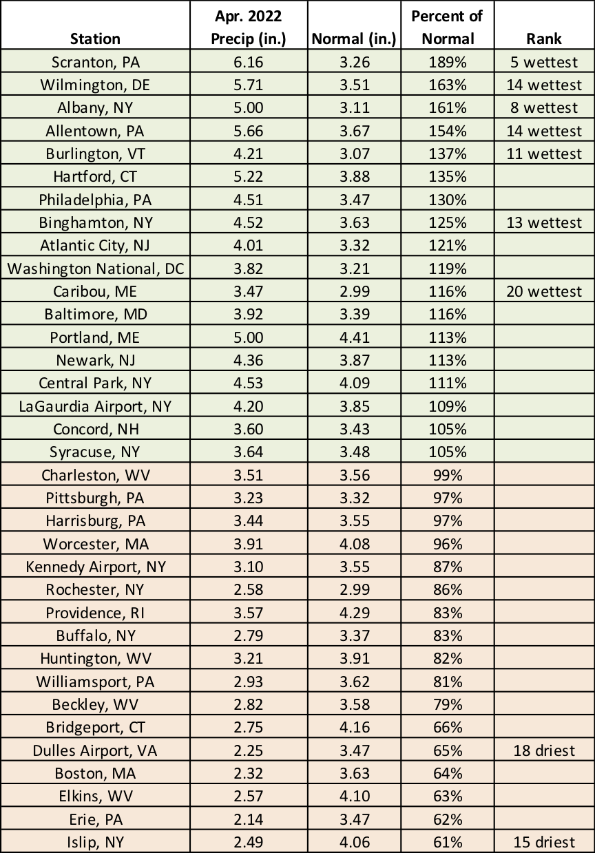
This April ranked among the 20 driest on record for two sites and among the 20 wettest for seven sites.
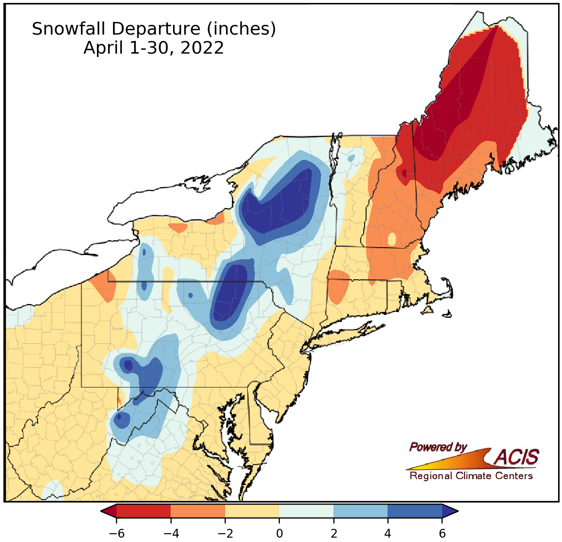
April snowfall ranged from more than 6 inches below normal to more than 6 inches above normal.
April snowfall also varied, ranging from more than 6 inches below normal in western Maine to more than 6 inches above normal in northeastern Pennsylvania and central/northern New York. April snowfall at the 35 major climate sites ranged from 4.2 inches below normal in Caribou, ME, to 11.2 inches above normal in Binghamton, NY, with 28 sites seeing below-normal snowfall. This April ranked among the 15 snowiest on record for Binghamton, NY, and Williamsport, PA.
Much of the snowfall surplus came from an April 18-19 storm that dropped 12 to 18 inches of snow on parts of central/northern New York and northeastern Pennsylvania. Binghamton, NY, accumulated snow at a rate of 3 inches per hour and recorded its greatest two-day snowfall for April with 14.6 inches of snow. The site reported 11.4 inches of snow on April 19, its third snowiest April day and its latest occurrence of a daily snowfall of at least 11 inches. The heavy, wet snow brought down trees and wires, blocking roads and knocking out power.
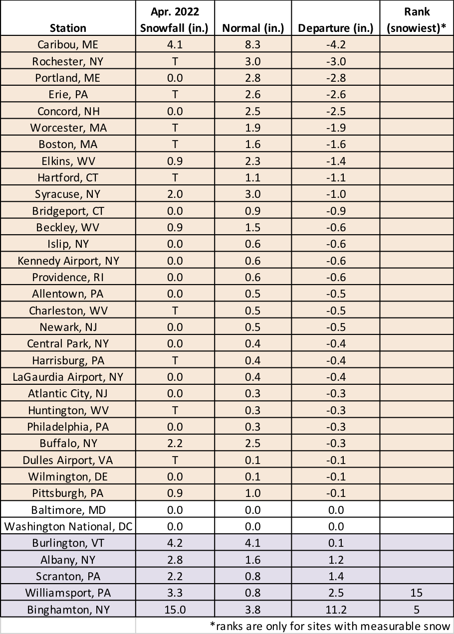
While 28 of the major climate sites saw below-normal April snowfall, two sites had one of their 15 snowiest Aprils.
NOAA’s Climate Prediction Center favors a cooler-than-normal May for northern Maine but favors a warmer-than-normal May for an area stretching from West Virginia through much of southern New England. Equal chances of below-, near-, or above-normal temperatures were forecast for areas in between. With no clear climate signal for precipitation, the Northeast falls into the equal chances category.
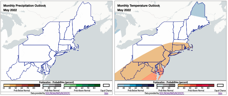
Equal chances of below-, near-, or above-normal precipitation for May were forecast for the Northeast. May is expected to be warmer than normal for areas shaded orange. Click to enlarge.