Summer Swelter
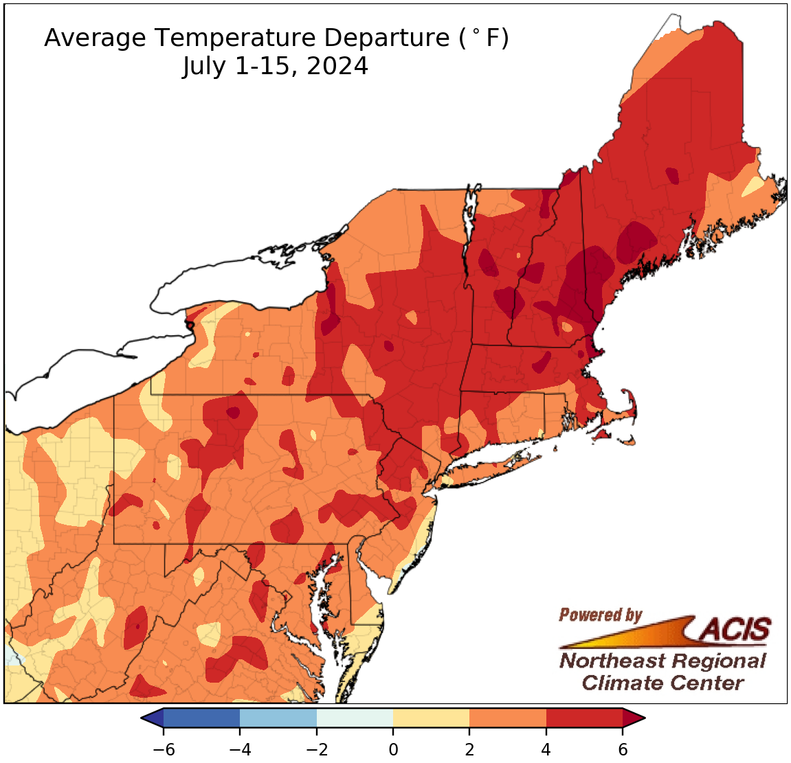
July 1-15 average temperatures ranged from near normal to more than 6°F above normal.
On the heels of an unusually hot June, the Northeast continued to swelter through the first half of July with average temperatures ranging from near normal to more than 6°F above normal. The greatest departures above normal were generally found in parts of New York and New England. July 1-15 average temperatures at the region’s 35 major climate sites ranged from 1.3°F above normal at Kennedy Airport, NY, to 6.7°F above normal in Syracuse, NY. This July 1-15 period was record hot for Hartford, CT; Dulles Airport, VA; and Portland, ME, and ranked among the 20 hottest for another 31 of the sites.
While both daily maximum and minimum temperatures were unusually hot, there have been some notable statistics about the low temperatures. For instance, a handful of sites like Albany, NY; Concord, NH; Allentown, PA; and Wilmington, DE, have seen low temperatures that rank among their 10 all-time hottest on record. Or, another example is that as of July 15, Washington, D.C., had recorded 11 consecutive days with a low at or above 75°F, tying as its third-longest such streak on record.
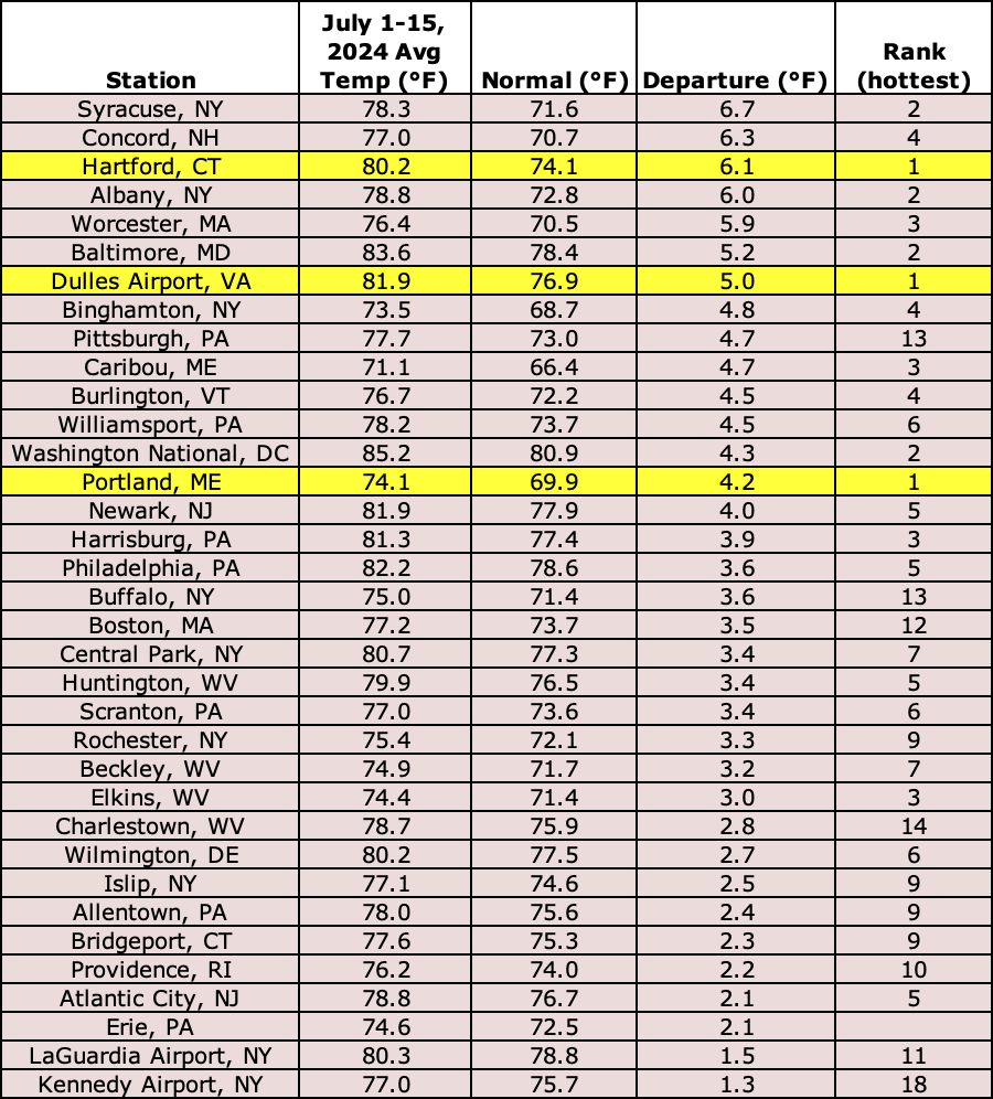
This first half of July was record hot for three major climate sites and among the 20 hottest for another 31 of the sites.
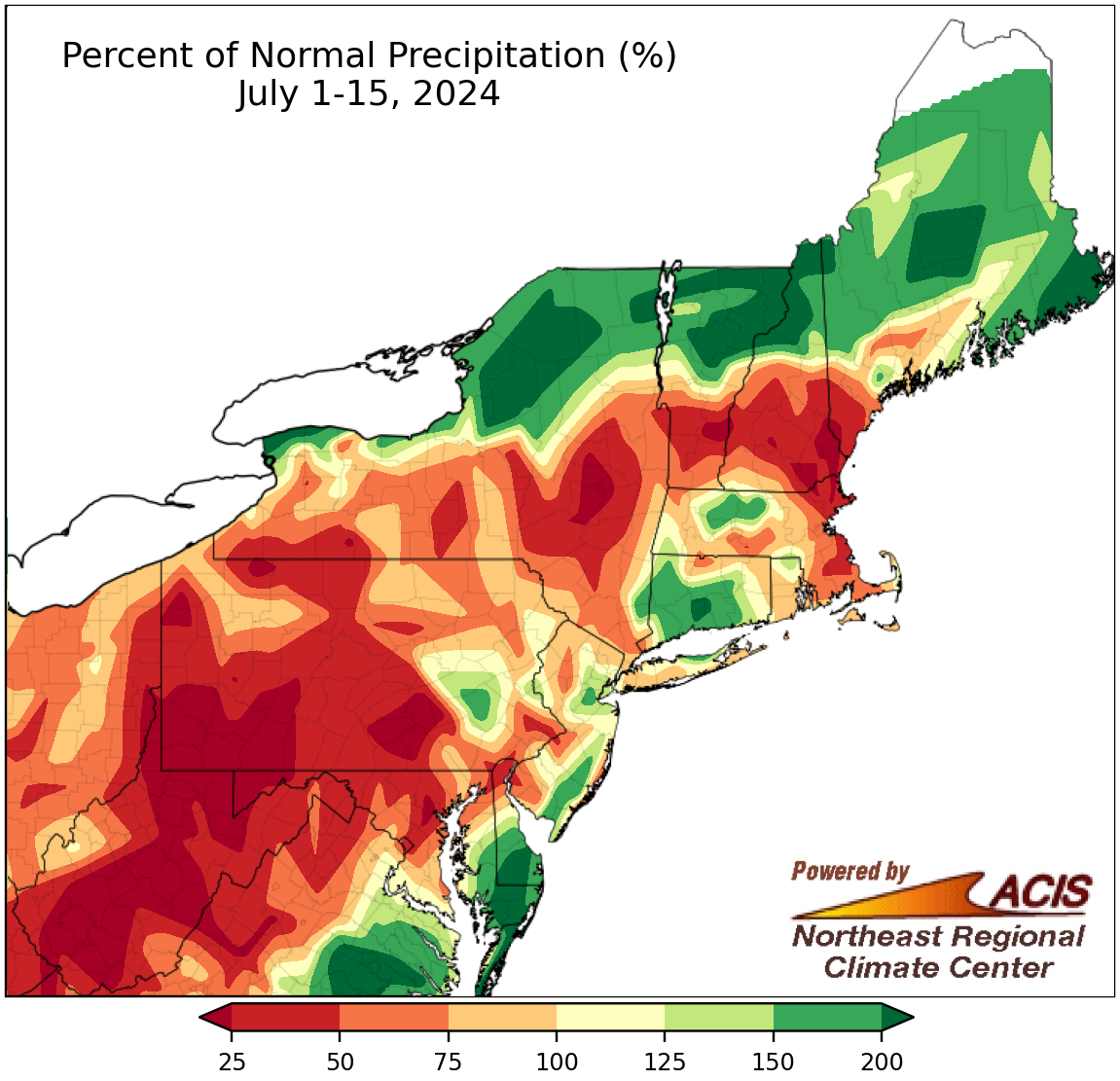
July 1-15 precipitation ranged from less than 25% of normal to more than 200% of normal.
Also like June, there was a wide range of rainfall amounts across the Northeast during the first half of July. The driest locations, including portions of southern Pennsylvania, western Maryland, and West Virginia, saw less than 25% of normal rainfall, contributing to the intensification of drought conditions that have affected crops and water levels. At the other extreme, the wettest locations, including northern New York, northern Vermont, and northern New Hampshire, saw more than 200% of normal rainfall, with intense flash flooding, particularly from the remnants of Hurricane Beryl, causing significant damage. At the Northeast’s 35 major climate sites, July 1-15 precipitation ranged from 0% of normal in Harrisburg, PA, to 204% of normal in Atlantic City, NJ. This first half of July was record dry for Harrisburg and among the 20 driest for five additional major climate sites but ranked among the 20 wettest for four other major climate sites.
The active severe weather pattern of June also carried over into July. This included the remnants of Hurricane Beryl, which produced extreme rainfall that caused significant flash flooding, seven tornadoes in New York, and multiple instances of damaging straight-line winds. The severe weather events will be covered in more detail in our monthly summary which will be released in early August.
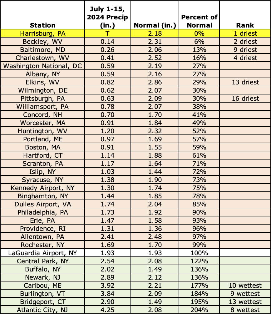
This first half of July was record dry for Harrisburg and among the 20 driest for five additional major climate sites but ranked among the 20 wettest for four other major climate sites.