Another Summer Comes to a Close
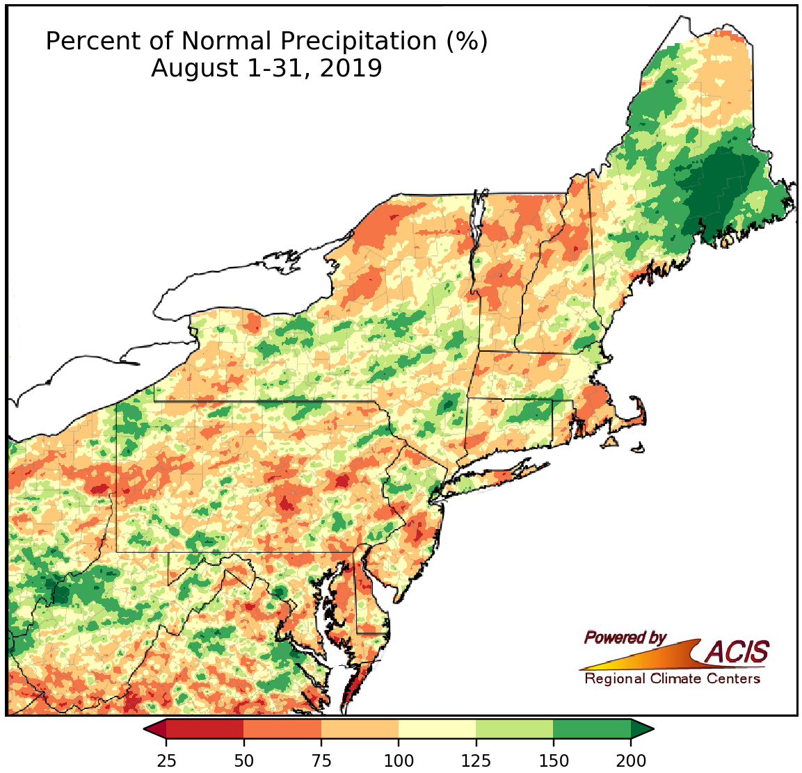
August rainfall ranged from less than 75% of normal to more than 150% of normal.
August precipitation was hit-or-miss, which tends to be the case with summertime convective rainfall. The driest areas saw less than 75% of normal precipitation, while the wettest areas received more than 150% of normal precipitation. The 35 major climate sites were nearly split, with 19 drier-than-normal sites, 15 wetter-than-normal sites, and one site right at normal. Atlantic City, NJ, had its 15th driest August, while the month ranked among the 20 wettest Augusts on record for six sites.
With increasing precipitation deficits during the month, abnormal dryness was introduced and expanded in parts of southern and western Maine, northern and western New Hampshire, northern and southern Vermont, northern and western New York, southwestern Massachusetts, northwestern Connecticut, and southern and western West Virginia.
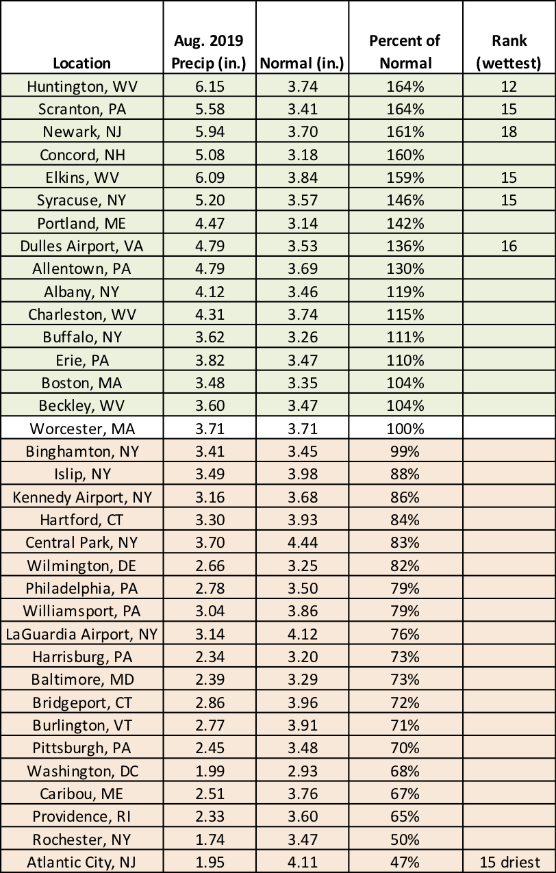
August precipitation at the major climate sites ranged from 47% of normal in Atlantic City, NJ, to 164% of normal in Scranton, PA, and Huntington, WV.
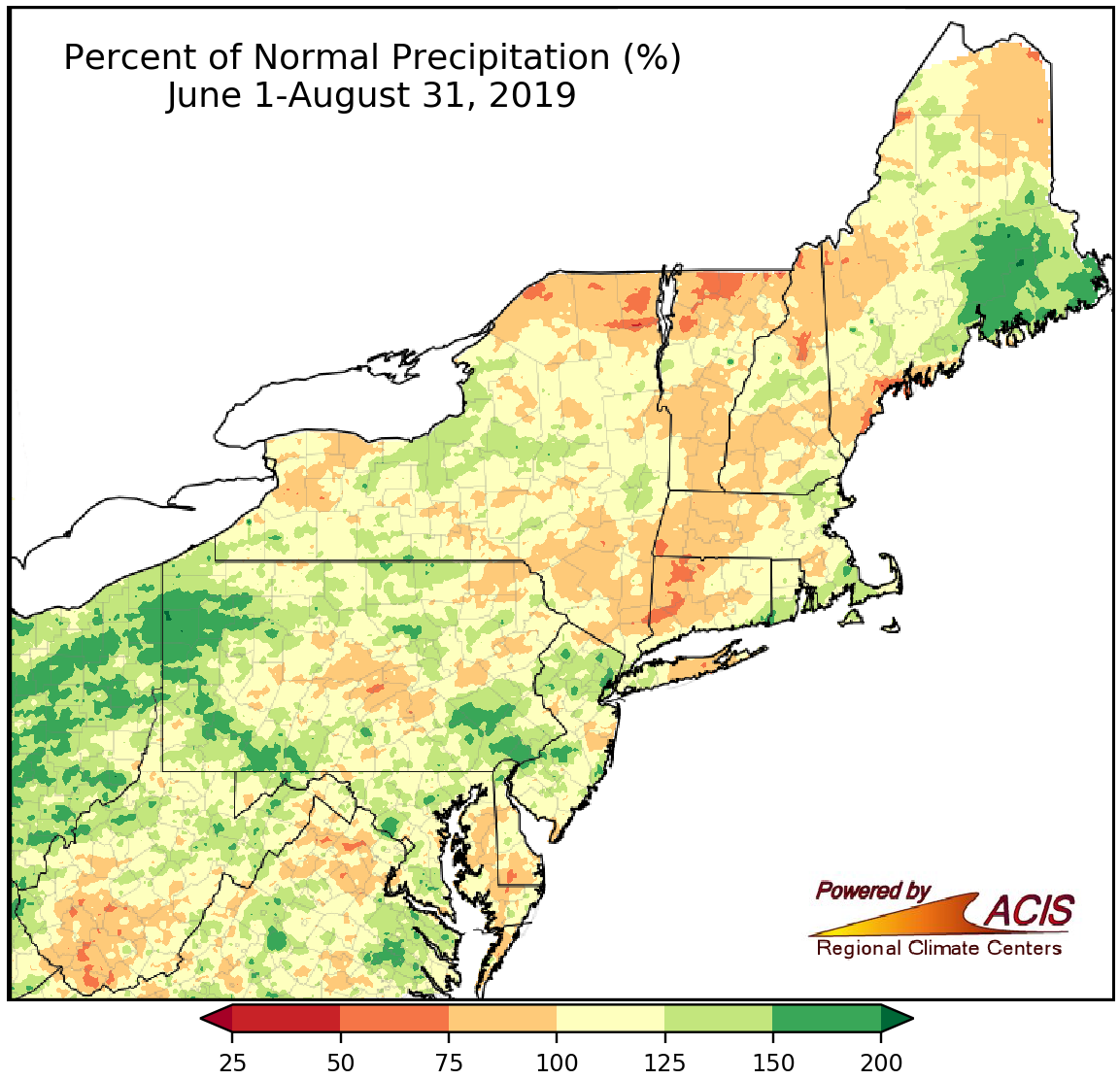
Summer rainfall varied, ranging from less 75% of normal to more than 150% of normal.
Summer precipitation also ranged from less than 75% of normal to more than 150% of normal, with some of the driest areas in northern New York, northern Vermont, and western Connecticut, and some of the wettest areas in Pennsylvania and Downeast Maine. Fourteen major climate sites recorded a drier-than-normal summer, with Caribou, ME, having its fifth driest on record. Conversely, twenty sites were wetter than normal, with eight ranking this summer among their 20 wettest on record.
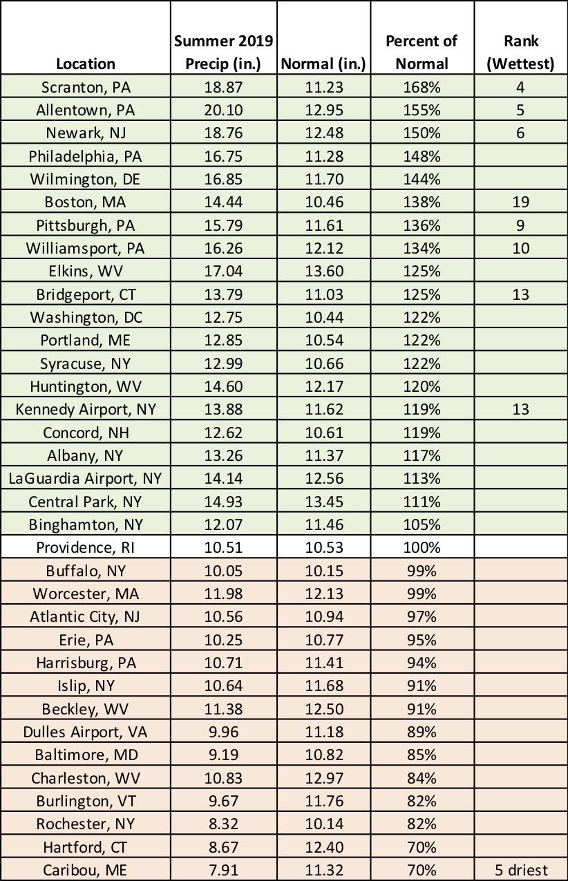
Summer precipitation at the major climate sites ranged from 70% of normal in Caribou, ME, and Hartford, CT, to 168% of normal in Scranton, PA.
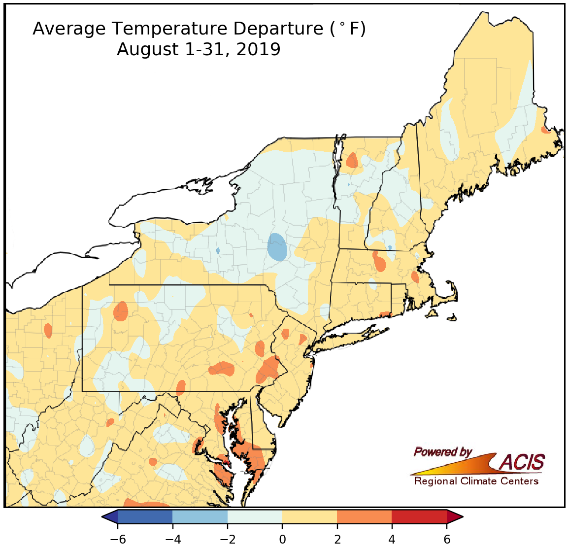
August average temperatures generally ranged from 2°F below normal to 4°F above normal.
August average temperatures were within 2°F of normal for much of the Northeast; however, there were a few warmer areas that were up to 4°F above normal. Thirty-two of the region’s 35 major climate sites experienced a warmer-than-normal August, with ten ranking this August among their 20 warmest on record.
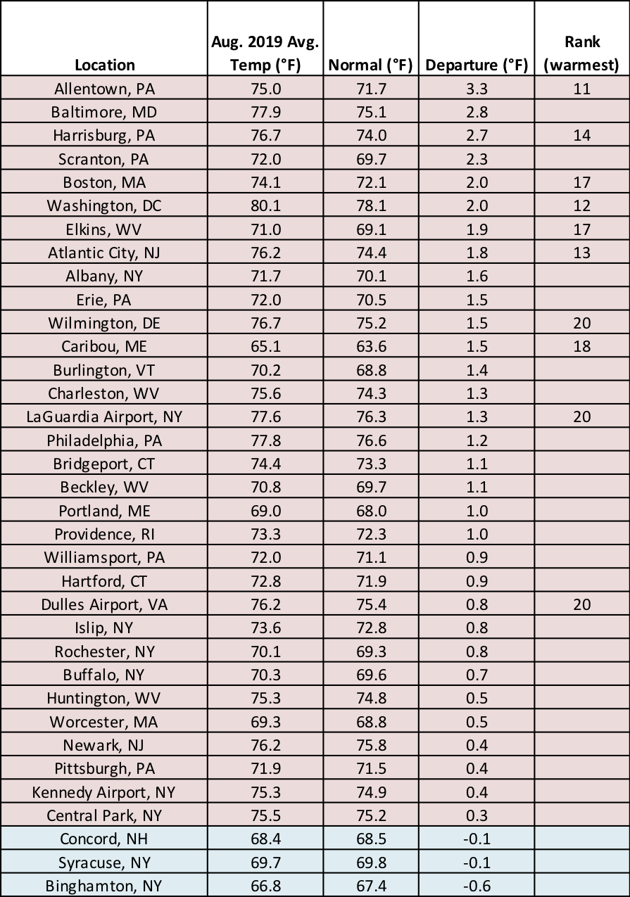
At the major climate sites, August average temperatures ranged from 0.6°F below normal in Binghamton, NY, to 3.3°F above normal in Allentown, PA.
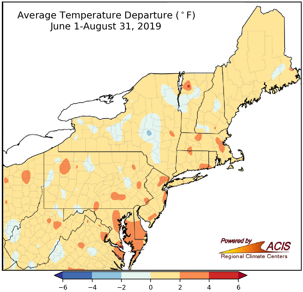
Summer average temperatures generally ranged from 2°F below normal to 4°F above normal.
Most areas also wrapped up the summer season within 2°F of normal, with a few warmer areas that were up to 4°F above normal. All of the 35 major climate sites had a warmer-than-normal summer, with 22 sites ranking this summer among their 20 warmest on record.
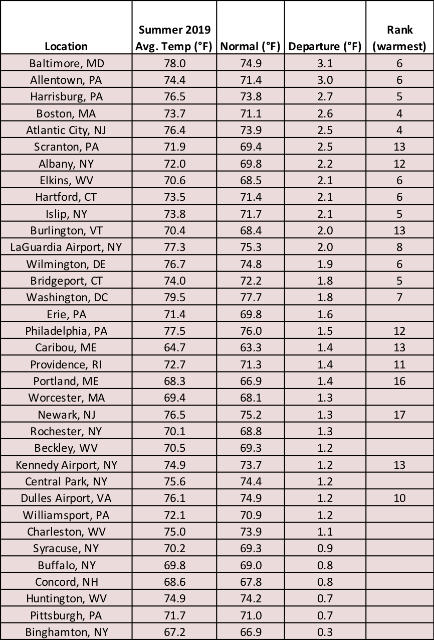
At the major climate sites, summer average temperatures were as much as 3.1°F above normal (in Baltimore, MD).
For September temperatures, a range of conditions is expected in the Northeast, according to NOAA’s Climate Prediction Center. There’s a slight tilt towards cooler-than-normal temperatures for northwestern Pennsylvania and western, central, and northern New York, while there’s a slight tilt towards warmer-than-normal temperatures for southern West Virginia, southern and eastern Maryland, and southern Delaware. The rest of the region falls into the equal chances category, meaning there are equal chances of below-, near-, and above-normal temperatures.
As for precipitation, a large portion of the region is forecast to be wetter than normal. The main exceptions are West Virginia, southwestern and south-central Pennsylvania, and western Maryland, where equal chances were predicted.
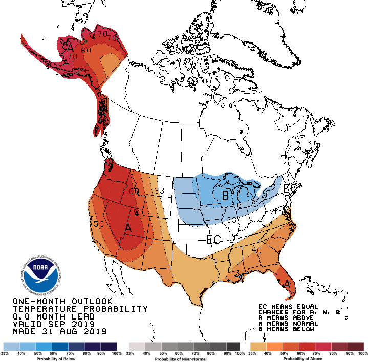
For September, equal chances of below-, near-, and above-normal temperatures are predicted for a large portion of the Northeast.
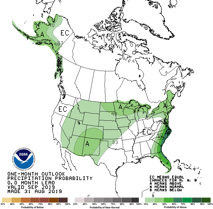
There are increased odds of a wetter-than-normal September for much of the region.