Mid-August: Some Rain, Still Dry
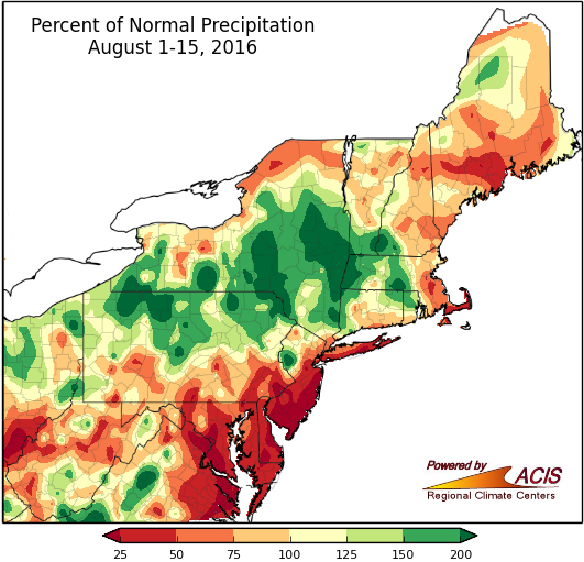
Precipitation for the first half of August ranged from less than 25% of normal to more than 200% of normal.
There has finally been rain in the dry Northeast states. Some of the areas in abnormally dry or drought categories have received over 150% of their normal precipitation during the first half of August. However, the rain was not region wide and other areas received less than 50% of their normal precipitation. Dulles Airport in Virginia had their driest first half of August on record, with less than a quarter inch of rain. Atlantic City, NJ, Islip, NY, and Wilmington, DE only received 9% of their normal precipitation.
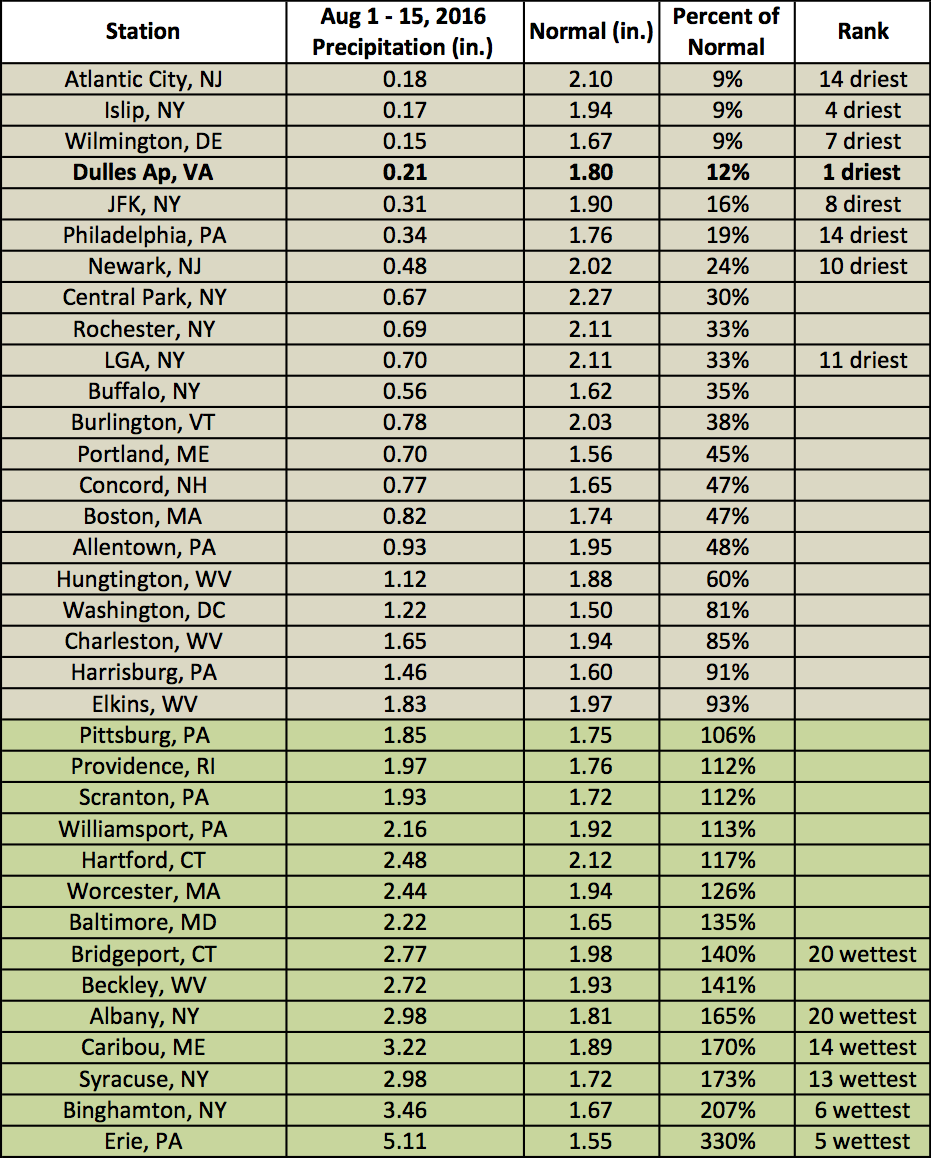
Precipitation across the region varied, with 21 wetter-than-normal sites and 14 drier-than-normal sites.
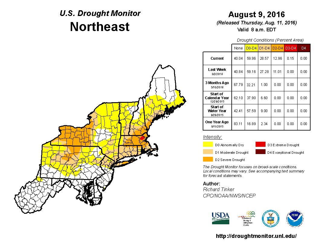
Parts of nine Northeast states were in a drought as of mid August. Click to enlarge.
While this rain is beneficial, parts of the Northeast are still experiencing drought conditions. According to the U.S. Drought Monitor released on August 9, 29% of the region was in drought, 31% of the region was abnormally dry, and a small area in Massachusetts was upgraded to extreme drought. For weekly updates during the drought, go to our Drought Update page.
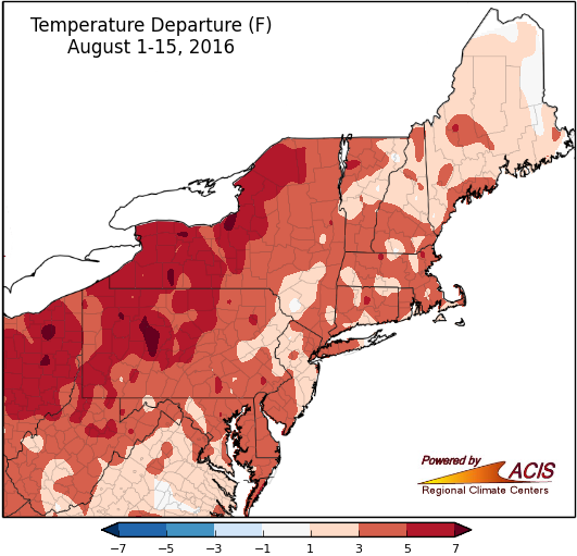
The Northeast continues to be warmer than normal in August.
So far, August temperatures have been a continuation of the July heat. All 35 of the major climate sites were warmer than normal, with all but Caribou, ME ranking among their top 20 warmest August 1-15. Rochester, NY was 7.5 °F warmer than normal.
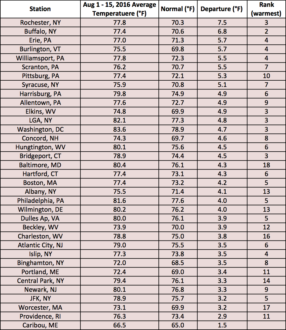
Average temperatures departures at the major climate sites ranged from 1.5°F above normal in Caribou, ME to 7.5°F above normal in Rochester, NY.