Missing Precipitation in September
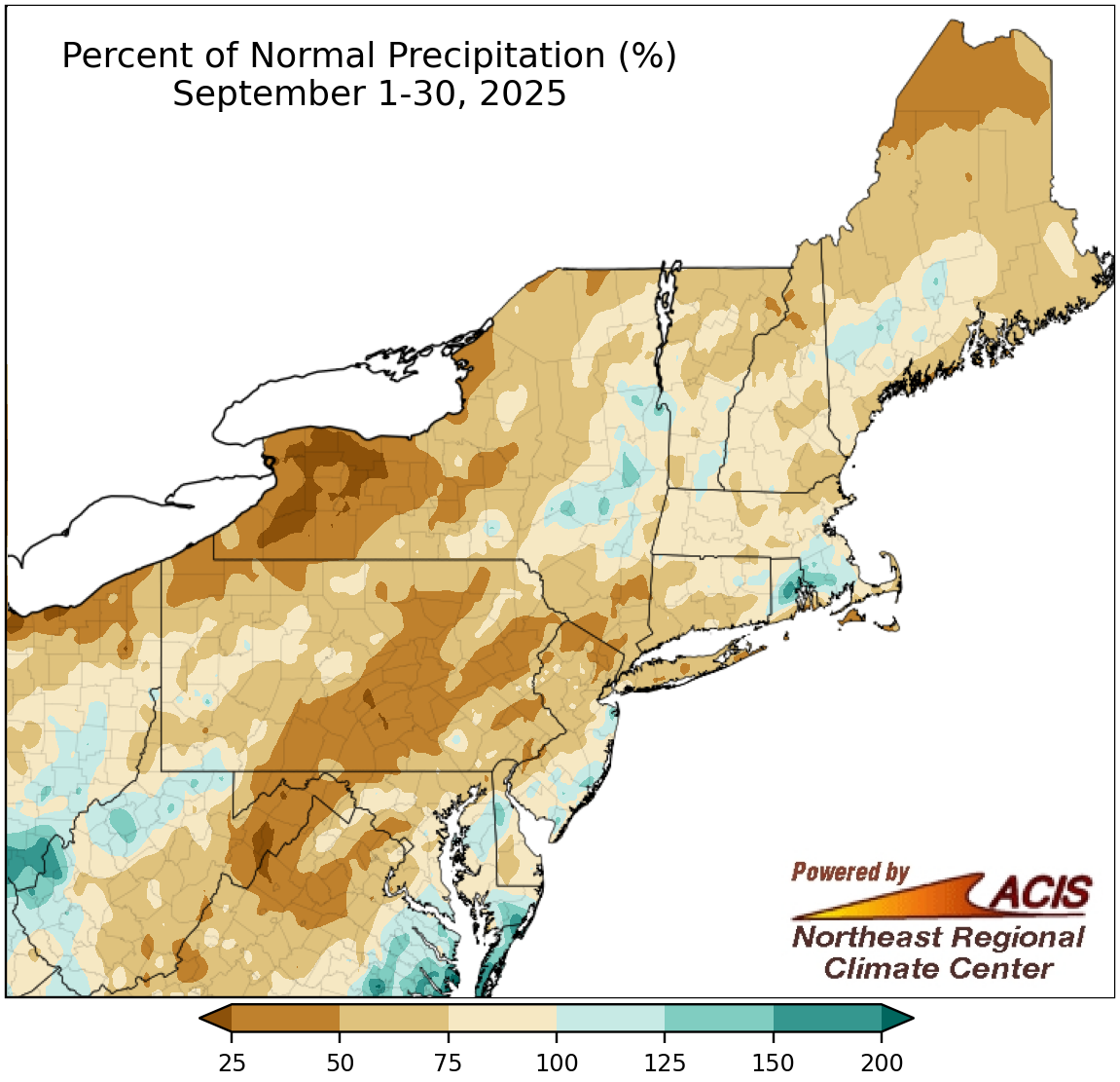
September precipitation ranged from less than 25% of normal to 200% of normal.
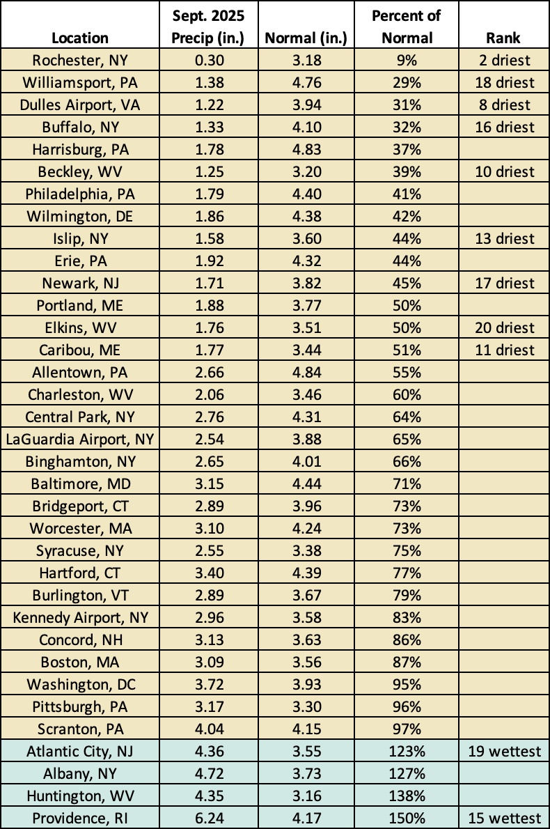
While a handful of locations were wetter than normal this September, most of the Northeast wrapped up the month on the dry side. The driest spots, which were in western New York and eastern West Virginia, saw less than 25% of normal precipitation. In addition, multiple places including eastern West Virginia, western Maryland, sections of Pennsylvania and New York, northern New Jersey, and northern Maine saw 25% to 50% of normal precipitation. Thirty-one of the Northeast’s 35 major sites were drier than normal, with this September ranking among the 20 driest for nine of the sites. However, three sites were wetter, with two having one of their 20 wettest Septembers. Overall, September precipitation ranged from 9% of normal in Rochester, NY, to 150% of normal in Providence, RI.
The dry weather allowed drought to expand and intensify across the Northeast. There were numerous drought-related impacts to agriculture and water resources, particularly in northern New England and West Virginia. For more information, see the NRCC’s weekly drought update.
This September was among the 20 driest for nine major sites but among the 20 wettest for two others.
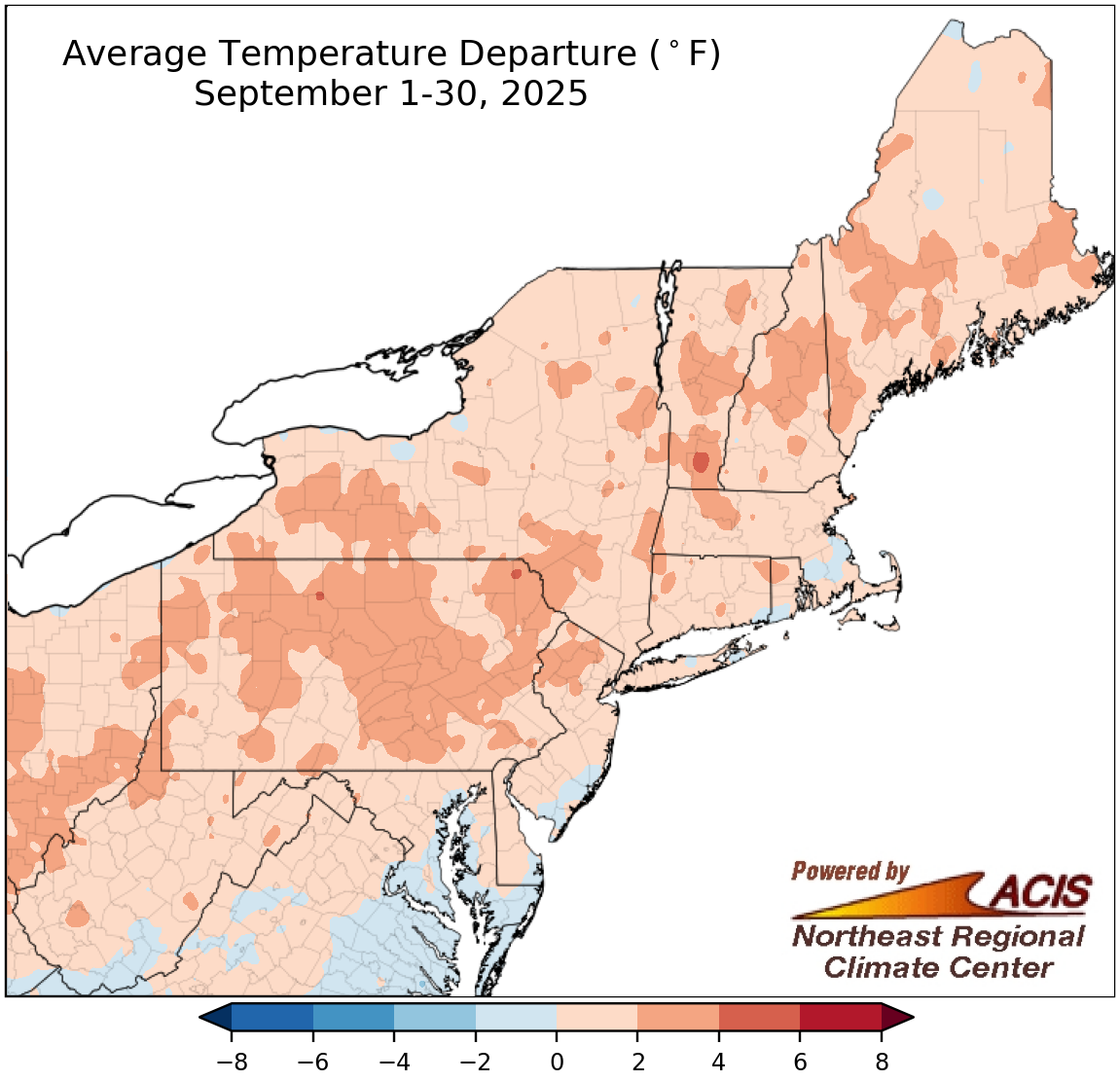
September temperatures ranged from 2°F below normal to 4°F above normal.
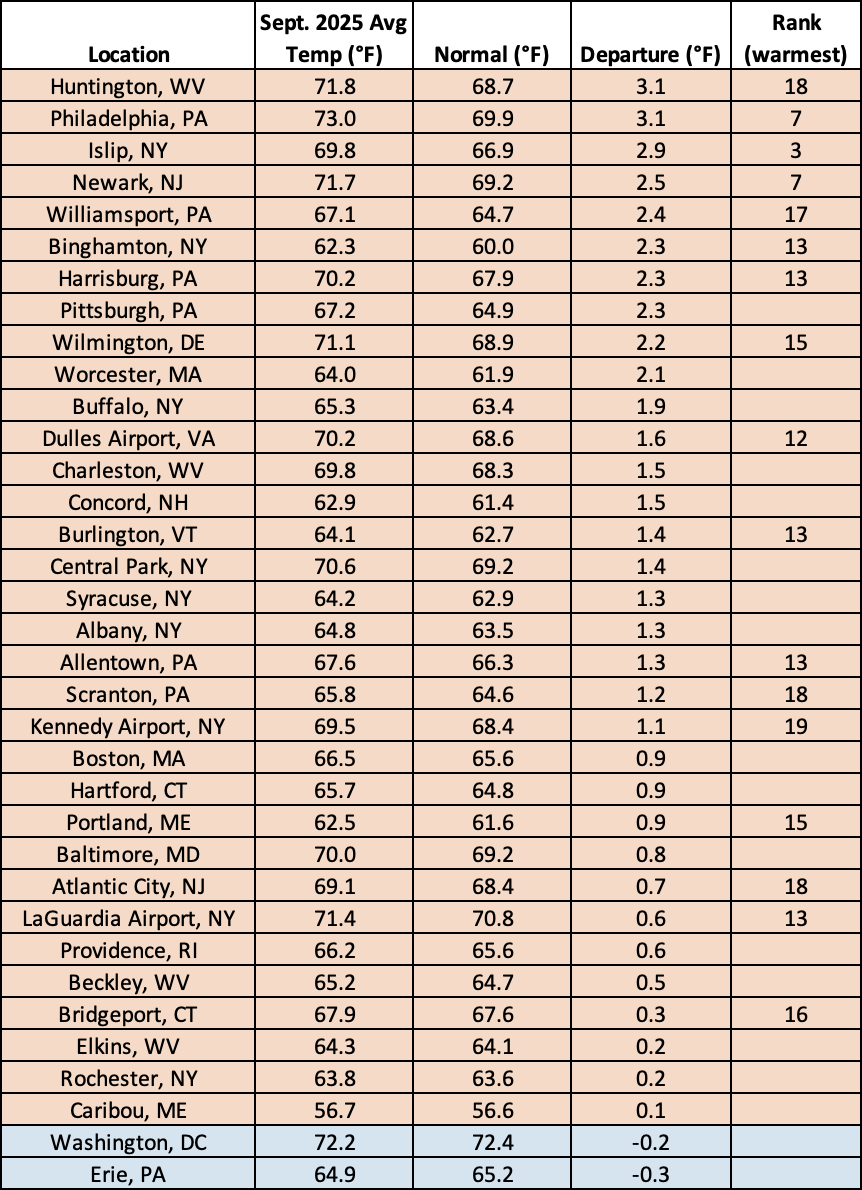
Much of the Northeast experienced a warmer-than-normal September, with average temperatures up to 4°F above normal. At the region’s 35 major sites, September average temperatures ranged from 0.3°F below normal in Erie, PA, to 3.1°F above normal in Huntington, WV, and Philadelphia, PA, with 33 of the sites being warmer than normal. This September ranked among the 20 warmest on record for 17 of the sites.
This September ranked among the 20 warmest on record for 17 major sites.
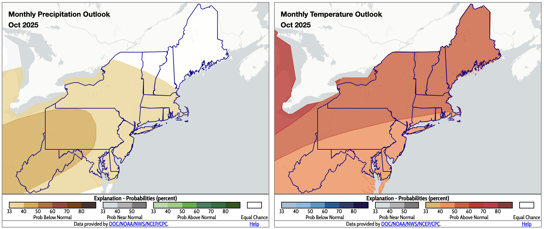
October is expected to be drier and warmer than normal for most of the Northeast. Click to enlarge.
Warm, dry conditions are expected to continue in October for much of the Northeast according to outlooks from NOAA’s Climate Prediction Center. Below-normal precipitation is favored for most of the region, with the greatest likelihood in western/central Pennsylvania, western Maryland, and a majority of West Virginia. The entire Northeast is expected to average out to be warmer than normal.