Seeing Red in Mid-October
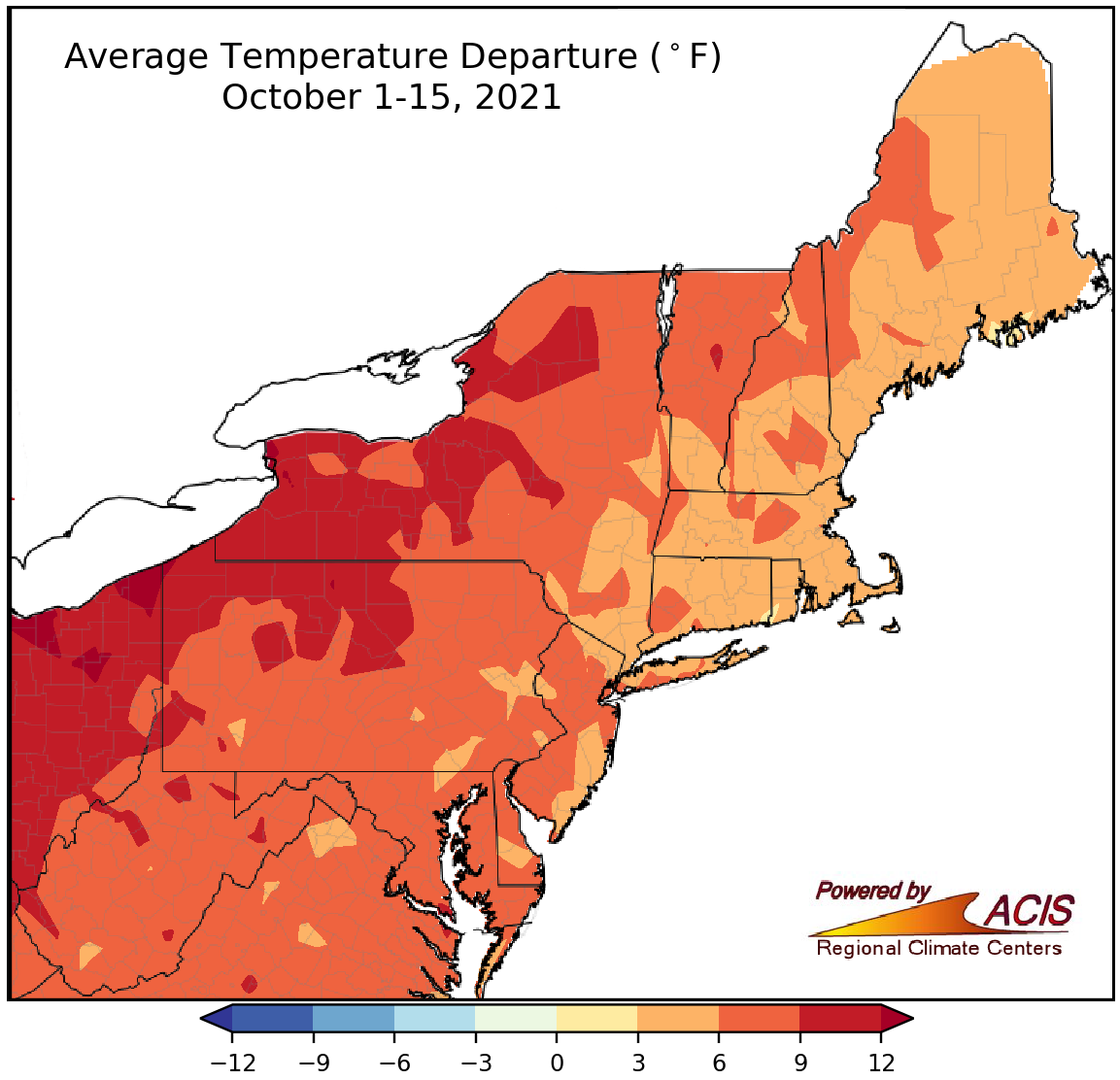
October 1-15 average temperatures ranged from 3°F to 12°F above normal in the Northeast, with the areas shaded red seeing the largest departures above normal.
Average temperatures during the first half of October were as much as 12°F warmer than normal, with the areas shaded red on the map above having the largest departures above normal. These areas included portions of New York, Pennsylvania, and West Virginia. This first half of October was the warmest on record for 10 major climate sites and ranked among the 13 warmest for the other 25 sites. Overall, average temperatures at the 35 major climate sites ranged from 4.3°F above normal in Portland, ME, to 12.3°F above normal in Buffalo, NY.
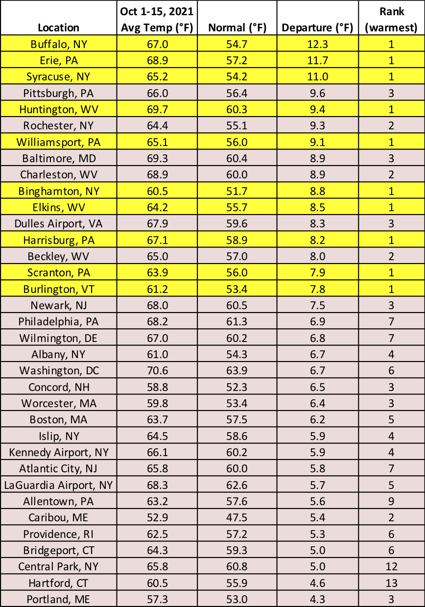
This first half of October was the warmest on record for 10 major climate sites, which are highlighted yellow.
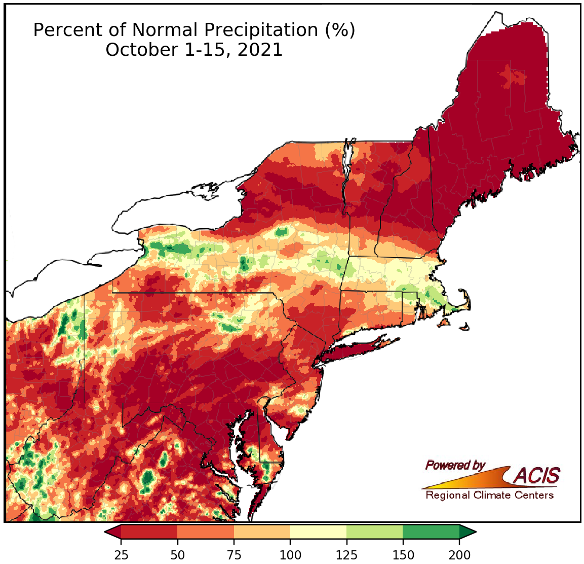
October 1-15 precipitation ranged from less than 25% of normal to near normal for much of the Northeast, with the driest locations shaded red.
Much of the Northeast saw below-normal precipitation during the first half of October. The driest areas, shaded red on the map above, saw less than 25% of their normal October 1-15 precipitation. At the 35 major climate sites, October 1-15 precipitation ranged from 2% of normal in Baltimore, MD; Dulles Airport, VA; and Caribou, ME, to 149% of normal in Buffalo, NY, with 28 of the sites being drier than normal. This first half of October was the driest on record at Caribou, ME, and ranked among the 20 driest at 12 additional major climate sites. However, three major climate sites experienced their 17th wettest October 1-15 period on record.
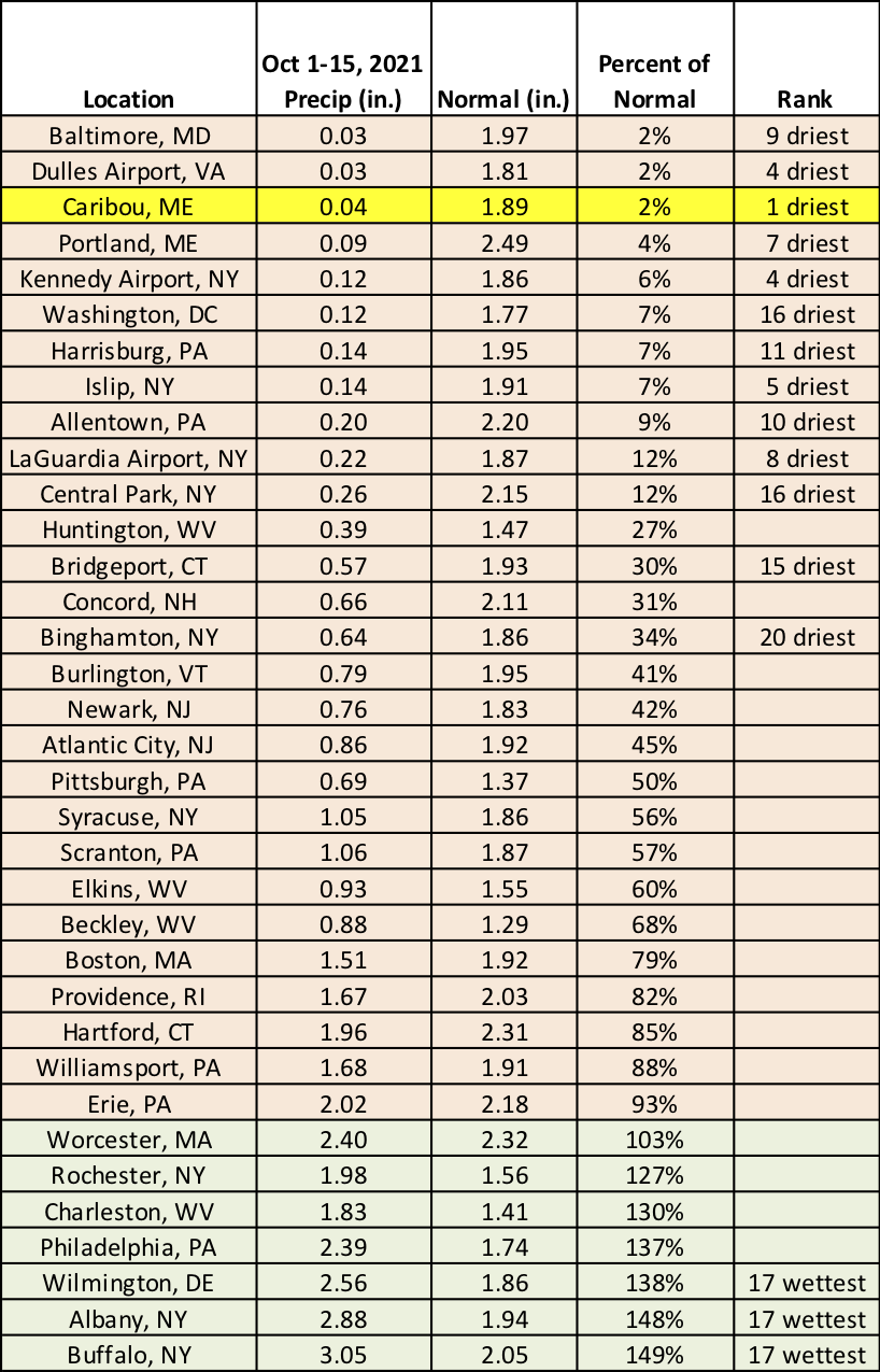
This first half of October was the driest on record at Caribou, ME, and among the 20 driest at 12 additional major climate sites. Conversely, it was the 17th wettest October 1-15 period for three major climate sites.
The warm conditions could stick around through the rest of October. The 6-10 day and 8-14 day outlooks from NOAA’s Climate Prediction Center favor near- or above-normal temperatures and below- or near-normal precipitation for the Northeast.
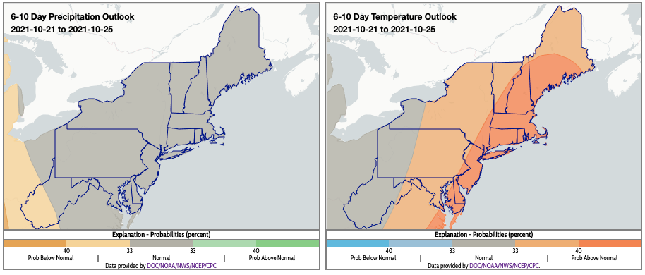
The 6-10 day outlook indicates near-normal precipitation and above-normal temperatures for most of the Northeast. Click to enlarge.
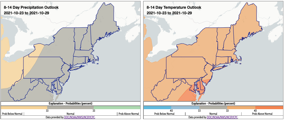
The 8-14 day outlook also indicates near-normal precipitation and above-normal temperatures for most of the Northeast. Click to enlarge.