Mid-July - The Haves and the Have Nots
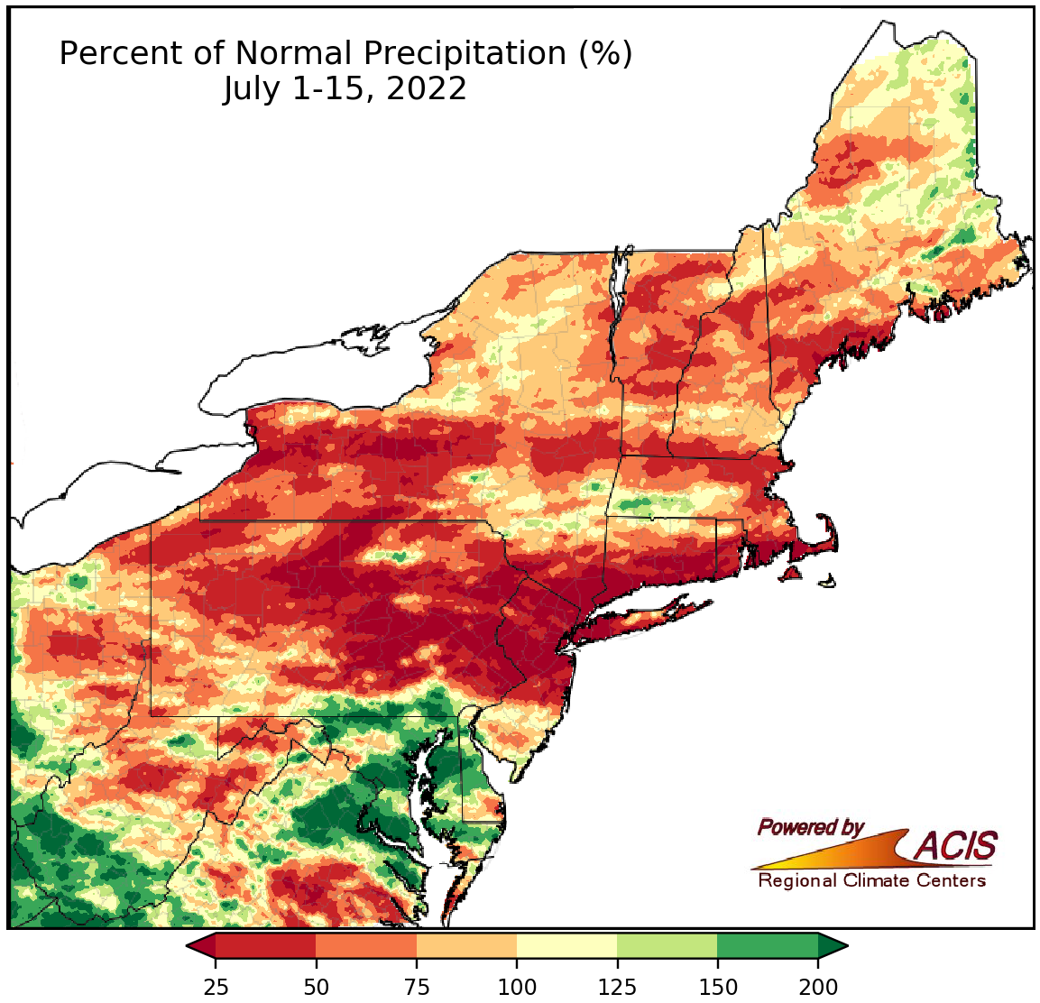
July 1-15 rainfall ranged from less than 25% of normal to more than 200% of normal.
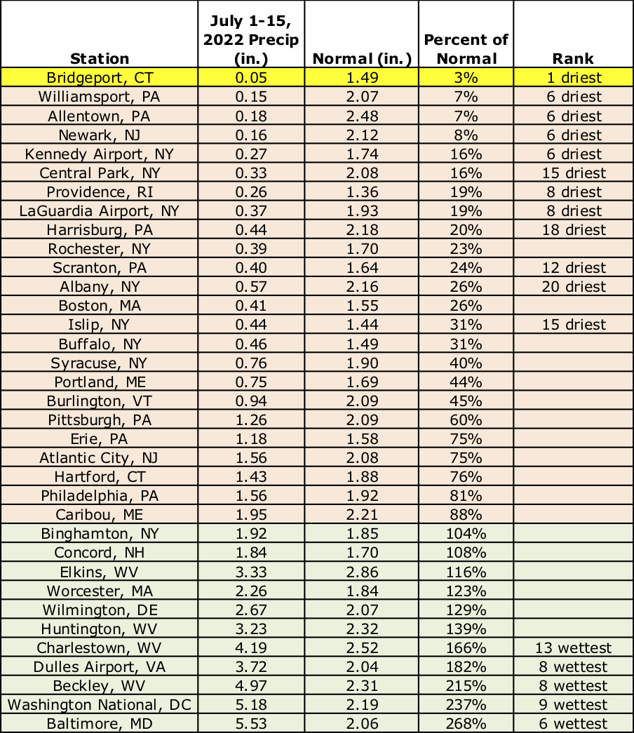
Much of the Northeast saw below-normal rainfall during the first half of July, with the driest locations including portions of Pennsylvania, New Jersey, New York, and southern New England receiving less than 25% of normal. With increasing precipitation deficits, below-normal streamflow and groundwater levels, and declining soil moisture, drought and abnormal dryness intensified/expanded in some of these areas. On the other end of the spectrum, extreme southeastern Pennsylvania, southern West Virginia, and portions of Maryland and Delaware were much wetter, seeing more than 200% of normal precipitation. Twenty-four of the 35 major climate sites were drier than normal, with rainfall ranging from 3% of normal in Bridgeport, CT, its driest July 1-15 on record, to 268% of normal in Baltimore, MD, its sixth wettest July 1-15 on record. This July 1-15 period ranked among the 20 driest on record at 12 major climate sites but among the 20 wettest on record for five major climate sites.
This July 1-15 period ranked among the 20 driest on record at 12 major climate sites including Bridgeport, CT, which was record dry but was among the 20 wettest on record for five major climate sites.
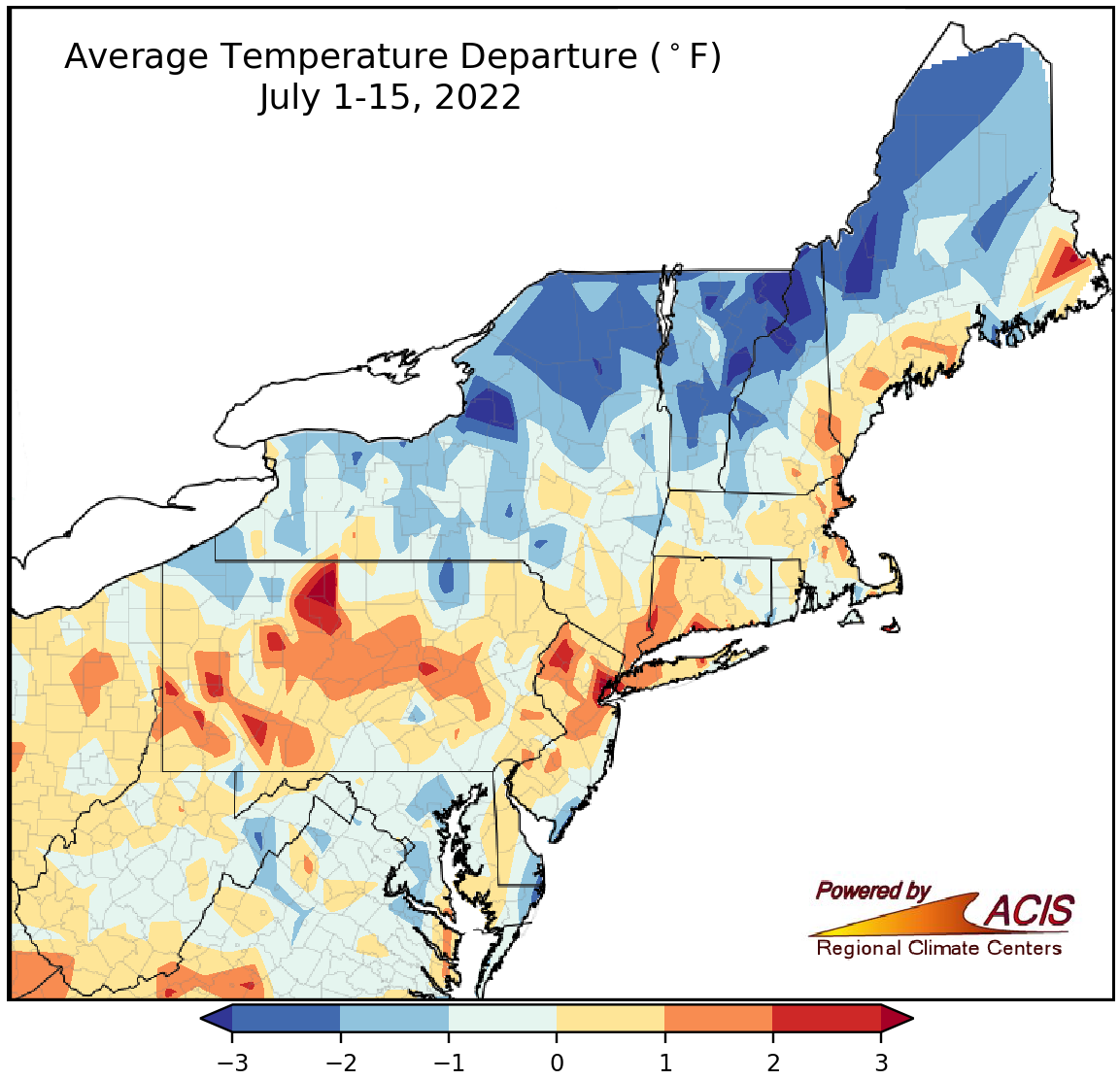
July 1-15 average temperatures ranged from more than 3°F below normal to more than 3°F above normal.
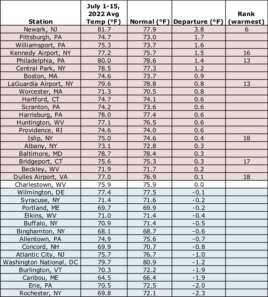
Similar to precipitation, average temperatures during the first half of July varied widely, ranging from more than 3°F cooler than normal in parts of New York to more than 3°F warmer tha normal in parts of Pennsylvania and New Jersey. At the 35 major climate sites, July 1-15 average temperatures ranged from 2.3°F below normal in Rochester, NY, to 3.8°F above normal in Newark, NJ, with 20 of the sites being warmer than normal. In fact, this first half of July ranked among the 20 warmest on record at seven major climate sites.
This July 1-15 period ranked among the 20 warmest on record at seven major climate sites.


