A Dry Start to November
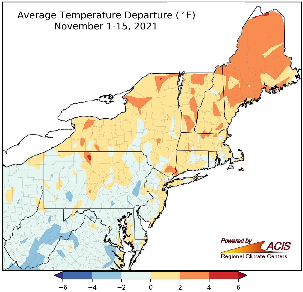
November 1-15 average temperatures ranged from 4°F below normal to 4°F above normal.
Average temperatures during the first half of November ranged from 4°F below normal in parts of West Virginia and Pennsylvania to 4°F above normal in parts of New York and New England. November 1-15 average temperatures at the 35 major climate sites ranged from 3.3°F below normal in Beckley, WV, to 2.8°F above normal in Caribou, ME, its 14th warmest first half of November on record. Overall, 22 major climate sites were colder than normal.
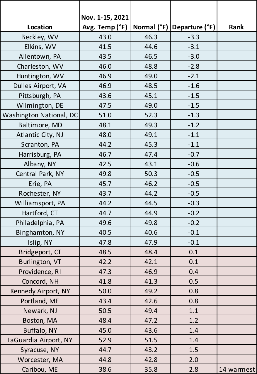
While 22 major climate sites were colder than normal, Caribou, ME, recorded its 14th warmest first half of November.
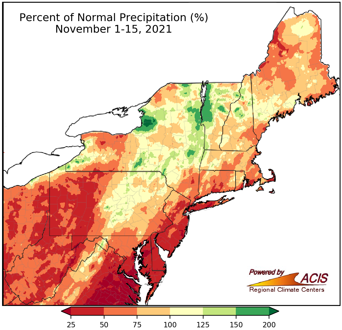
November 1-15 precipitation ranged from less than 25% of normal to 200% of normal.
Much of the Northeast was drier than normal for the November 1-15 period, with the driest locations in coastal areas from southern Maryland to Long Island seeing less than 25% of normal precipitation. However, parts of New York and Vermont were wetter, seeing up to 200% of normal precipitation. November 1-15 precipitation at the major climate sites ranged from 13% of normal in Philadelphia, PA, to 142% of normal in Williamsport, PA. Twenty-eight of the 35 major climate sites were drier than normal, with six ranking this first half of November among their 20 driest on record. Drought and/or abnormal dryness persisted in parts of northern New England and West Virginia.
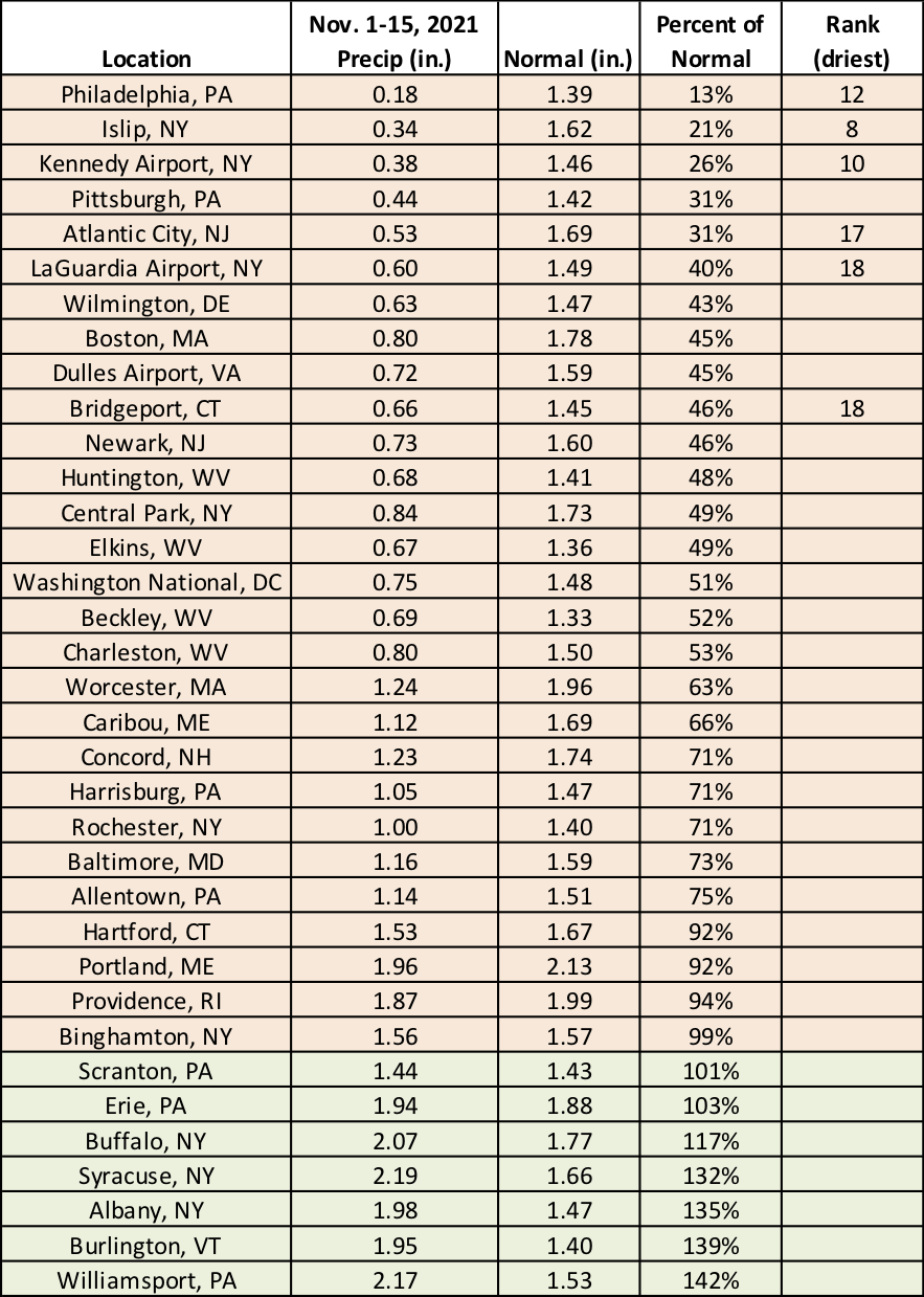
This first half of November ranked among the 20 driest on record for six major climate sites.
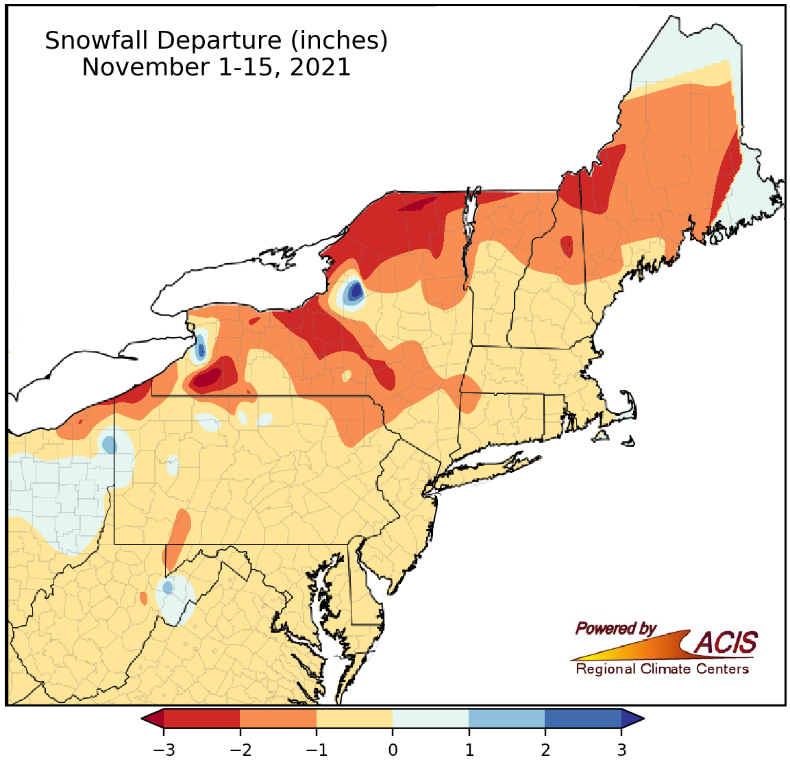
November 1-15 snowfall generally ranged from 3 inches below normal to 3 inches above normal.
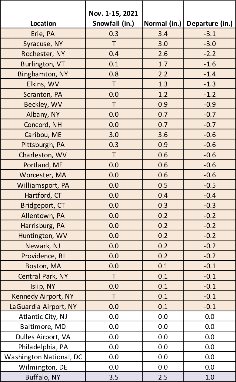
While climatological normals show that much of the Northeast averages measurable snow during the first half of November, it’s not uncommon for many areas to see no snow during the period. With that, November 1-15 snowfall generally ranged from 3 inches below normal in northern New England and parts of New York to 3 inches above normal in a few lake-effect spots in New York. Twenty-nine of the 35 major climate sites average measurable snow during the November 1-15 period, with only seven of the sites seeing it this year.
Seven major climate sites saw measurable snow during the November 1-15 period.
Perhaps some more sites will see their first measurable snow of the season soon. NOAA’s Climate Prediction Center favors a cooler, wetter weather pattern for many parts of the Northeast for much of the rest of November.
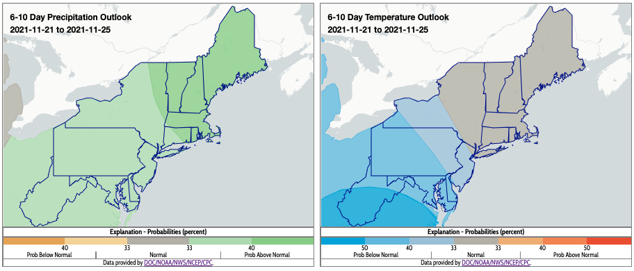
Above-normal precipitation and below- to near-normal temperatures are favored for the 6-10 day period. Click to enlarge.
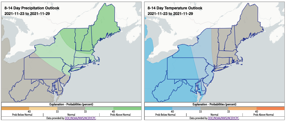
Near- to above-normal precipitation and below- to near-normal temperatures are also favored for the 8-14 day period. Click to enlarge.