That’s a Wrap on Winter
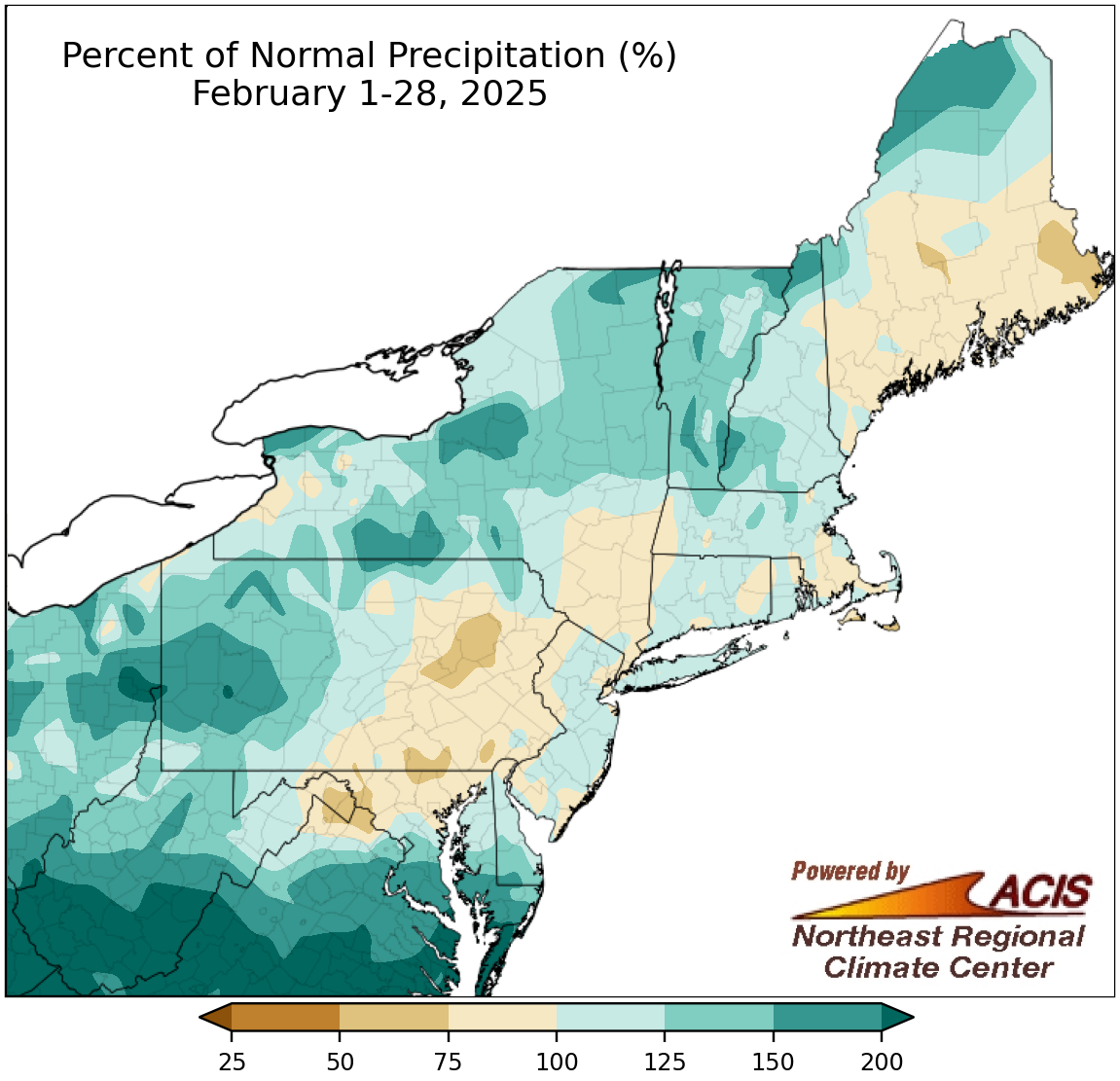
February precipitation ranged from 50% of normal to more than 200% of normal.
Precipitation during February in the Northeast ranged from 50% of normal in places like eastern Pennsylvania and eastern Maine to over 200% of normal in places like southern West Virginia. In fact, this February was the wettest February on record for Beckley, WV, and ranked among the 20 wettest for another seven of the region’s 35 major sites. February precipitation at these sites ranged from 67% of normal in Scranton, PA, to 241% of normal in Beckley, WV, with 18 sites being drier than normal.
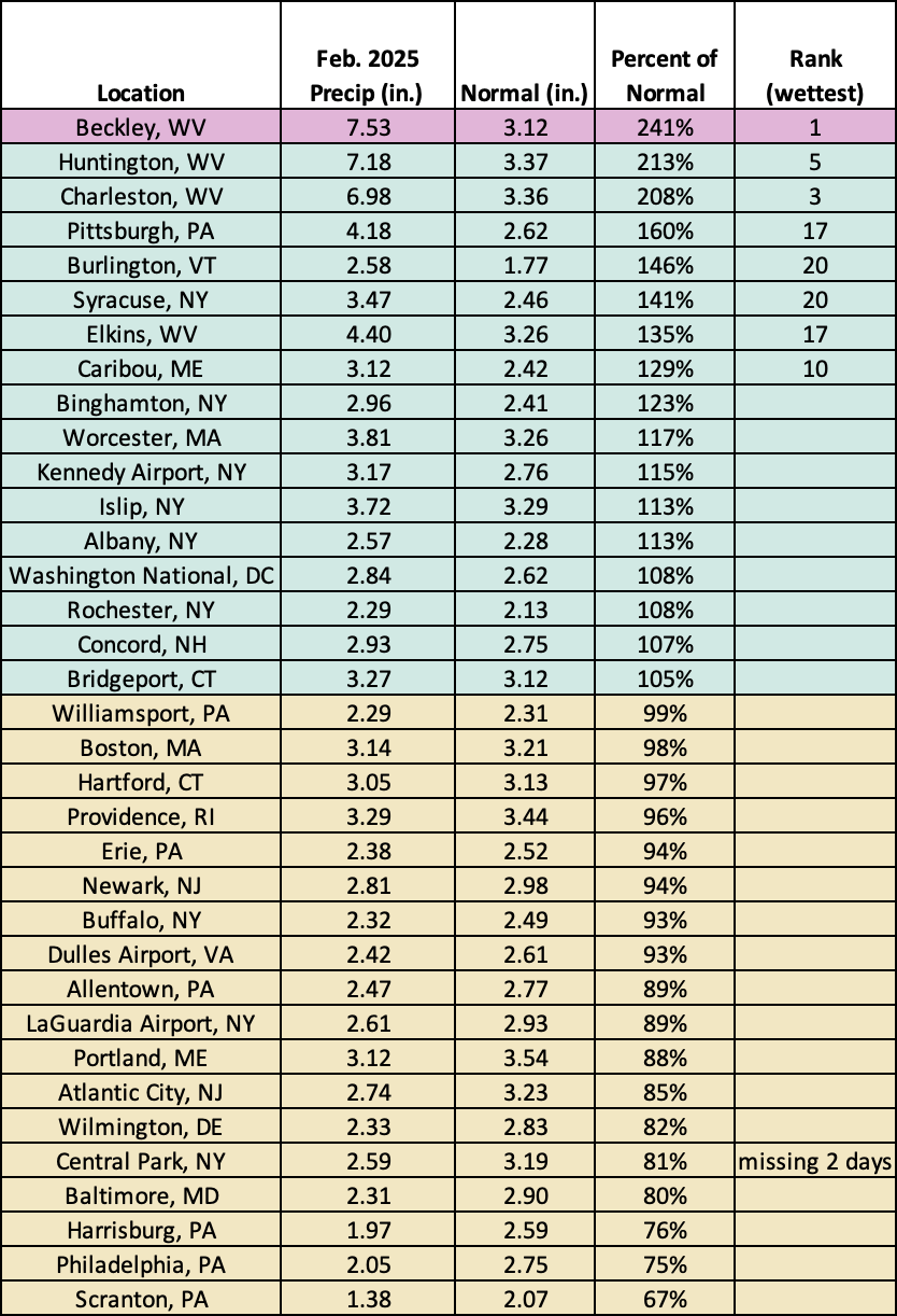
This February was record wet for Beckley, WV, and among the 20 wettest for another seven of the sites.
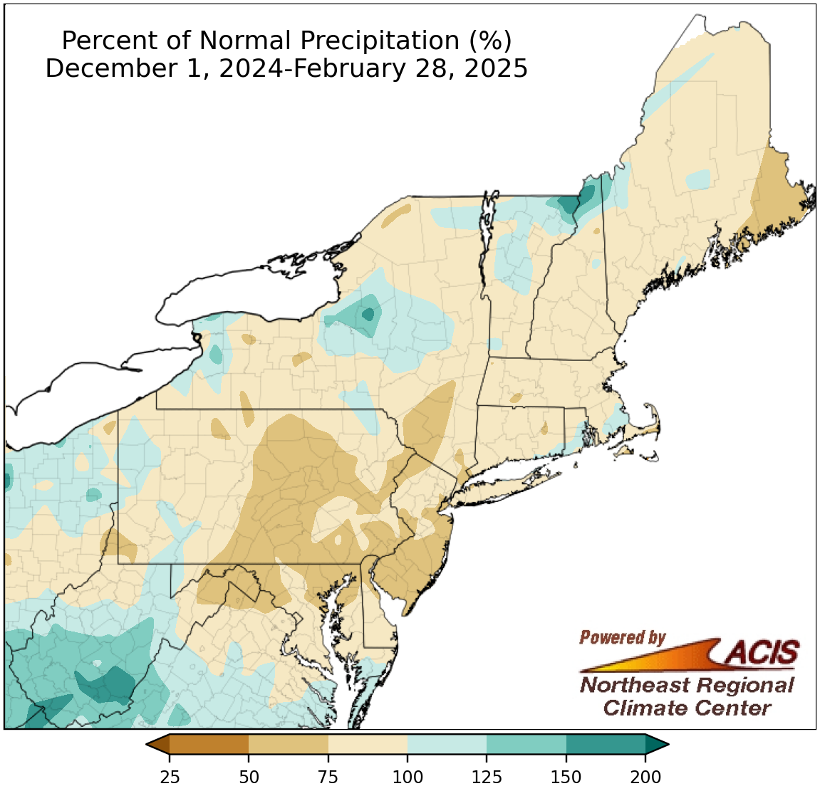
Winter precipitation ranged from 50% of normal to 200% of normal.
Much of the Northeast experienced a drier-than-normal winter, with the driest locations seeing 50% to 75% of normal precipitation. However, there were a few wetter-than-normal areas, particularly places like southern West Virginia and lake-effect areas of central New York, which both saw up to 200% of normal precipitation. At the region’s 35 major sites, winter precipitation ranged from 65% of normal in Atlantic City, NJ, and Philadelphia, PA, to 161% of normal in Beckley, WV, with 26 of the sites being drier than normal. This winter ranked among the 20 driest winters for four sites but among the 20 wettest for the four West Virginia sites.
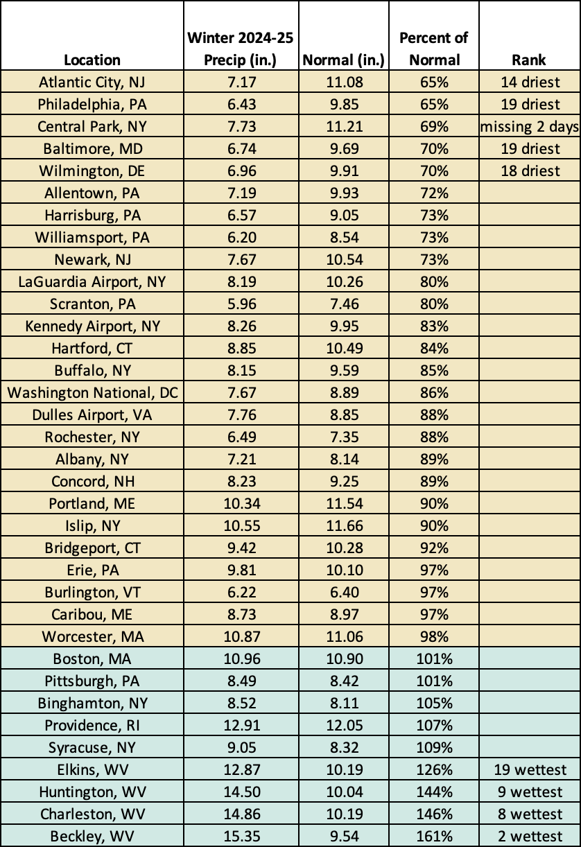
This winter was among the 20 driest winter for four sites but among the 20 wettest for the four West Virginia sites.
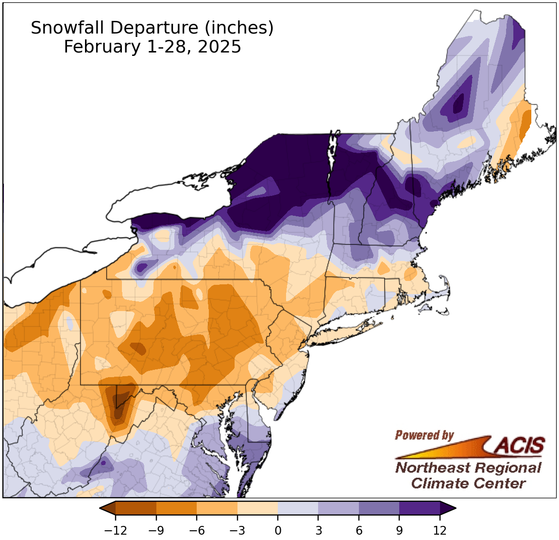
February snowfall ranged from more than 12 inches below normal to more than 12 inches above normal.
February snowfall varied, ranging from more than 12 inches below normal in higher elevations of eastern West Virginia and western Maryland to over 12 inches above normal in an area from western and northern New York into northern New England. Snowfall for February at the region’s 35 major sites ranged from 7.1 inches below normal in Worcester, MA, (Scranton was skipped due to too many missing days) to 13.9 inches above normal in Burlington, VT. While 20 sites received less snowfall than usual this February, the month did rank among the 20 snowiest Februarys for four major sites.
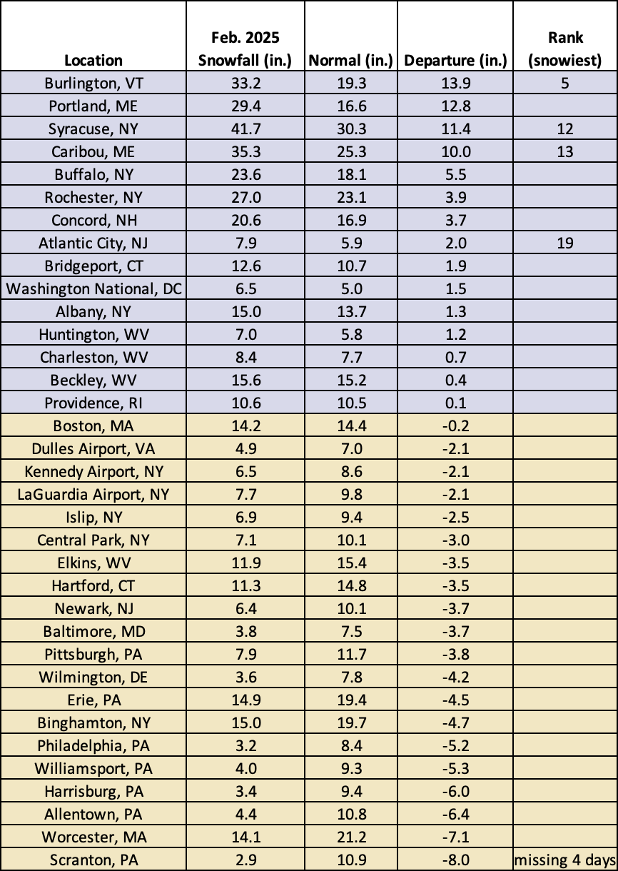
This February ranked among the 20 snowiest for four major sites.
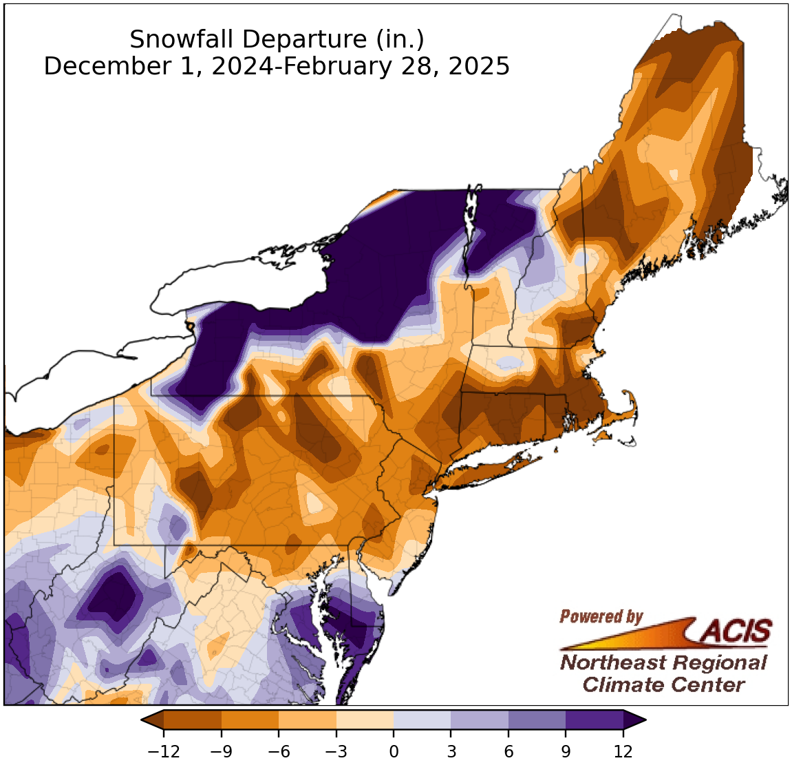
Winter snowfall ranged from more than 12 inches below normal to more than 12 inches above normal.
Winter snowfall was also highly variable, ranging from more than 12 inches below normal in multiple spots including much of southern New England to over 12 inches above normal in areas such as much of Vermont and lake-effect zones of New York. Snowfall for the winter season at the region’s 35 major sites ranged from 21 inches below normal in Worcester, MA, to 10.9 inches above normal in Huntington, WV, with 25 of the sites having a snowfall deficit. This winter ranked as the 18th least snowy for Islip, NY, but was among the 20 snowiest for three major sites.
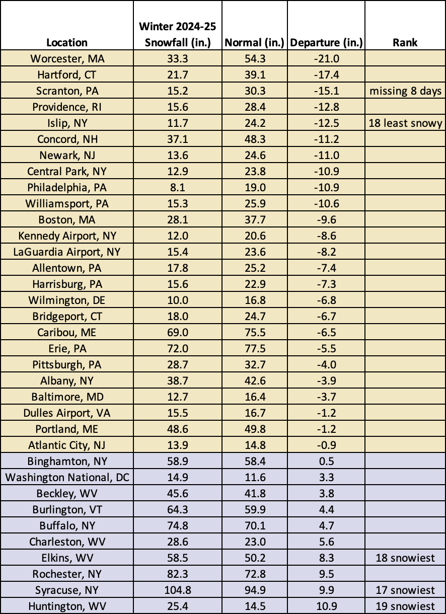
This winter was the 18th least snowy for Islip, NY, but was among the 20 snowiest for three major sites.
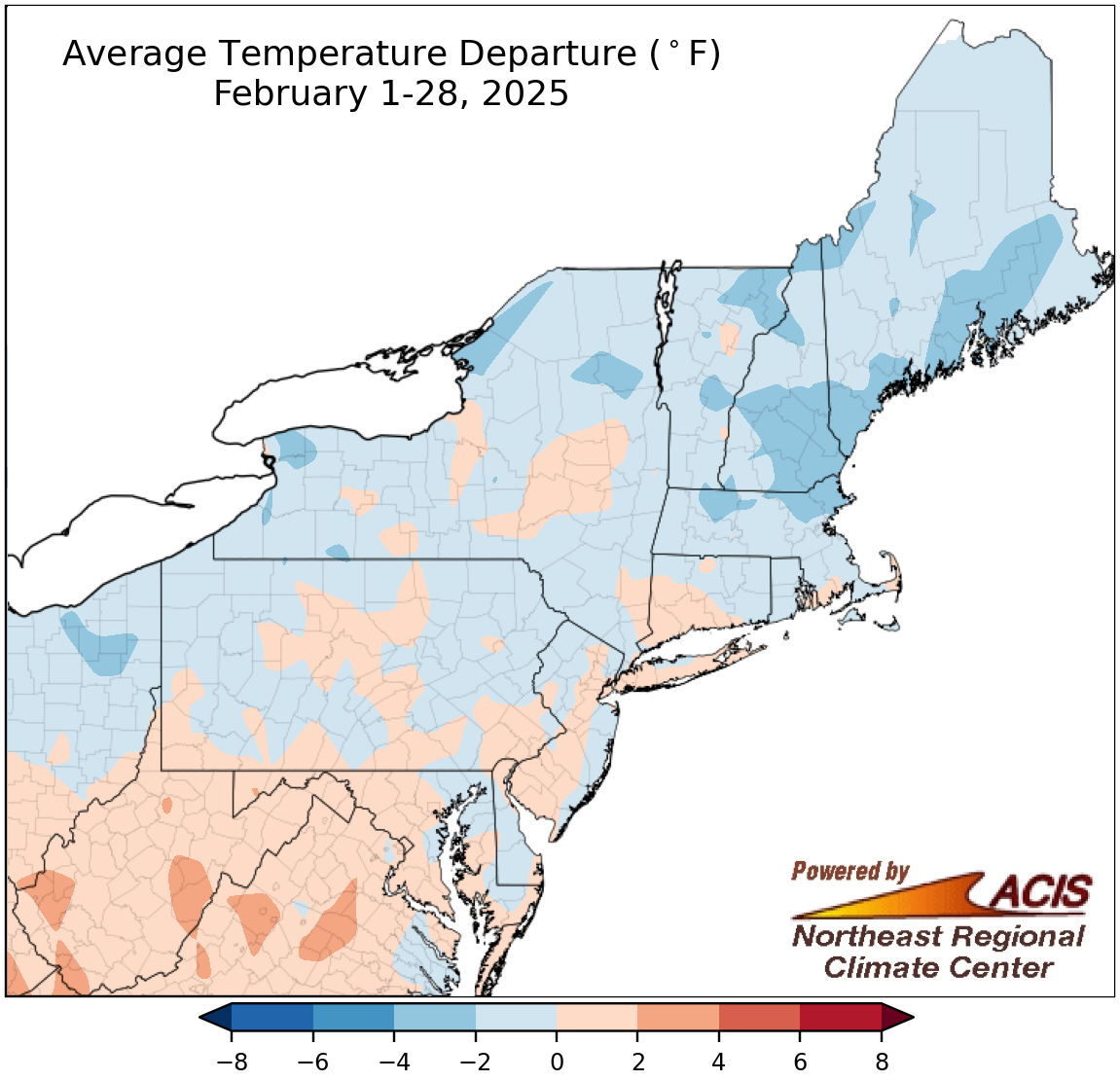
February average temperatures ranged from 4°F below normal to 4°F above normal.
Average temperatures for February were within 2°F of normal for much of the Northeast but ranged from 4°F below normal in parts of New York and New England to 4°F above normal in parts of West Virginia. At the region’s 35 major sites, February average temperatures ranged from 3.8°F below normal in Portland, ME, to 2.7°F above normal at Kennedy Airport, NY, which had its 19th warmest February. Additionally, Islip, NY, had its 20th warmest February. However, 18 of the sites wrapped up the month on the cold side of normal.
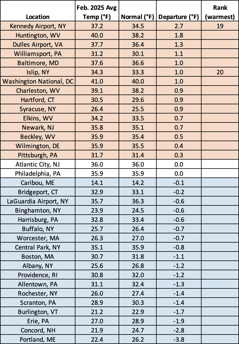
This February was among the 20 warmest for two sites.
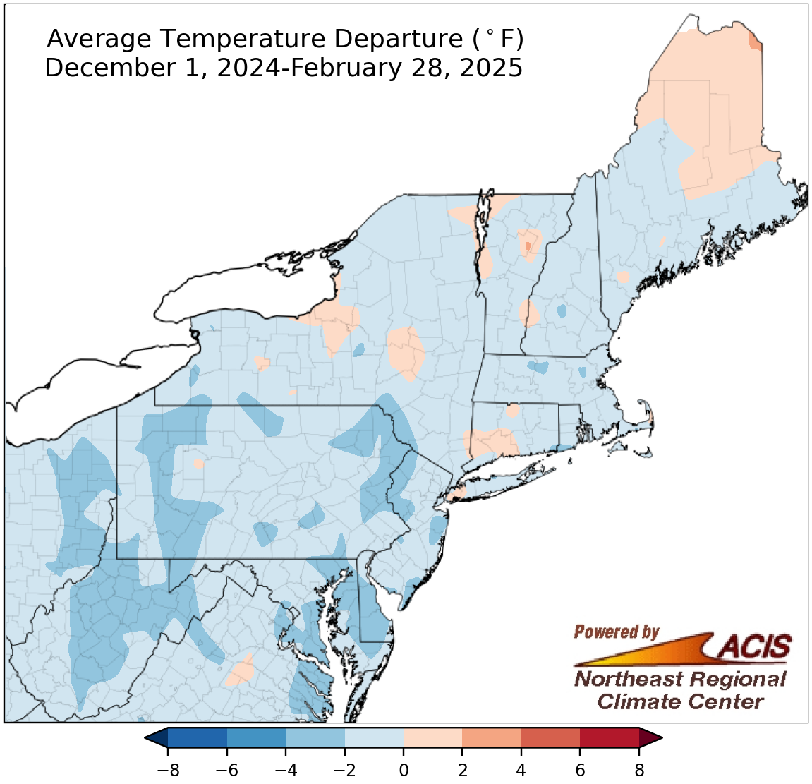
Winter average temperatures ranged from 4°F below normal to 2°F above normal.
Much of the Northeast experienced a colder-than-normal winter, with average temperatures ranging from 4°F below normal to near normal. However, a few locations, especially in New York and New England were as much as 2°F warmer than normal. Winter average temperatures at the 35 major sites ranged from 3.0°F below normal in Elkins, WV, to 1.6°F above normal in Caribou, ME, which had its 18th warmest winter. Overall, 30 of the sites were colder than normal this winter.
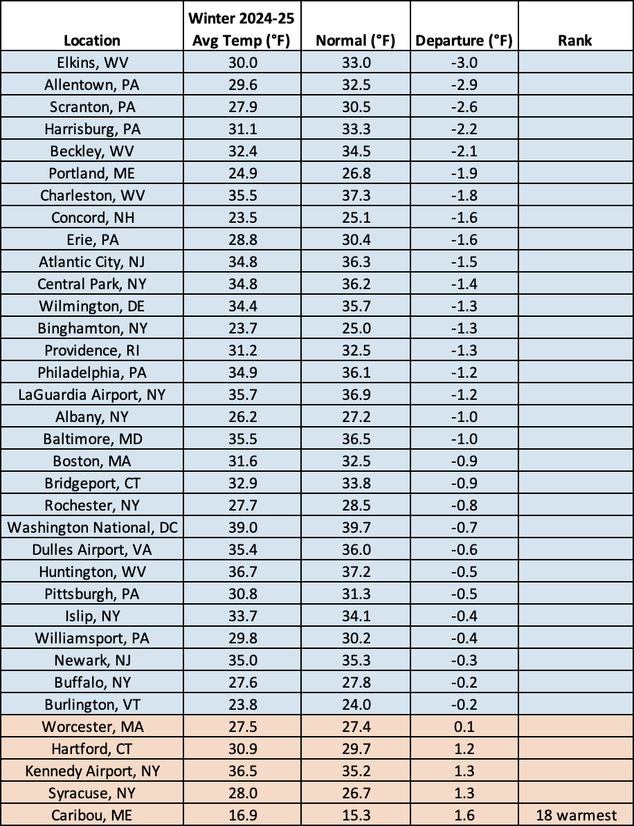
This winter was the 18th warmest on record for Caribou, ME.
According to NOAA’s Climate Prediction Center, March is expected to be wetter than normal for interior areas from West Virgina up to Maine. Meanwhile, there’s an increased likelihood of above-normal temperatures for parts of West Virginia, with equal chances of below-, near-, or above-normal temperatures predicted for the rest of the Northeast.
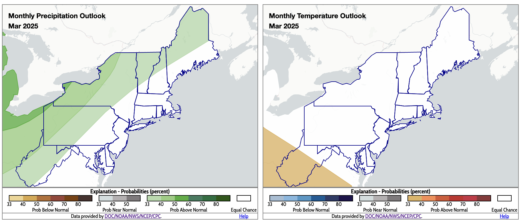
For March, there’s an increased likelihood of above-normal precipitation for interior areas and above-normal temperatures for parts of West Virginia. Click to enlarge.