May - From Winter to Summer
The last, and typically mildest, month of spring started off more like winter, with record to near-record cold. However, a sudden transition to summer-like heat occurred late in the month. Scranton, PA, and Burlington, VT, had their hottest May days on record, while Caribou, ME, and Burlington recorded their warmest low temperatures for May. Several additional sites had one of their 10 warmest May days and/or warmest low temperatures for May. In addition, it was the third earliest occurrence of a day over 90°F for Buffalo, NY.
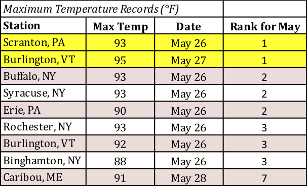
Scranton, PA, and Burlington, VT, had their hottest May days on record.
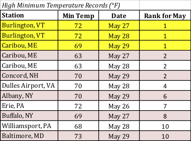
Caribou, ME, and Burlington, VT, recorded their warmest low temperatures for May.
Despite the late-month warm up, a majority of the region ended May on the cold side of normal. Average temperature departures ranged from 4°F below normal, particularly in southern areas, to 2°F above normal, mostly in New England. Twenty-nine of the 35 major climate sites were colder than normal, with three ranking this May among their 20 coldest on record. Overall, average temperatures at the major climate sites ranged from 2.5°F below normal in Philadelphia, PA, and Wilmington, DE, to 1.6°F above normal in Burlington, VT.
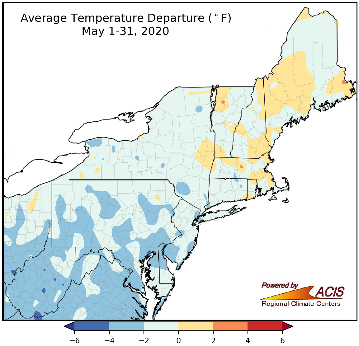
May average temperatures ranged from 4°F below normal to 2°F above normal, with most of the region being colder than normal.
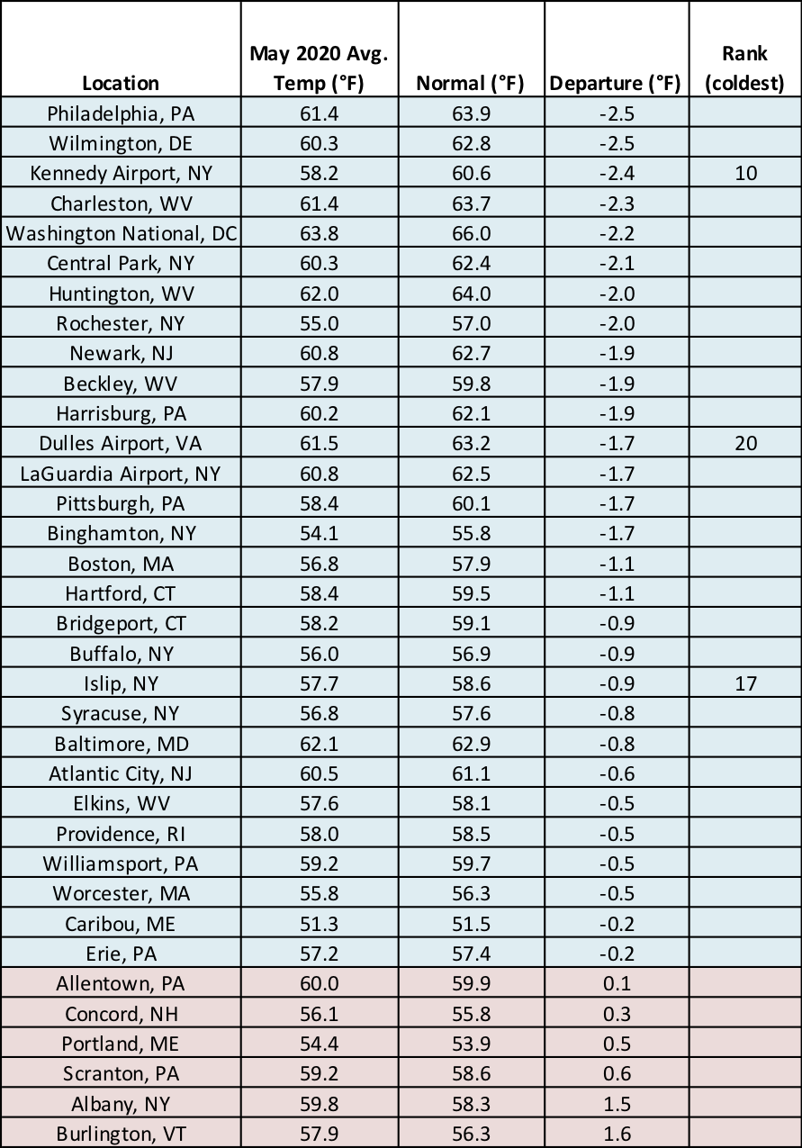
Three major climate sites ranked this May among their 20 coldest on record.
During the previously-mentioned record to near-record cold event, much of the Northeast also saw some snowfall, which was extremely unusual, and in some cases, record-setting. That particular event made May a snowier-than-normal month for a large chunk of the Northeast. Overall, May snowfall ranged from near normal to more than 3 inches above normal, with the greatest surpluses in parts of northern New England and the eastern half of New York. Elkins, WV, had its snowiest May on record, and another eight major climate sites ranked this May among their 15 snowiest on record.
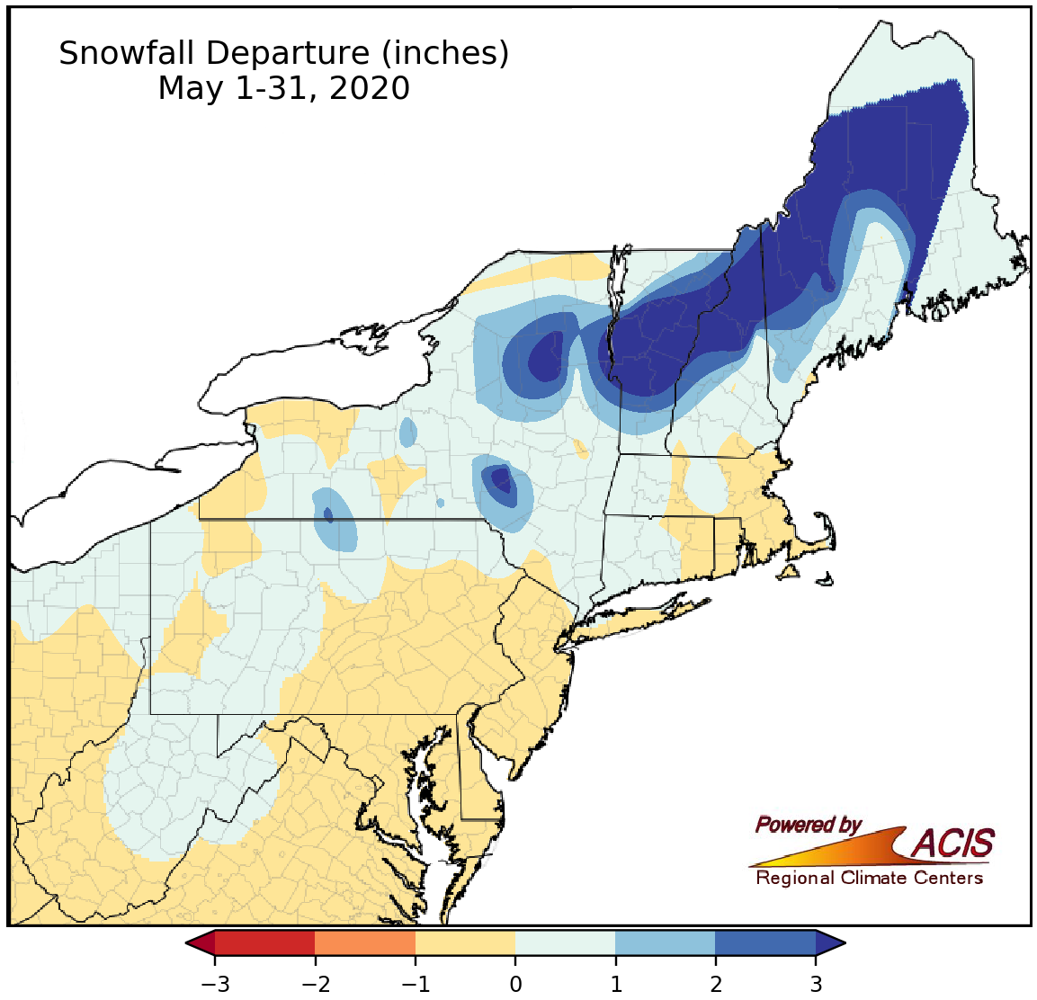
May snowfall ranged from near normal to more than 3 inches above normal.
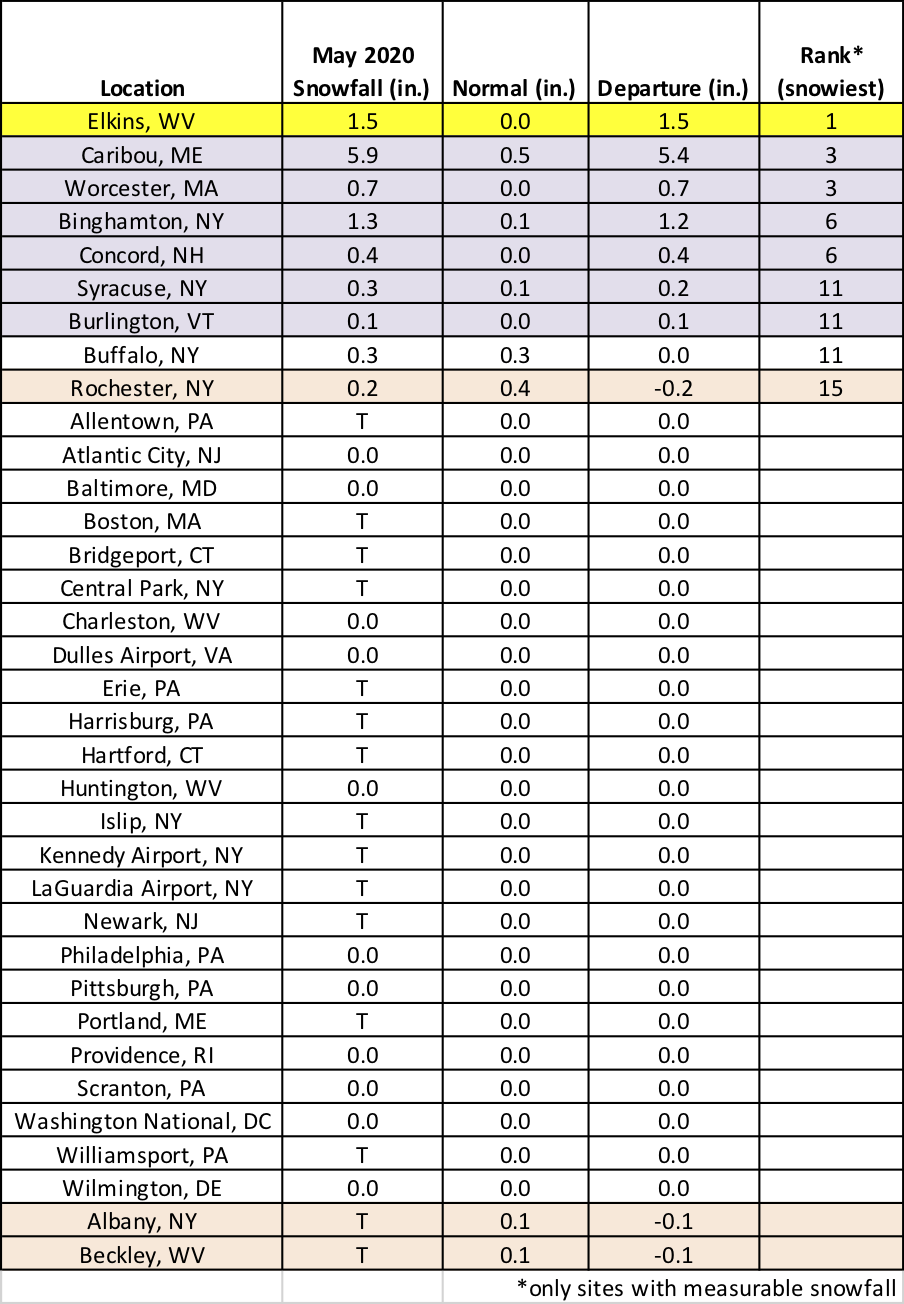
Elkins, WV, had its snowiest May on record.
Much of the Northeast experienced a drier-than-normal May, with the driest locations in parts of northern New England, eastern/northern New York, and central New Jersey seeing less than 50% of normal precipitation. On the other hand, portions of West Virginia, north-central Pennsylvania, and central New York were the wettest areas, seeing up to 200% of normal precipitation. Precipitation at the 35 major climate sites ranged from 31% of normal at LaGuardia Airport, NY, to 186% of normal in Charleston, WV, which had its wettest May on record. Overall, 30 major climate sites were drier than normal, with 10 ranking this May among their 20 driest on record. Below-normal precipitation contributed to the introduction of abnormal dryness in northern New York, southern New Hampshire, and western Maine during May.
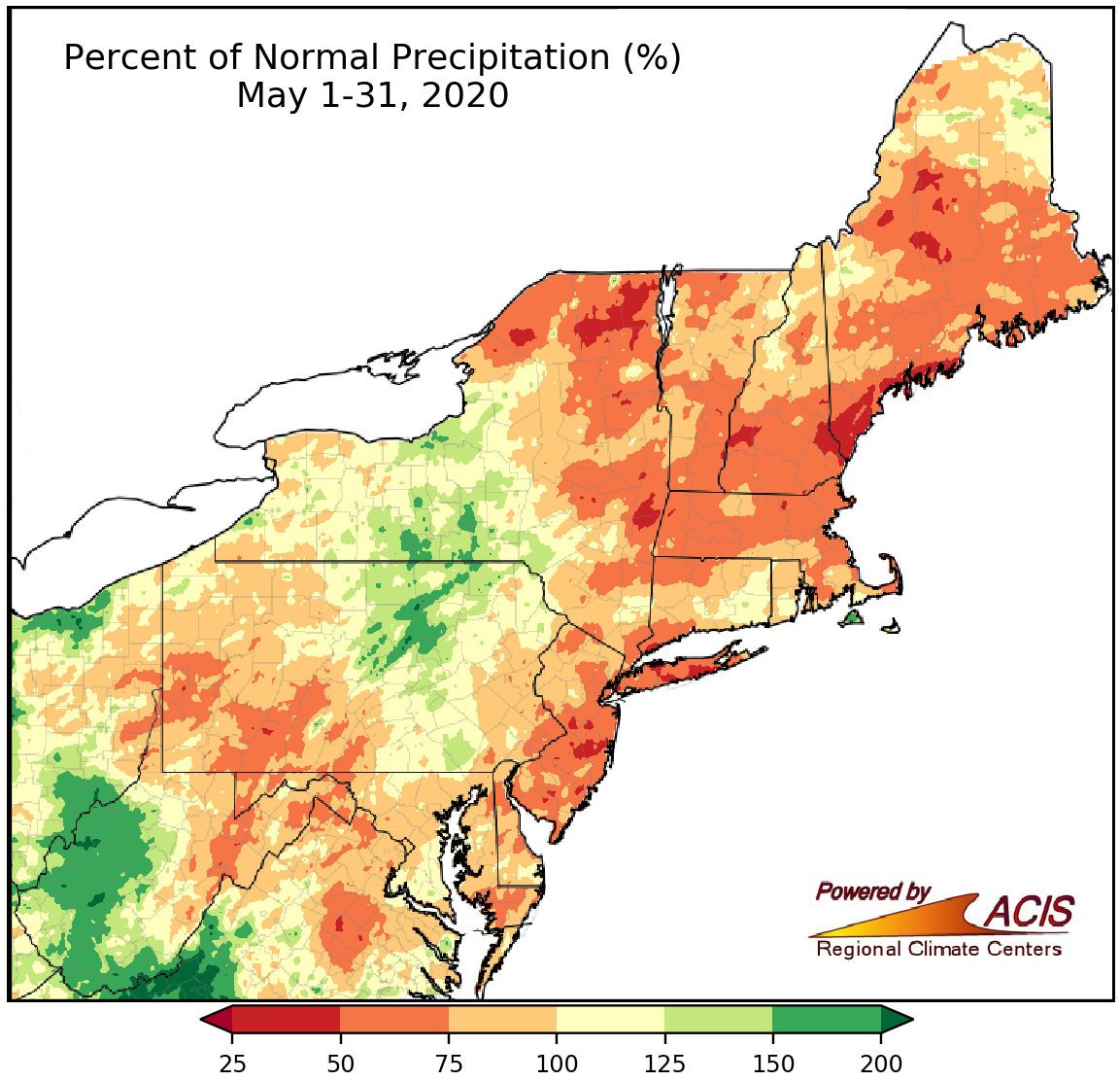
May precipitation ranged from 25% of normal ot 200% of normal, with many locations being drier than normal.
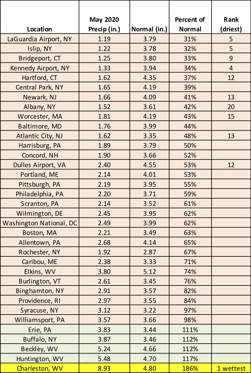
While Charleston, WV, had its wettest May on record, 10 other major climate sites ranked this May among their 20 driest on record.
Spring averaged out to be within 2°F of normal for almost the entire Northeast, with many locations just on the warm side of normal. At the 35 major climate sites, spring average temperatures ranged from 0.4°F below normal in Boston, MA, to 2.9°F above normal in Allentown, PA. Twenty-nine of the 35 major climate sites were warmer than normal, with nine ranking this spring among their 20 warmest on record.
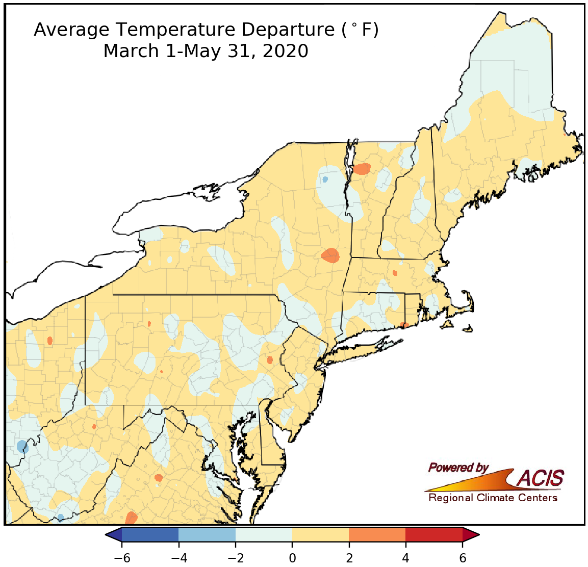
Spring temperatures generally ranged from 2°F below normal to 2°F above normal.
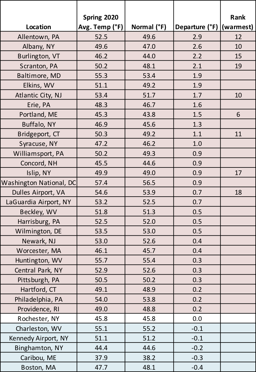
Nine major climate sites ranked this spring among their 20 warmest on record.
Spring precipitation ranged from 50% of normal in parts of northern New England and the eastern half of New York to 200% of normal in western and southern West Virginia. In fact, Charleston, WV, had its wettest spring on record, and Beckley, WV, logged its seventh wettest on record. In all, 23 of the 35 major climate sites were drier than normal, with Kennedy Airport, NY, having its 15th driest spring on record.
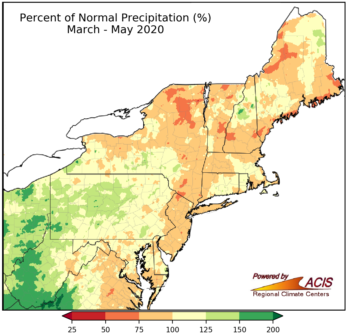
Spring precipitation ranged from 50% of normal to 200% of normal.
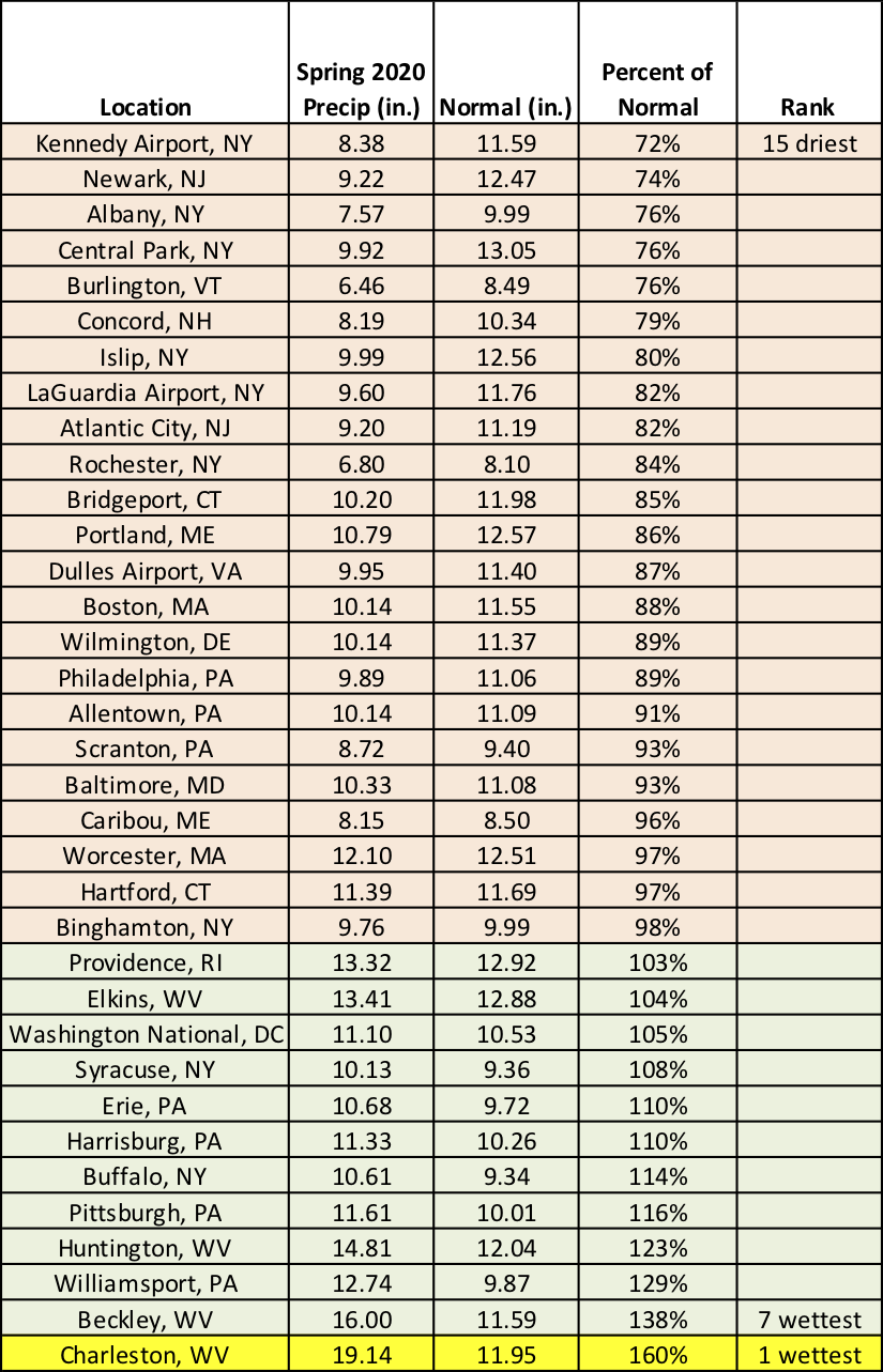
Charleston, WV, had its wettest spring on record.
Almost the entire Northeast saw less snow than usual this spring, with the largest deficits of more than 12 inches in northwestern Vermont and near Lakes Ontario and Erie in New York and Pennsylvania. Thirty-three of the 35 major climate sites saw below-normal spring snowfall, with seven tying their least snowy spring on record and another 14 ranking it among their 20 least snowy springs. However, northern Maine was the snowy exception, seeing a surplus of more than 12 inches and with Caribou having its 10th snowiest spring on record.
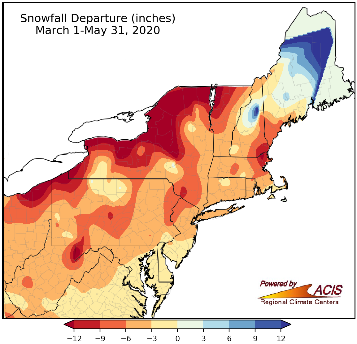
Spring snowfall ranged from more than 12 inches below normal to near normal for most of the Northeast, except northern Maine, which was snowier.
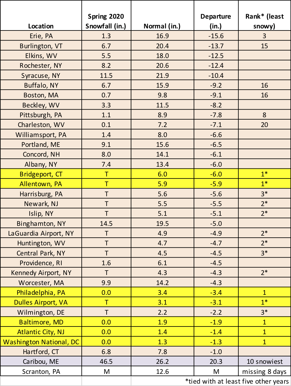
Seven major climate sites tied their least snowy spring on record.
A similar pattern to spring emerged for the snow season (October-May), with almost the entire region, except for northern Maine, seeing less snowfall than usual. The largest departures of more than 48 inches were east of Lake Ontario in New York. Thirty-three of the 35 major climate sites saw below-normal spring snowfall. Allentown, PA, and Harrisburg, PA, had their least snowy seasons on record, while another 20 sites ranked this season among their 20 least snowy on record. Philadelphia, PA, and Washington, D.C., saw less than an inch of snow for the season for only the third time on record. However, northern Maine had a snowfall surplus of more than 36 inches, with Caribou having its 6th snowiest season on record.
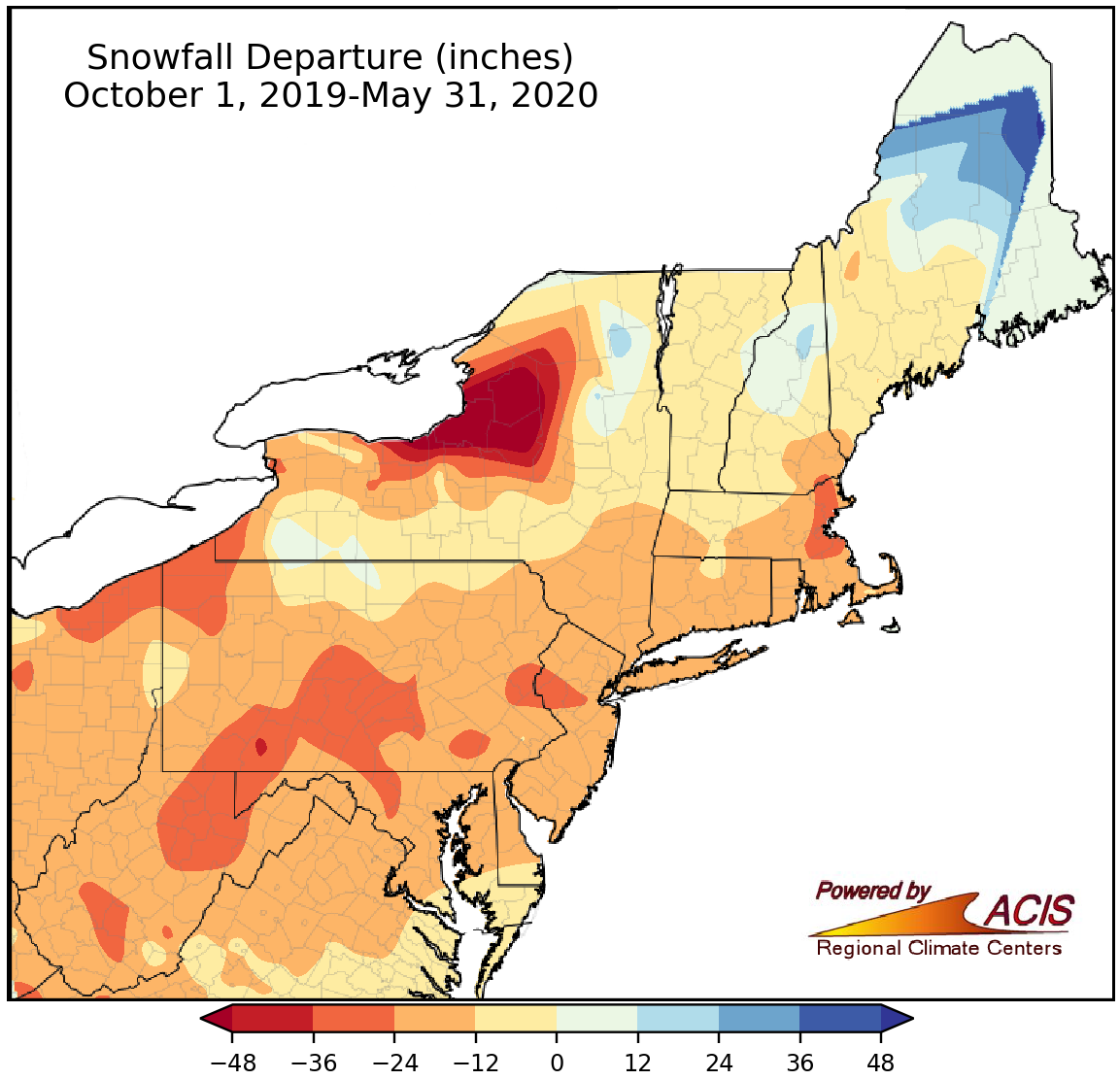
Seasonal snowfall ranged from more than 48 inches below normal to near normal for most of the Northeast, except northern Maine, which was snowier.
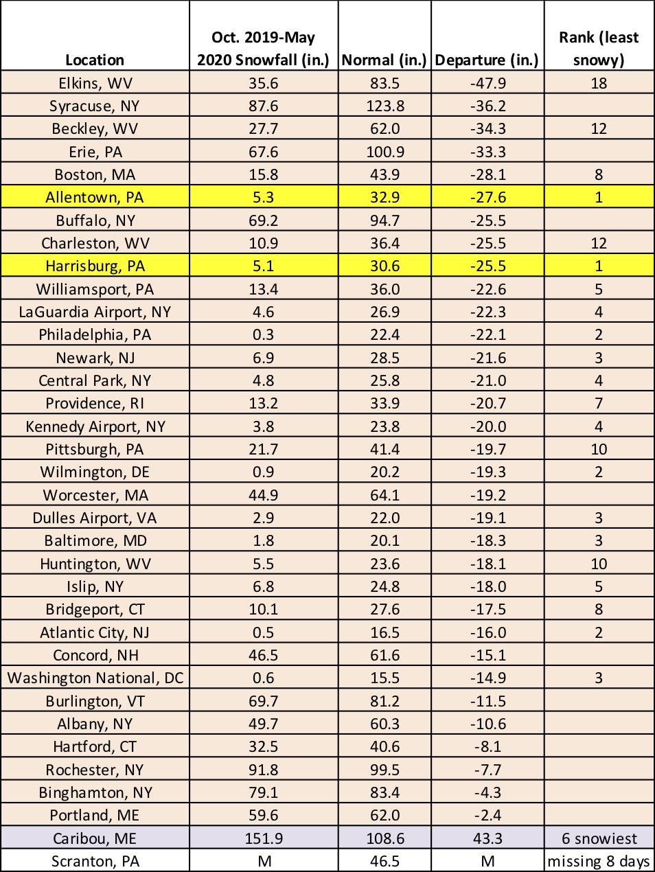
Allentown, PA, and Harrisburg, PA, had their least snowy seasons on record.
For June, NOAA’s Climate Prediction Center (CPC) favors above-normal temperatures for the entire Northeast, with increased chances of below-normal precipitation for eastern areas. For summer, CPC is calling for an increased likelihood of above-normal precipitation for southern areas and an increased likelihood of above-normal temperatures for the whole Northeast.
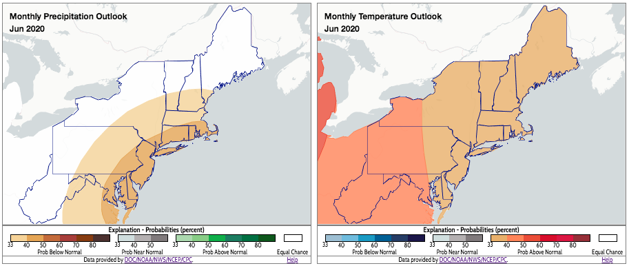
CPC’s June outlooks indicate a tilt towards drier-than-normal (shaded tan) and warmer-than-normal (shaded orange) conditions for parts of the Northeast. Click to enlarge.
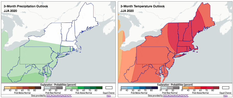
CPC’s summer outlooks indicate a tilt towards wetter-than-normal (shaded green) and warmer-than-normal (shaded orange) conditions for parts of the Northeast. Click to enlarge.