Summer 2024 - Mostly Hot with Precipitation Extremes
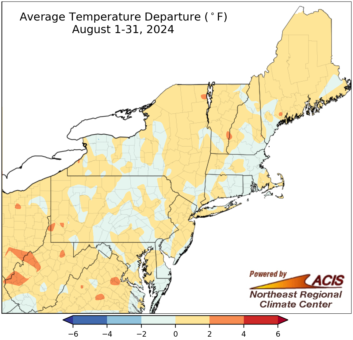
August average temperatures ranged from 2°F below normal to 4°F above normal.
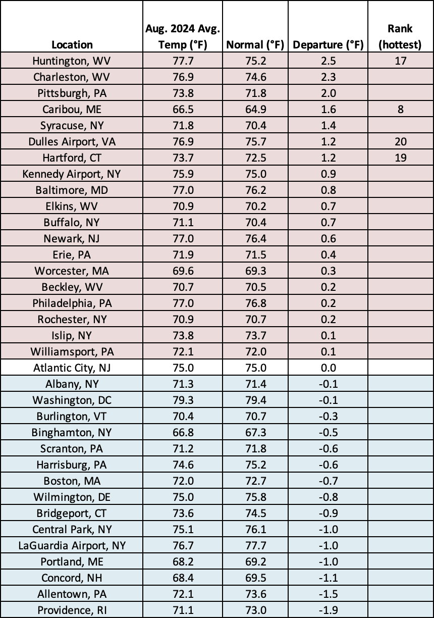
In contrast to the previous two months of summer which were quite hot, August temperatures averaged out to be within 2°F of normal for most of the Northeast. There were a few warmer spots, mostly in western and northern West Virginia, that were over 2°F above normal. August average temperatures at the region’s 35 major climate sites ranged from 1.9°F below normal in Providence, RI, to 2.5°F above normal in Huntington, WV. Nineteen of the sites were warmer than normal, with this August ranking among the 20 hottest for four of them.
This August ranked among the 20 hottest on record for four major climate sites.
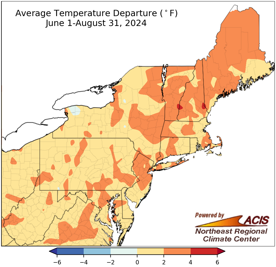
Summer average temperatures ranged from near normal to 4°F above normal for most areas.
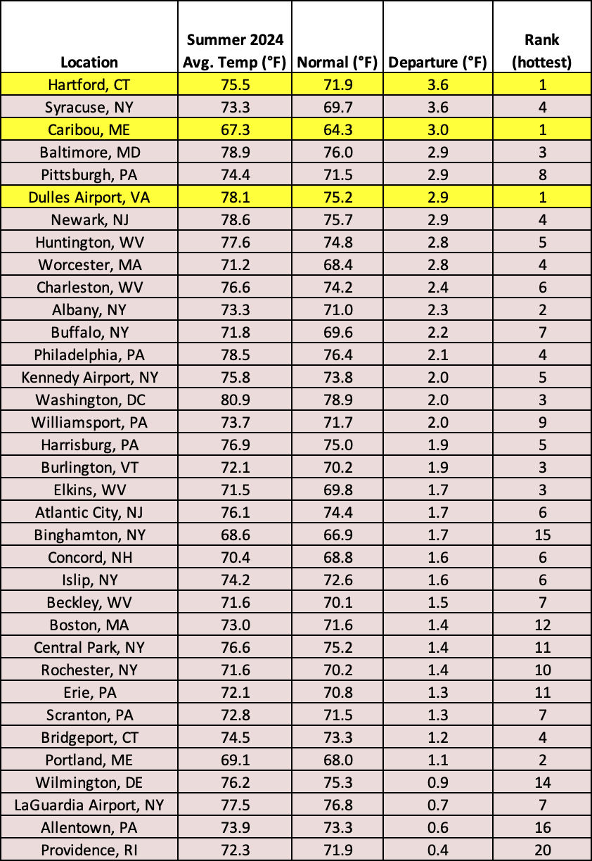
Driven by unusually hot temperatures in June and July, Summer 2024 average temperatures ranged from near normal to 4°F above normal for almost the entire Northeast. In fact, this summer was record hot for Hartford, CT; Caribou, ME; and Dulles Airport, Virginia, and among the 20 hottest summers for the other 32 major climate sites. Average temperatures for all of the major climate sites ranged from 0.4°F above normal in Providence, RI, to 3.6°F above normal in Hartford, CT, and Syracuse, NY.
Summer 2024 was record hot for three major climate sites and among the 20 hottest for the other 32 sites.
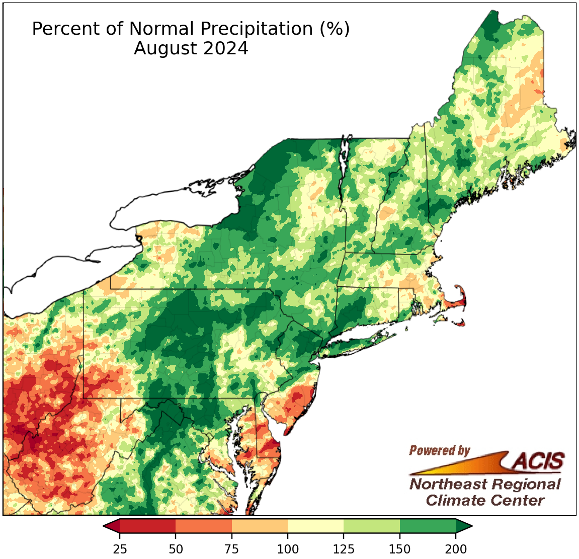
August precipitation ranged from less than 50% of normal to more than 200% of normal.
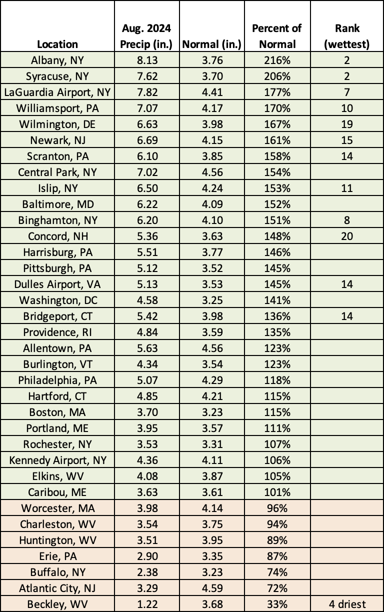
While a large portion of the Northeast had a wetter-than-normal August, precipitation overall ranged from less than 50% of normal to more than 200% of normal. The driest locations were generally in West Virginia (outside of the Eastern Panhandle), with the state experiencing exceptional drought for the first time since the U.S. Drought Monitor began in 2000. There were widespread impacts, which were discussed in our August webinar or can be read about in our weekly Northeast Drought Update. Meanwhile, the wettest locations were generally in two areas - along the path of Hurricane Debby’s remnants from eastern West Virginia through Pennsylvania into New York and where an extreme rainfall event occurred stretching from northern New Jersey into southeastern New York and western Connecticut. At the Northeast’s 35 major climate sites, August precipitation ranged from 33% of normal in Beckley, WV, to 216% of normal in Albany, NY, with 28 of the sites being wetter than normal. This August was the fourth driest for Beckley, WV, but among the 20 wettest for 12 other major climate sites.
This August ranked was Beckley, WV’s fourth driest but was among the 20 wettest for 12 other major climate sites.
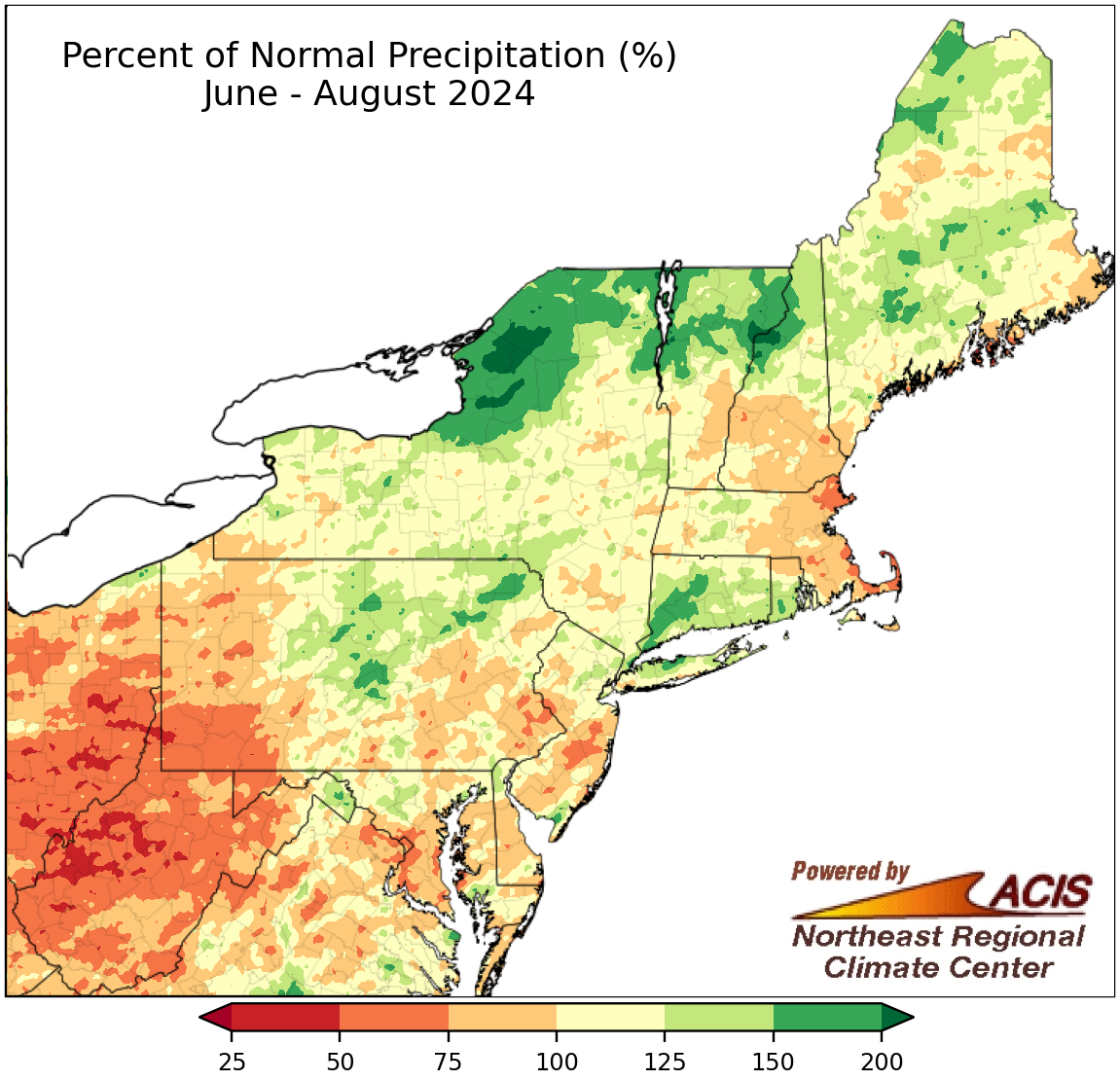
Summer precipitation ranged from less than 50% of normal to more than 200% of normal.
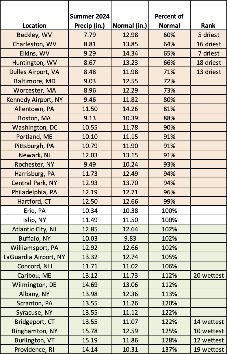
With June and July tending to lean toward the dry side of normal for many areas but August trending wetter for much of the region, Summer 2024 precipitation varied, ranging from less than 50% of normal in parts of West Virginia to more than 200% of normal in parts of New York. Summer precipitation at the 35 major climate sites ranged from 60% of normal in Beckley, WV, to 137% of normal in Providence, RI, with 19 sites being drier than normal, two at normal, and 14 being wetter than normal. Overall, this summer was among the 20 driest for five major climate sites but among the 20 wettest for another five of the sites.
Summer 2024 was among the 20 driest for five major climate sites but among the 20 wettest for another five of the sites.
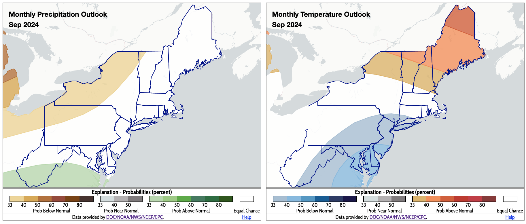
September is expected to produce a wide range of conditions in the Northeast, based on outlooks from NOAA’s Climate Prediction Center. There’s a tilt toward below-normal precipitation in northwestern Pennsylvania, portions of New York, and northwestern Vermont, while above-normal precipitation is favored for the southern half of West Virginia. Equal chances of below-, near-, or above-normal precipitation were predicted for the rest of the region. For temperatures, there’s an increased likelihood of below-normal temperatures for an area stretching from eastern West Virginia through parts of the Mid-Atlantic and southeastern New York into southwestern Connecticut. Meanwhile, above-normal temperatures are favored for most of northern New England and northern New York. The remainder of the Northeast falls into the equal chances category.
For September, there’s a tilt toward below-normal precipitation for parts of Pennsylvania and New York (shaded tan), but above-normal precipitation is favored for parts of West Virginia (shaded green). The region’s southeastern corner could be cooler than normal (shaded blue) for September, while the region’s northern parts could be warmer than normal (shaded orange). Click to enlarge.

