Mid-May
After a cold April, May so far has been the opposite! All 35 major climate sites ranked this May 1-15 in their top 20 warmest and four have had their record warmest start to the month. Washington, DC and Baltimore, MD have both had four days of 90 degrees or hotter, ranking as the record most such days for the first half of May.
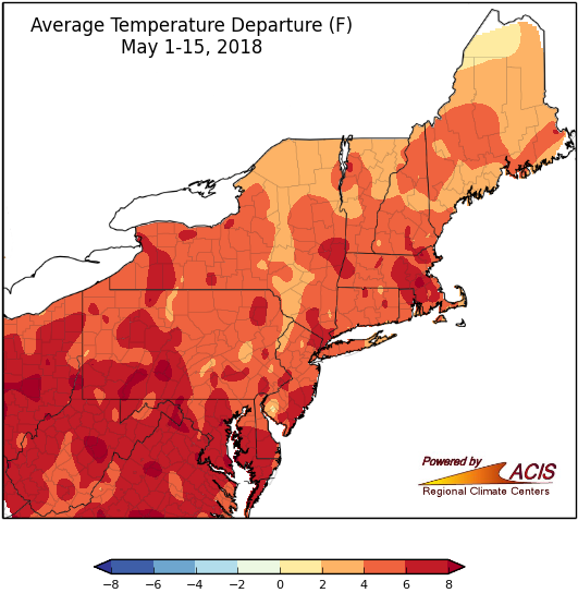
The entire Northeast experienced temperatures that ranged from near normal to more than 8°F above normal during the first half of May.
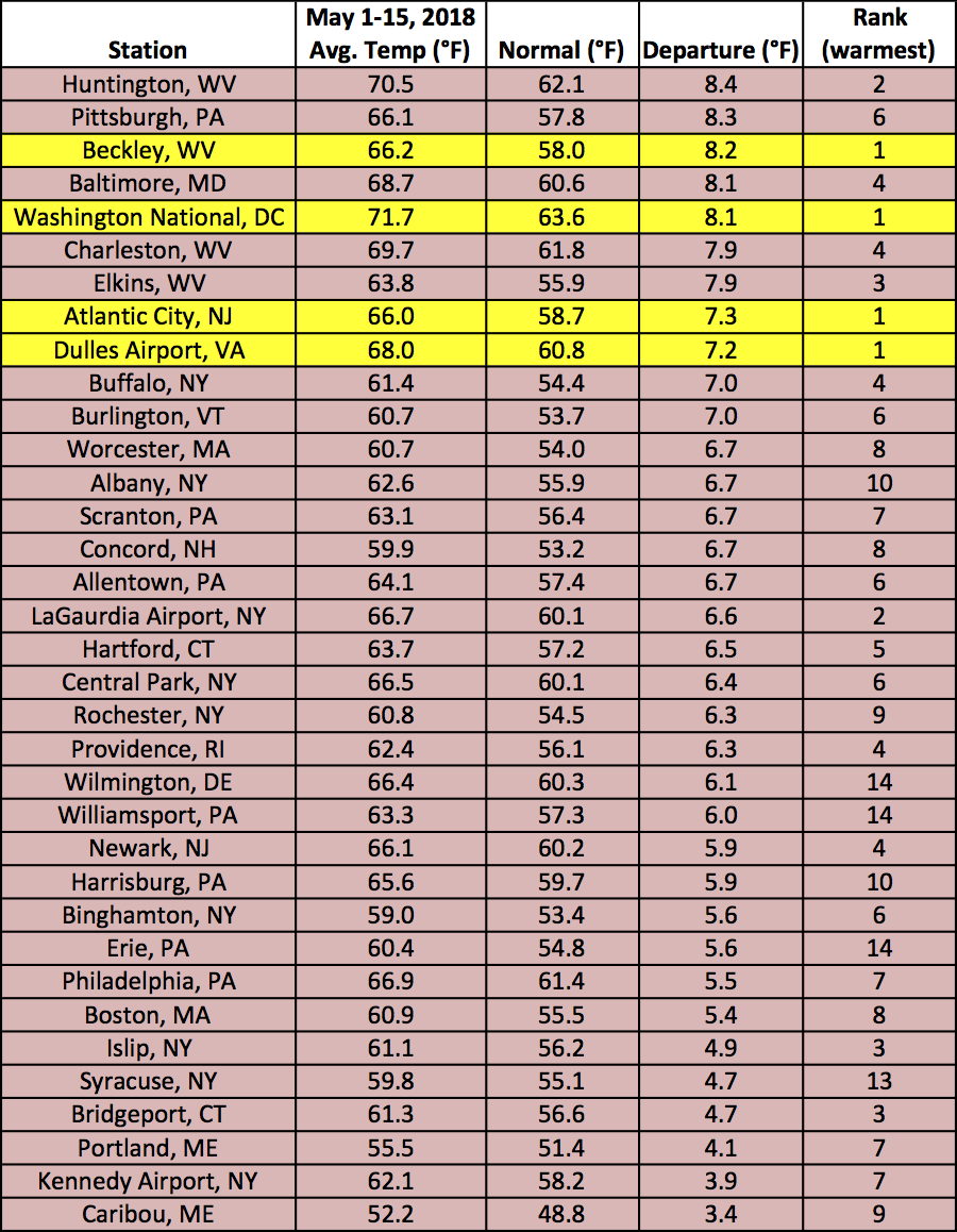
Each of the 35 major climate sites in the Northeast have ranked in their top 20 warmest May 1-15.
Precipitation was split in the region. Parts of New York and New England were very dry, receiving less than 25% of normal precipitation. Concord, NH only had 0.26 inches of rain, which is 15% of normal. Other parts of the Northeast saw over 200% of normal precipitation. Atlantic City, NJ had their 9th wettest start to May.
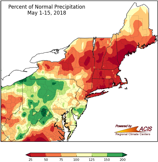
Precipitation across the Northeast ranged from less than 25% to more than 200% of normal.
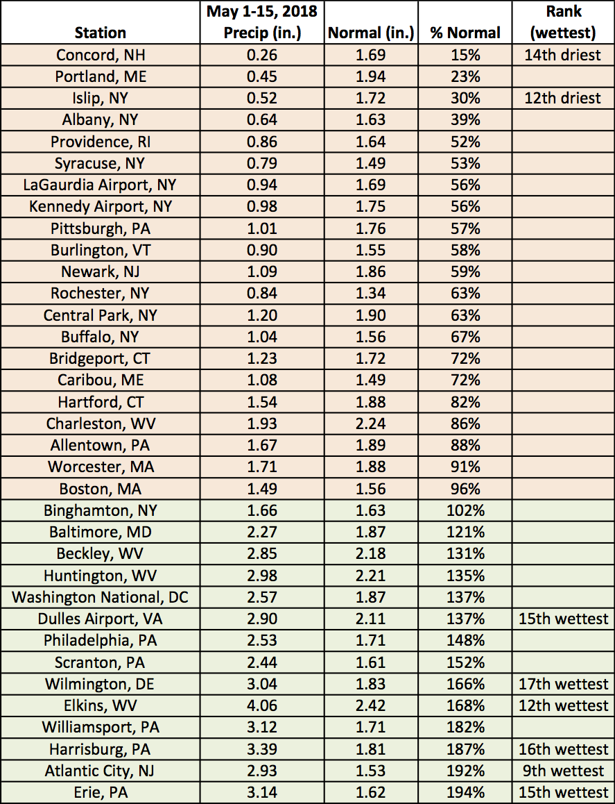
Precipitation ranged from 0.26 inches to 3.14 inches.
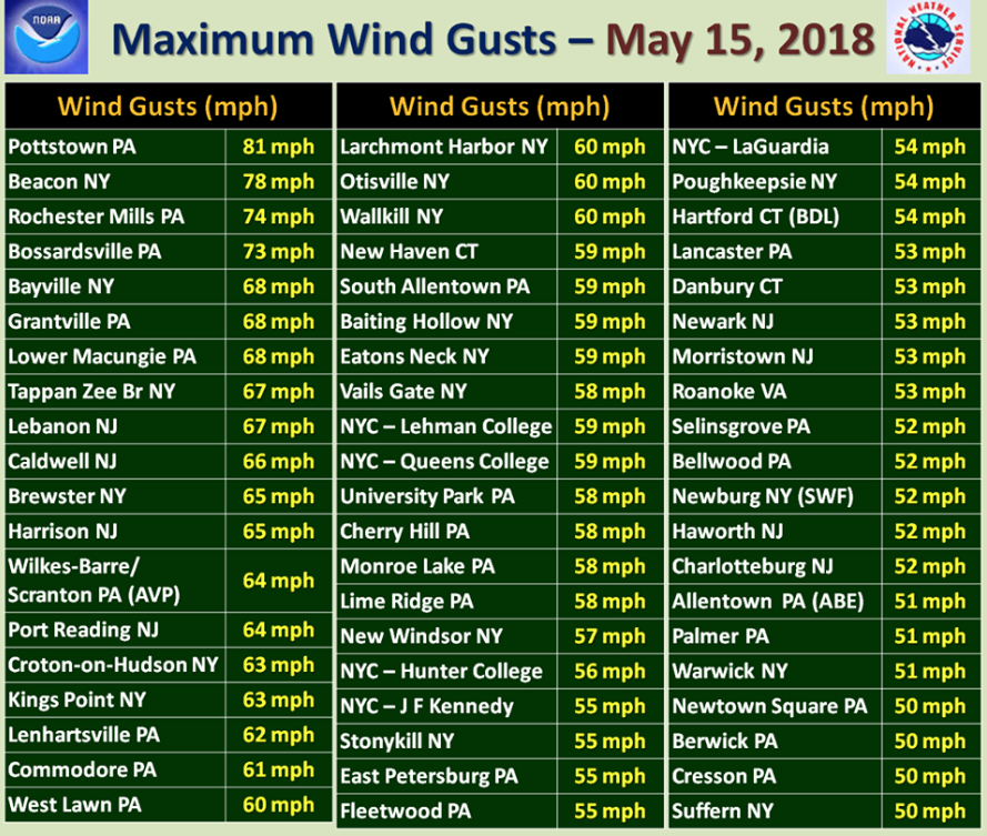
Contributing to the precipitation totals was a severe weather outbreak on May 15th. Intense downpours caused flooding, trapped cars, and road closures. Large hail was reported in Connecticut and New York. There were strong winds that downed trees and power lines that caused 496,777 customers in Pennsylvania, New York, New Jersey and Connecticut to lose power, and unfortunately also 5 deaths. There were several confirmed tornadoes in New York, Connecticut, and Pennsylvania.