Mid-March - Lacking in Precipitation and Snowfall
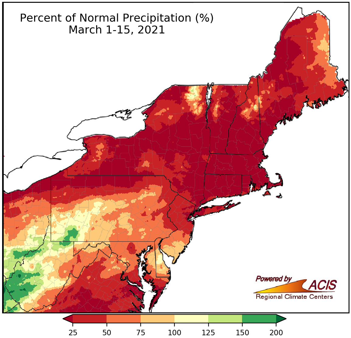
March 1-15 precipitation ranged from less than 25% of normal to 200% of normal, with most areas being drier than normal.
The first half of March was quite dry for much of the Northeast, with the driest locations, including large swaths of New York and New England, seeing less than 25% of normal precipitation. In fact, for many areas, precipitation was reported on March 1, with little, if any, precipitation during the next two weeks. Precipitation at the 35 major climate sites ranged from 5% of normal in Allentown, PA, to 60% of normal in Beckley, WV. Seven major climate sites had their driest first half of March on record, with another 26 major climate sites ranking this March 1-15 period among their 20 driest on record. Given the dry conditions, abnormal dryness expanded in the region. The main exceptions to the dryness were portions of southwestern Pennsylvania and western West Virginia which were wetter, seeing up to 200% of normal precipitation.
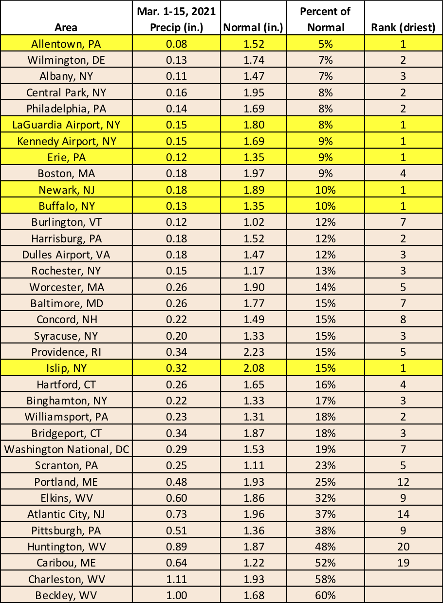
Seven major climate sites had their driest first half of March on record, with most of the other sites ranking it their 20 driest.
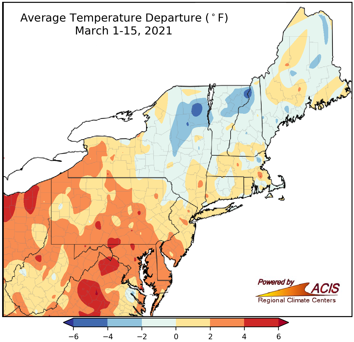
March 1-15 average temperatures ranged from 6°F below normal to 6°F above normal.
Average temperatures for the first half of March varied widely in the Northeast, ranging from 6°F below normal to 6°F above normal. In general, much of New York and New England saw below- or near-normal temperatures and much of the Mid-Atlantic and West Virginia saw near- or above-normal temperatures. At the 35 major climate sites, March 1-15 average temperatures ranged from 2.6°F below normal in Caribou, ME, to 4.0°F above normal in Baltimore, MD, and Erie, PA. Overall, 26 of the sites were warmer than normal, with Dulles Airport, VA, having its 16th warmest first half of March on record.
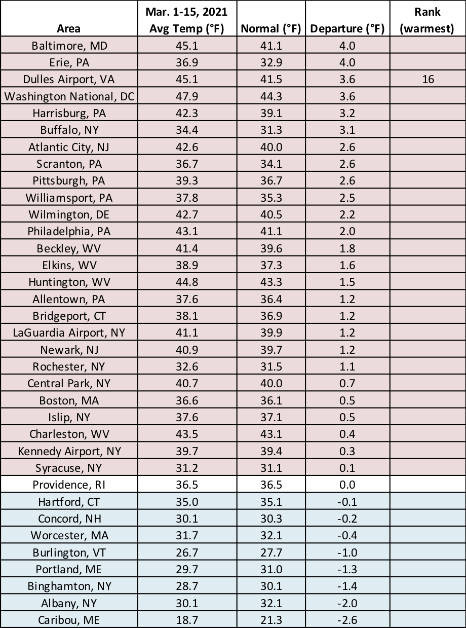
Average temperatures for the first half of March at the major climate sites ranged from 2.6°F below normal in Caribou, ME, to 4.0°F above normal in Baltimore, MD, and Erie, PA.
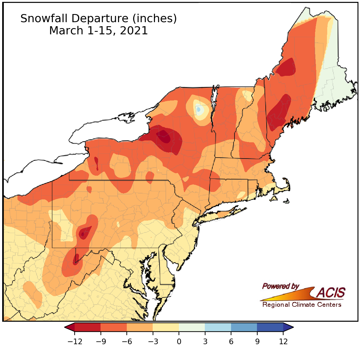
March 1-15 snowfall ranged from more than 12 inches below normal to near normal.
With little precipitation, and in some locations near- or above-normal temperatures, the Northeast saw below-normal snowfall during the first half of March. The largest deficits of more than 12 inches were found east of Lake Ontario in northern/central New York. At the 35 major climate sites, snowfall ranged from 8.5 inches below normal in Rochester, NY, to 0.9 inches below normal in Atlantic City, NJ. This March 1-15 period tied several other years as the least snowy on record for the 15 major climate sites that saw no snowfall. For instance, Central Park, NY, received no snowfall during the period, tying 13 other years as the least snowy. The main exception was Elkins, WV, which saw no snowfall from March 1-15 for only the third time on record. Sixteen additional major climate sites ranked this first half of March among their 20 least snowy, with sites that saw a trace of snow tying several other years.
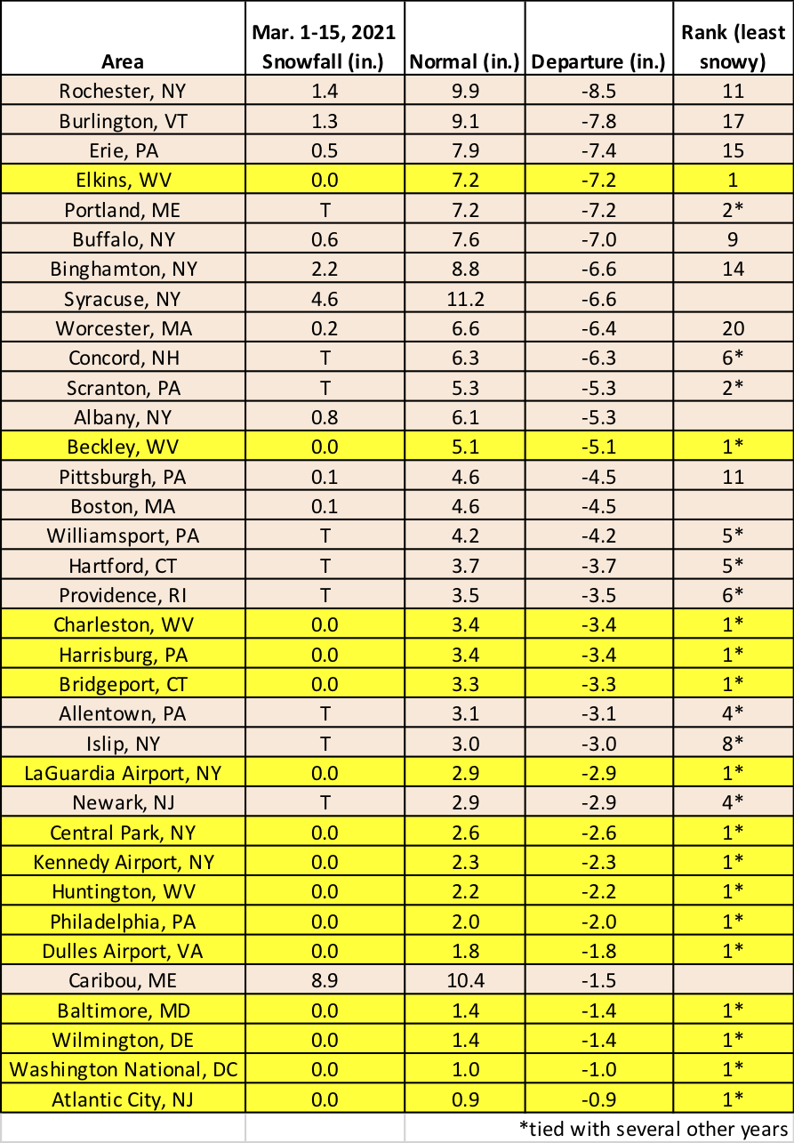
This March 1-15 period tied several other years as the least snowy on record for the 15 major climate sites that saw no snowfall.