January Brings Cold, Dry Conditions
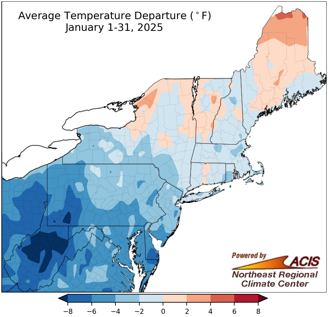
January average temperatures ranged from more than 8°F below normal to 4°F above normal.
Much of the Northeast was colder than normal during January, with the largest departures below normal of more than 8°F found in parts of West Virginia and southwestern Pennsylvania. However, some locations in New York, Connecticut, and northern New England experienced warmer-than-normal temperatures, with northern Maine being up to 4°F above normal. January average temperatures at the Northeast’s 35 major climate sites ranged from 9.7°F below normal in Elkins, WV, to 3.1°F above normal in Caribou, ME, with 30 of the sites closing out the month on the cold side of normal. This January ranked among the 13 coldest on record for three of the sites but was Caribou’s 19th warmest.
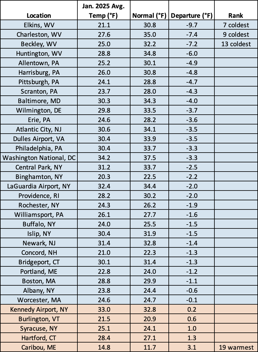
January 2025 was among the 13 coldest on record for three major climate sites but ranked as the 19th warmest for Caribou, ME.
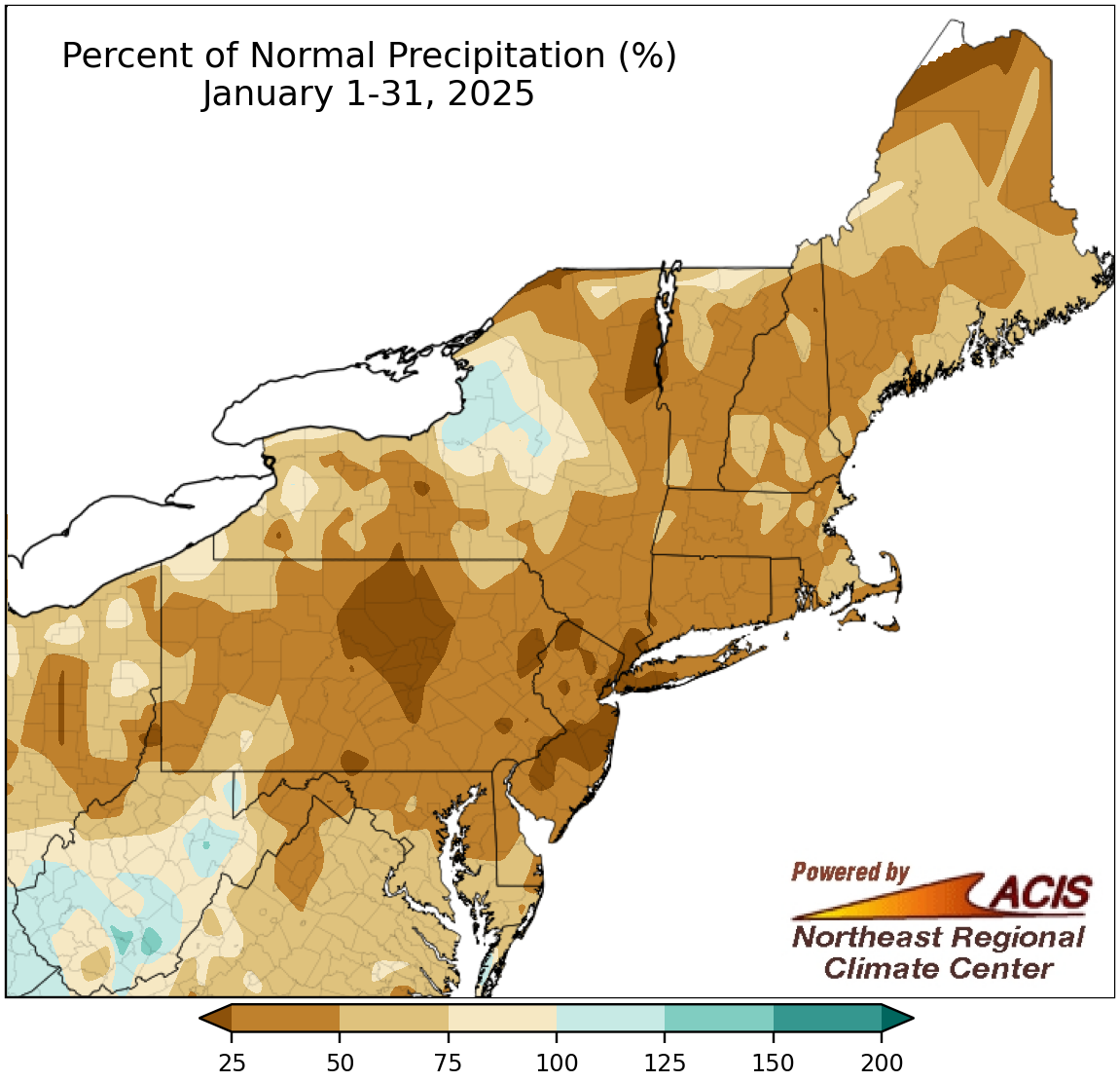
January precipitation ranged from less than 25% of normal to 150% of normal.
January was also drier than normal for much of the Northeast, with the driest locations such as central Pennsylvania, parts of New Jersey, and southeastern New York seeing less than 25% of normal precipitation. On the other hand, some spots in West Virginia and northern New York were wetter, seeing up to 150% of normal precipitation. January precipitation at the Northeast’s 35 major climate sites ranged from 14% of normal in Newark, NJ, to 142% of normal in Beckley, WV, with 31 of the sites being drier than normal. This January tied as the driest January on record for LaGuardia Airport, NY, and ranked among the 17 driest for another 18 major climate sites. The lack of precipitation allowed drought and abnormal dryness to persist in parts of the Northeast.
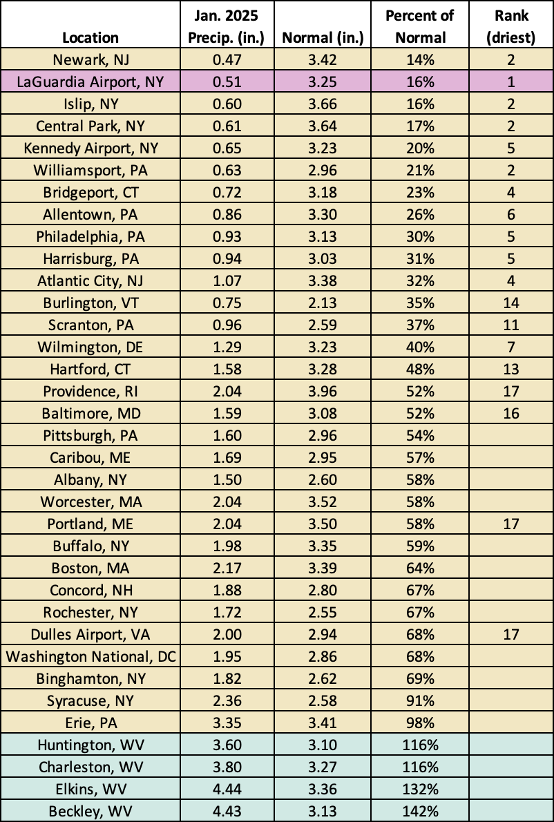
This January was record dry for LaGuardia Airport, NY, and among the 17 driest for another 18 major climate sites.
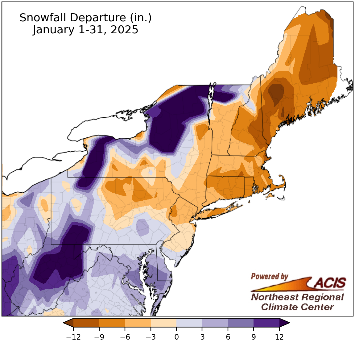
January snowfall ranged from more than 12 inches below normal to more than 12 inches above normal.
Despite the overall lack of precipitation, January snowfall totals varied, ranging from more than 12 inches below normal in western Maine to more than 12 inches above normal in several places including northern and western New York, southwestern Pennsylvania, and parts of West Virginia. At the Northeast’s 35 major climate sites, January snowfall ranged from 9.2 inches below normal in Worcester, MA, to 18.5 inches above normal in Elkins, WV, with 19 sites seeing snowfall deficits. This January ranked as the 20th least snowy for two major climate sites but was among the 19 snowiest for seven other sites.
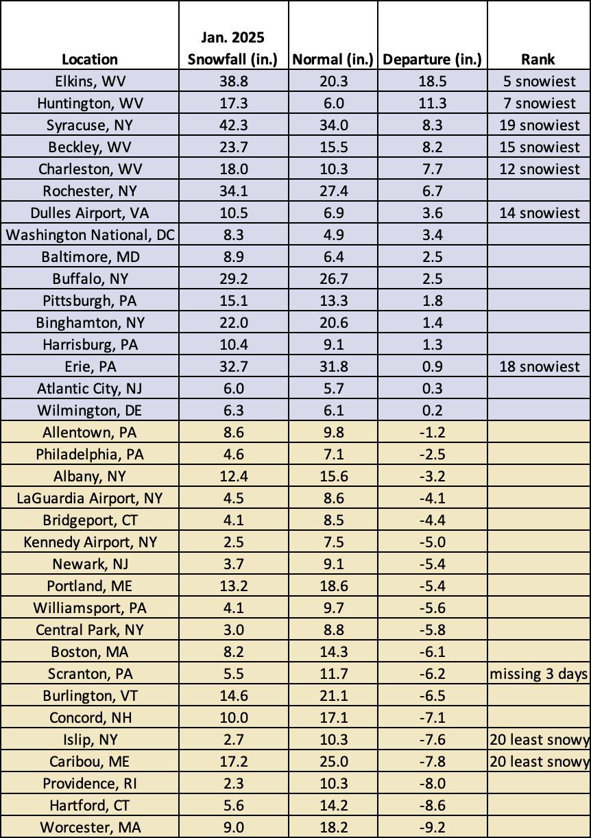
This January ranked as the 20th least snowy for two major climate sites but was among the 19 snowiest for seven other sites.
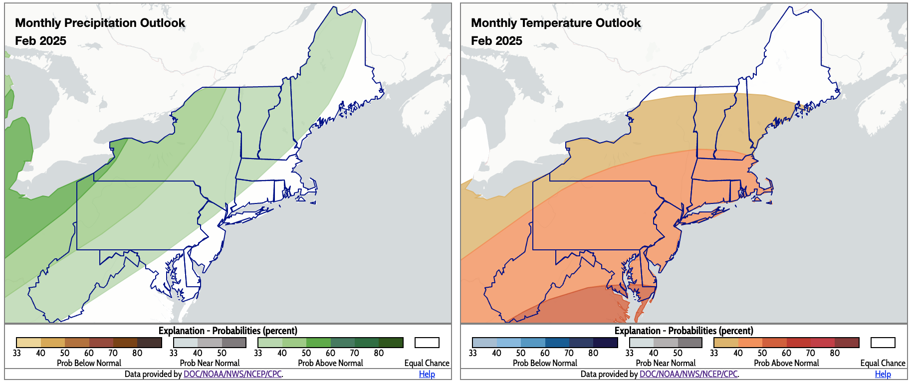
For February, NOAA’s Climate Prediction Center favors above-normal precipitation and above-normal temperatures for much of the Northeast. Click to enlarge.
According to NOAA’s Climate Prediction Center, there’s an increased likelihood of above-normal precipitation for much of the Northeast for February, with the greatest chances in northwestern Pennsylvania and western New York. The exception is areas close to the coast, which have equal chances of below-, near-, or above-normal precipitation. There’s a tilt toward above-normal temperatures for most of the region, as well, with the greatest likelihood in southeastern West Virginia and southern and eastern Maryland. Meanwhile, parts of northern New York and northern New England fall into the equal chances category.