Mmmmm, January!
No, today’s blog isn’t about food (although, I may have been hungry when writing it). What it is about are the “M” words that describe this January.
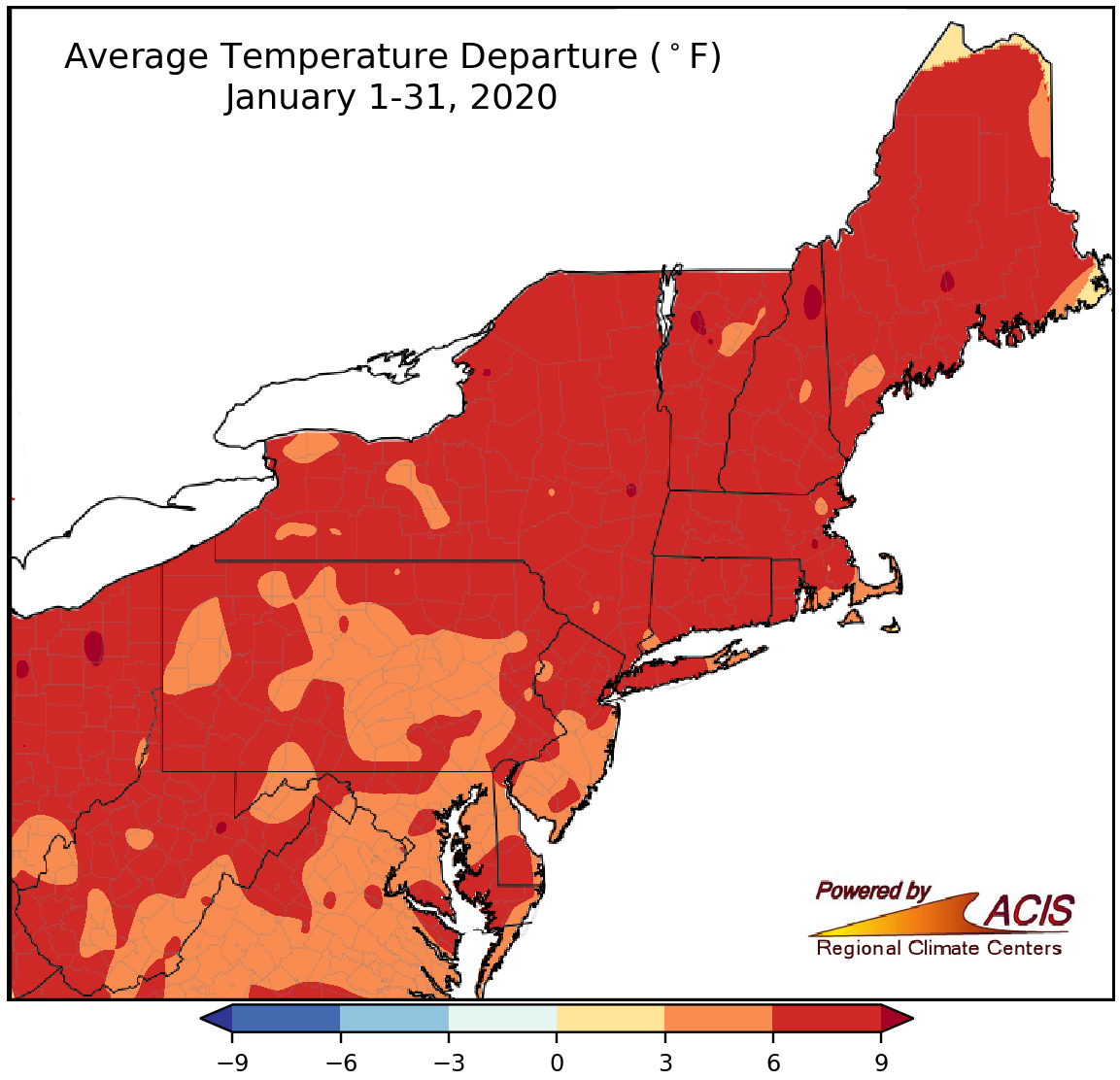
January average temperatures were 3°F to 9°F warmer than normal.
Mild! Simply put, January was a mild month region-wide, with average temperatures generally ranging from 3°F to 9°F above normal. Thirty-three of the Northeast’s 35 major climate sites ranked this January among their 20 warmest on record. Of those, Albany had the largest departure at 9.2°F above normal. Many days this January were milder than usual but January 11 and 12 were particularly noteworthy, with a few sites having their warmest January day on record.
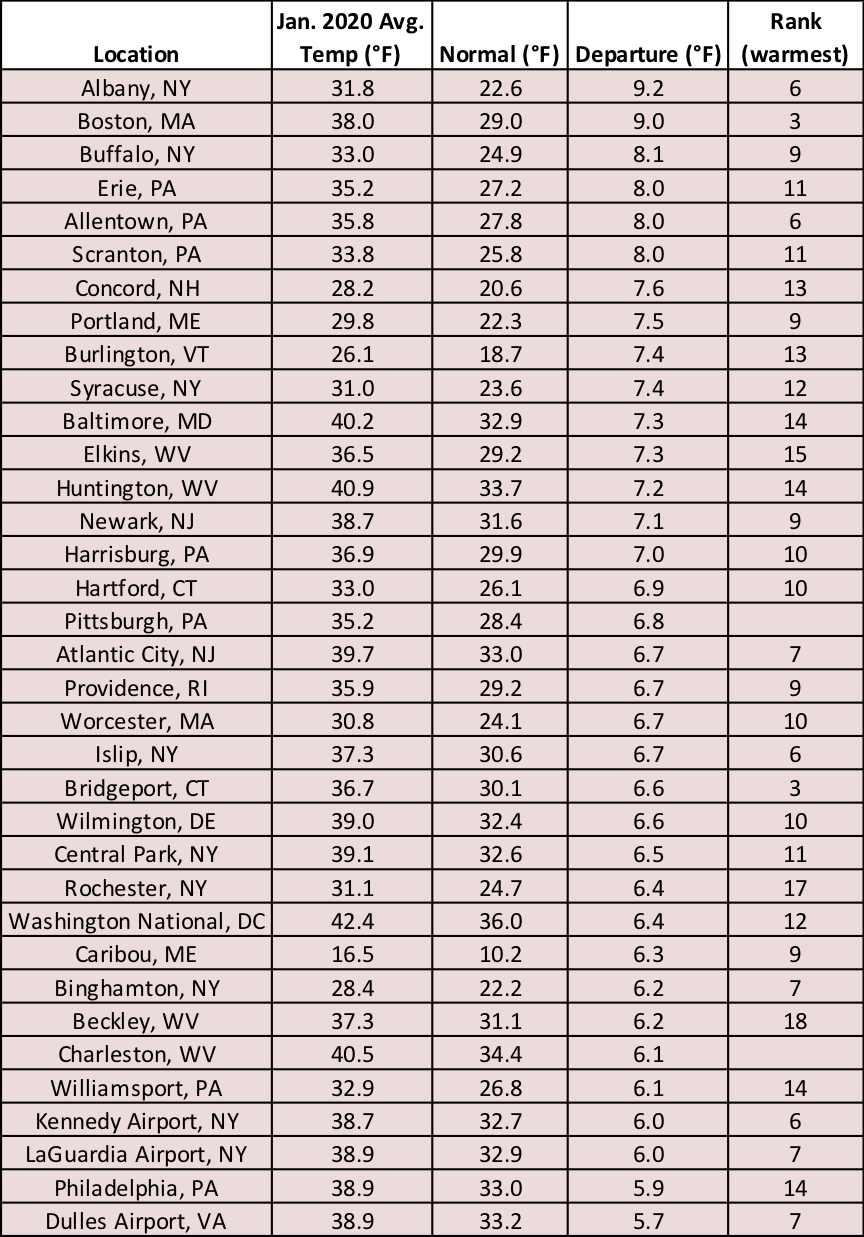
This January ranked among the 10 warmest Januarys on record at 19 major climate sites.
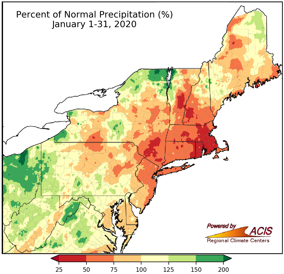
January precipitation ranged from 25% to 200% of normal.
Mixed! There were two reasons behind this word choice. First, the region has seen a mix of precipitation types, including snow, sleet, freezing rain, and rain. Second, there was a mix of January precipitation amounts, from 25% of normal in parts of New England and southeastern New York to 200% of normal in parts of northern/western New York, western Pennsylvania, and eastern West Virginia. In addition, the major climate sites were nearly split, with 19 drier than normal, one at normal, and 15 wetter than normal. Precipitation at the major climate sites ranged from 33% of normal in Providence to 137% of normal in Pittsburgh.
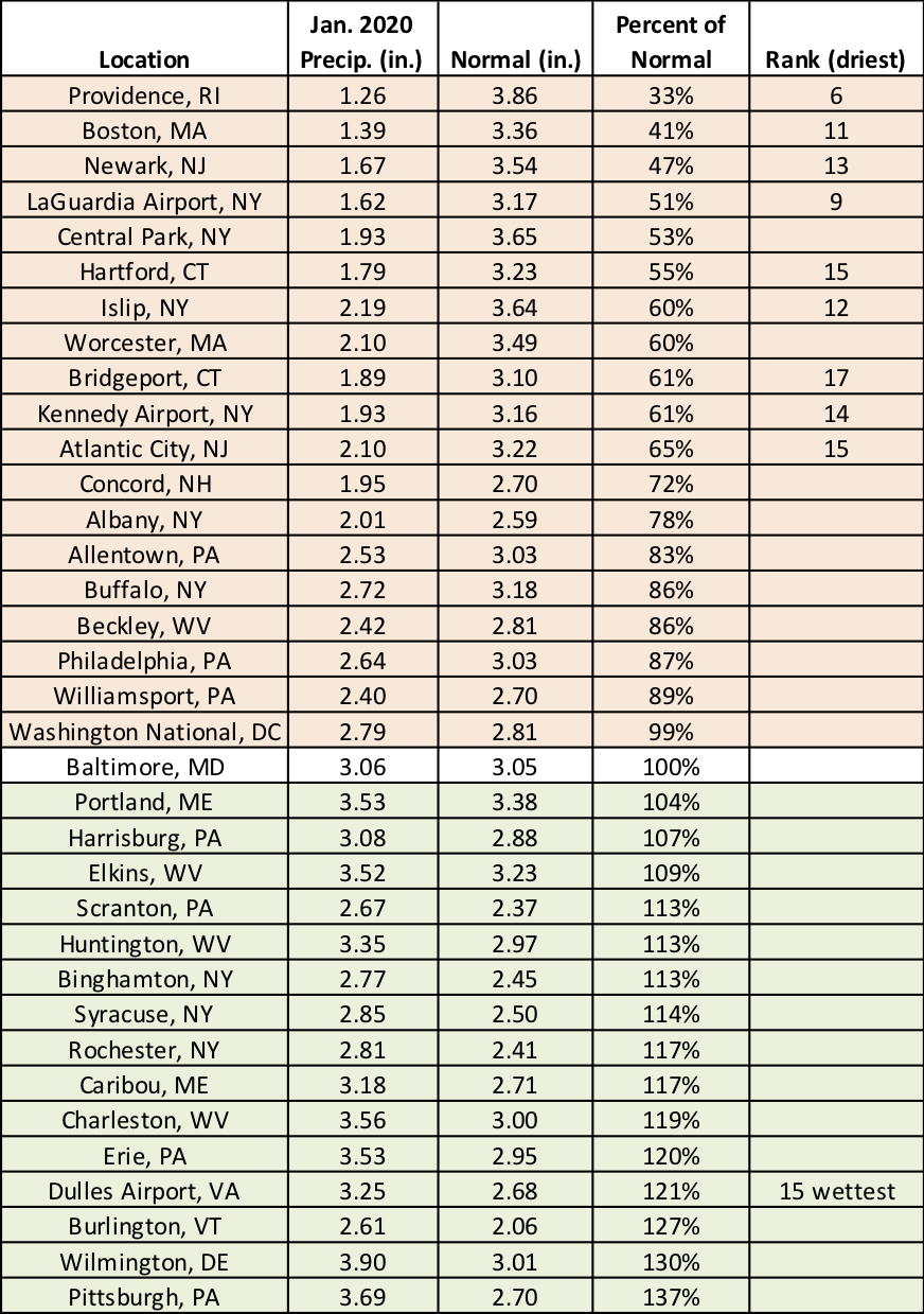
This January ranked among the 20 driest Januarys on record for nine major climate sites but as Dulles Airport’s 15th wettest.
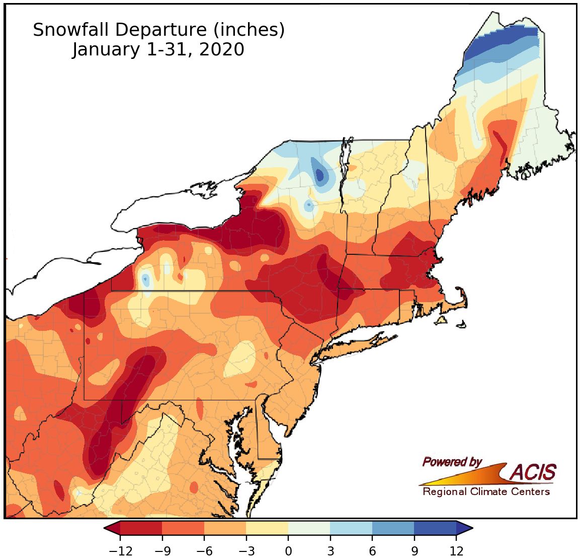
January snowfall ranged from more than 12 inches below normal to 12 inches above normal.
Missing! It’s not surprising given the mild temperatures that snowfall was below normal for almost the entire Northeast. The greatest deficits of over a foot were generally found in some lake-effect areas of New York and Pennsylvania and the higher elevations of West Virginia, western Pennsylvania, and southern New England. Thirty-four major climate sites saw below-normal snowfall this January. Atlantic City and Huntington didn’t even see measurable snow, making this January the second least snowy on record for both. Some sites - Washington, D.C., Wilmington, Philadelphia, and Atlantic City - still have yet to see their first inch of snow! As of February 3, the first inch of snow was a month past due and will rank among the ten latest on record when (or if) it does fall. In fact, if Wilmington doesn’t see their first inch of snow by the end of the day on February 8, it’ll be the site’s latest on record (since 1943).
Maine! Northern Maine to be exact. That was one of the few places to see a snowfall surplus this January. Caribou got an extra 6.3 inches of snow, making it the site’s 20th snowiest January.
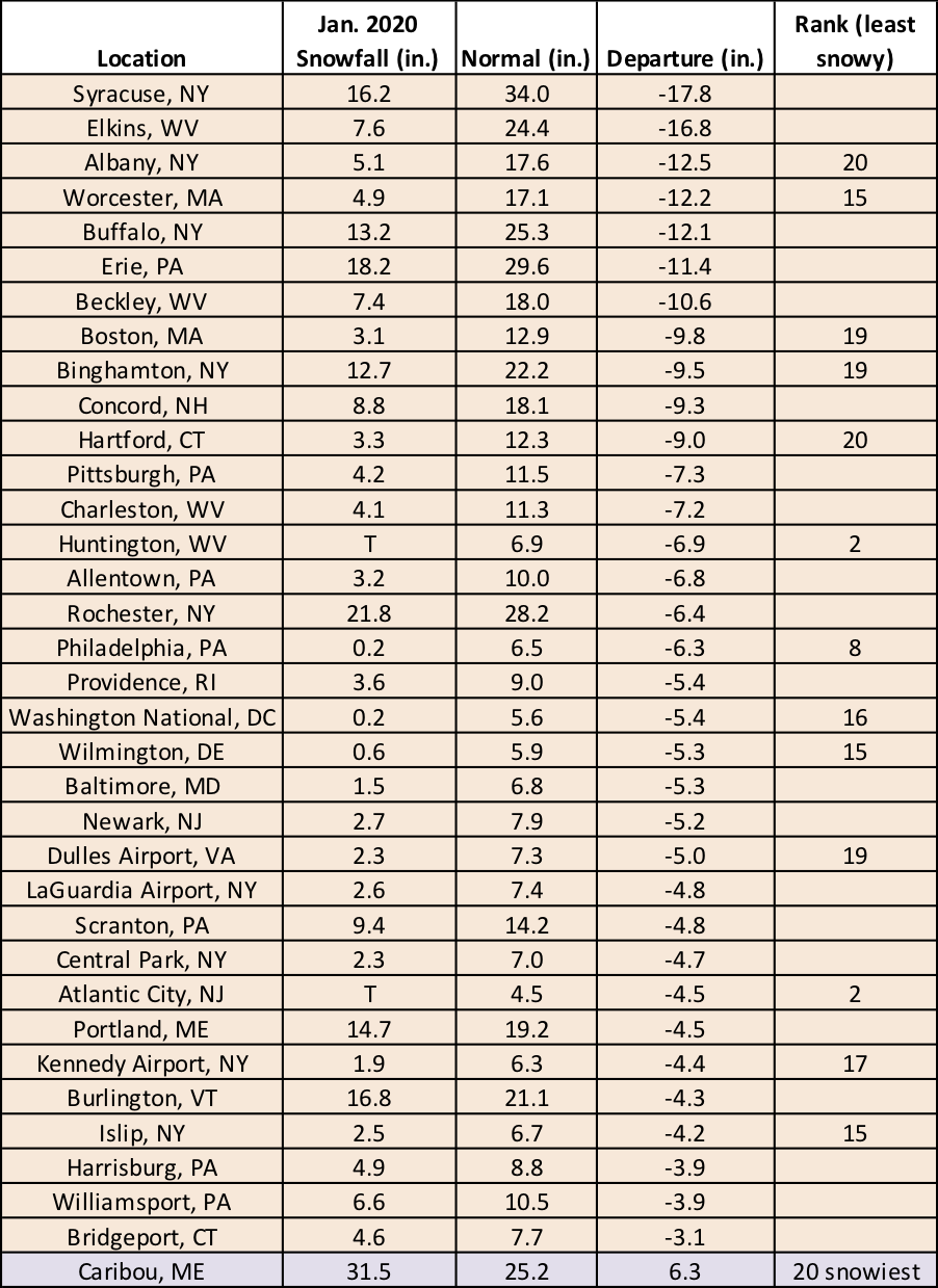
This January ranked among the 20 least snowy Januarys on record for 13 major climate sites but as Caribou’s 20th snowiest.
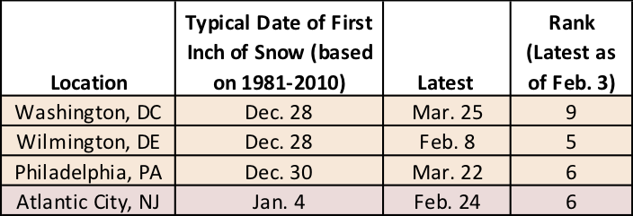
Four sites haven’t seen their first inch of snow, which ranks among the 10 latest on record.
Miracle! That’s what it may take to revive this winter season. According to NOAA’s Climate Prediction Center, warmer-than-normal conditions are favored to continue in February for much of the region. And for southern areas, there’s a slight tilt towards wetter-than-normal weather.
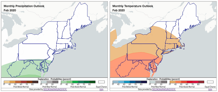
NOAA’s Climate Prediction Center favors above-normal temperatures and above-normal precipitation for parts of the region in February. Click to enlarge.