Mid-August Recap
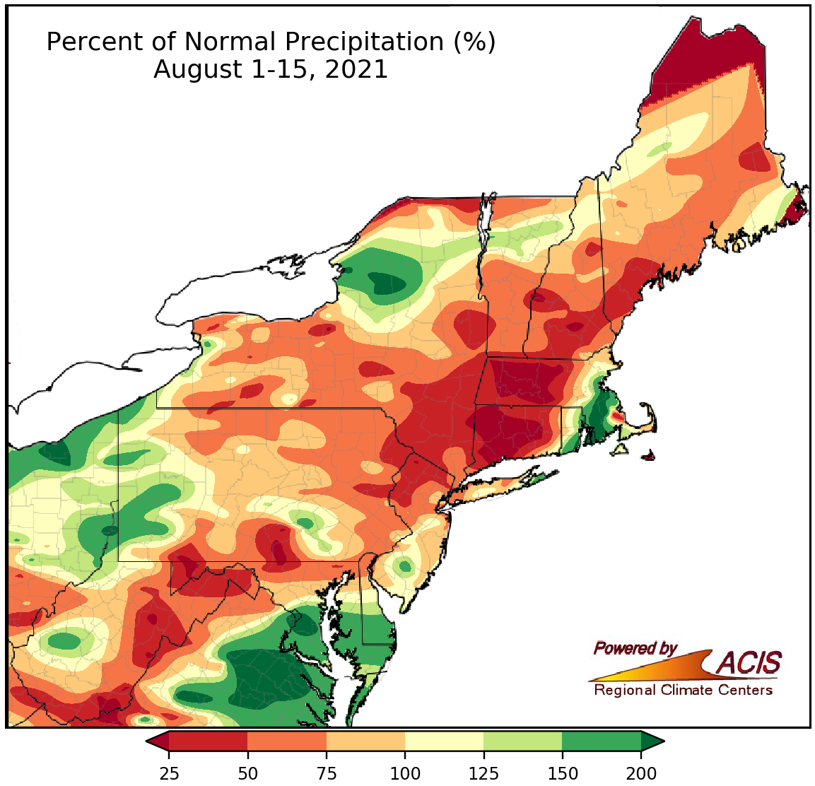
August 1-15 rainfall ranged from less than 25% of normal to more than 200% of normal.
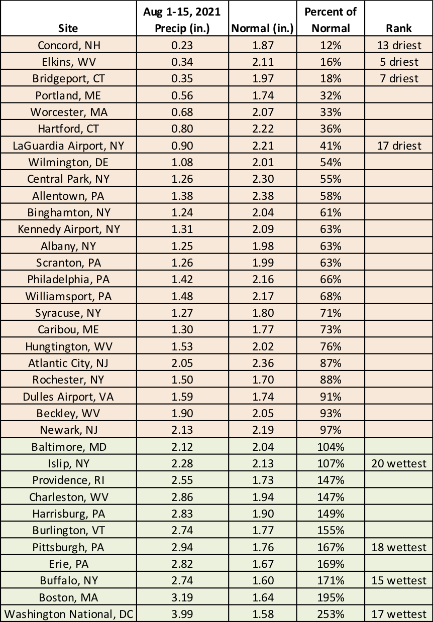
A large portion of the Northeast saw below-normal rainfall during the first half of August, with the driest locations, generally in New England, seeing less than 25% of normal precipitation. However, there were a few areas such as southern Maryland, western Pennsylvania, northern New York, and eastern Massachusetts that were wetter, seeing more than 150% of normal rainfall. At the 35 major climate sites, rainfall ranged from 12% of normal in Concord, NH, to 253% of normal in Washington, D.C. This August 1-15 period ranked among the 20 driest on record at four major climate sites but among the 20 wettest on record for another four of the sites. Dryness persisted in parts of New England and expanded or was introduced in several southern locations in the Northeast. For more information, see the weekly Northeast Drought Update and the Northeast DEWS Dashboard.
This August 1-15 period was among the 20 driest on record at four major climate sites but among the 20 wettest on record for another four of the sites.
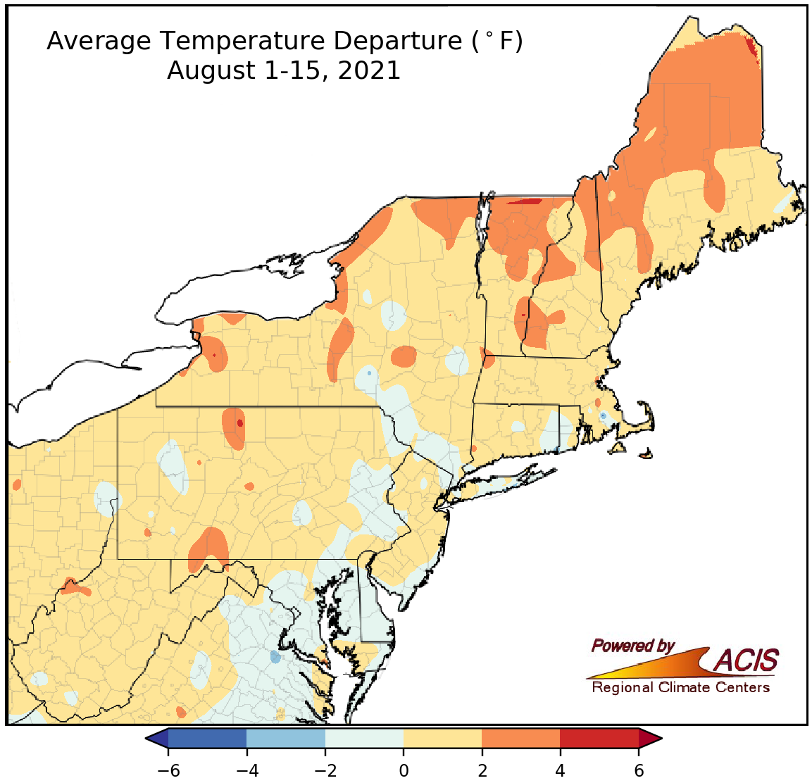
August 1-15 average temperatures ranged from 2°F colder than normal to 4°F warmer than normal.
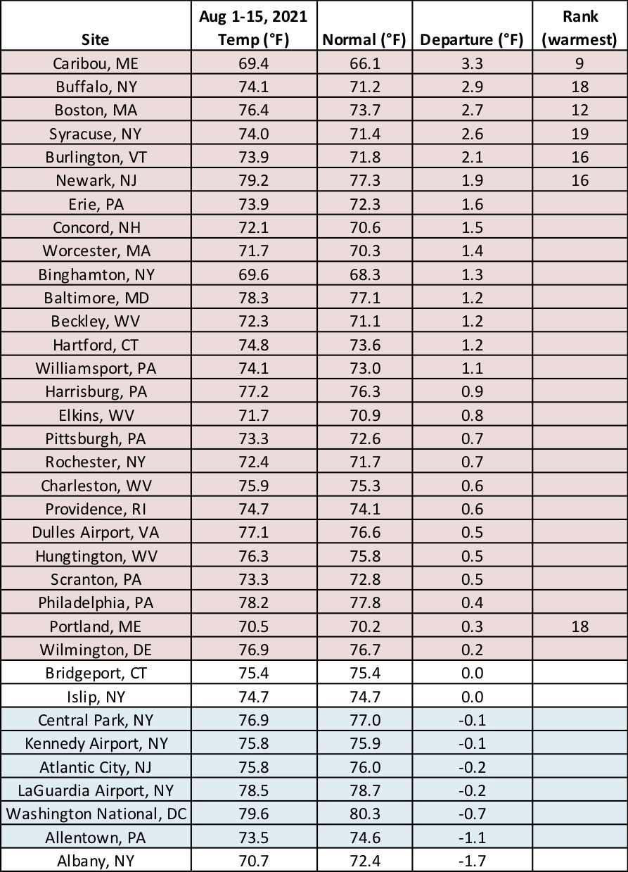
During the first half of August, average temperatured ranged from 2°F colder than normal to 4°F warmer than normal, with the coolest locations generally in more coastal areas and the warmest locations generally in more northern areas. Overall, much of the Northeast saw near- or above-normal temperatures during the first half of August. Temperatures at the major climate sites ranged from 1.1°F below normal in Allentown, PA, to 3.3°F above normal in Caribou, ME, with the majority of sites being on the warm side of normal. In fact, seven major sites ranked this August 1-15 period among their 20 warmest on record. In addition, Caribou, ME, tied its hottest minimum temperature on record for the month of August, 70°F, on August 12 and 13.
Seven major sites ranked this August 1-15 period among their 20 warmest on record.


