Late Snow and Record Warmth
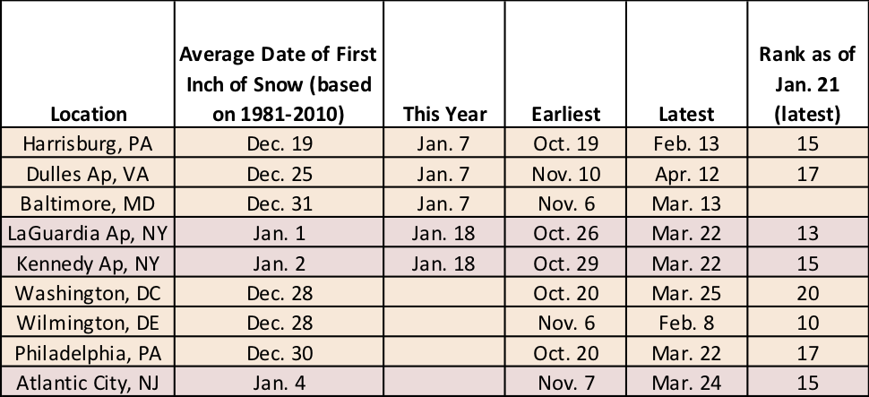
The first inch of snow ranks among the 20 latest on record for eight of these sites.
At last check at the end of December, nine major climate sites still hadn’t seen their first inch of snow. Two storm events, on January 7 and January 18, brought at least an inch of snow to Harrisburg, Dulles Airport, Baltimore, Laguardia Airport, and Kennedy Airport. For four of those sites, this was among the 20 latest on record.
The four sites that have yet to see an inch of snow are Wilmington, Philadelphia, Atlantic City, and Washington, D.C. The first inch is 2 to 4 weeks overdue at these sites and when it does fall, it will already be among the 20 latest on record. In fact, it’ll be among the 10 latest on record for Wilmington. However, to rank among the 10 latest for Philadelphia, Atlantic City, and Washington, D.C., the snow would need to hold off until late January. That is a possibility as the forecast over the next few days isn’t looking very conducive for snow in these areas.
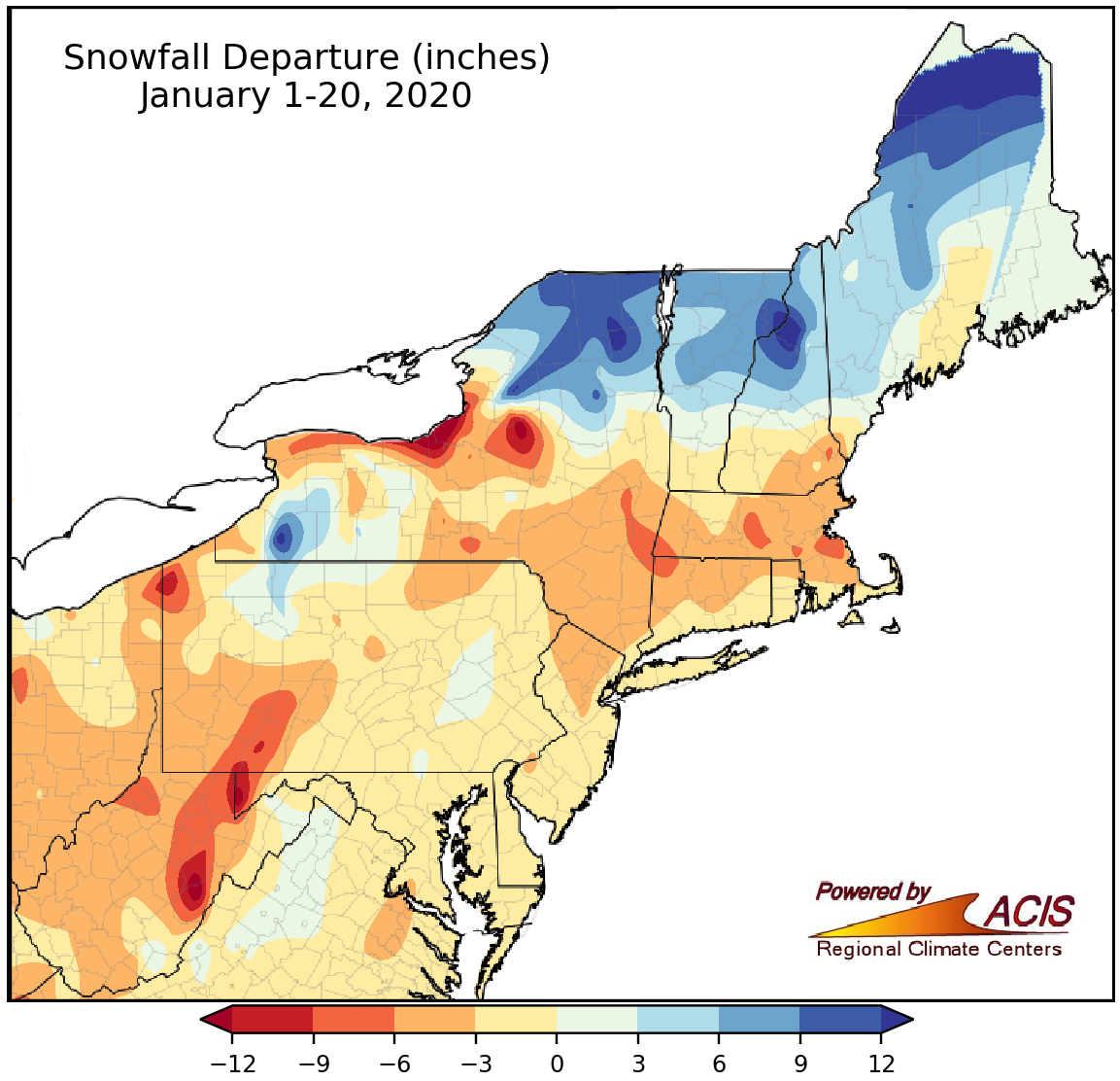
January 1-20 snowfall ranged from more than a foot below normal to more than a foot above normal.
Except for portions of northern New England and New York, January-to-date hasn’t been particularly snowy across the Northeast. That likely has to do with the fact that January-to-date has been quite mild, with average temperatures running 3°F to more than 9°F above normal. January 11 and 12 were particularly warm. On the 11th, Charleston reported a high of at least 80°F for only the second time on record in the month of January. And on the 12th, Bridgeport, Boston, and Providence had their warmest January day on record with highs ranging from 69°F to 74°F.
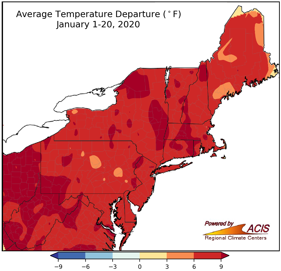
January 1-20 average temperature were more than 6°F above normal for most of the Northeast.
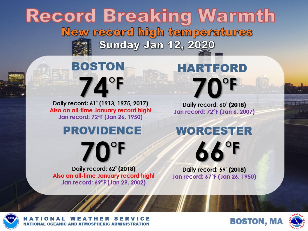
On January 12, a few sites had their warmest January temperatures on record. Image credit: NWS Boston.