May and Spring Recap
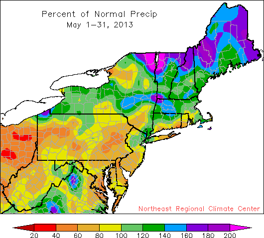
May precipitation ranged from 40% of normal to more than 200% of normal.
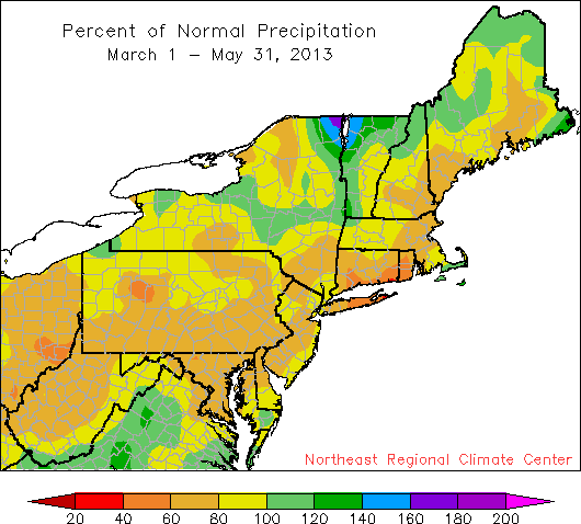
The spring season, however, was drier than normal for most of the region.
All but one of the 35 first-order climate sites in the Northeast ended May with warmer than normal temperatures, with 12 of the 35 ranking this May among their top 30 warmest. Looking at spring, 28 sites were within 1.0 degree of normal. Overall, 17 sites were cooler than normal, 15 were warmer than normal, and 3 were normal. While 20 sites were drier than normal during May, 15 sites were wetter than normal. Burlington set a new precipitation record for the month with 8.74". The old record was 8.67" set in 2011. As for spring, 30 of 35 sites ended spring with below normal precipitation, with 20 of them ranking this spring among their top 30 driest. Eight tornadoes touched down in the Northeast in May: an EF-0 in Massachusetts on the 9th; an EF-0 and three EF-1s in Pennsylvania on the 28th; and two EF-1s and an EF-2 in New York on the 29th. Damaging straight-line winds, hail up to 2.5" in diameter, and flash flooding also occurred. In addition, the month featured late-season snow at some higher elevations. Mount Mansfield, VT, received 13.2" from the 25-26th, making it the latest in the season that the peak has received a foot of snow, and Whiteface Mountain in upstate New York accumulated 36".