A Ho (Ho Ho) Hum December-To-Date?
December-to-date has been cold, dry, and lacking snow, but not exceptionally so for most of the Northeast.
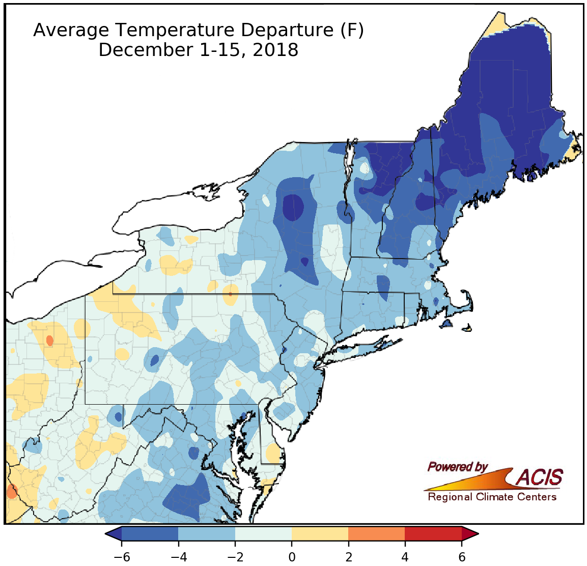
Average temperatures as of mid-December ranged from more than 6°F below normal to 2°F above normal.
Most of the Northeast has experienced below-normal temperatures during the first half of December, with average temperatures generally ranging from more than 6°F below normal in parts of northern New York and northern New England to near normal. Twenty-eight of the 35 major climate sites also experienced a cooler-than-normal start to December.
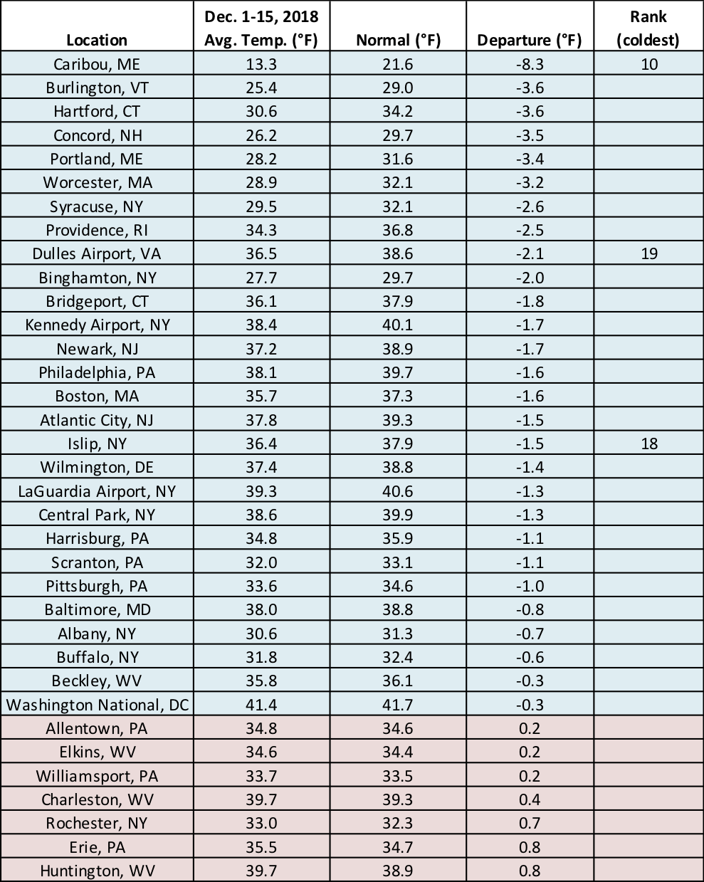
Three major climate sites ranked this first half of December among their 20 coldest on record.
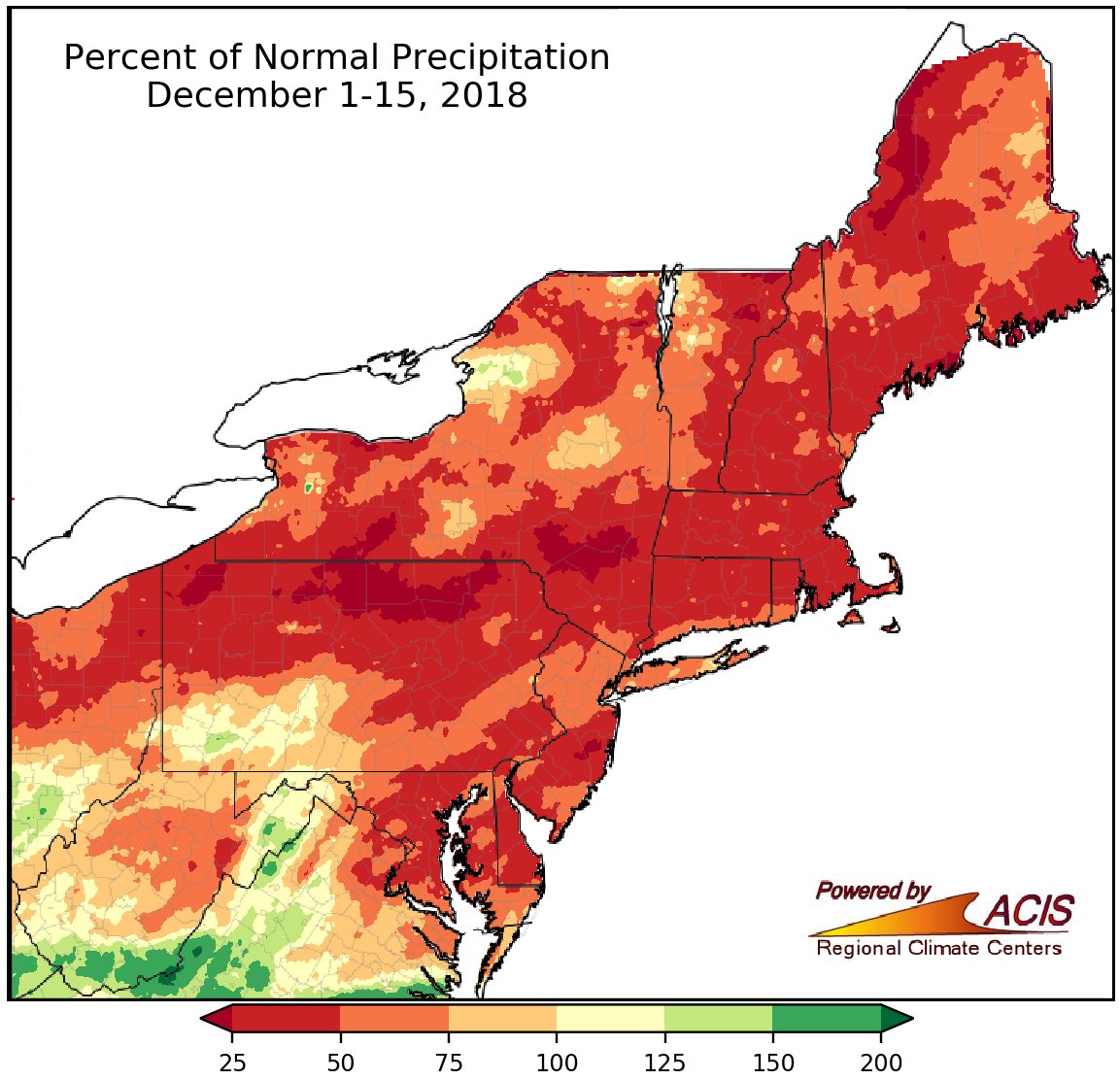
December 1-15 precipitation ranged from less than 25% of normal to near normal for a large portion of the Northeast.
The first half of December has been drier than normal for a majority of the Northeast, with precipitation generally ranging from less than 25% of normal to near normal. The driest areas were in northern Pennsylvania, southern New York, and western Maine. However, there were a few spots, mainly in southern and eastern West Virginia, southwestern Pennsylvania, and east of Lake Ontario in New York, that received up to 200% of normal precipitation. Twenty-eight of the 35 major climate sites also experienced a drier-than-normal first half of December.
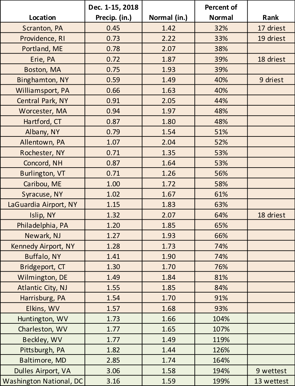
Five major climate sites ranked this December 1-15 period among their 20 driest on record, while two sites ranked it among their 20 wettest.
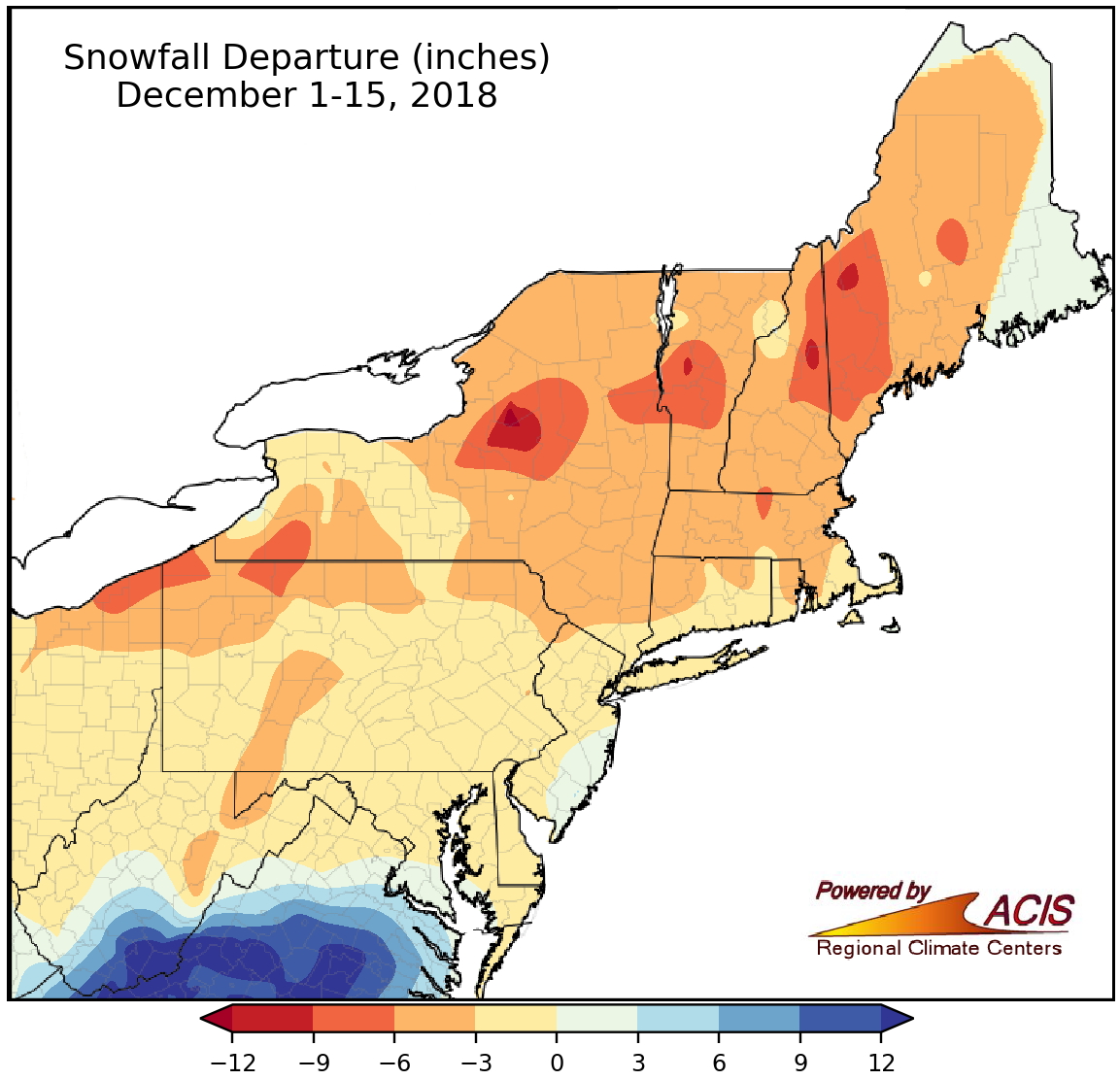
Snowfall during the first half of December ranged from 12 inches below normal to more than 12 inches above normal.
Despite below-normal temperatures, there was also a lack of snowfall for most of the region. The largest deficits of more than 12 inches were found in parts of New York and a few spots in northern New England. The greatest surplus of more than 12 inches was found in southeastern West Virginia. For most of the region, though, snowfall ranged from 9 inches below normal to within 3 inches of normal.
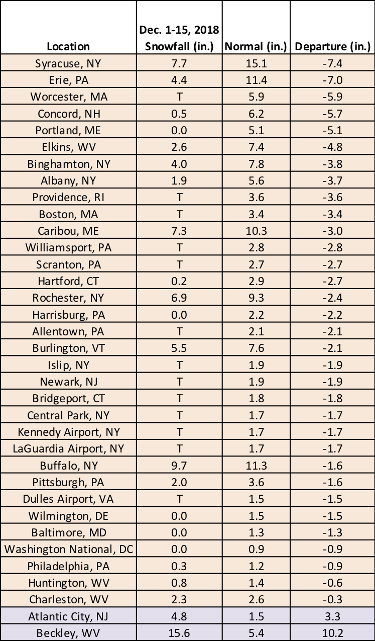
December 1-15 snowfall at the major climate sites ranged from 7.4 inches below normal in Syracuse, NY, to 10.2 inches above normal in Beckley, WV.