A Conflicted May-to-Date
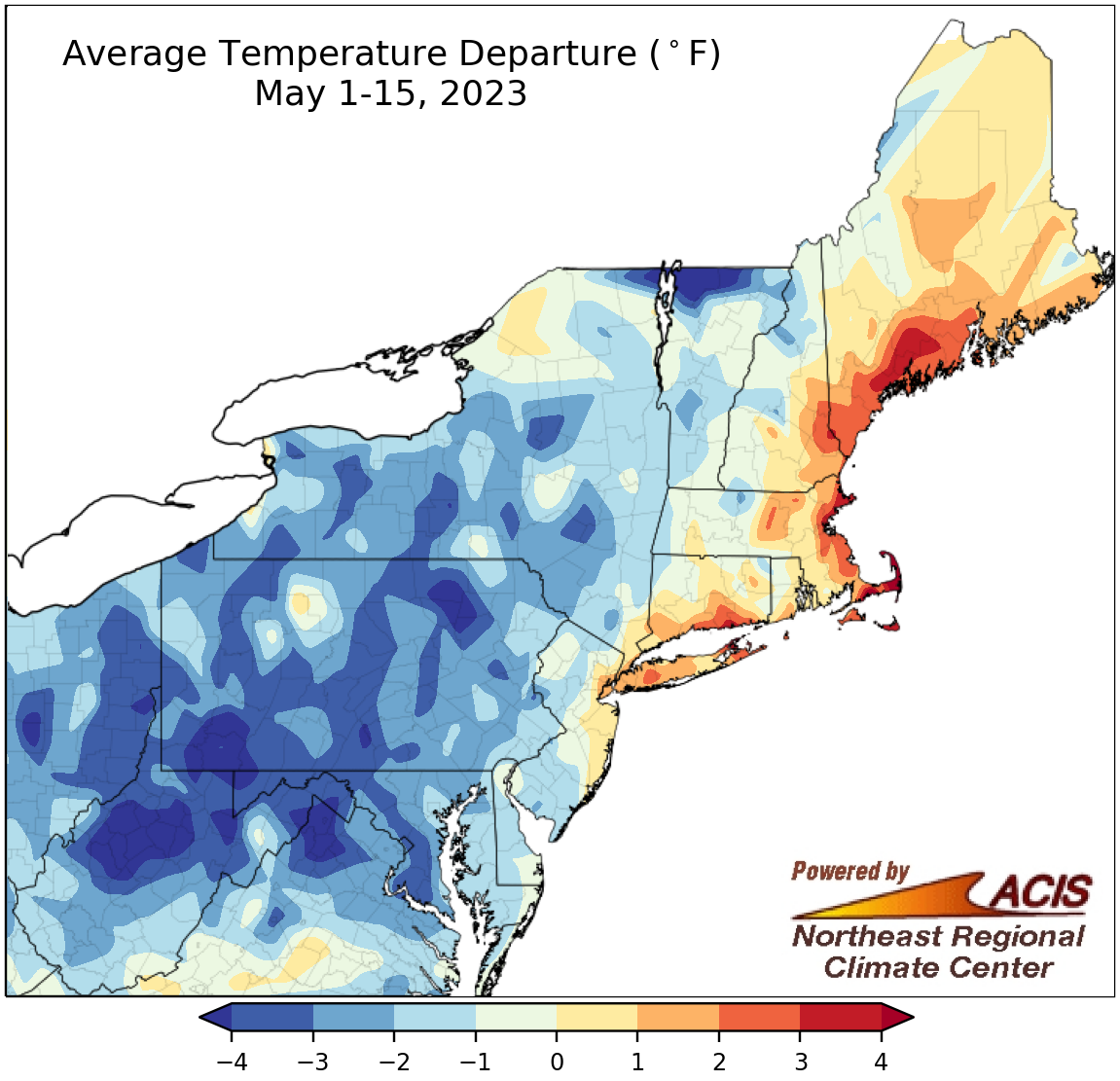
May 1-15 average temperatures ranged from more than 4°F below normal to 4°F above normal.
May started off on a cool note for many parts of the Northeast, with May 1-15 average temperatures ranging from more than 4°F below normal to near normal. The main exceptions were coastal areas from central New Jersey to Maine, where average temperatures ranged from near normal to 4°F above normal. At the 35 major climate sites, average temperatures for the first half of May ranged from 3.5°F below normal in Elkins, WV, to 3.9°F above, normal in Boston, MA. Despite 22 of the sites being cooler than normal, this May 1-15 period ranked among the 20 warmest on record for six major climate sites.
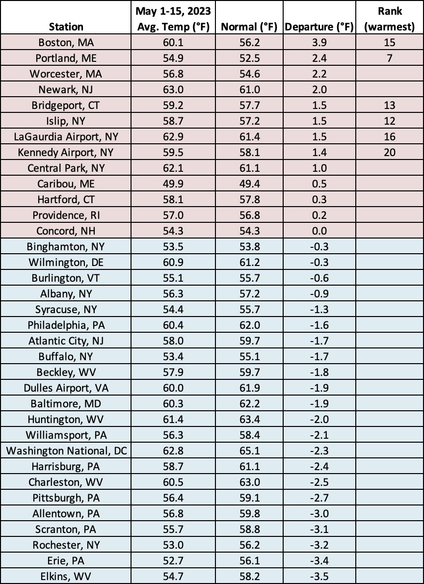
This May 1-15 period ranked among the 20 warmest on record for six major climate sites.
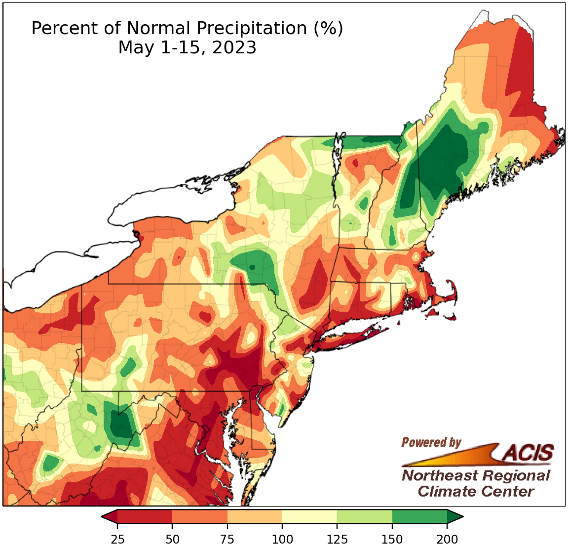
May 1-15 precipitation ranged from less than 25% of normal to more than 200% of normal.
Precipitation during the first half of May ranged from less than 25% of normal in areas such as southeastern Pennsylvania to more than 200% of normal in areas such as western Maine. May 1-15 precipitation at the 35 major climate sites ranged from 5% of normal in Philadelphia, PA, and LaGuardia Airport, NY, to 147% of normal in Elkins, WV, the lone wetter-than-normal site. This first half of May ranked among the 20 driest on record for 18 major climate sites but was Elkins’ 16th wettest.
No major climate sites saw measurable snow during the first half of May. Only five of major sites average snowfall for the May 1-15 period with amounts being 0.6 inches or less.
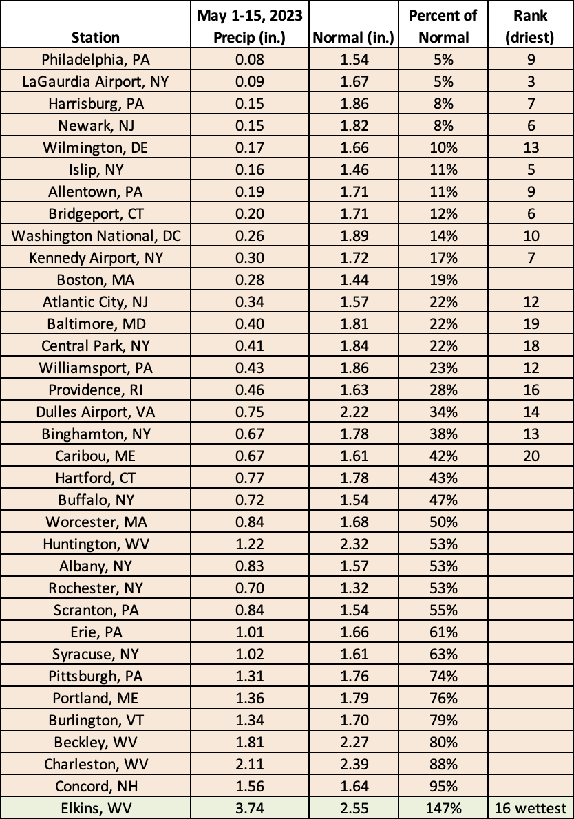
This May 1-15 period ranked among the 20 driest on record for 18 major climate sites but was the 16th wettest for Elkins, WV.