A Soggy May Closes Out a Warm Spring
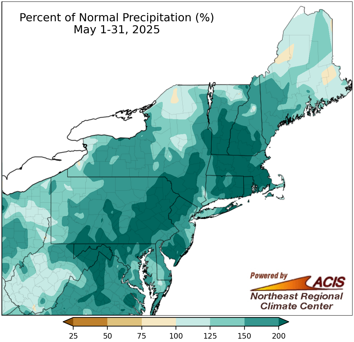
May precipitation ranged from 75% of normal to over 200% of normal.
May wrapped up on the wet side of normal for almost the entire Northeast, with the wettest locations including an area from eastern West Virginia to southern parts of Vermont and New Hampshire seeing more than 200% of normal precipitation. Harrisburg, PA, had its wettest May (and 10th all-time wettest month) since its records began in the late 1880s. Additionally, this May ranked among the 20 wettest Mays for another 25 of the region’s 35 major sites. May precipitation for all sites ranged from 91% of normal in Buffalo, NY, the lone dry site, to 286% of normal in Allentown, PA. The wet weather allowed drought and abnormal dryness to contract in much of the region.
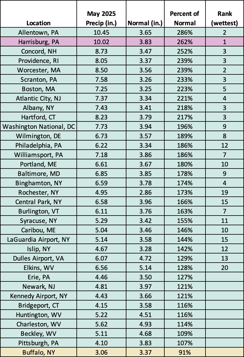
This May was record wet for Harrisburg, PA, and among the 20 wettest for another 25 major sites.
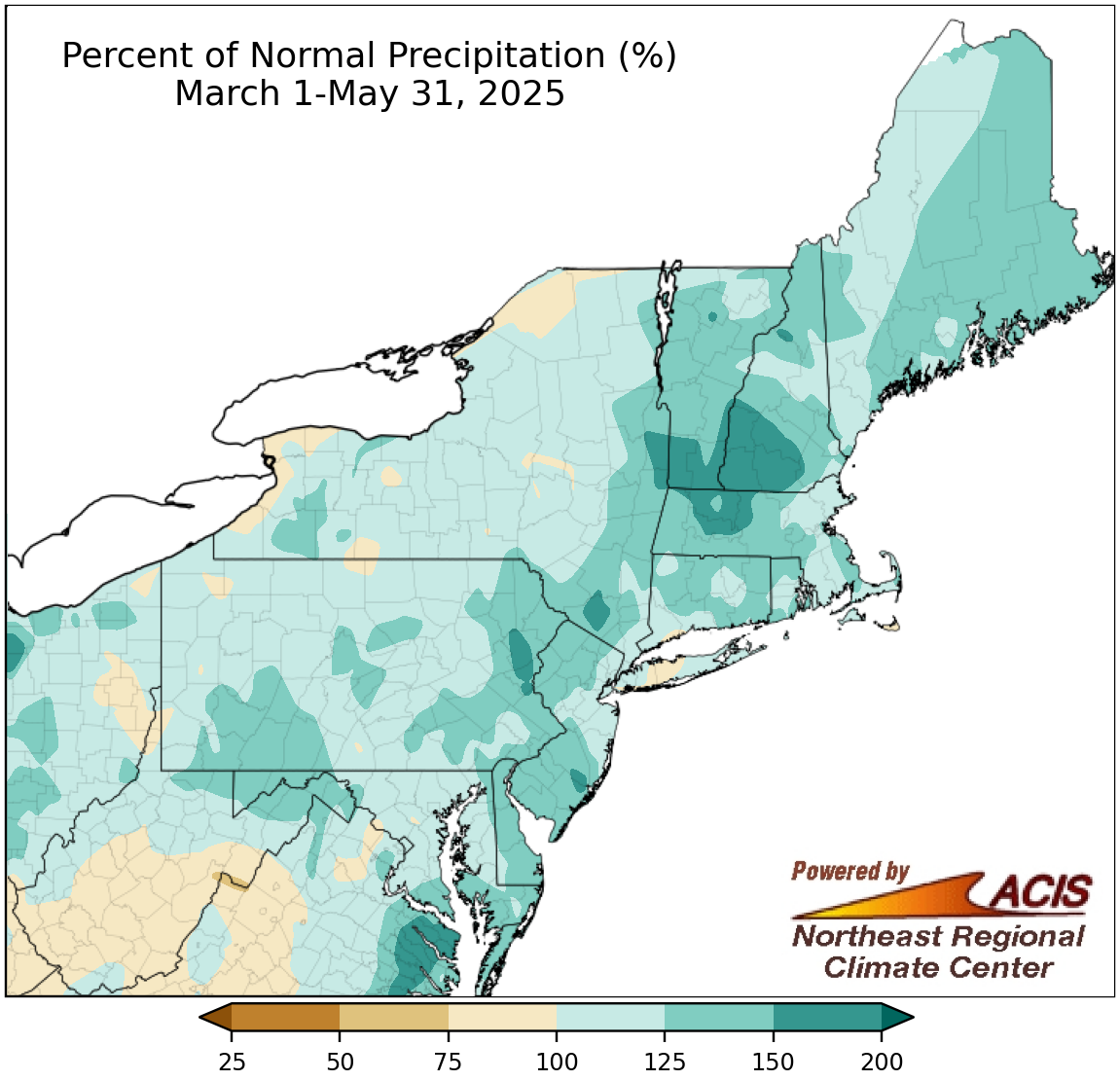
Spring precipitation ranged from 75% of normal to 200% of normal.
The exceptional wetness of May overpowered the variable precipitation amounts in March and April for many locations, allowing spring season precipitation to range from 75% of normal to 200% of normal. At the region’s 35 major sites, spring precipitation ranged from 81% of normal in Buffalo, NY, to 156% of normal in Concord, NH, with 25 sites being wetter than normal. This spring ranked among the 20 wettest springs on record for 16 major sites.
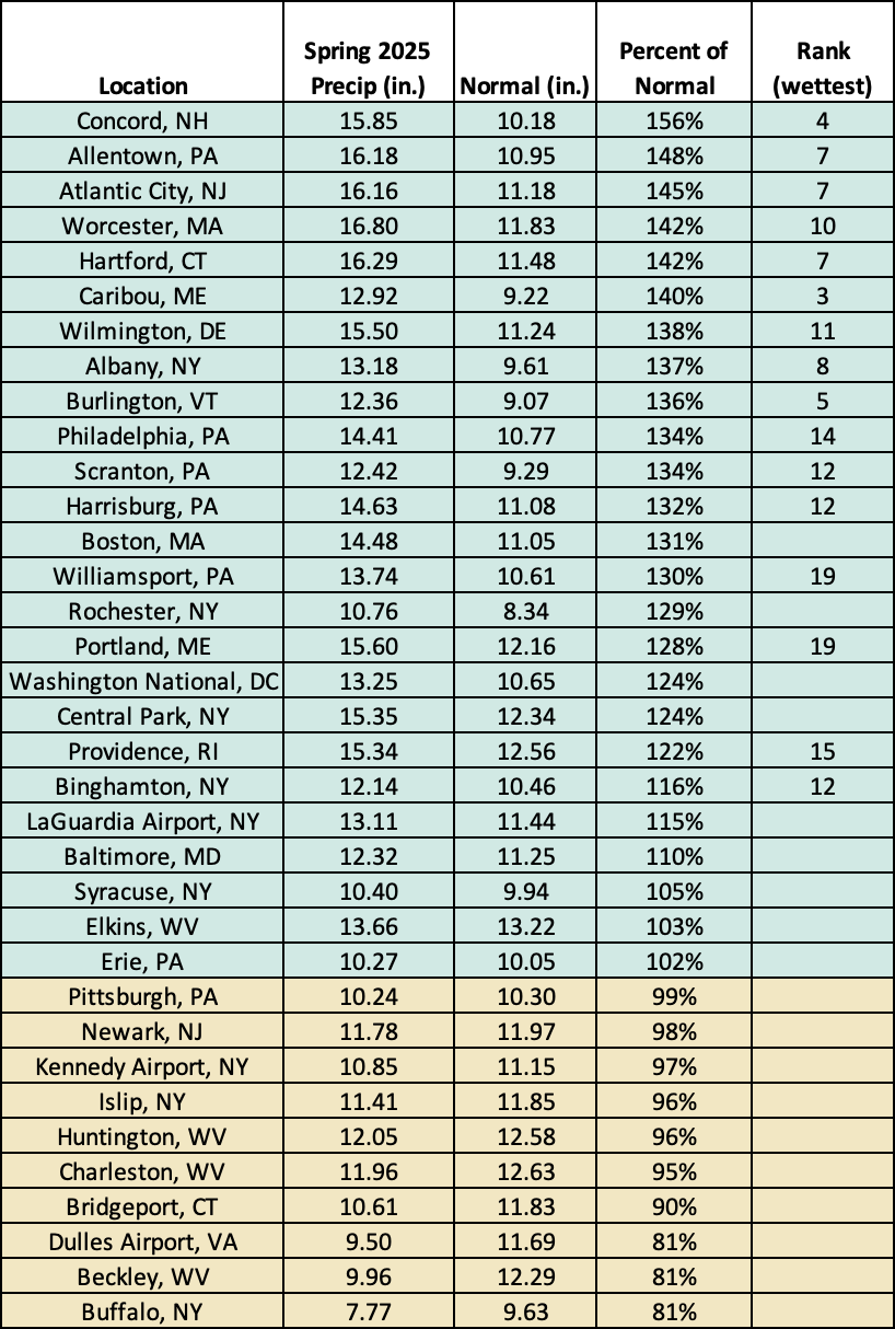
This spring ranked among the 20 wettest on record for 16 major sites.
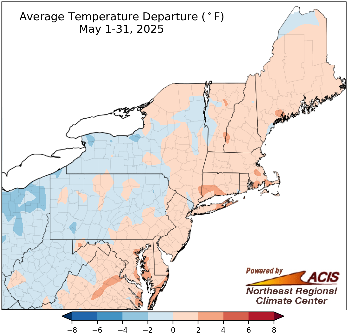
May average temperatures ranged from 4°F below normal to 4°F above normal.
The first half of May was unusually warm but the second half was much cooler. This allowed May to average out to be within 2°F of normal for most locations, but some interior spots were more than 2°F cooler than normal while some coastal spots were over 2°F warmer than normal. May average temperatures at the Northeast’s 35 major sites ranged from 2.7°F below normal in Erie, PA, to 2.1°F above normal at Kennedy Airport, NY, with 19 sites being cooler than normal. However, this May ranked among the 20 warmest Mays on record for four major sites.
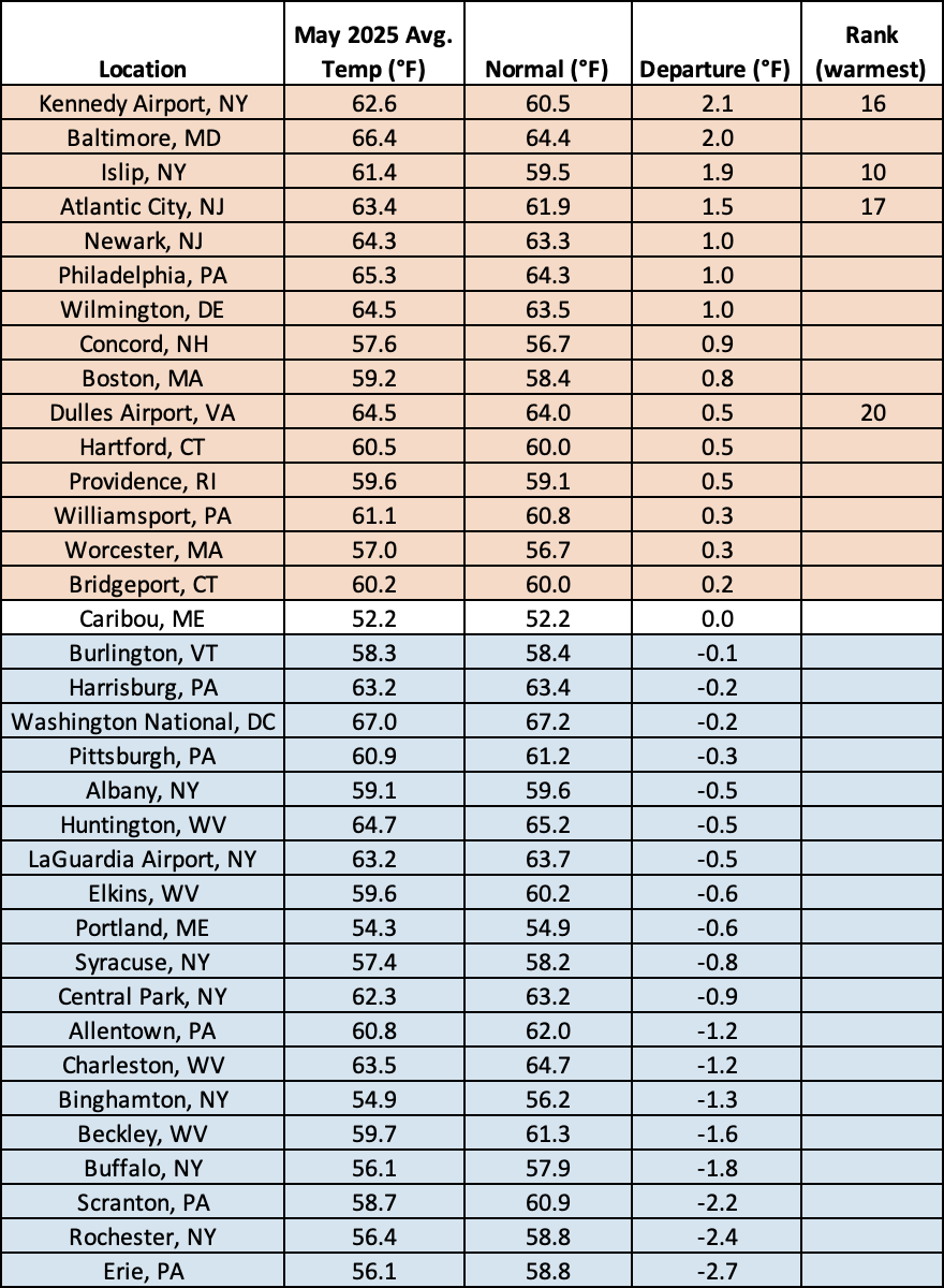
This May was among the 20 warmest Mays on record for four major sites.
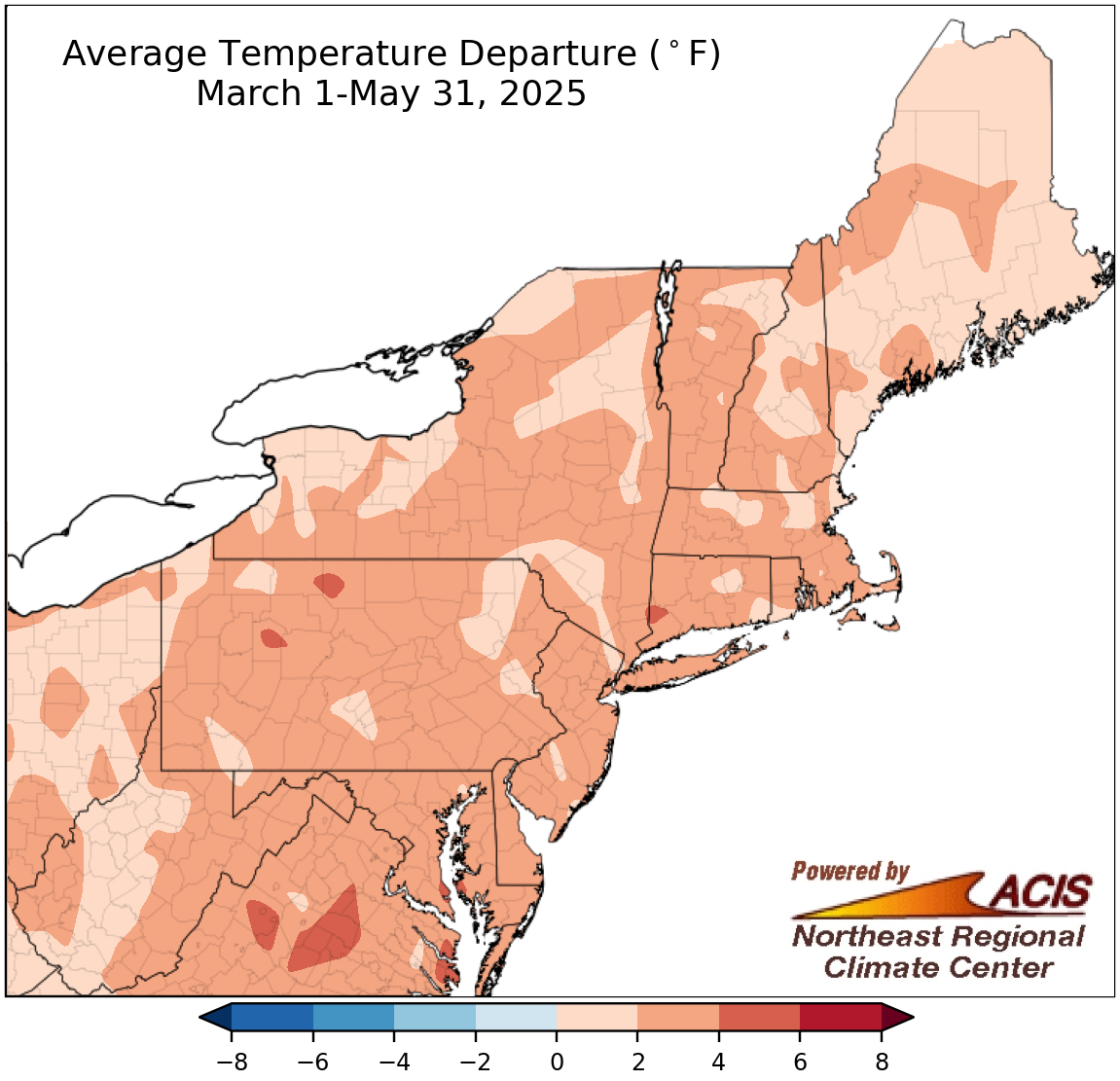
Spring average temperatures were generally up to 4°F warmer than normal.
Both March and April temperatures averaged out to be warmer than normal for most areas, and along with the mild start to May, were enough to push spring average temperatures up to 4°F above normal in the Northeast. This spring was among the 20 warmest on record for 34 of the region’s 35 major sites, with average temperatures ranging from 0.6°F above normal in Portland, ME, to 3.7°F above normal at Kennedy Airport, NY, and Baltimore, MD.
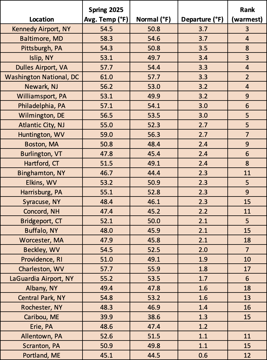
This spring was among the 20 warmest on record for all but one major site.
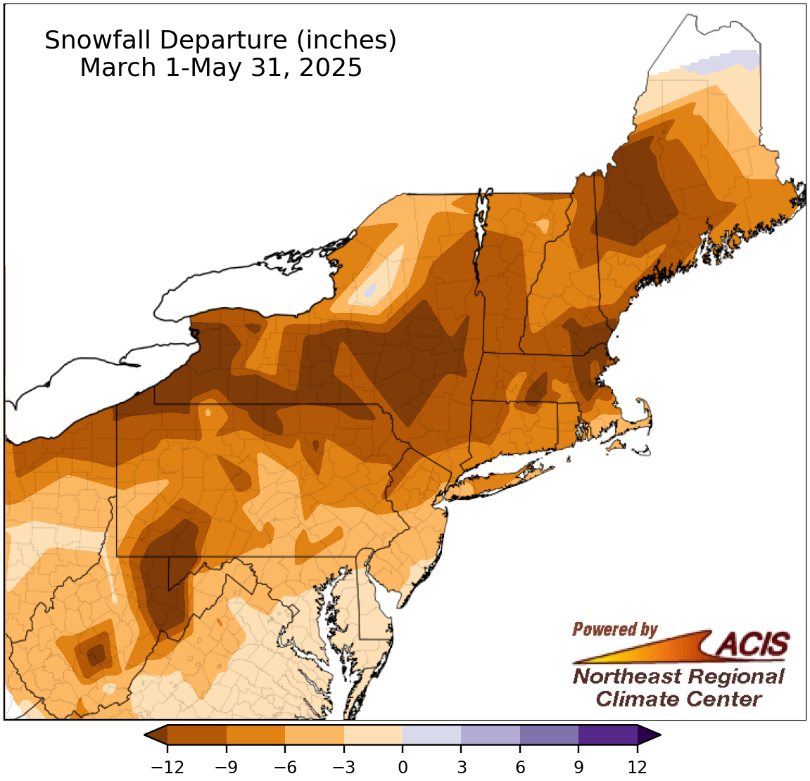
Spring snowfall ranged from more than 12 inches below normal to near normal.
As is typical, there was little, if any, snowfall during May. With above-normal temperatures throughout most of the season, and limited precipitation in some spots during March and April, much of the Northeast saw below-normal snowfall amounts this spring. The largest deficits, which exceeded 12 inches, were found throughout the region. Spring snowfall at the 35 major sites ranged from 15.3 inches below normal in Buffalo, NY, to 0.6 inches above normal in Caribou, ME, the only snowier-than-normal site. Looking only at sites with measurable snowfall, this spring ranked among the 20 least snowy for 11 sites. However, there were some interesting stats for a few sites without measurable snowfall. For instance, it was the first spring since on record that Allentown, PA, did not see even a trace of snow, with its records going back to 1925. It was only the second time on record without even a trace of snowfall for sites like Bridgeport, CT; Newark, NJ; and Kennedy Airport, NY.
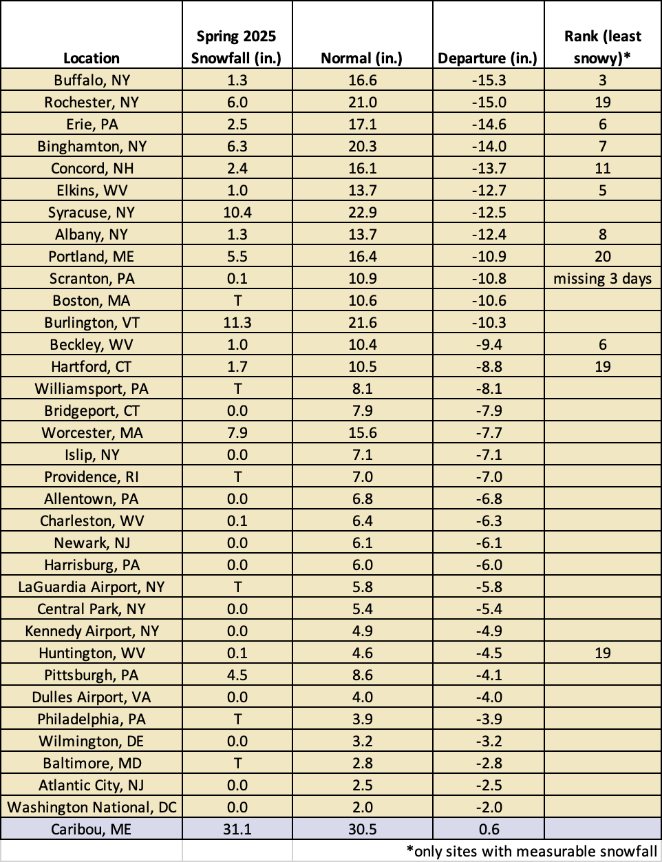
This spring ranked among the 20 least snow for 11 major sites.
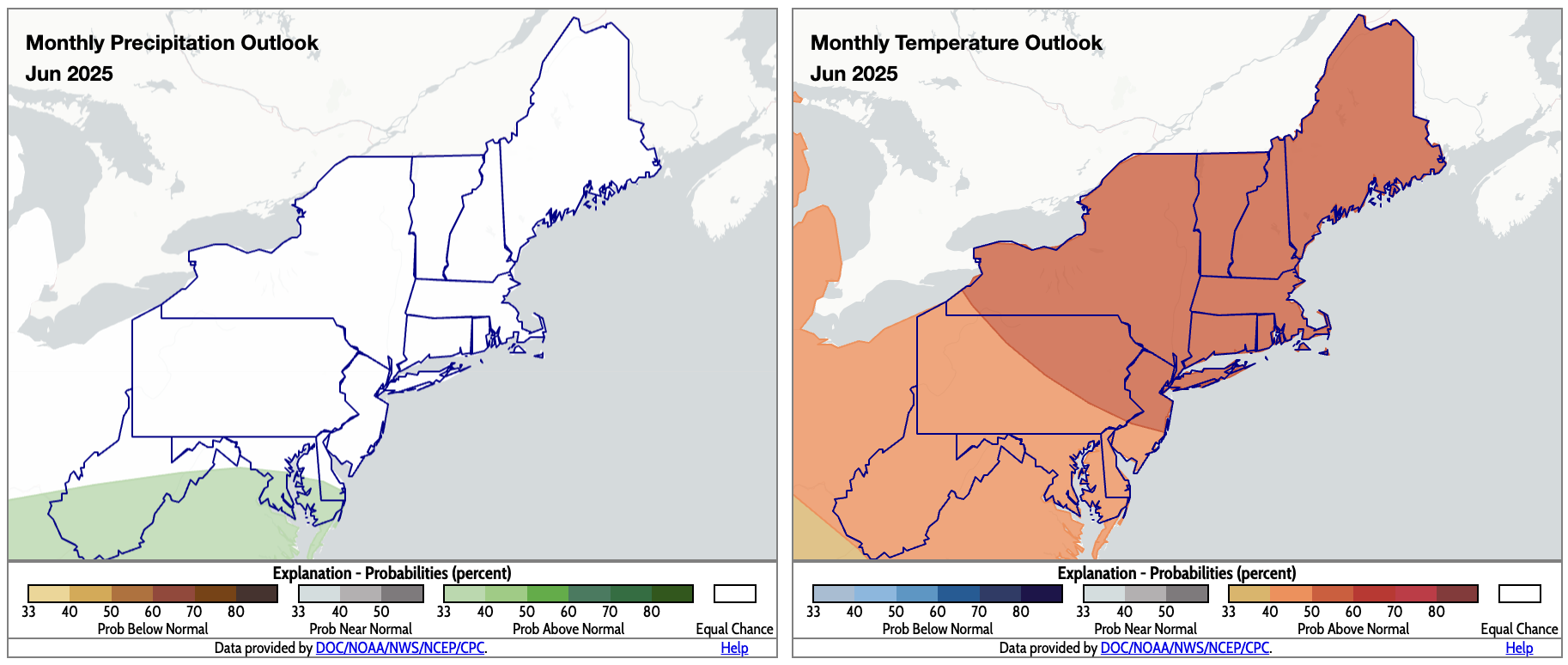
June is expected to be wetter than normal for some southern areas (shaded green) and warmer than normal for all (shaded orange). Click to enlarge.
For June, outlooks from NOAA’s Climate Prediction Center (CPC) call for above-normal precipitation for parts of West Virginia, Maryland, and Delaware, with equal chances of below-, near-, or above-normal precipitation forecast for the rest of the Northeast. The entire region is expected to average out to be warmer than normal for June. Summer is favored to be wetter than normal for the entire Northeast except northern Maine, which falls into the equal chances category. Warmer-than-normal weather is predicted for summer for whole region. Meanwhile, the Atlantic hurricane season is expected to be more active than usual, which could have implications in the Northeast depending on storm track, etc.
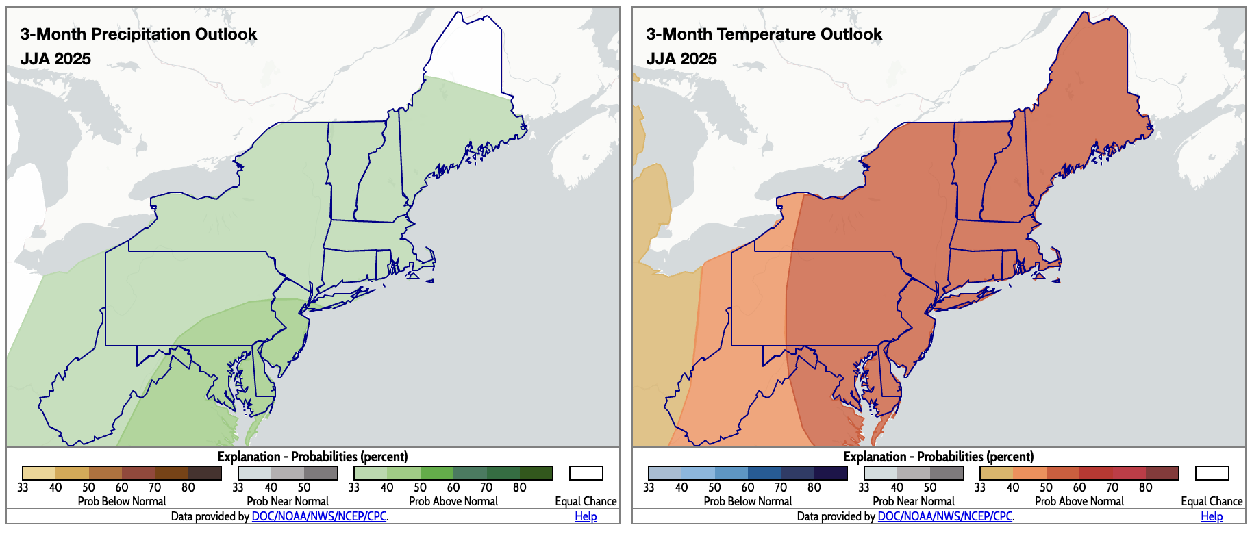
CPC’s summer outlooks indicate a tilt toward wet, warm conditions for most of the Northeast. Click to enlarge.