Mid-Summer…I Mean September
The calendar says September but temperatures have felt more summer-like in many parts of the Northeast. Let’s put it this way…the average temperatures at multiple sites for the first half of September were warmer than their normal temperatures for the first half of July! Departures ranged from around 1°F above normal in parts of West Virginia to more than 8°F above normal in parts of New York and New England. All 35 major airport climate sites saw above-normal temperatures during the first half of the month, with 29 of those sites ranking the period among their top 10 warmest. In fact, Islip, NY was record-warm for the time period.
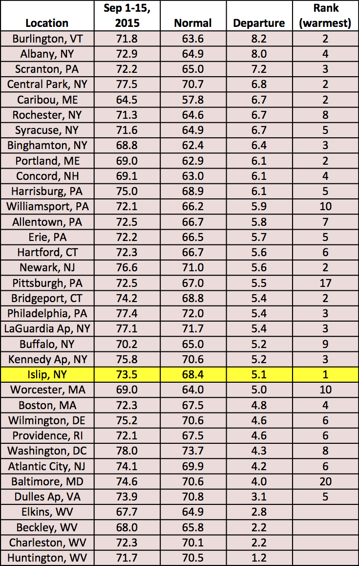
The region saw well-above-normal temperatures during the first half of September.
The entire region was dry for the first nine days of the month, then downpours hit some areas a few days prior to mid-month. For the first half of September, precipitation totals ranged from 16% of normal around the nation’s capital to 332% of normal in Harrisburg, PA. With the exception of a brief intermission Saturday, high pressure will dominate the weather pattern for the next week, helping increase the region’s chances for below-normal precipitation. Beyond that, things are still looking dry (and warm)!
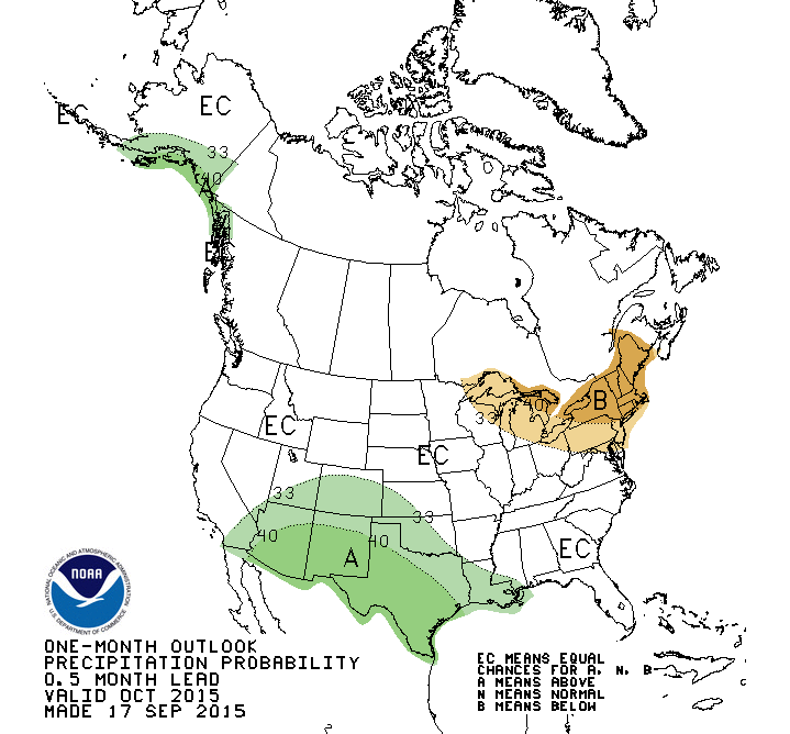
The Climate Prediction Center is predicting an increased chance of below-normal precipitation for October, as well.