A Mild, Dry Mid-November
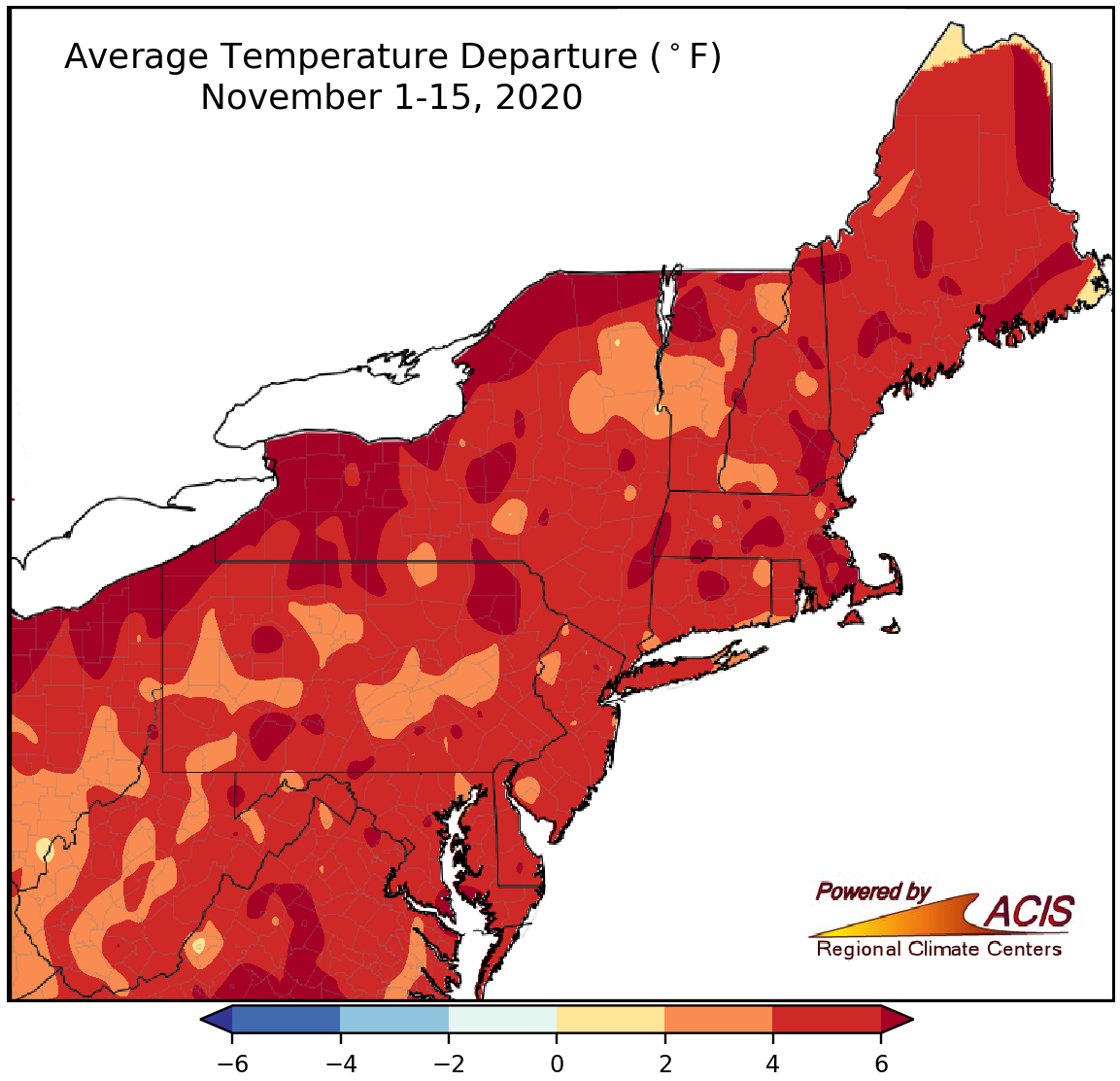
November 1-15 average temperatures ranged from 2°F to more than 6°F above normal.
The first half of November was warmer than normal by 2°F to more than 6°F, driven by an unusually warm period from November 6 to 12. The major climate sites were warmer than normal, with average temperatures ranging from 3.5°F above normal at Kennedy Airport, NY, to 8.8°F above normal in Erie, PA, which had its warmest November 1-15 period on record. Another 32 major climate sites ranked this first half of November among their 20 warmest on record.
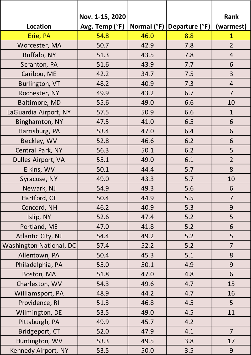
The major climate sites were up to 8.8°F above normal from November 1-15, with Erie, PA, being record warm.
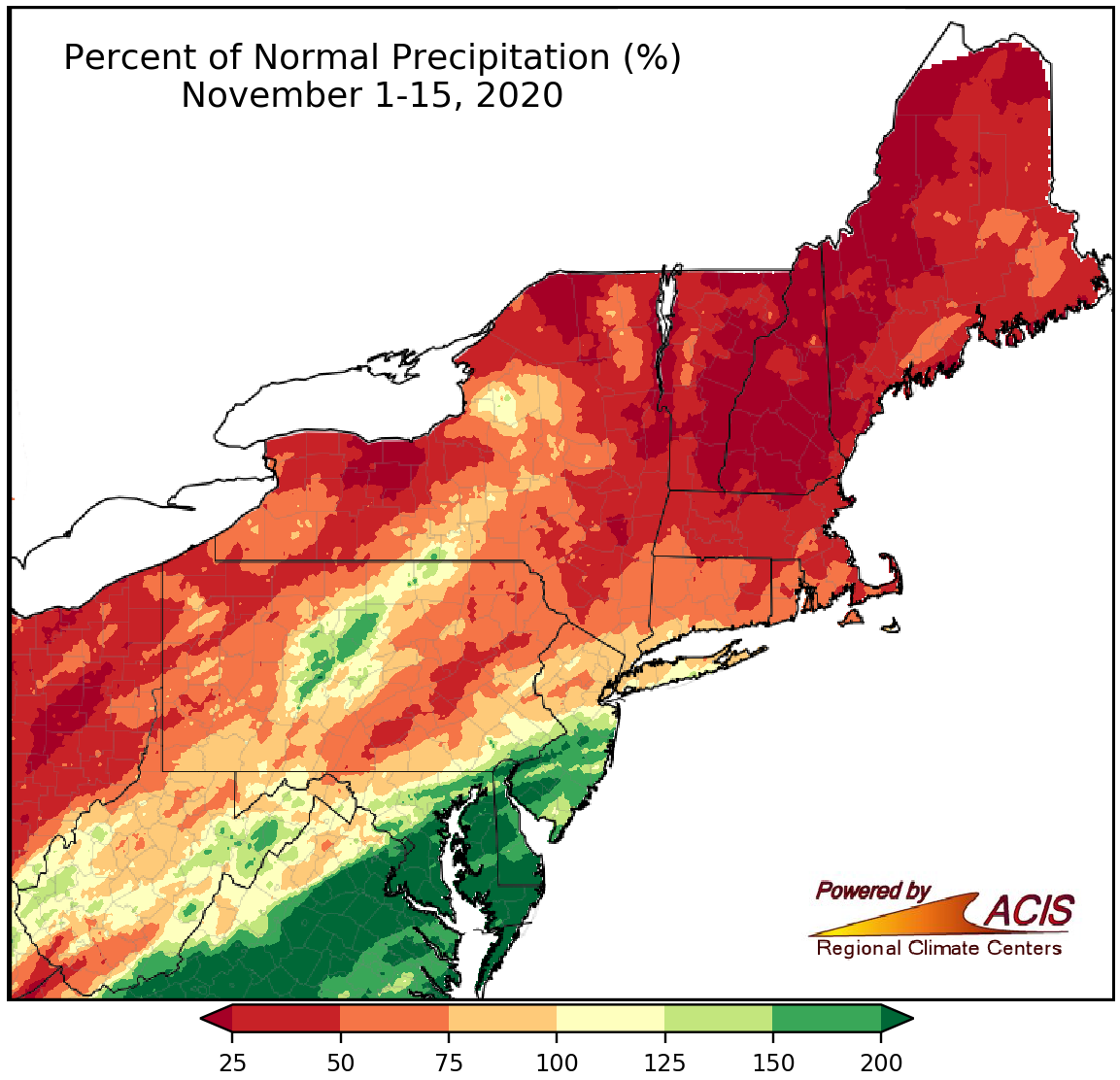
November 1-15 precipitation ranged from less than 25% of normal to more than 200% of normal.
The first half of November was drier than normal for much of the Northeast, with the driest locations in New England and New York seeing less than 25% of normal precipitation. However, there were several areas including portions of Maryland, Delaware, Pennsylvania, and New Jersey that were quite wet, seeing more than 200% of normal. At the major climate sites, precipitation ranged from 36% of normal in Caribou, ME, to 235% of normal in Washington, D.C. Twenty-four of the major climate sites were drier than normal, with Caribou, ME, having its 14th driest November 1-15 period on record. Of the 11 wetter-than-normal major climate sites, nine ranked the period among their 20 wettest on record. With generally drier-than-normal conditions over the past two weeks, drought and abnormal dryness persisted in the region.
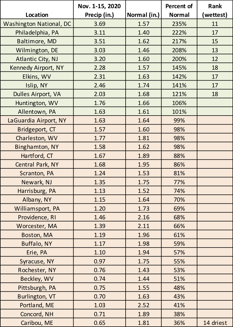
Nine major climate sites ranked the November 1-15 period among their 20 wettest on record, while Caribou, ME, had its 14th driest.
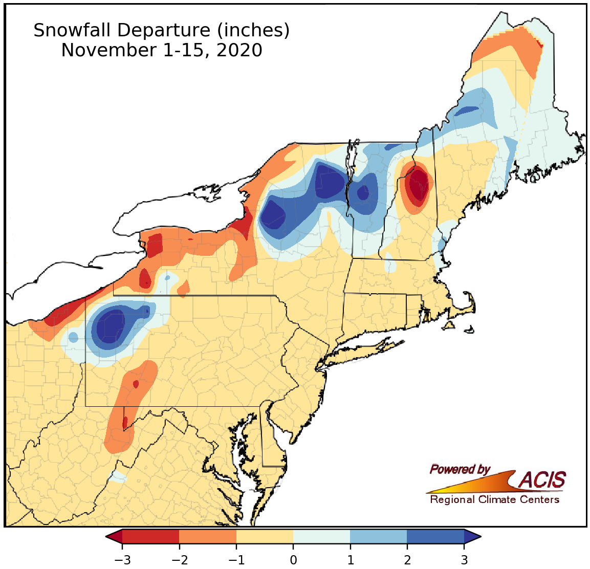
November 1-15 snowfall ranged from more than 3 inches below normal to more than 3 inches above normal.
Snowfall during the first half of November was below- to near-normal for most of the Northeast, with the greatest deficit of more than 3 inches in higher elevations of New Hampshire. However, a few locations, particularly northwestern Pennsylvania, northern New york, and central Vermont, were snowier, seeing a surplus of more than 3 inches. The largest deficit at the major climate sites was 2.7 inches below normal in Erie, PA.
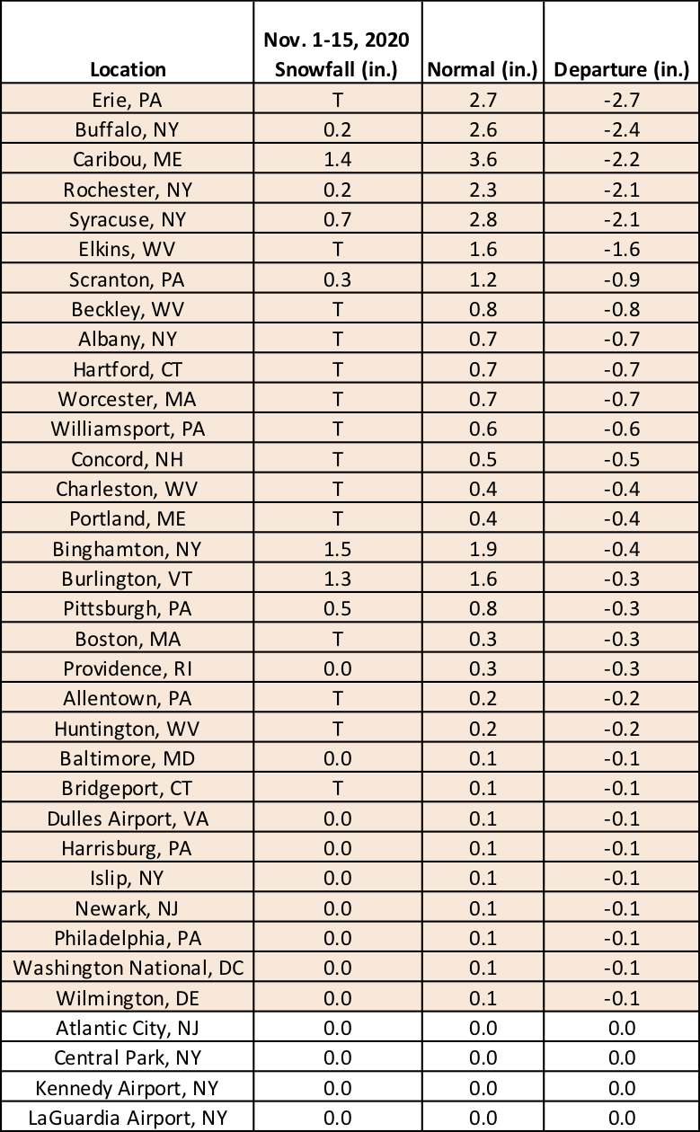
Snowfall was below- or near-normal at the major climate sites during the first two weeks of November.