Cold and Wet April
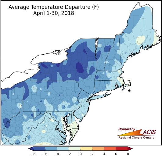
The entire Northeast experienced temperatures that ranged from near normal to more than 8°F below normal during April.
The shades of blue on the map of the Northeast depict how much cooler than normal it was throughout the region during the month of April. All of the 35 major climate sites experienced colder than normal temperatures during this past month, and 22 of those sites have ranked this April amongst their twenty coldest on record. Areas in the western part of the region, particularly a large portion of central New York, had average temperatures ranging from 4°F to 8°F below normal. Locations along the coast, such as Boston, MA, eastern Maine, and southern Delaware also experienced below-normal temperatures but their departures were closer to normal.
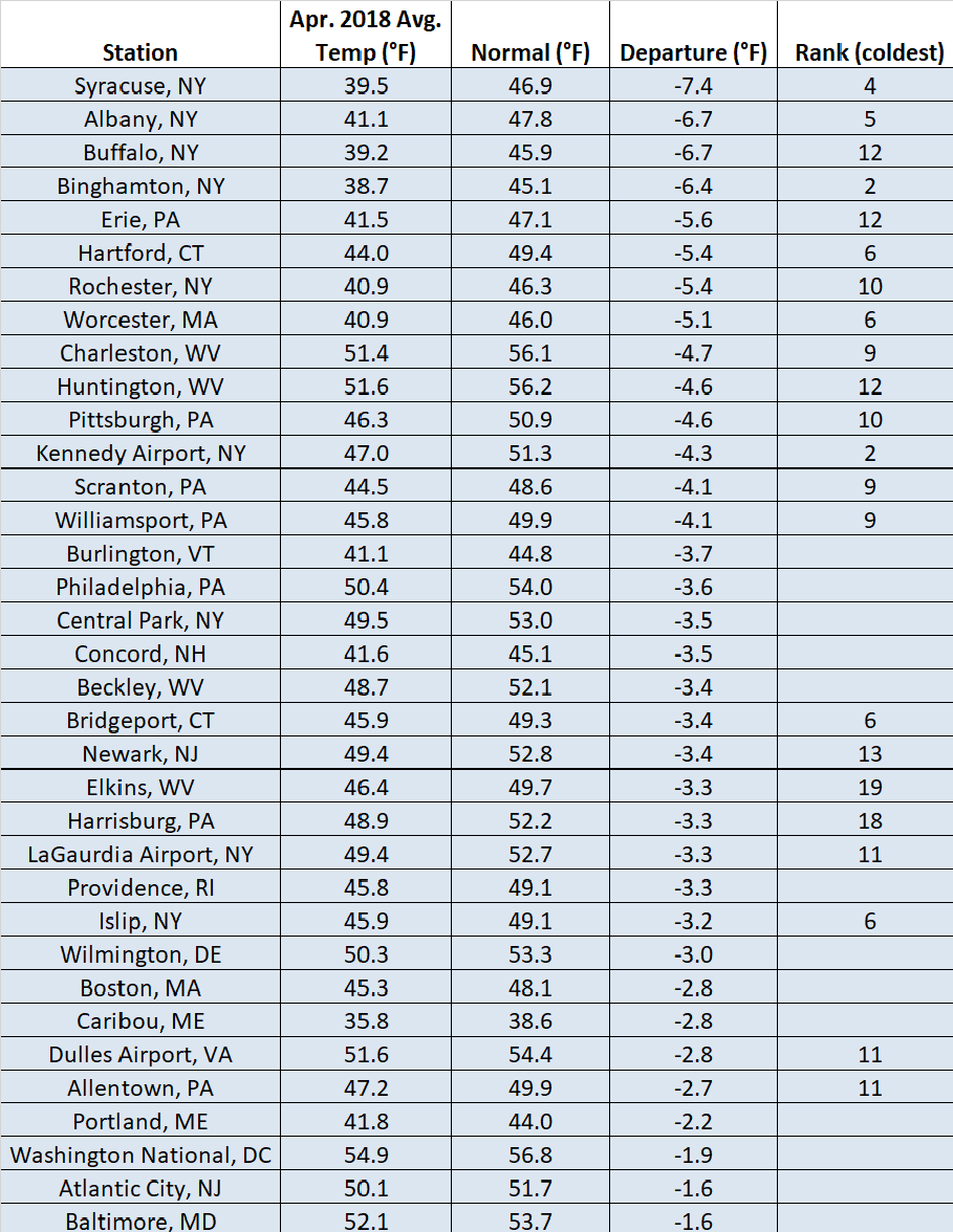
April temperatures have trended below normal at each of the 35 major climate sites in the Northeast.
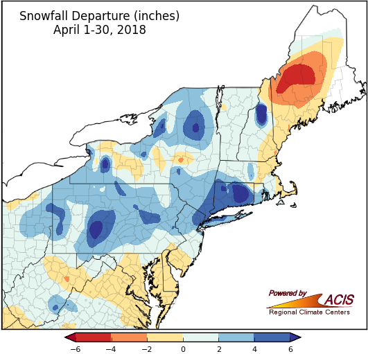
Snowfall ranged from six inches below normal to six inches above normal throughout the region.
As winter comes to an end, it is often difficult to get accumulating snow because the ground begins to get warmer, which can cause snow to melt faster than during the winter. But even so, there were many locations that saw above normal snowfall totals, including parts of Connecticut, Pennsylvania, New Hampshire and New York. Bridgeport, CT received six inches of snow, making this April their second snowiest on record. However, it wasn’t a snowy April for everyone. Ten climate sites from around the region received below normal amounts of snow during the month.
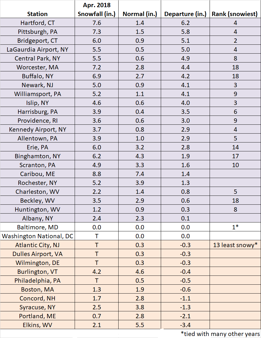
Snowfall departures ranged from 3.4 inches below normal in Elkins, WV to 6.2 inches above normal in Hartford, CT.
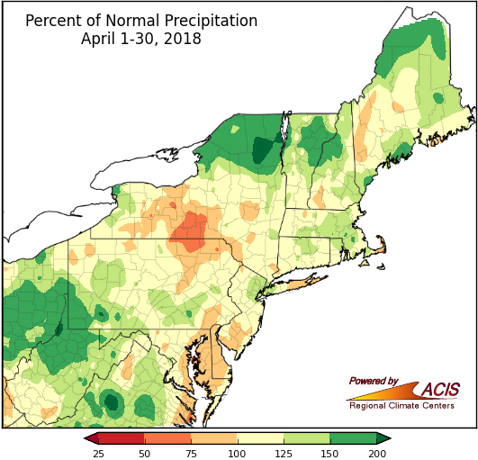
Precipitation across the Northeast ranged from 50% to more than 200% of normal in April.
Parts of southern New York, Maryland, and Delaware saw drier than normal conditions this month. Drought conditions have lingered in Maryland throughout April. In other parts of the Northeast, numerous “April showers” during the month led to wetter than normal conditions being reported at 27 of the 35 major climate sites. Caribou, ME received 174% of normal precipitation this month, ranking this as their third wettest April on record.
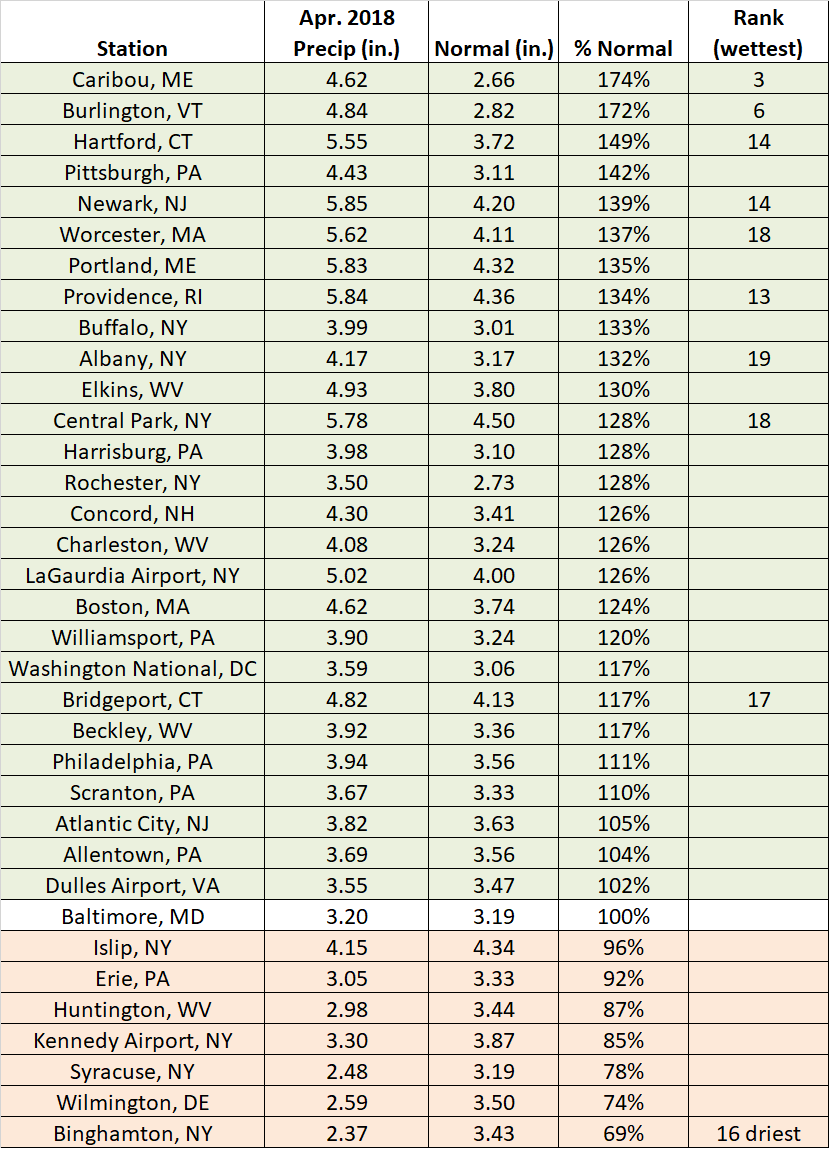
Many climate sites in the Northeast experienced a wetter than normal April.
The Climate Prediction Center (CPC) released their one month outlook and it looks like the warmer weather might last beyond just the beginning of May. The eastern part of the region has the highest chances of seeing above normal-temperatures this coming month, although the entire continental U.S. has increased chances of experiencing a warmer than normal May.
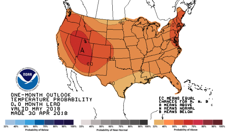
NOAA’s Climate Prediction Center May temperature outlook indicates increased chances of above-normal temperatures for the Northeast.