2020 - Another Warm Year in the Books
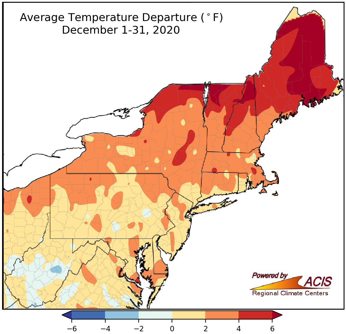
December average temperatures ranged from 2°F below normal to more than 6°F above normal in most areas.
Average temperatures for December ranged from 4°F below normal in central West Virginia to more than 6°F above normal in northeastern New York and portions of northern New England. Overall, most areas wrapped up the last month of the year on the warm side of normal. Thirty-four of the 35 major climate sites in the Northeast were warmer than normal, with average temperatures ranging from normal in Charleston, WV, to 7.8°F above normal in Caribou, ME. Six of the sites ranked this December among their 20 warmest on record.
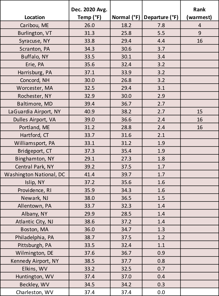
December average temperatures were as much as 7.8°F above normal at the major climate sites.
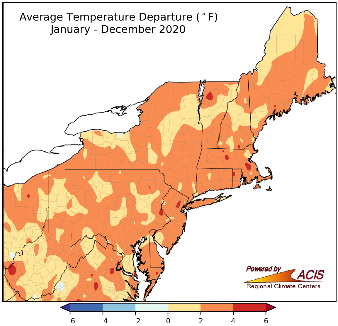
Average temperatures for 2020 were as much as 6°F warmer than normal.
2020 was a warm one in the Northeast, with average temperatures ranging from near normal to 6°F above normal. All of the major climate sites were warmer than normal, with average temperatures ranging from 1.6°F above normal in Charleston, WV, to 4.3°F above normal in Scranton, PA. In fact, it was the hottest year on record for six major climate sites - Scranton, PA; Harrisburg, PA; Atlantic City, NJ; Portland, ME; Central Park, NY; and Providence, RI. Another 23 major climate sites ranked 2020 among their five warmest years on record.
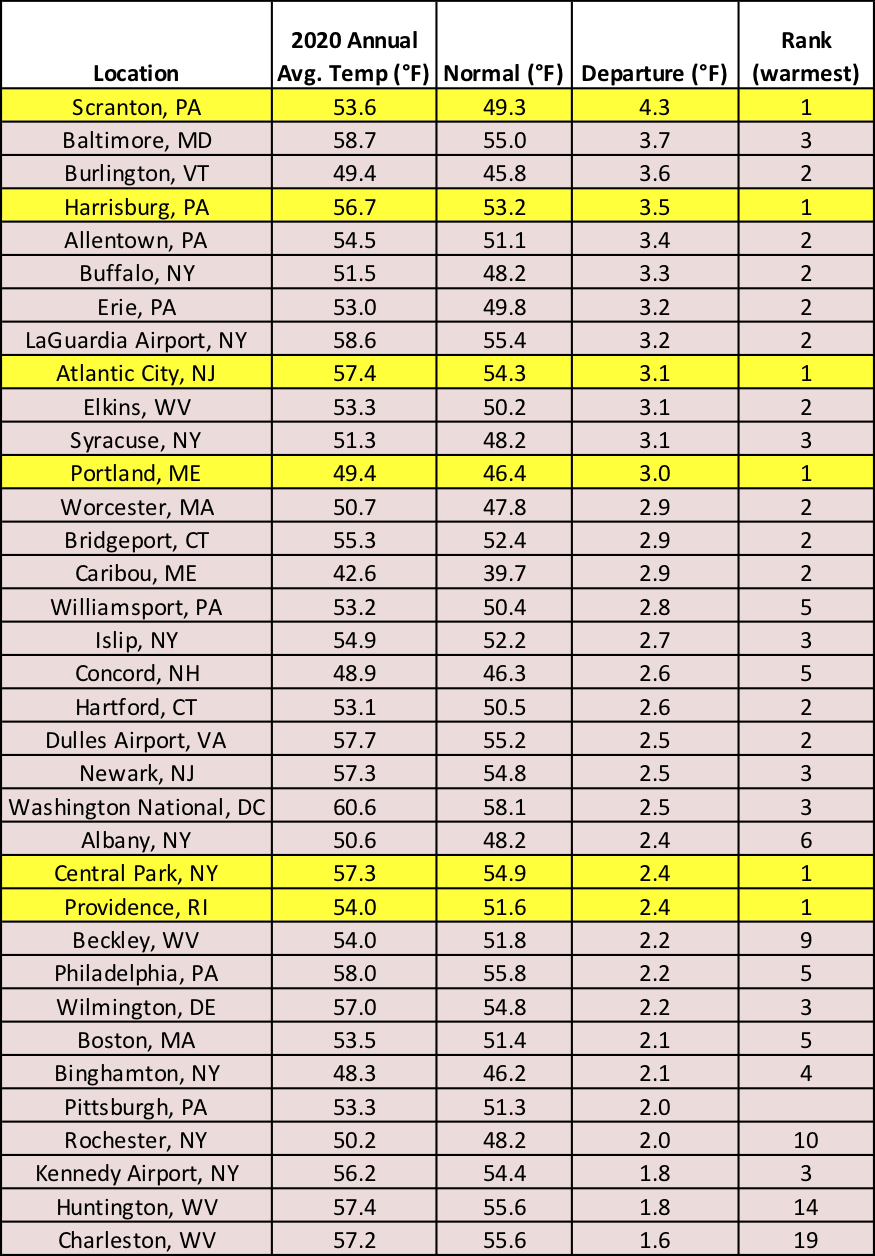
Six major climate sites recorded their hottest year on record, with another 23 sites having one of their five hottest years on record.
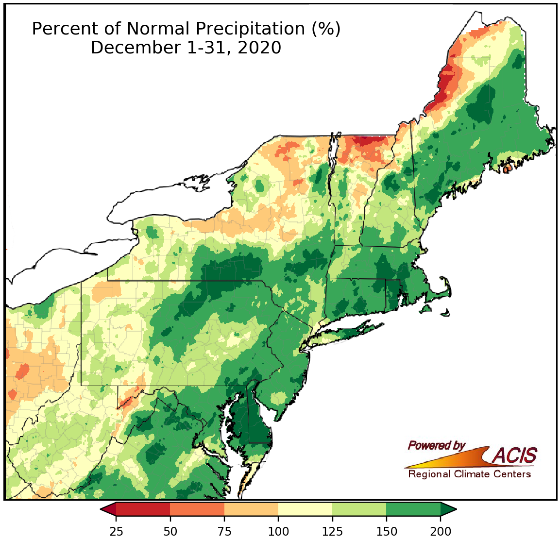
December precipitation ranged from near normal to more than 200% of normal for a large portion of the Northeast.
While December precipitation ranged from 25% of normal to more than 200% of normal, it was a wetter-than-normal month for a majority of the Northeast. At the major climate sites, precipitation ranged from 53% of normal in Burlington, VT, to 208% of normal in Binghamton, NY. Ten of the 30 wetter-than-normal climate sites ranked this December among their 20 wettest.
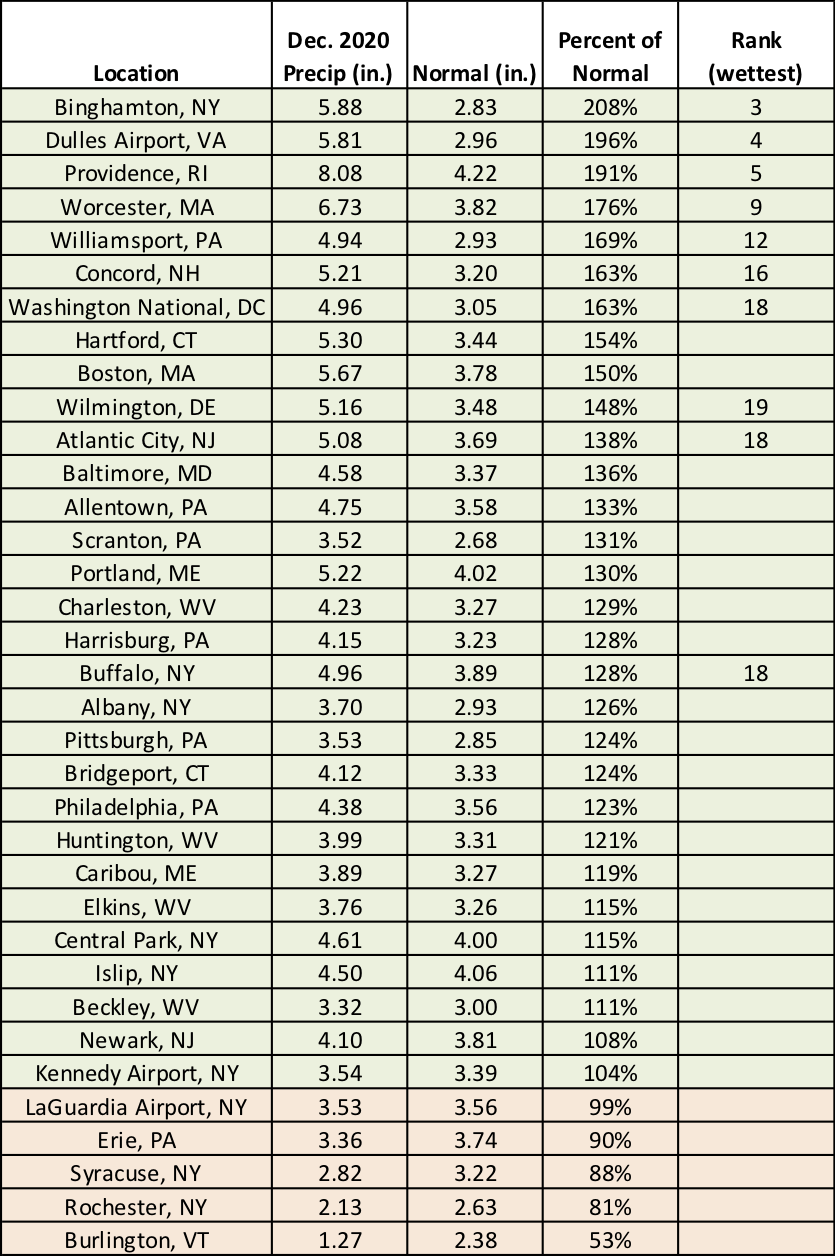
Ten major climate sites ranked this December among their 20 wettest on record.
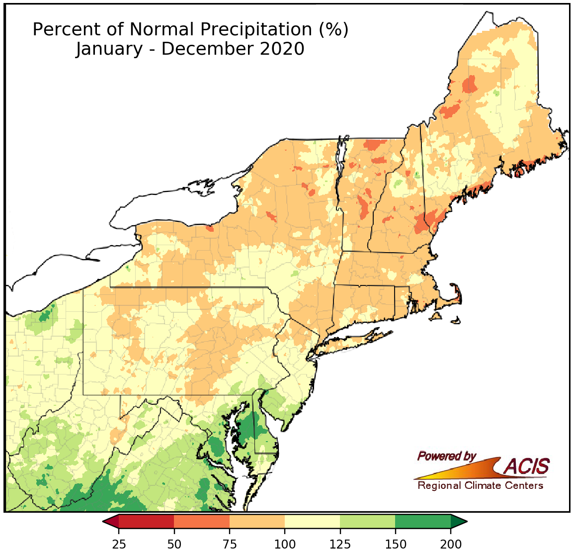
2020 precipitation ranged from 50% of normal to 200% of normal.
2020 precipitation ranged from 50% of normal in parts of New England and New York to 200% of normal in parts of Maryland, Delaware, and West Virginia. The major climate sites were similarly split, with 19 being wetter than normal, 14 being drier than normal, and two right at normal. Nine of the major climate sites recorded one of their 20 wettest years on record. Overall, precipitation at the major climate sites ranged from 82% of normal in Concord, NH, to 144% of normal in Washington, D.C.
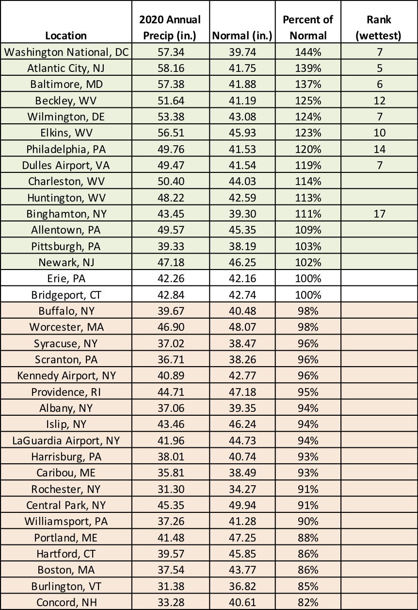
2020 ranked among the 20 wettest years on record at nine major climate sites.
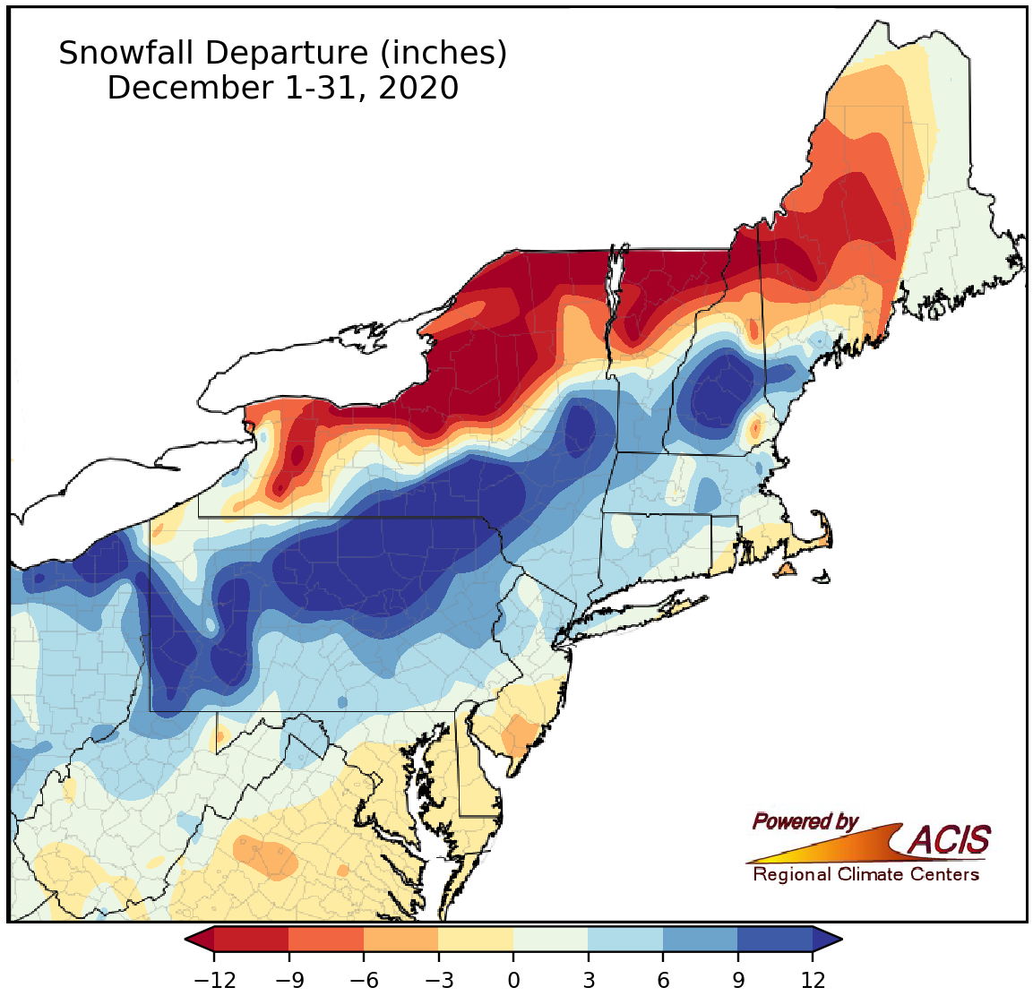
December snowfall ranged from more than 12 inches below normal to more than 12 inches above normal.
December snowfall ranged from more than 12 inches below normal in northern New York, northern parts of Vermont and New Hampshire, and western Maine to more than 12 inches above normal in western and northern Pennsylvania, central and eastern New York, and southern New Hampshire. At the major climate sites, December snowfall ranged from 19.5 inches below normal in Syracuse, NY, to 30.4 inches above normal in Binghamton, NY. Twenty-five of the climate sites saw above-normal snowfall, with 16 of those sites having one of their 20 snowiest Decembers on record.
A record-setting storm in mid-December was the major factor in which sites saw below-normal snowfall or above-normal snowfall in December. The storm dropped 24 to 44 inches of snow on an area from central Pennsylvania through New York and into northern New England from December 16 to 17. Two-day snowfall totals ranked as the largest on record for any month at Binghamton, NY, and Williamsport, PA, while Concord, NH, had its all-time snowiest day on record and largest December snowstorm. In addition, December 17 became the snowiest December day on record for Binghamton, as well as Albany, NY.
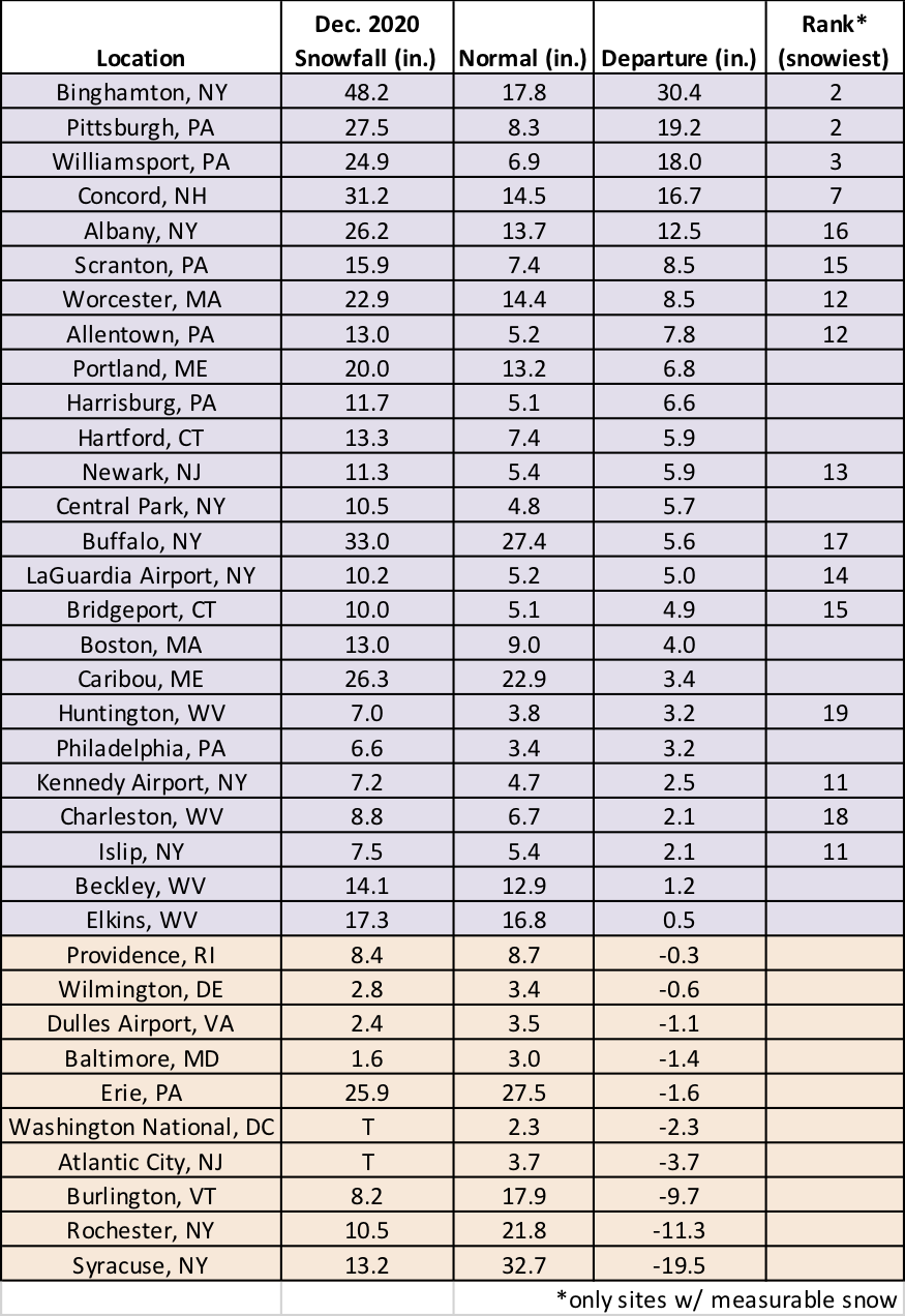
Sixteen major climate sites had one of their 20 snowiest Decembers on record.