A Warm, Dry Start to March
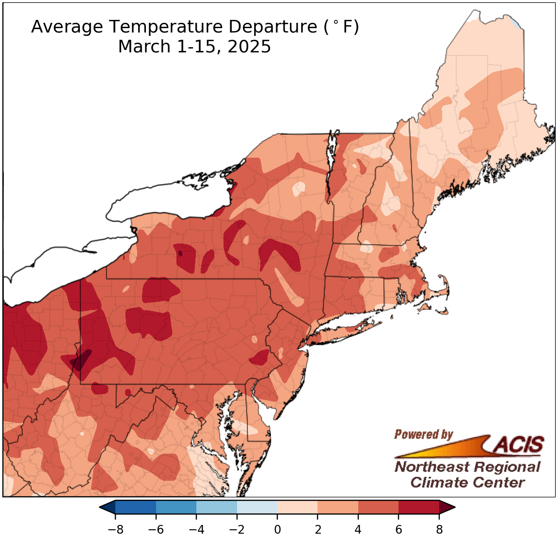
March 1-15 average temperatures ranged from near normal to over 8°F above normal.
The first half of March featured above-normal temperatures across the Northeast, with the largest departures of over 8°F in southwestern Pennsylvania and northern West Virginia. At the Northeast’s 35 major sites, March 1-15 average temperatures ranged from 1.3°F above normal in Portland, ME, to 8.6°F above normal in Pittsburgh, PA, with 24 sites experiencing one of their 20 warmest starts to March.
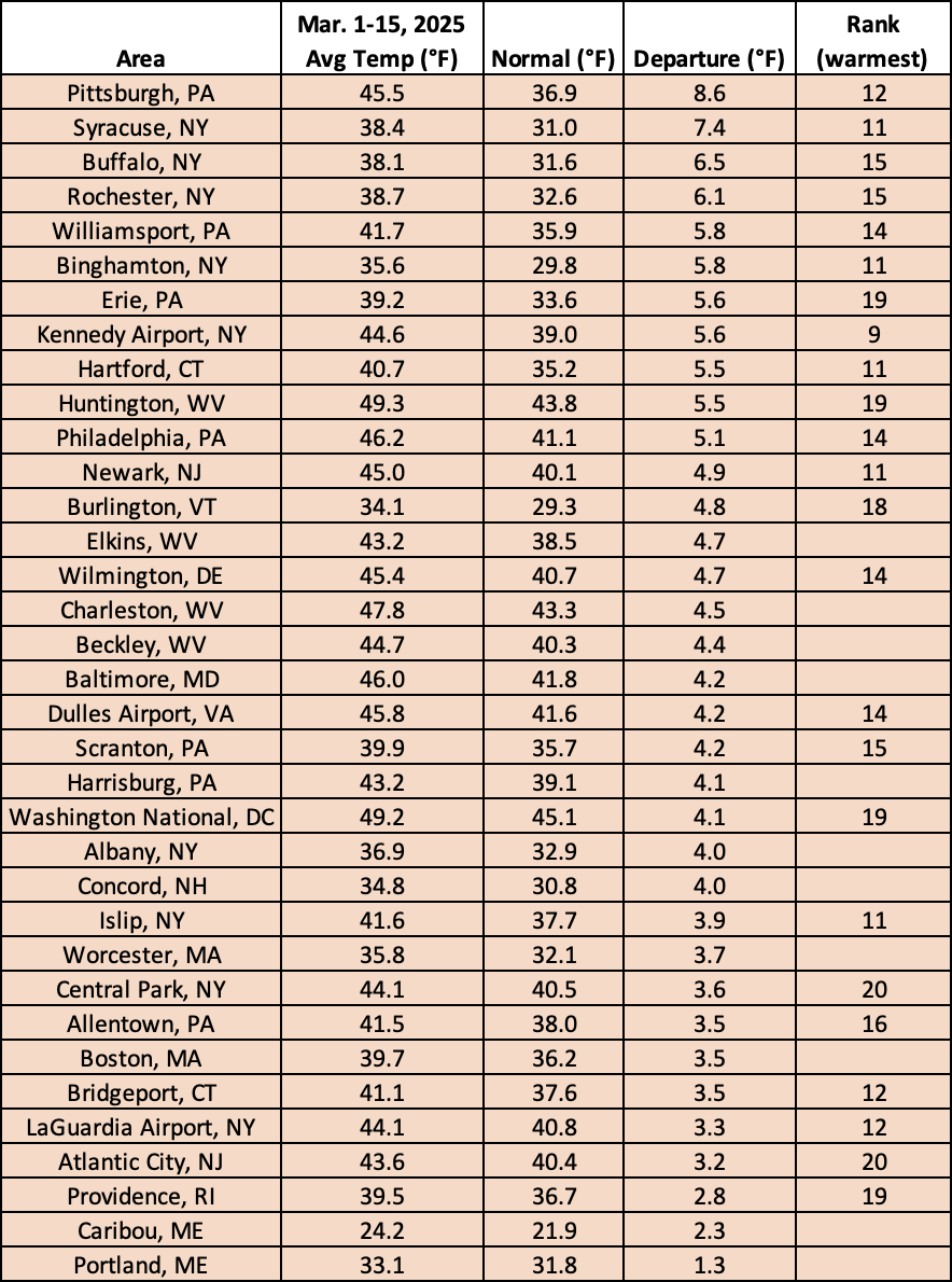
This March 1-15 period ranked among the 20 warmest for 24 major sites.

March 1-15 precipitation ranged from less than 25% of normal to 200% of normal, with most areas being drier.
While precipitation during the first half of March ranged from less than 25% of normal in the region’s southwestern corner to 200% of normal in northern Maine, most of the region experienced drier-than-normal conditions. At the region’s 35 major sites, March 1-15 precipitation ranged from 10% of normal in Huntington, WV, to 162% of normal in Caribou, ME, with 33 sites being drier than normal. This first half of March was among the 20 driest for 13 sites but was the ninth wettest for Caribou.
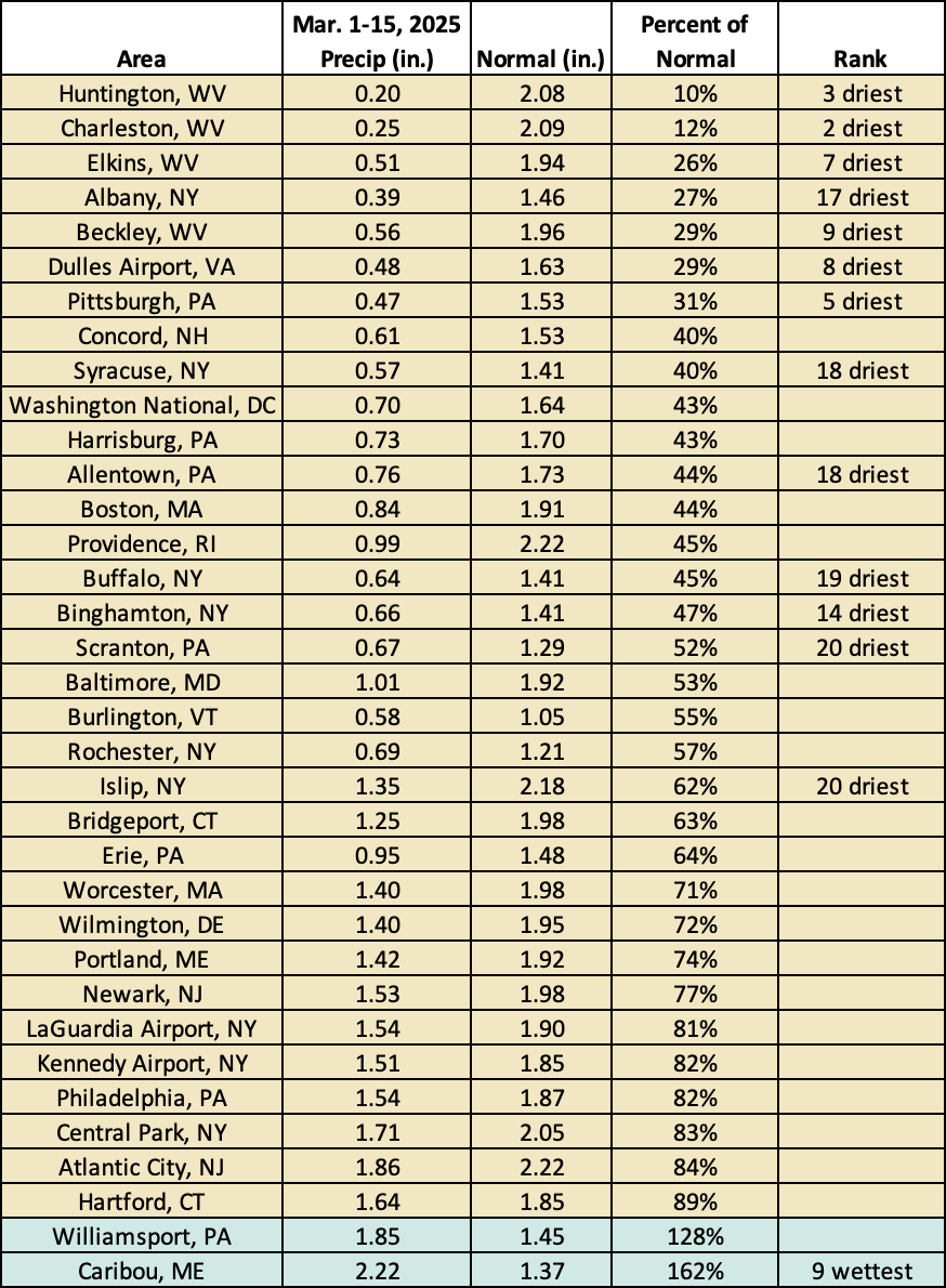
This March 1-15 period was among the 20 driest for 13 sites but was the ninth wettest for Caribou, ME.
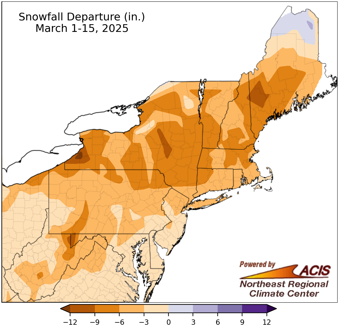
March 1-15 snowfall ranged from over 12 inches below normal to 6 inches above normal, with most areas having a snowfall deficit.
For the first half of March, most of the Northeast had a snowfall deficit, with the largest departure of over 12 inches in western New York. However, northern Maine saw a snowfall surplus of up to 6 inches. In fact, Caribou, ME, was the only snowier-than-normal major site, with the other 34 sites seeing deficits of up to 8.1 inches (in Buffalo, NY). This March 1-15 period ranked among the 20 least snowy for three major sites.
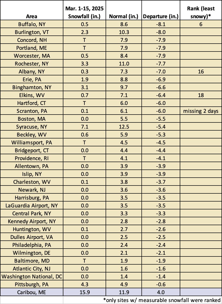
This March 1-15 period ranked among the 20 least snowy for three major sites.