A Cold and Snowy February-to-Date
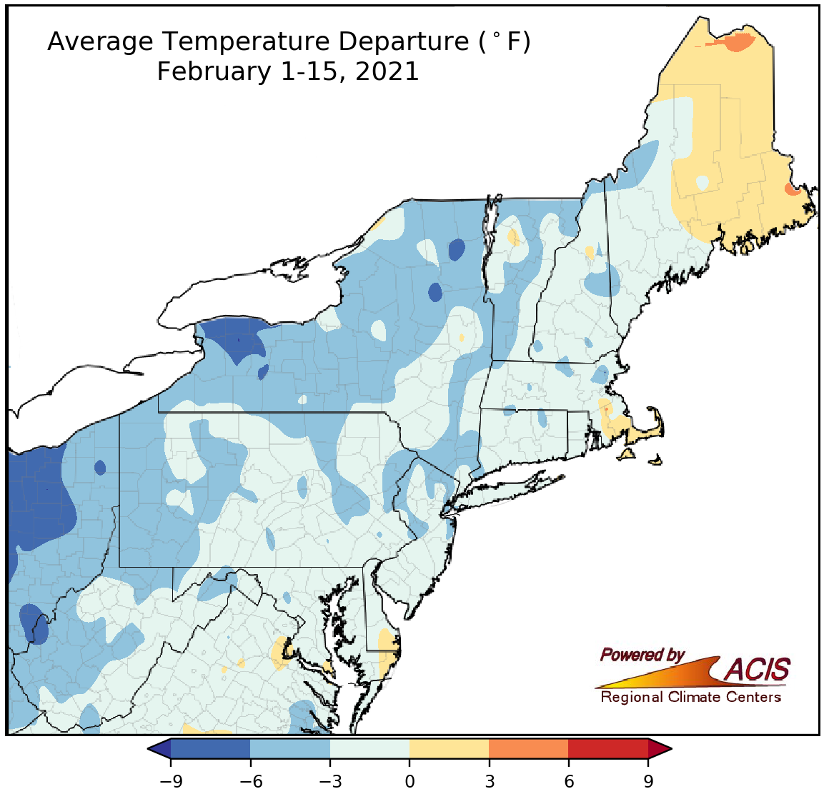
February 1-15 average temperatures ranged from 9°F below normal to 3°F above normal.
The first half of February was colder than normal for a majority of the Northeast, with the coldest locations, generally in parts of New York and West Virginia, being as much as 9°F below normal. Thirty-three of the Northeast’s 35 major climate sites experienced colder-than-normal average temperatures during the first half of February, with the greatest departure from normal being 5.6°F below normal in Huntington, WV. However, a few areas, most notably northern and eastern Maine, were as much as 3°F above normal. In fact, Caribou, ME, recorded its 18th warmest February 1-15 period on record at 2.5°F above normal.
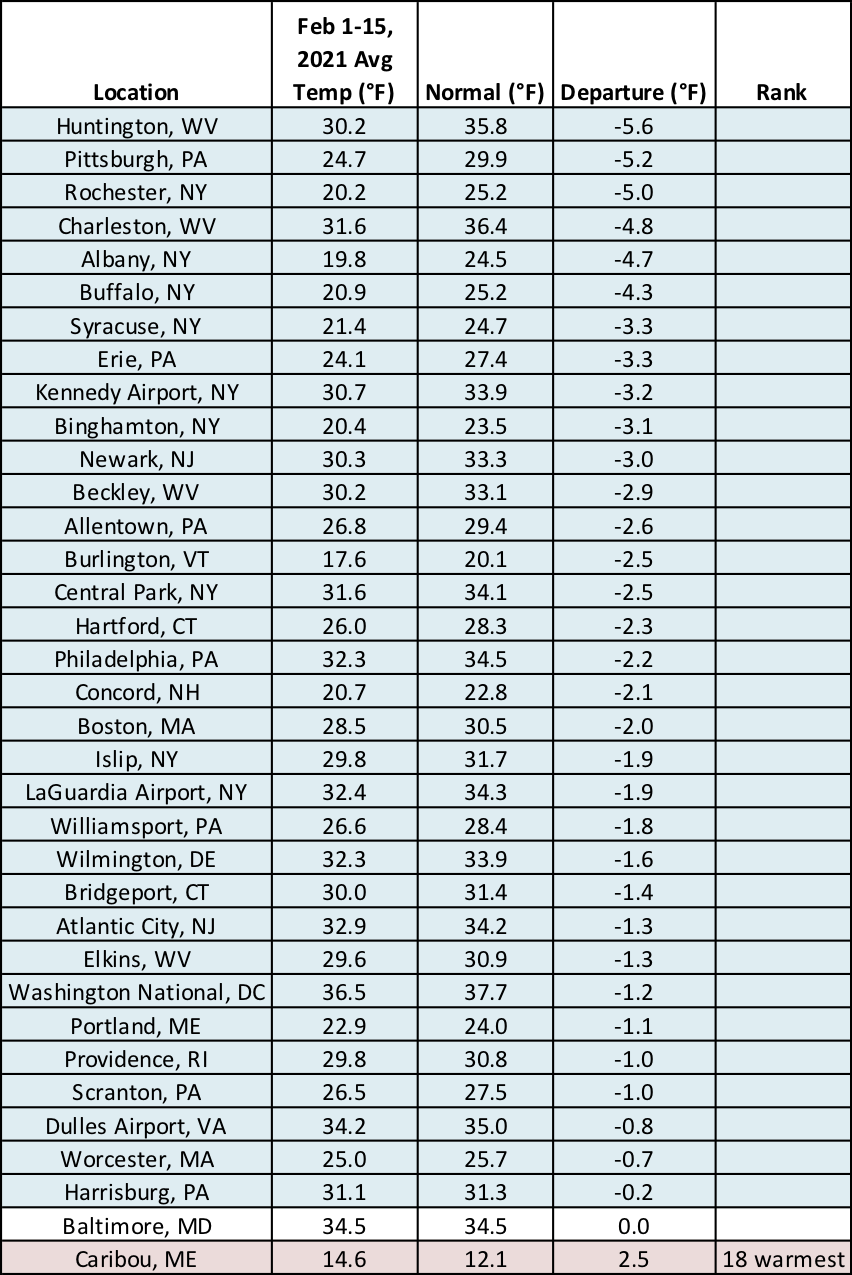
All but two of the region’s 35 major climate sites experienced a colder-than-normal first half of February.
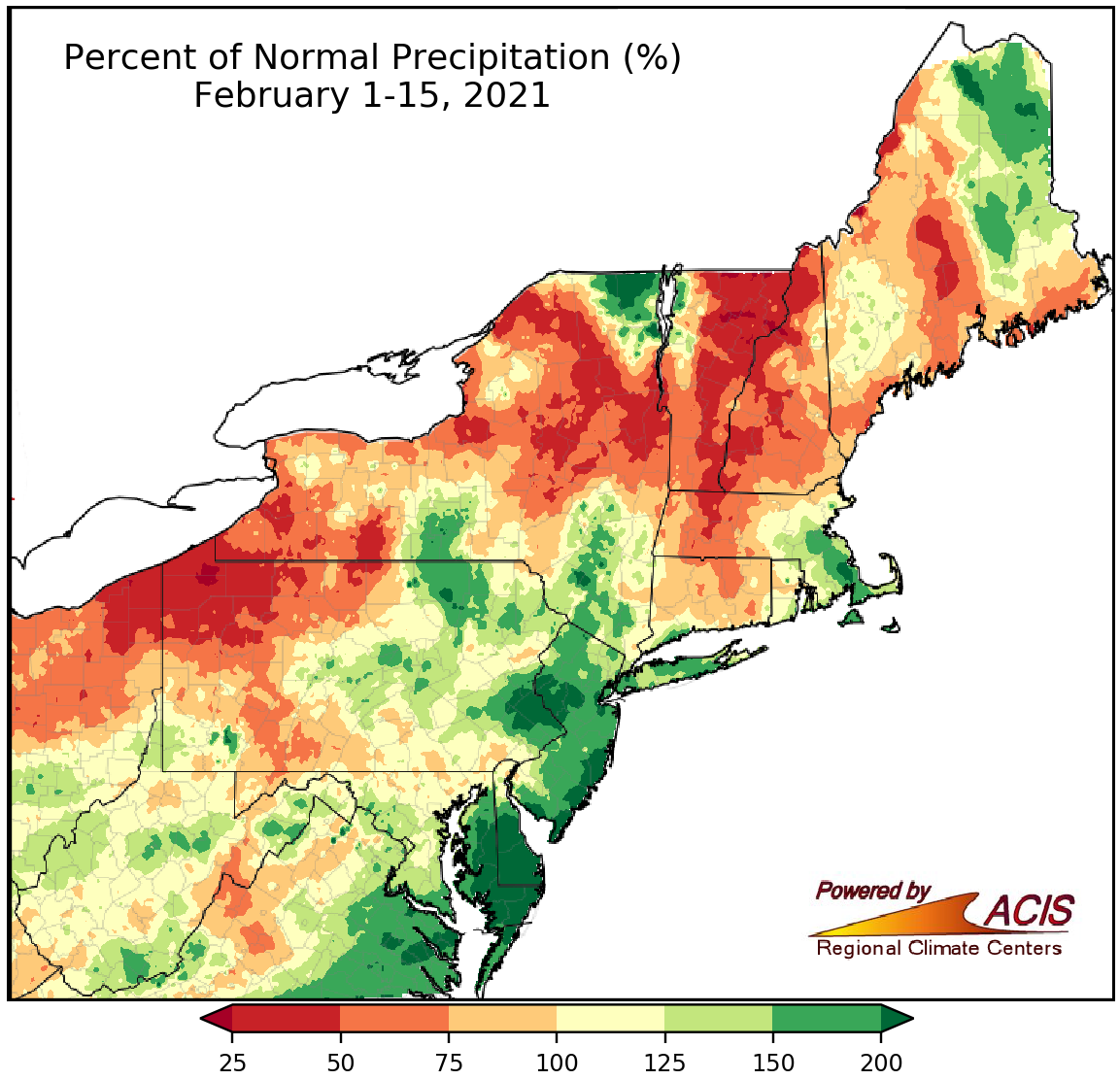
February 1-15 precipitation ranged from 25% of normal to more than 200% of normal.
Precipitation during the first half of February varied, ranging from as little as 25% of normal to more than 200% of normal. The driest areas were generally in northern New England, northern and western New York, and northwestern Pennsylvania, while the wettest locations were generally in eastern Pennsylvania, central and southern New Jersey, and on the Delmarva Peninsula. The 35 major climate sites were nearly split, with 19 being wetter than normal and 16 being drier than normal. This February 1-15 period ranked among the 20 wettest on record for Atlantic City, NJ; Allentown, PA; and Dulles Airport, VA, but as the 17th driest for Islip, NY. Overall, precipitation at the major climate sites ranged from 64% of normal in Concord, NH, and Erie, PA, to 187% of normal in Atlantic City, NJ.
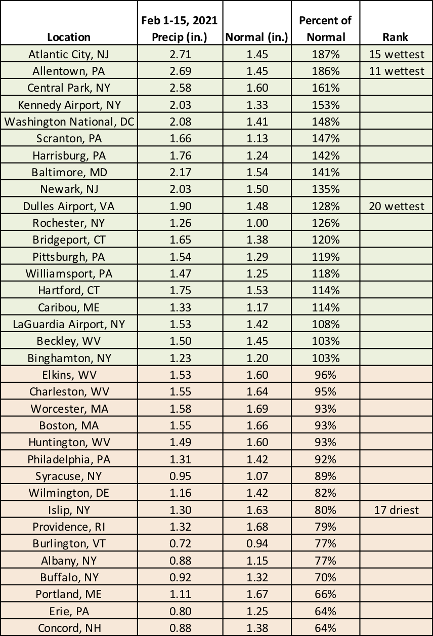
This February 1-15 period ranked among the 20 wettest on record for three sites but among the 20 driest for one site.
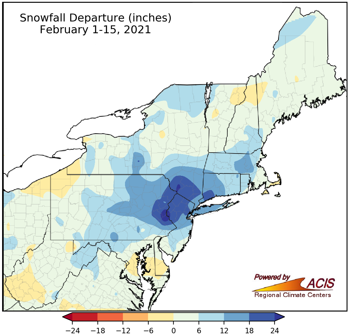
February 1-15 snowfall ranged from within 6 inches of normal to more than 24 inches above normal.
Snowfall during the first half of February ranged from within 6 inches of normal to more than 24 inches above normal, with the greatest surpluses generally found in eastern Pennsylvania, northern New Jersey, and southeastern New York. Snowfall at the 35 major climate sites ranged from 3.6 inches below normal in Erie, PA, to 23.0 inches above normal in Allentown, PA. Twenty-nine of the sites were snowier than normal, with 18 of those having one of their 20 snowiest starts to February. Much of the snow fell during a significant storm from February 1-3. Storm snow totals ranged from less than 6 inches to more than 30 inches. February 1 became one of the 10 all-time snowiest days on record for sites such as Central Park, NY; Bridgeport, CT; and Allentown, PA, and one of the 10 snowiest February days on record for several other sites including Newark, NJ; Scranton, PA; and Kennedy Airport, NY.
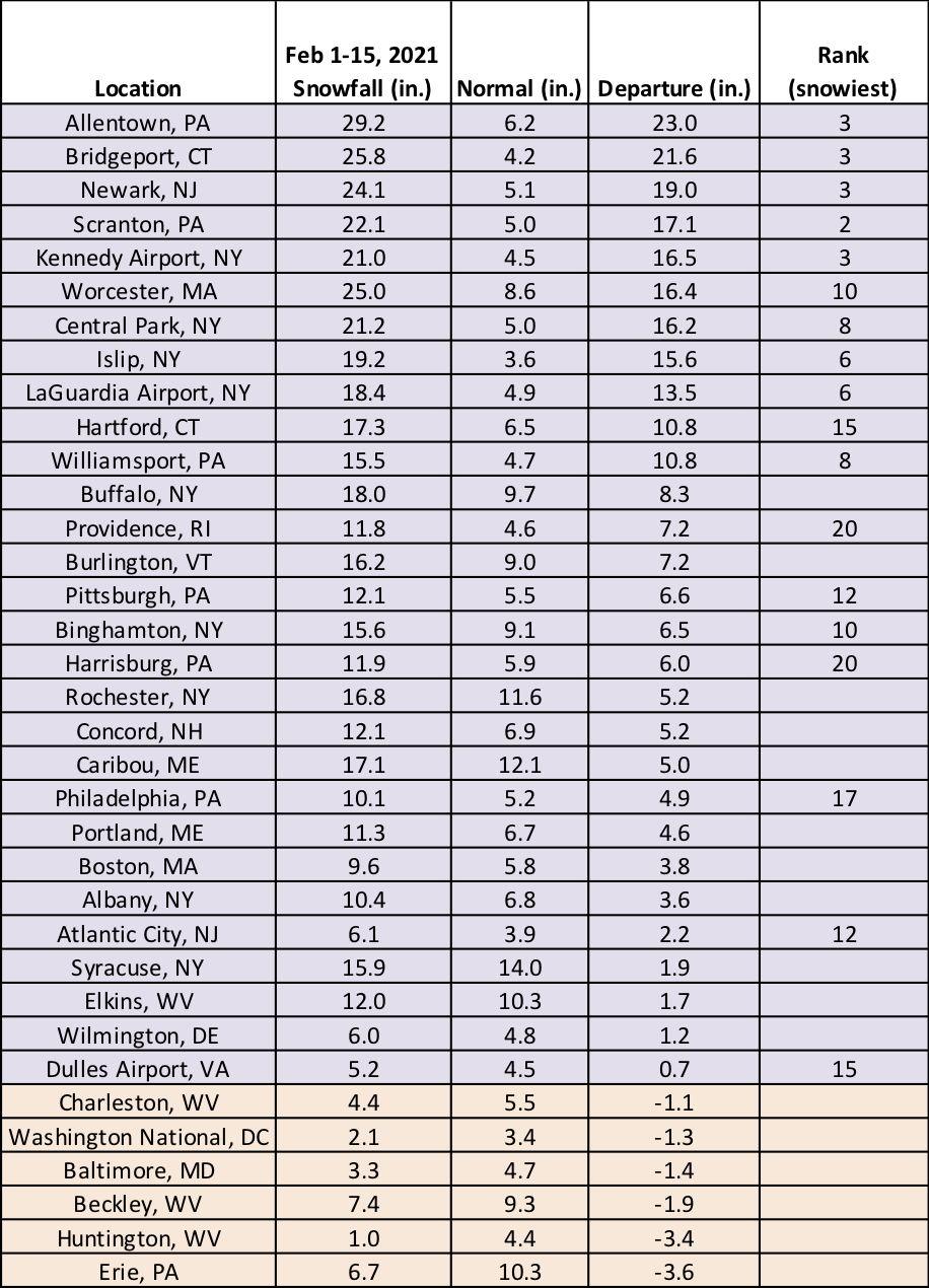
This February 1-15 period ranked among the 20 snowiest on record for 18 sites.
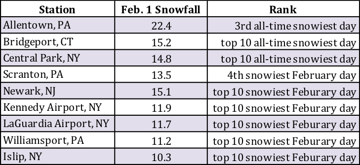
February 1 became one of the 10 all-time snowiest days and/or February days on record for several sites.