April Came in Hot
April 1-15 average temperatures ranged from 2°F below normal to more than 8°F above normal.
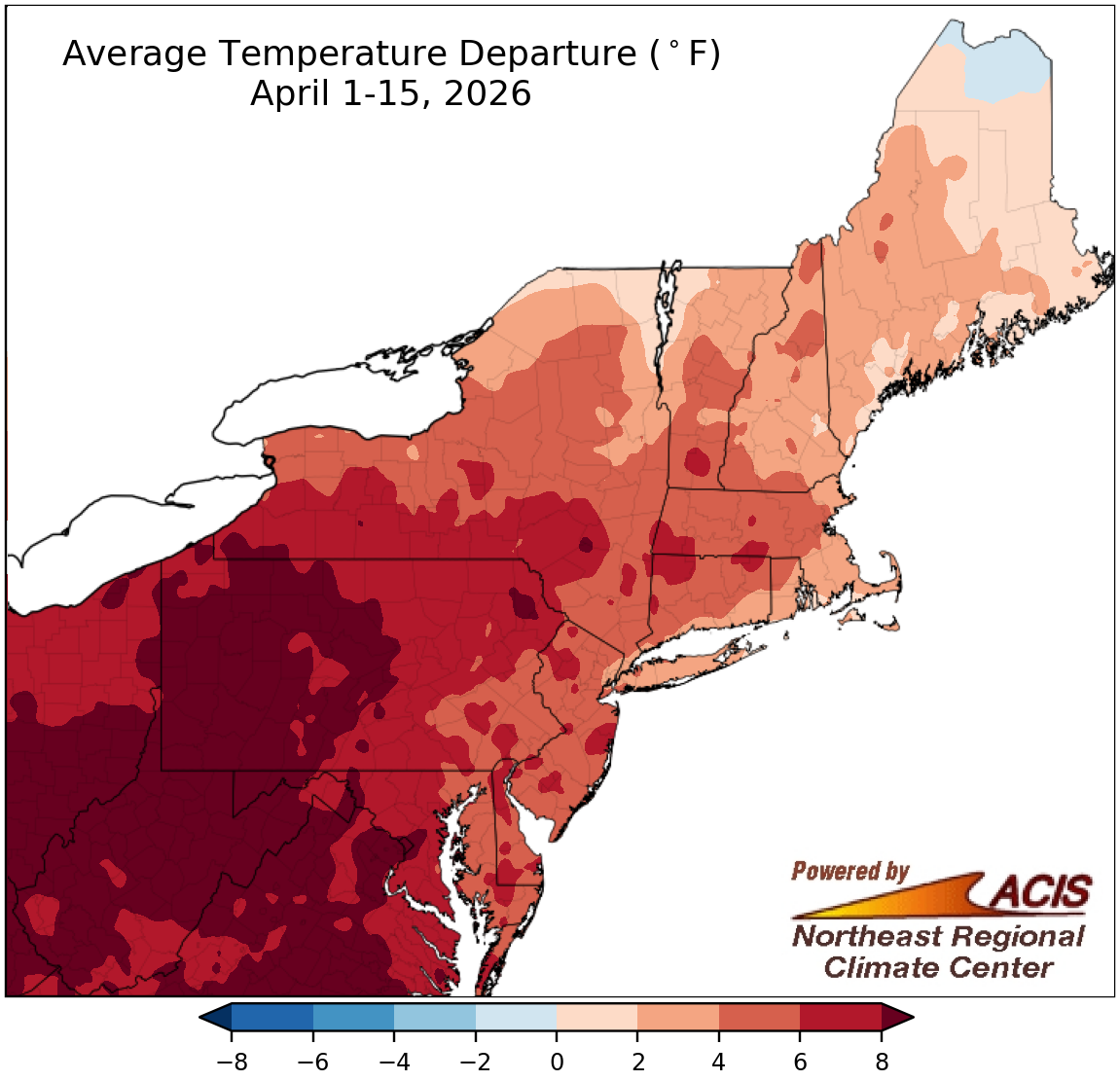
The first half of April was unusually warm for much of the Northeast, with average temperatures more than 8°F above normal in portions of western New York, Pennsylvania, Maryland, and West Virginia. The exception to this warmth was northern Maine, where average temperatures were as much as 2°F cooler than normal. At the Northeast’s 35 major sites, April 1-15 average temperatures ranged from 0.4°F below normal in Caribou, ME, the only cooler-than-normal site, to 11.2°F above normal in Huntington, WV. This first half of April was record warm for four sites - Huntington, Charleston, and Elkins, WV, and Pittsburgh, PA. It ranked among the 20 warmest for another 28 major sites.
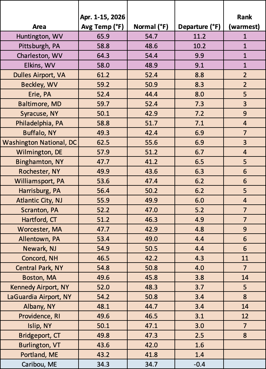
This first half of April was record warm for four major sites and among the 20 warmest for another 28 of the sites.
Precipitation during the first two weeks of April ranged from less than 25% of normal to over 200% of normal.
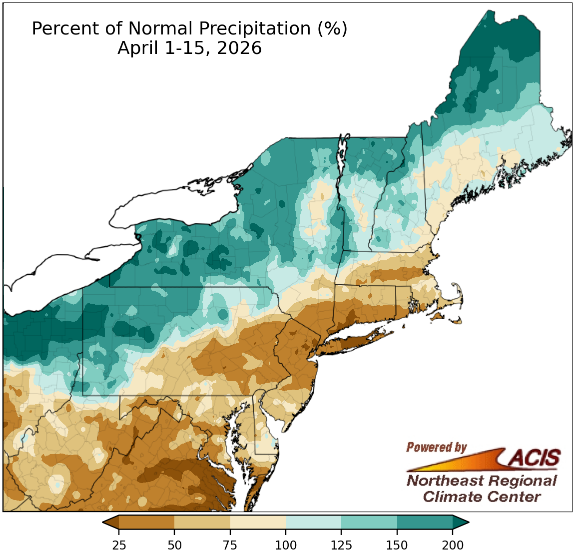
Precipitation during the first two weeks of April ranged from less than 25% of normal in places like the New York City metro area to over 200% of normal in locations such as northern Maine, western New York, and northwestern Pennsylvania. In general, areas closer to the coast, as well as much of West Virginia, saw below- or near-normal precipitation, while northern locations saw near- or above-normal precipitation. April 1-15 precipitation at the region’s 35 major sites ranged from 14% of normal in Bridgeport, CT, to 172% of normal in Caribou, ME, with 26 of the sites being on the dry side. This April 1-15 period ranked among the 20 driest such periods on record for 10 major sites but was Caribou’s sixth wettest. Drought and abnormal dryness expanded in some of the drier locations but improved in some of the wetter locations.
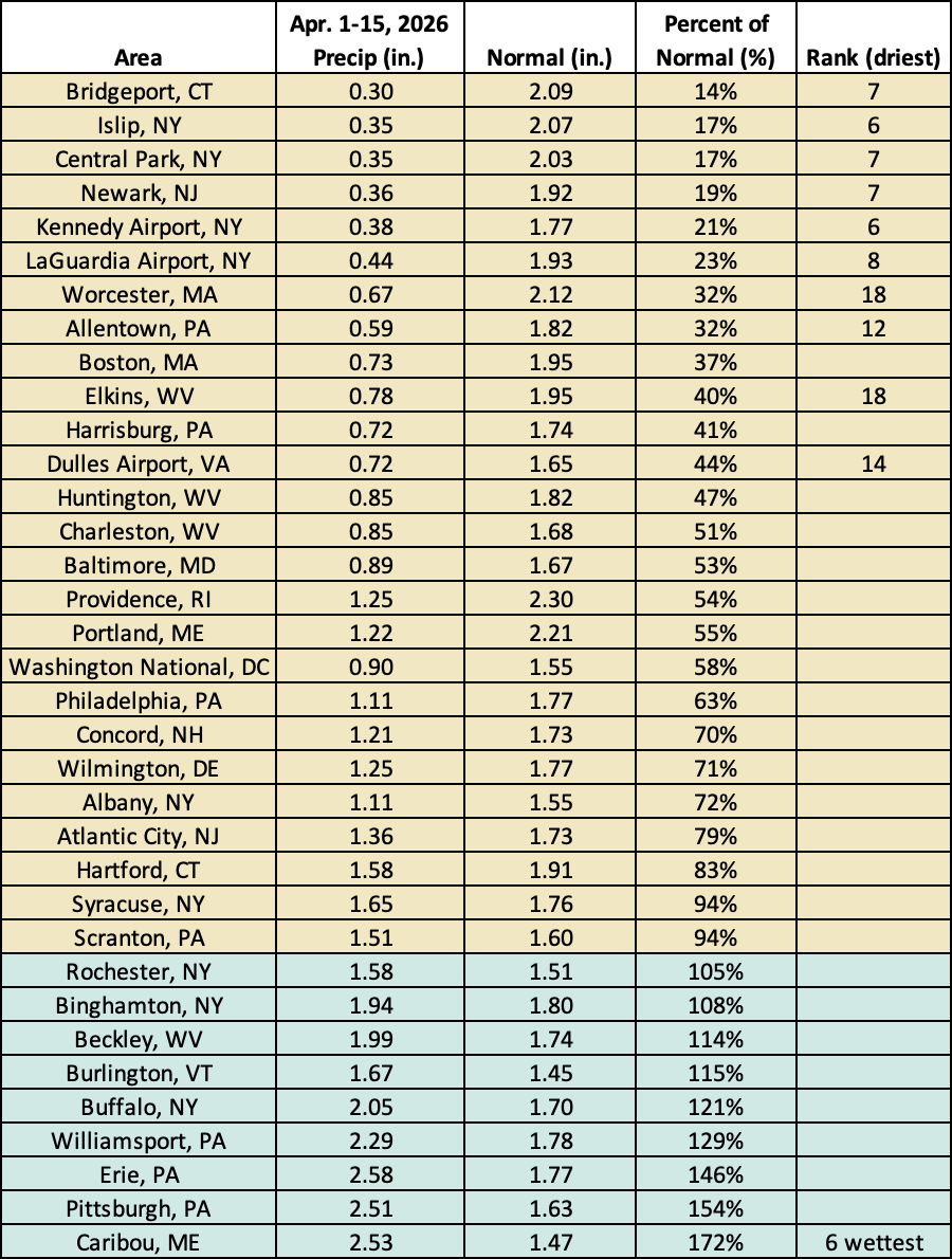
This April 1-15 period ranked among the 20 driest such periods on record for 10 major sites but was Caribou’s sixth wettest.
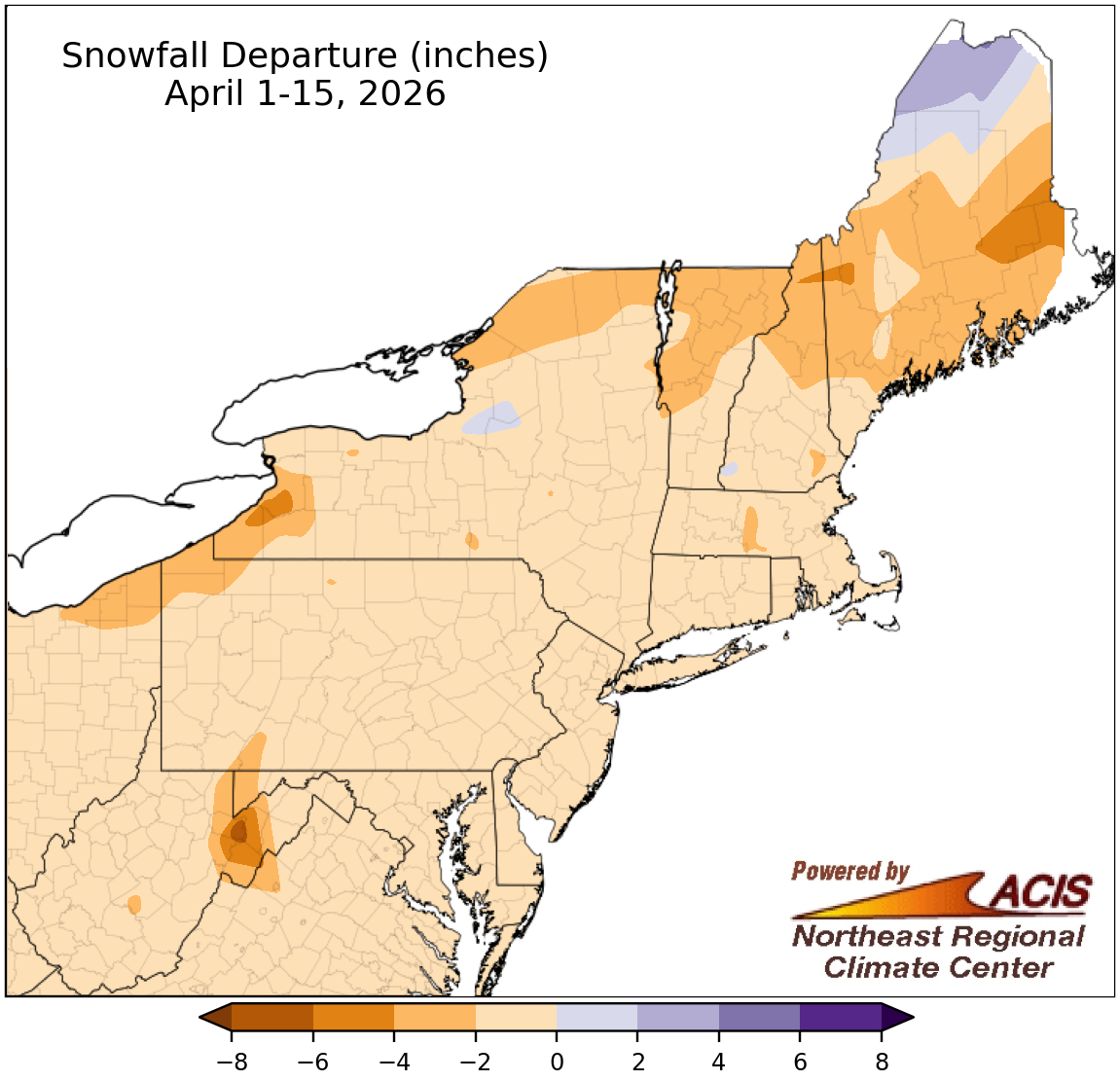
April 1-15 snowfall was within 2 inches of normal for much of the Northeast.
Most of the Northeast saw below or near normal snowfall during the first half of April, with the largest deficits exceeding 4 inches in a couple locations like eastern West Virginia, western New York, and eastern Maine. However, a few spots like northern Maine saw a surplus of up to 4 inches. April 1-15 snowfall at the region’s 35 major sites ranged from 2.4 inches below normal in Rochester, NY, to normal (no snow) at Baltimore, MD, and Washington, D.C. This first half of April ranked as the 19th least snowy on record for Binghamton, NY.
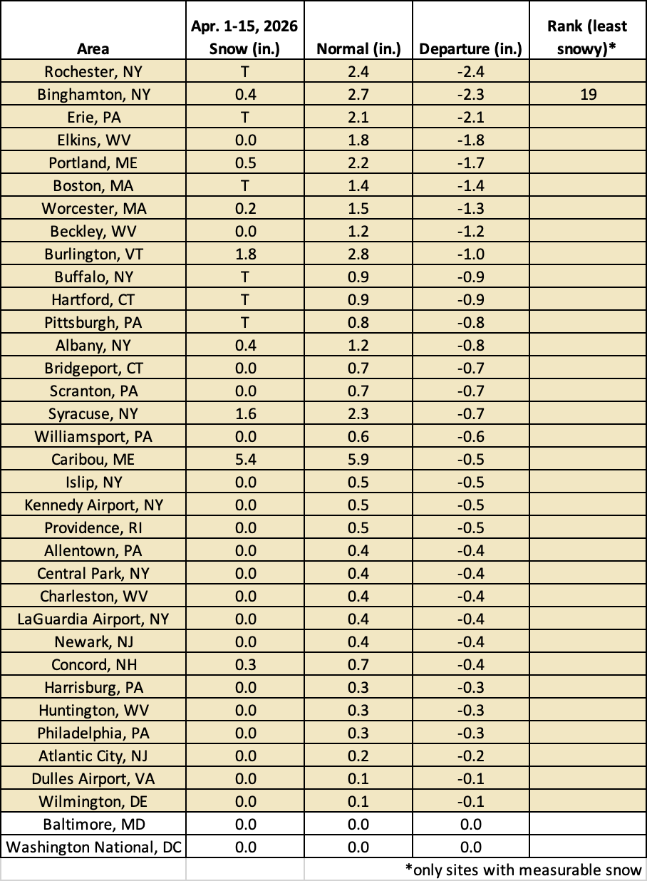
Binghamton, NY, had its 19th-least snowy April 1-15 period.