A Mild-Mannered November
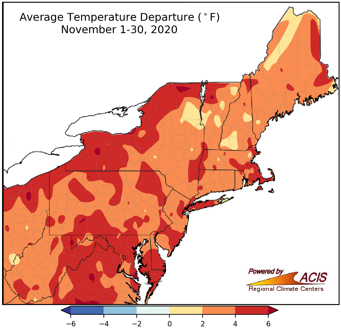
November average temperatures ranged from near normal to more than 6°F above normal.
November was warmer than normal for the entire Northeast, with most areas seeing average temperatures that were 2°F to 6°F above normal. The first half of the month featured a period of record or near-record warmth. At the major climate sites, average temperatures were as much as 6.2°F above normal (in Scranton, PA). This November wrapped up as the warmest November on record for LaGuardia Airport and Central Park, NY, and among the 20 warmest Novembers on record for another 32 major climate sites.
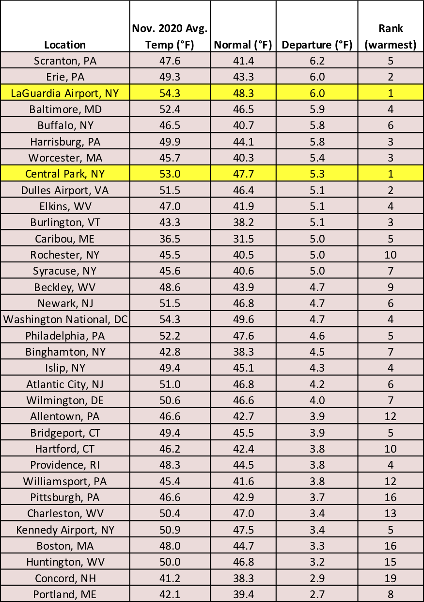
November was up to 6.2°F warmer than normal at the major climate sites, with LaGuardia Airport and Central Park, NY, having their warmest November on record.
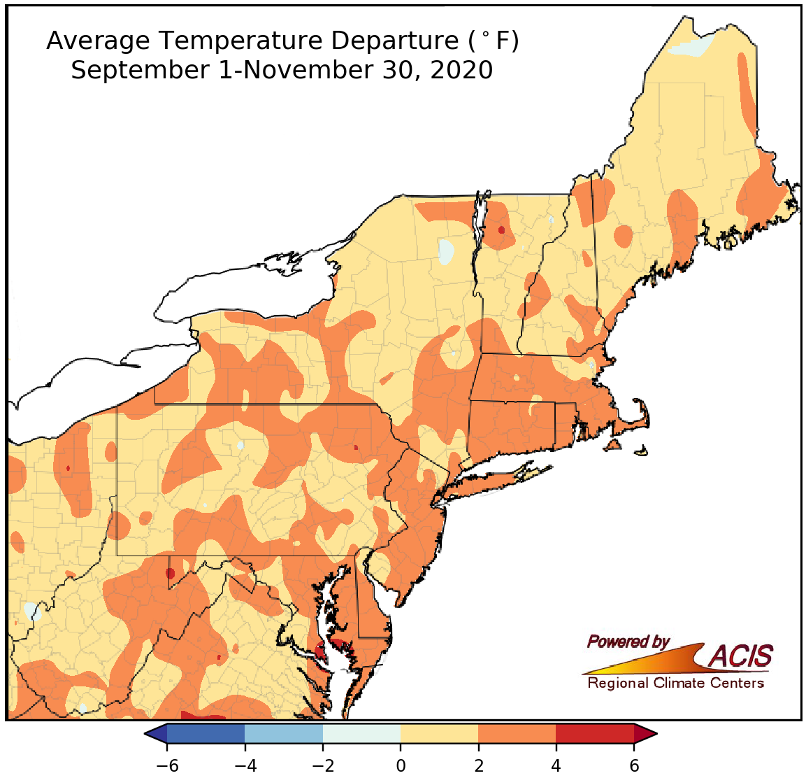
Fall average temperatures ranged from near normal to 6°F above normal.
Fall also averaged out to be warmer than normal for the Northeast, with average temperatures generally ranging from near normal to 4°F above normal. The major climate sites were also warmer than normal, with average temperatures up to 4.2°F above normal (in Scranton, PA). Twenty-seven of the sites ranked this fall among their 20 warmest on record.
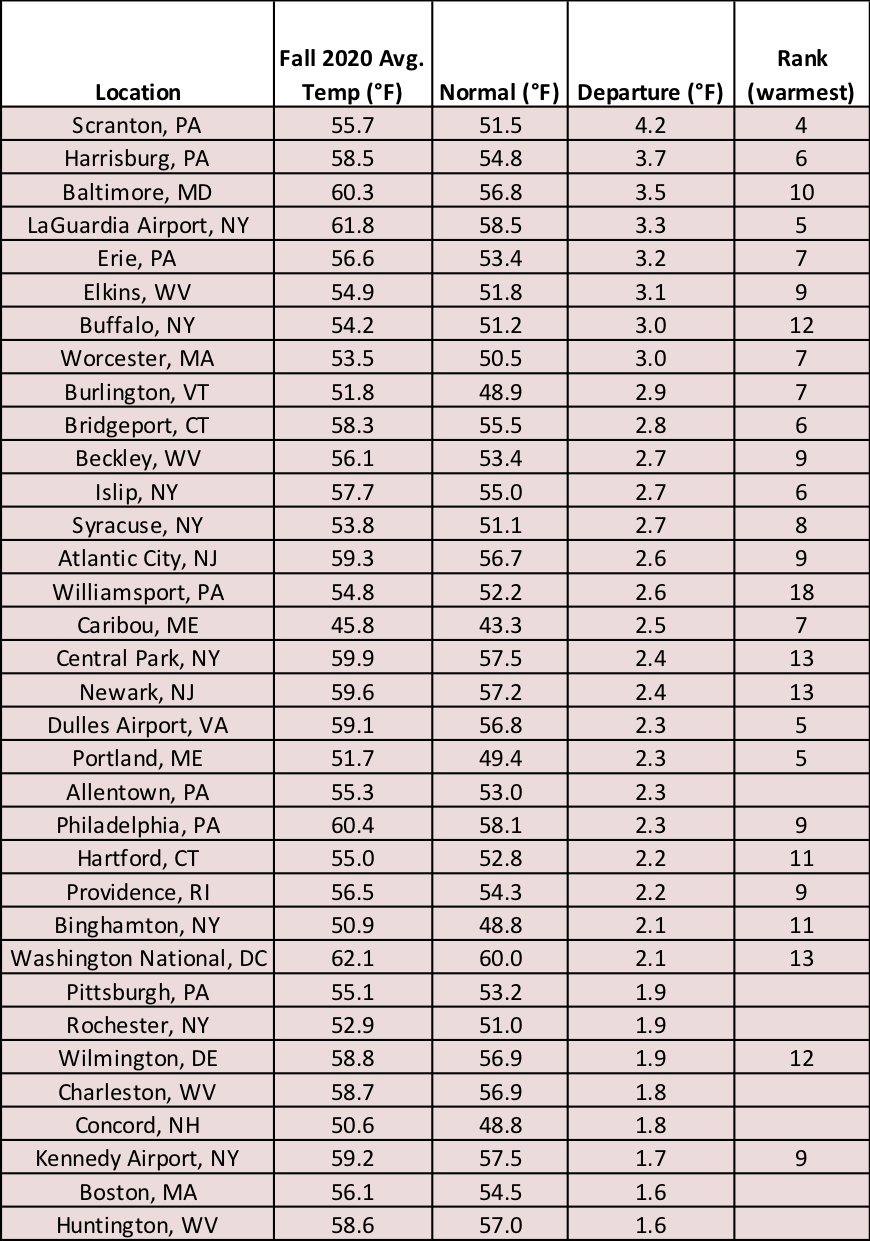
Fall was as much as 4.2°F warmer than normal at the major climate sites.
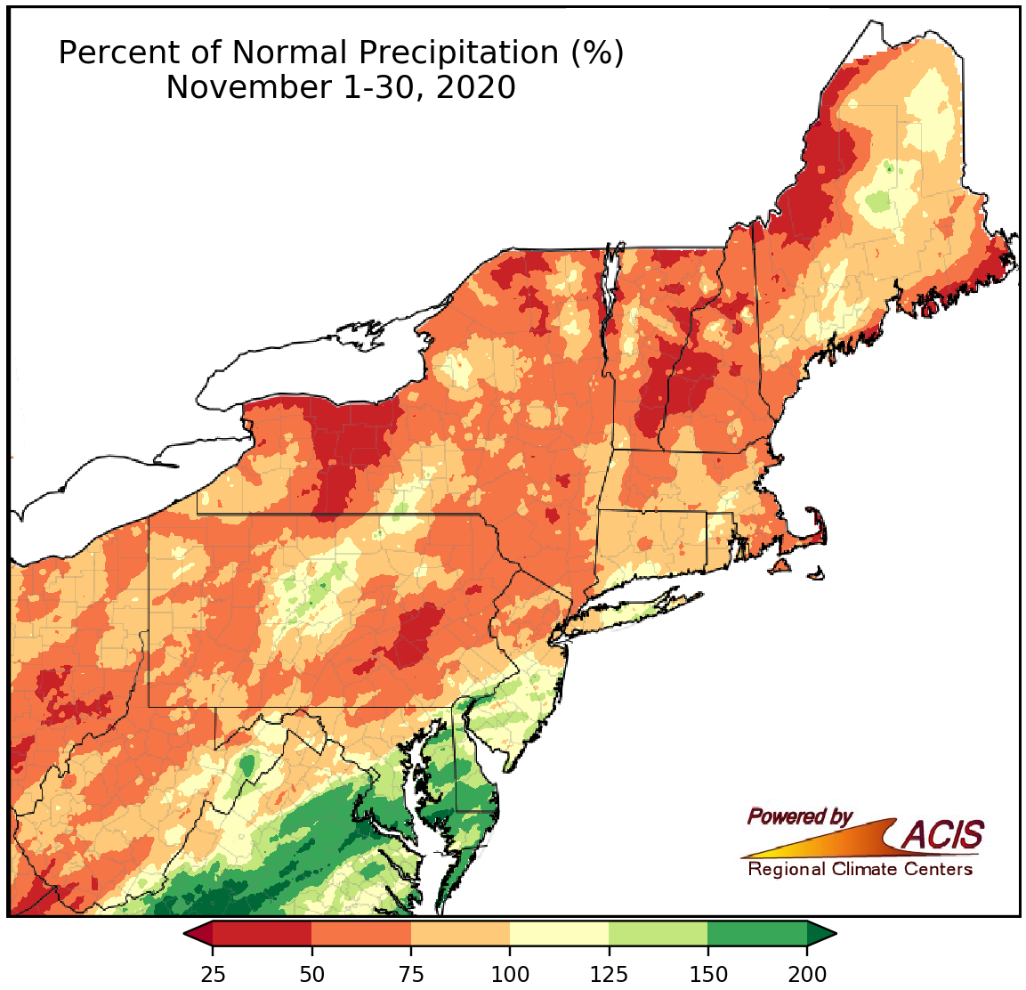
November precipitation ranged from 25% of normal to 200% of normal.
There was a wide range of precipitation totals in the Northeast, from 25% of normal in parts of New England, New York, and Pennsylvania to 200% of normal in parts of Maryland, Delaware, and New Jersey. At the major climate sites, November precipitation ranged from 56% of normal in Beckley, WV, to 194% of normal in Washington, D.C. Twenty-two of the 35 major climate sites were wetter than normal, with 10 of those sites ranking this November among their 20 wettest on record. On the other hand, Beckley had its 20th driest November. Drought and abnormally dry conditions lingered in the region during November.
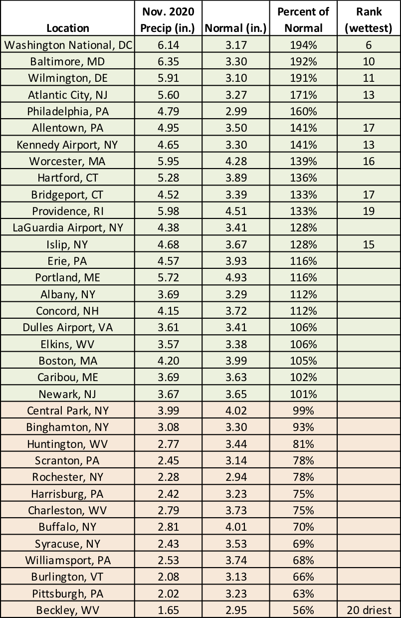
November precipitation ranged from 56% of normal in Beckley, WV, to 194% of normal in Washington, D.C.
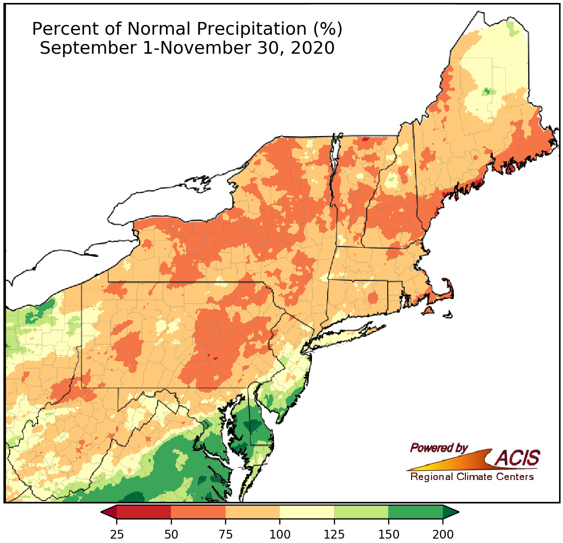
Fall precipitation ranged from 50% of normal to more than 200% of normal.
Fall precipitation was also variable in the Northeast, ranging from 50% of normal to more than 200% of normal. The major climate sites were nearly split, with 18 being wetter than normal and 17 being drier than normal. Overall, precipitation ranged from 60% of normal in Williamsport, PA, to 186% of normal in Atlantic City, NJ. This fall ranked among the 20 wettest on record for seven sites but as Williamsport’s 18th driest.
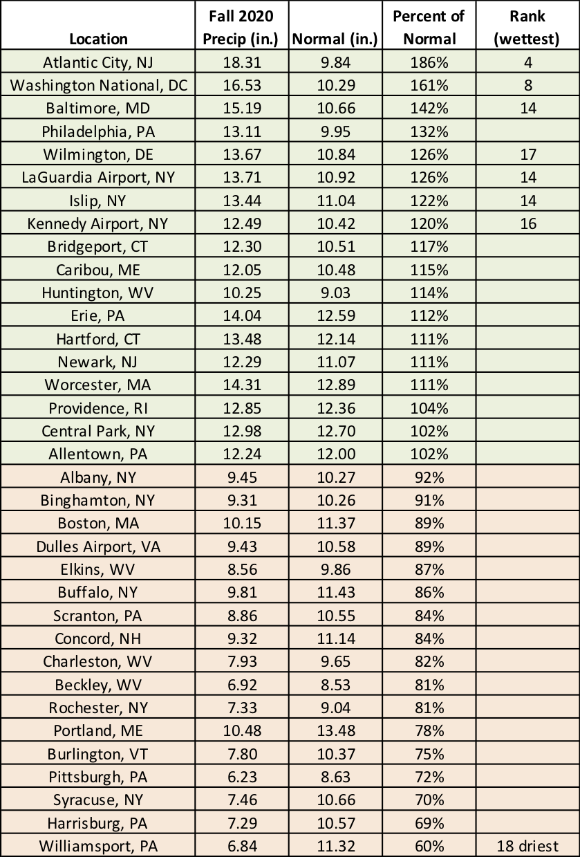
Fall precipitation ranged from 60% of normal in Williamsport, PA, to 186% of normal in Atlantic City, NJ.
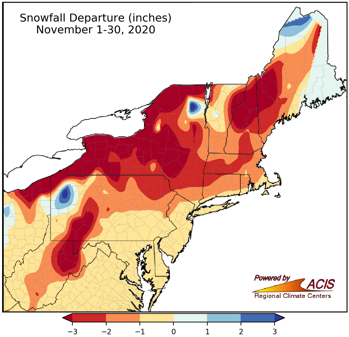
November snowfall ranged from more than 3 inches below normal to near normal for most areas.
Most of the Northeast saw less snowfall than normal, generally ranging from more than 3 inches below normal to near normal. All 35 major climate sites saw below-normal November snowfall, from 7.9 inches below normal in Syracuse, NY, to 0.2 inches below normal in Atlantic City, NJ, and Kennedy Airport, NY. This November ranked among the 20 least snowy on record for three sites. However, there were a few locations, in northwestern Pennsylvania and northeastern New York, that were snowier, seeing a surplus of more than 3 inches.
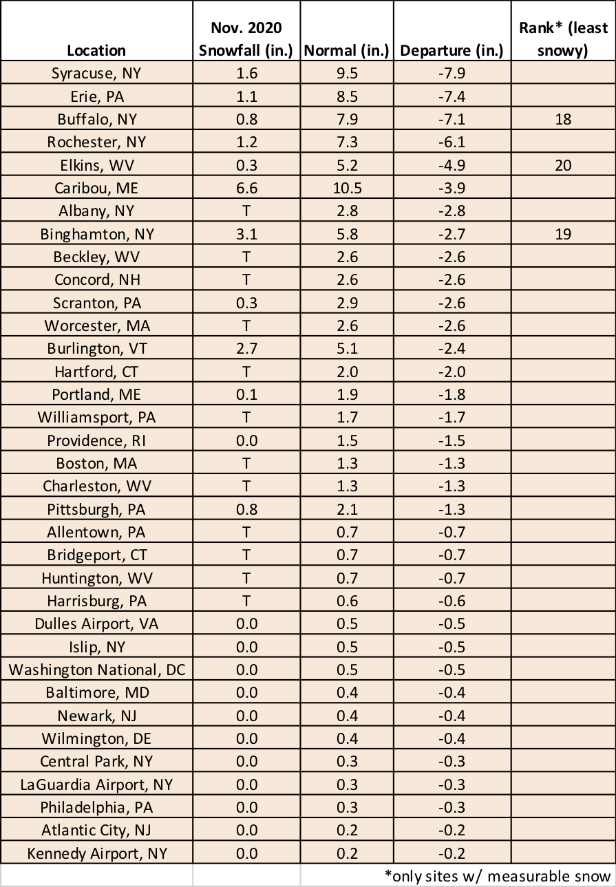
November snowfall deficits ranged from 7.9 inches below normal in Syracuse, NY, to 0.2 inches below normal in Atlantic City, NJ, and Kennedy Airport, NY.
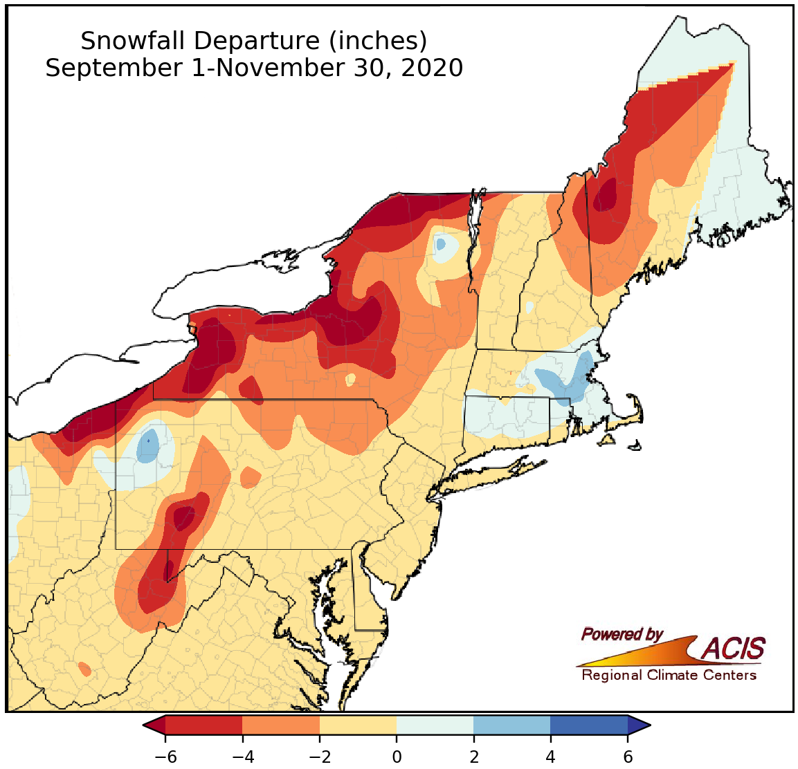
Fall snowfall ranged from more than 6 inches below normal to 4 inches above normal.
Fall was also less snowy than usual for a majority of the Northeast, with the greatest deficits of over 6 inches in portions of New York, Pennsylvania, and Maine. Thirty-two of the 35 major climate sites saw below-normal fall snowfall, with deficits of up to 8.3 inches in Syracuse, NY. Four of the sites had one of their 20 least snowy falls on record. However, a few locations, particularly in southern New England, were snowier, seeing a surplus of up to 4 inches thanks to a record-setting storm in late October. Two major climate sites saw above-normal snowfall, with Boston, MA, having its 10th snowiest fall on record.
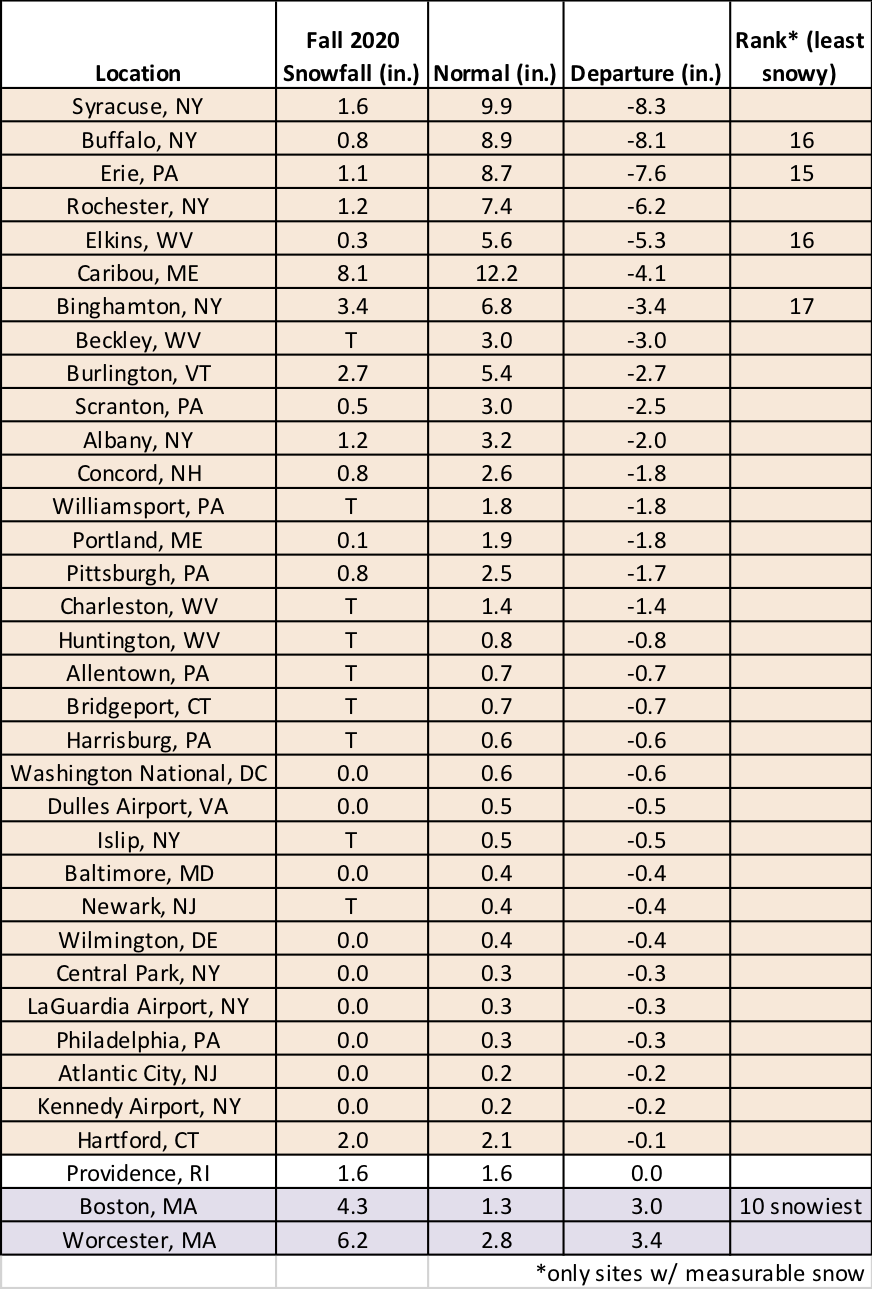
November snowfall ranged from 8.3 inches below normal in Syracuse, NY, to 3.4 inches above normal in Worcester, MA.
December is expected to average out to be warm and wet in the Northeast, according to NOAA’s Climate Prediction Center. Northern New England and part of New York have the greatest likelihood of above-normal temperatures, while coastal New England has the highest probability of seeing wetter-than-normal conditions.
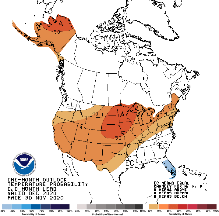
December is expected to be warmer than normal in areas shaded orange.
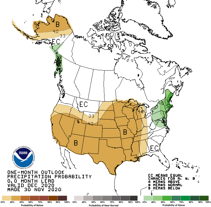
Areas shaded green are expected to be wetter than normal for December.