Polar Plunge
As the polar jet stream plunged south this weekend, Arctic air spilled into the Northeast and temperatures took a nosedive. Oh, and there was snow…in May!
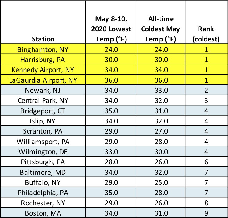
Four sites experienced their coldest May temperature on record, while several others had one of their ten coldest May temperatures.
Temperatures across the Northeast were unseasonably cold from May 8-10. Low temperatures bottomed out in the 20s and 30s, as much as 30°F colder than normal. Four major climate sites - Binghamton, NY; Harrisburg, PA; Kennedy Airport, NY; and LaGuardia Airport, NY - recorded their coldest May temperature on record. The low temperatures at 13 additional major climate sites ranked among the ten coldest for May on record.
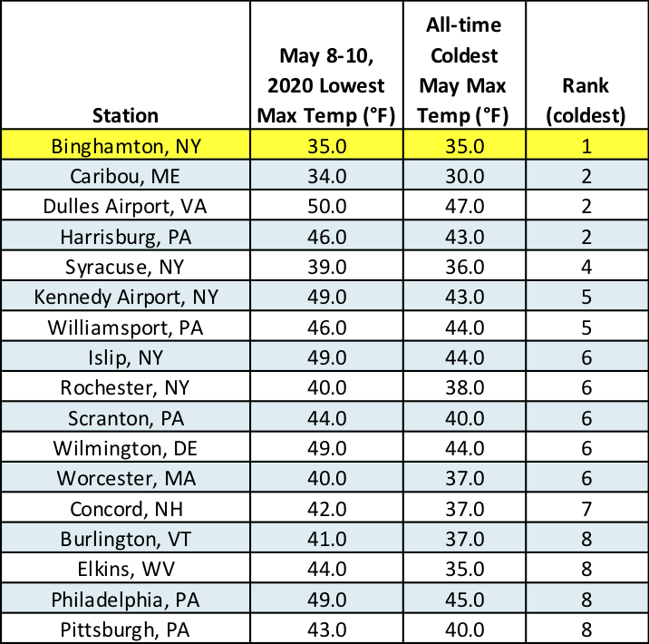
On May 9, high temperatures struggled to make it to 50°F, running as much as 30°F below normal. Binghamton, NY, had its coldest max temperature for May on record. Another 16 sites ranked their high temperatures among their 10 coldest on record for May.
High temperatures were among the ten coldest on record for May at several sites.
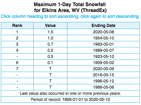
Elkins, WV, had its snowiest May day on record.
Parts of the region also saw snowfall. For instance, Elkins, WV, reported 1.5 inches of snow on May 8, making it the site’s snowiest May day on record and only the second time the site has seen an inch of snow in May. Concord, NH, which saw 0.4 inches of snow on May 9, hadn’t seen measurable snow during May in over 50 years. Burlington, VT, picked up only 0.1 inches on May 9, but it tied as the third latest measurable snow on record. Other sites saw only a trace but in the case of Islip, NY, the trace of snow made May a snowier month than February.
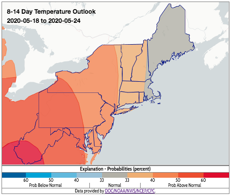
It looks like spring could make a comeback as early as next week! NOAA’s Climate Predication Center’s 8-14 day outlook indicates a tilt towards warmer-than-normal temperatures!
Above-normal temperatures are favored in CPC’s 8-14 day outlook.


