An Unusually Dry June
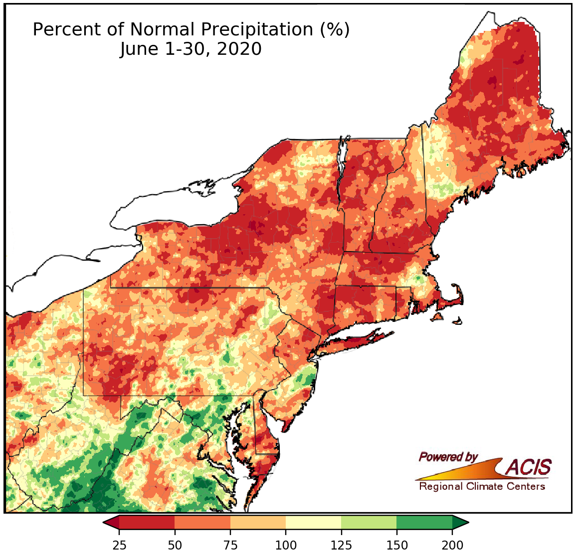
June precipitation ranged from 25% of normal to 100% of normal for much of the Northeast.
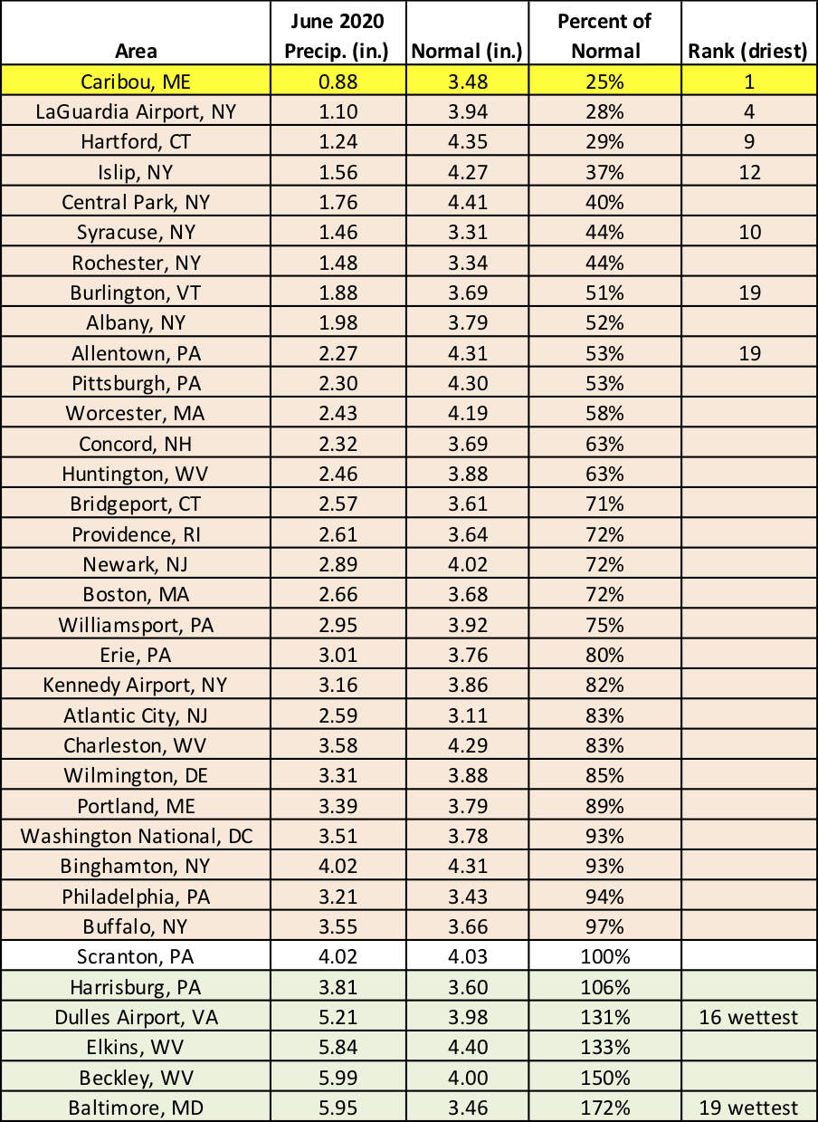
While June precipitation ranged from less than 25% of normal in parts of northern Maine and central New York to more than 200% of normal in parts of eastern West Virginia and central Maryland, a large portion of the Northeast saw between 25% and 100% of normal June precipitation. Rainfall at the 35 major climate sites ranged from 25% of normal in Caribou, ME, to 172% of normal in Baltimore, MD, with 29 of the sites being drier than normal. Seven major climate ranked this June among their 20 driest. In fact, it was the driest June since 1939 in Caribou, ME. The site received less than an inch of rain during June for only the second time on record. However, Dulles Airport, VA, and Baltimore, MD, had one of their 20 wettest Junes on record.
Caribou, ME, had its driest June on record. Six additional sites ranked this June among their 20 driest, while two sites ranked it among their 20 wettest.
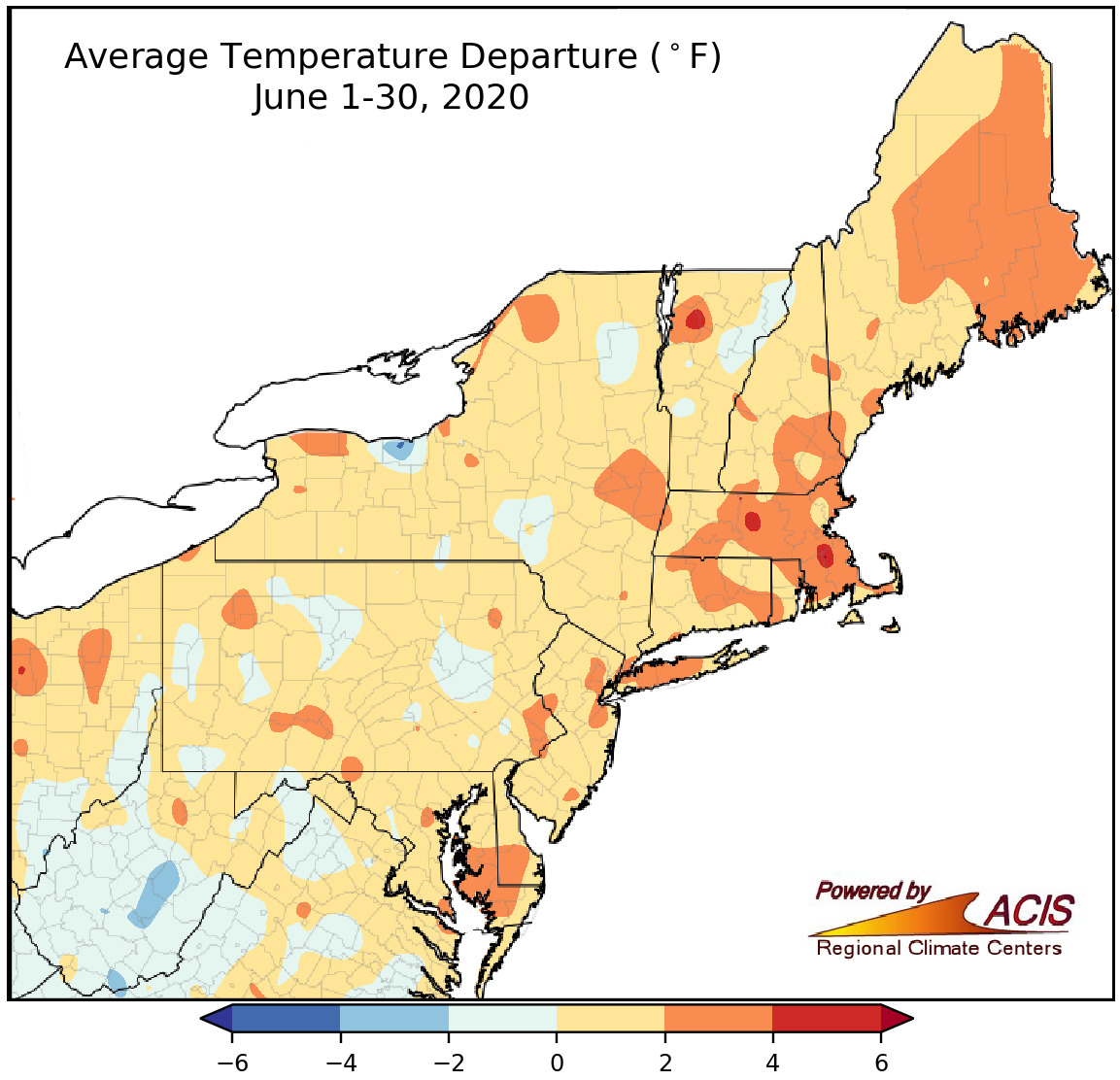
June average temperatures ranged from near normal to 4°F above normal for many areas.
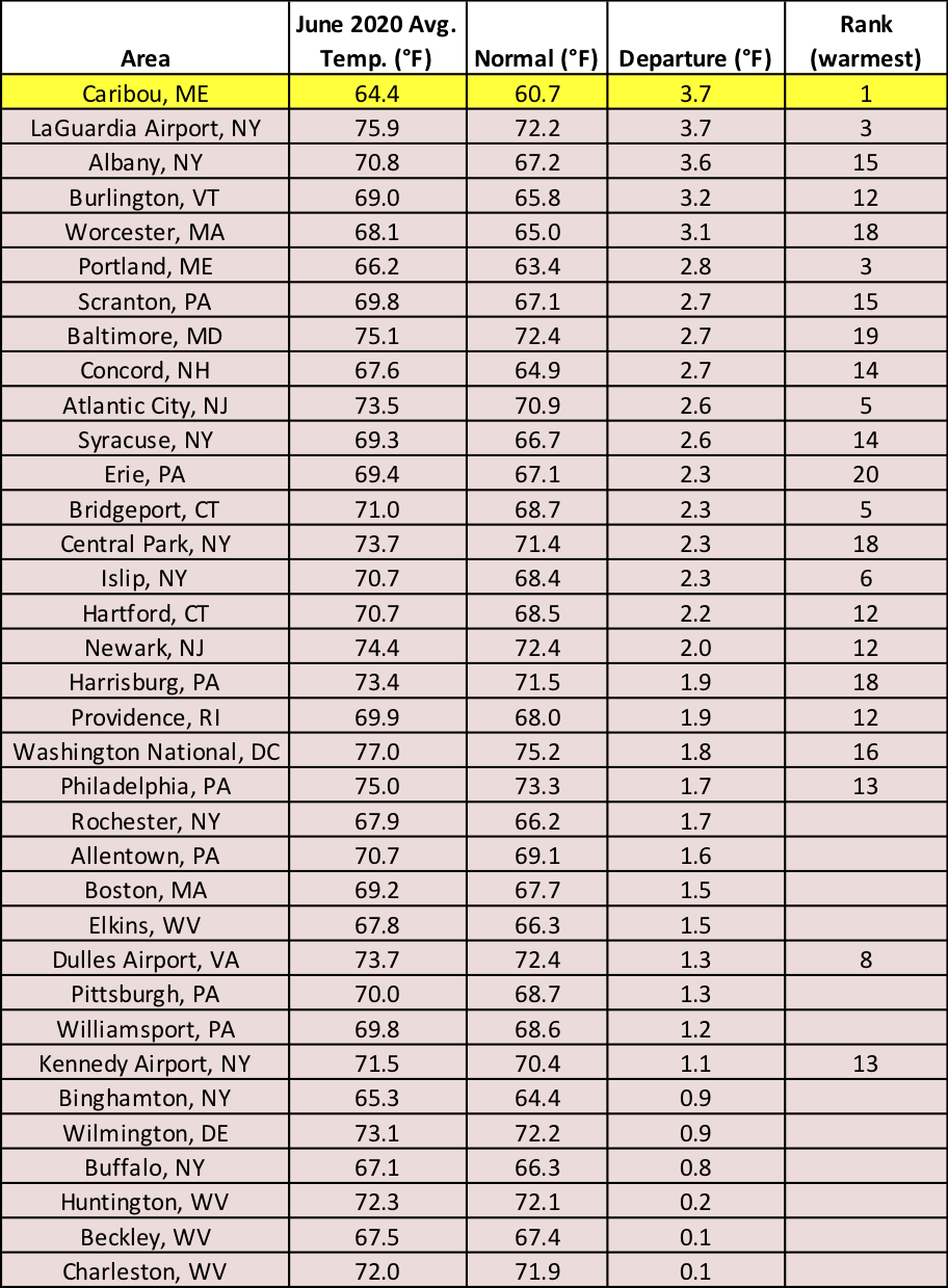
While average temperatures for June ranged from 4°F below normal to 4°F above normal, a majority of the Northeast wrapped up the month on the warm side of normal. All 35 major climate sites were warmer than normal, with average temperatures ranging from 0.1°F above normal in Beckley and Charleston, WV, to 3.7°F above normal in Caribou, ME, and LaGuardia Airport, NY. Twenty-three major climate sites ranked this June among their 20 hottest on record, with Caribou having its hottest June on record. Caribou set/tied several other temperature records in June including all-time hottest day, longest stretch of days with a high of at least 80°F, and greatest number of June days with a high of at least 80°F. Another site, Burlington, VT, tied their greatest number of June days with a high of at least 90°F.
Caribou, ME, had its hottest June on record, and another 22 major climate sites ranked this June among their 20 hottest.
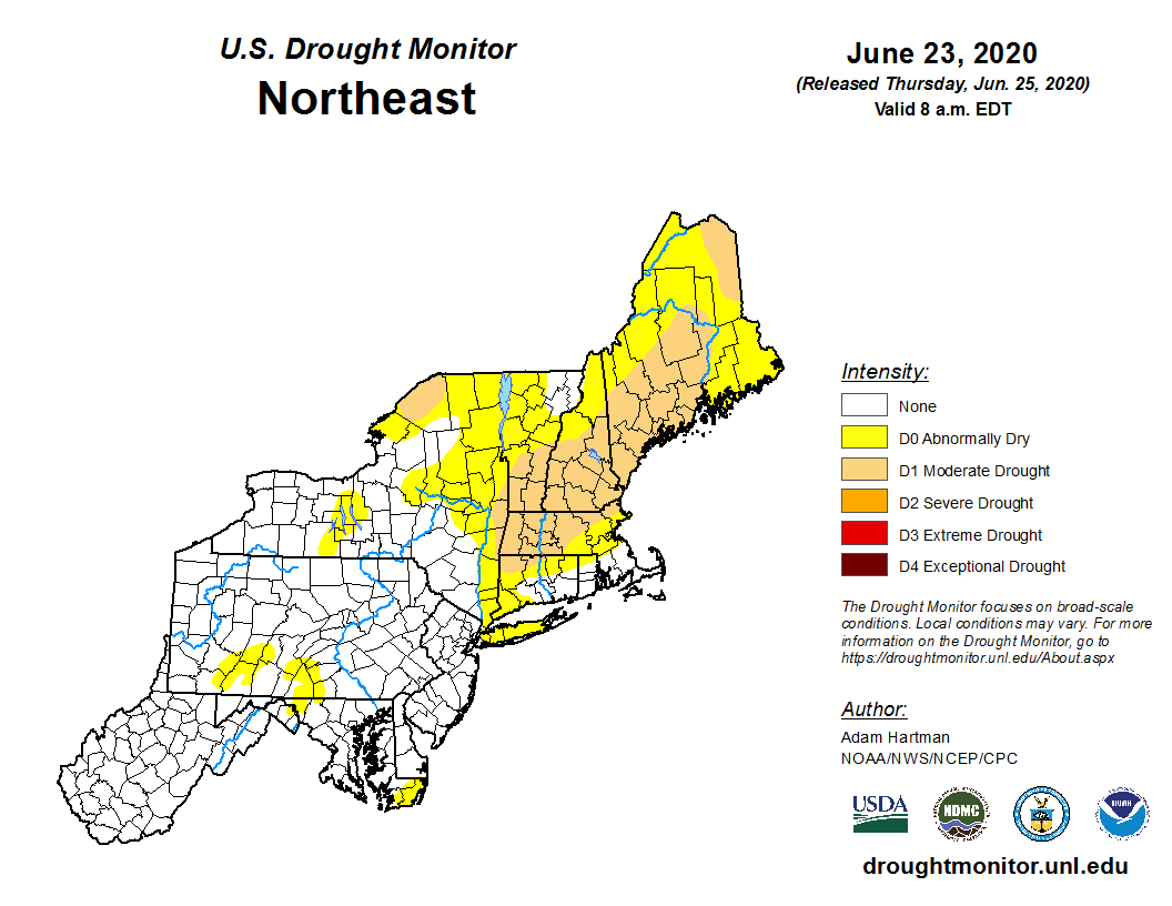
Several factors, including below-normal precipitation, above-normal temperatures, low streamflow, declining soil moisture, and agriculture, fire, and water impacts, led to the expansion of abnormal dryness and introduction of moderate drought in New York and New England during June.
Moderate drought developed in New England and New York during June.
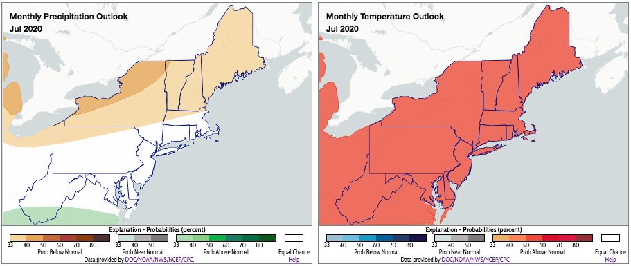
July is expected to be warmer than normal for the entire Northeast (right map). For precipitation, some areas could be drier than normal, while other areas could be wetter (left map). Click to enlarge.
NOAA’s Climate Prediction Center indicates there’s an increased likelihood of July being warmer than normal for the entire Northeast. As for precipitation, there’s a tilt towards drier-than-normal conditions for portions of New England, New York, and northern Pennsylvania and a tilt towards wetter-than-normal conditions for southern West Virginia. The rest of the Northeast falls into the equal chances category.

