Cool & Wet So Far
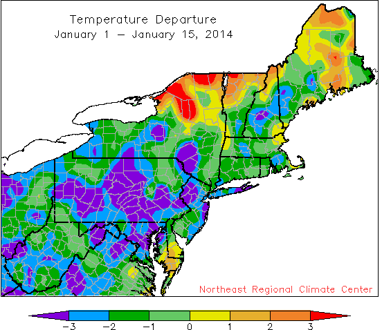
January has been colder than normal for most areas.
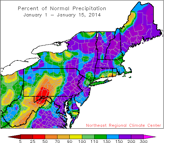
It has been a wet January, except in parts of central Pennsylvania and eastern West Virginia.
As you may have guessed from spending any time outside, January so far has been cooler and wetter than normal for much of the Northeast. With an Arctic blast early in the month, temperatures at 29 of the 35 first order climate sites have been below normal. Precipitation was plentiful at 30 sites, with a handful of those already exceeding their normal January totals. On the other hand, snow has been more hit-or-miss. While sites like Boston, MA, and Islip, NY, have seen an extra 8 or 9 inches, typically snowy places like Caribou, ME, and Syracuse, NY, have a snowfall deficit.
The cool January was somewhat moderated for several sites dueto a warm December. Overall, winter so far has been cooler than normal at 20 sites. Much of the Northeast has seen above-normal precipitation and snowfall during December and January. In fact, Dulles Airport, VA, had their wettest first half of winter on record and 20 other sites have ranked it among their top 20 wettest. As for snow, 27 sites have been snowier than normal, with Philadelphia, PA, already exceeding their normal winter snow total. The extra precipitation continues to ease dryness across the region.