A Warm, Wet April
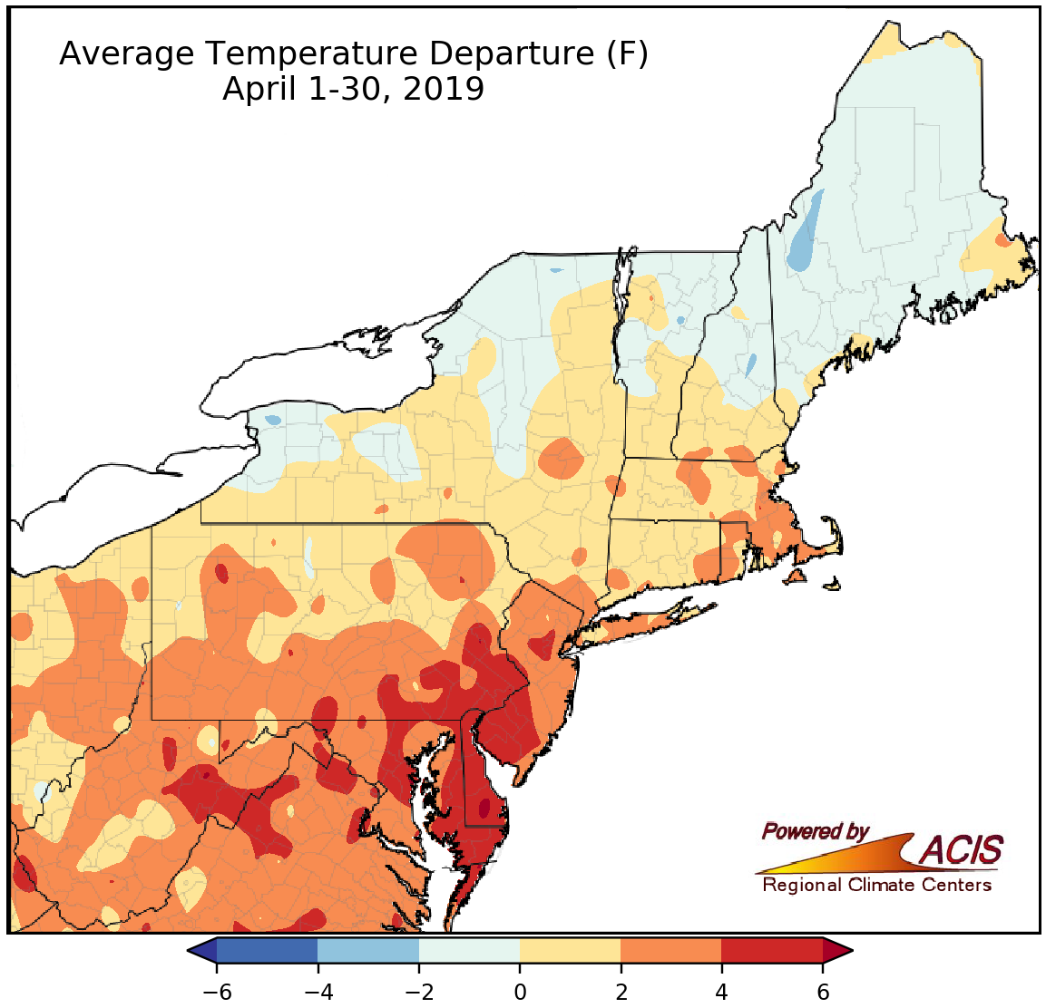
April average temperatures ranged from 2°F below normal to 6°F above normal.
April wrapped up on the warm side of normal for a large portion of the Northeast, with average temperatures up to 6°F above normal. The warmest areas were in eastern West Virginia, Maryland, Delaware, southern Pennsylvania, and New Jersey. However, parts of New York and northern New England experienced average temperatures that were as much as 2°F below normal. Thirty-three of the Northeast’s 35 major climate sites had a warmer-than-normal April, with 25 of them ranking this April among their 20 warmest on record. In fact, for ten sites this April ranked among the five warmest on record. Allentown, PA, had the greatest departure of the major climate sites at 6.3°F above normal.
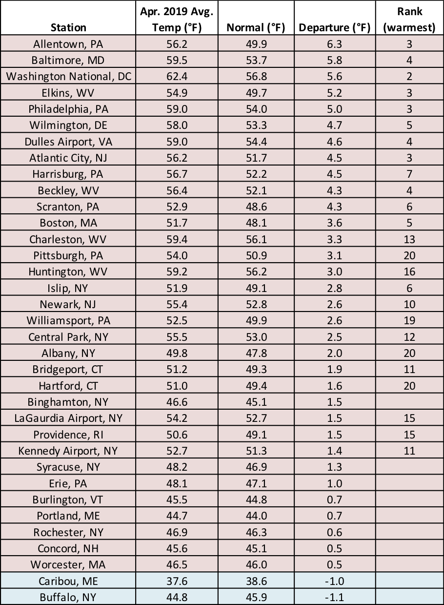
This April was among the five warmest on record for ten major climate sites.
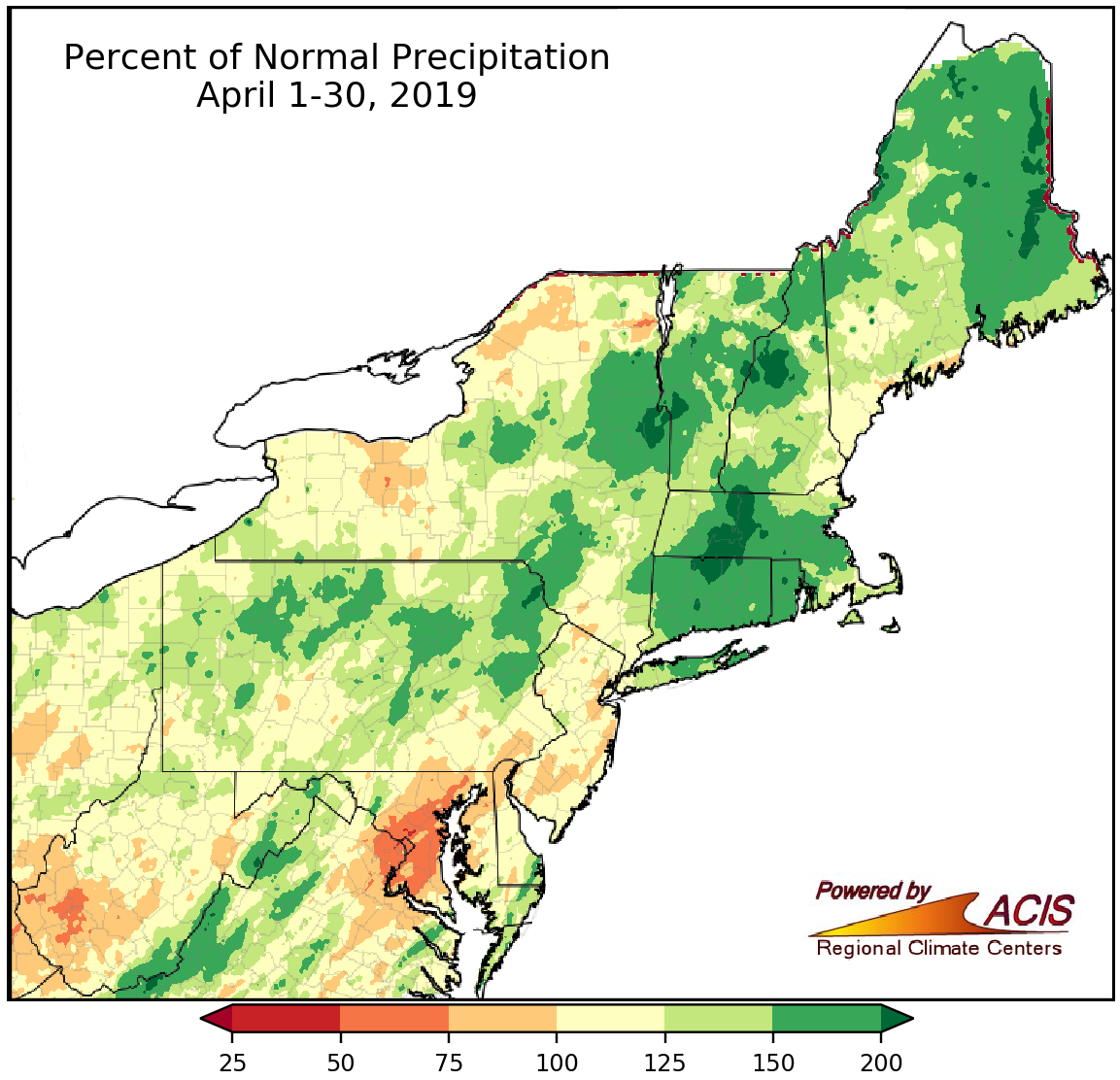
April precipitation ranged from 50% of normal to more than 200% of normal.
April showers were common across much of the Northeast, with most areas seeing between 100% and 200% of normal precipitation. The wettest spots, which picked up more than double their normal April precipitation, were located in New England and eastern New York. There were a couple of areas that did not receive as much precipitation, particularly central Maryland and southwestern West Virginia, which saw less than 75% of normal. At month’s end, precipitation at the major climate sites ranged from 46% of normal in Baltimore, MD, its 14th driest April, to 217% of normal in Hartford, CT. Of the 24 wetter-than-normal sites, 12 ranked this April among their 20 wettest on record.
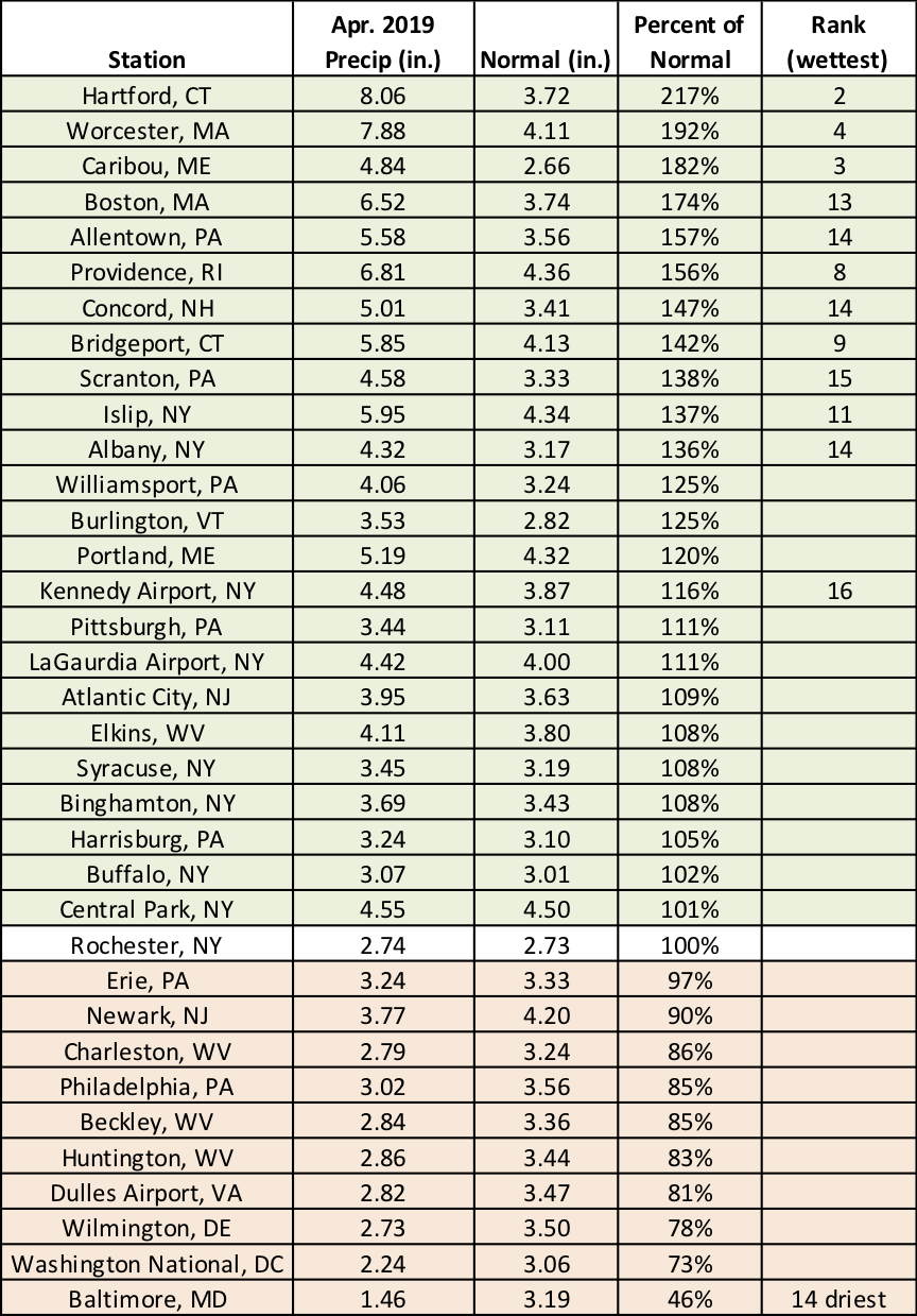
This April ranked among the 20 wettest on record for 12 major climate sites and as the 14th driest for Baltimore, MD.
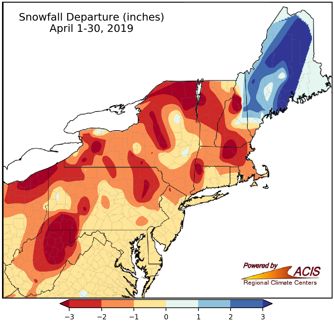
April snowfall ranged from more than three inches below normal to more than three inches above normal.
Despite plentiful precipitation, above-normal temperatures meant a lack of snowfall for almost the entire Northeast. The greatest deficits of over three inches were found throughout the region. The main exception was Maine. Parts of the state had the greatest surplus of over three inches. Thirty-one of the 35 major climate sites had below-normal April snowfall. The two major climate sites in Maine were the only ones with a surplus, with Caribou having its 19th snowiest April on record. Caribou’s record streak of days with an inch or more of snow on the ground finally came to an end on April 21 after 163 days.
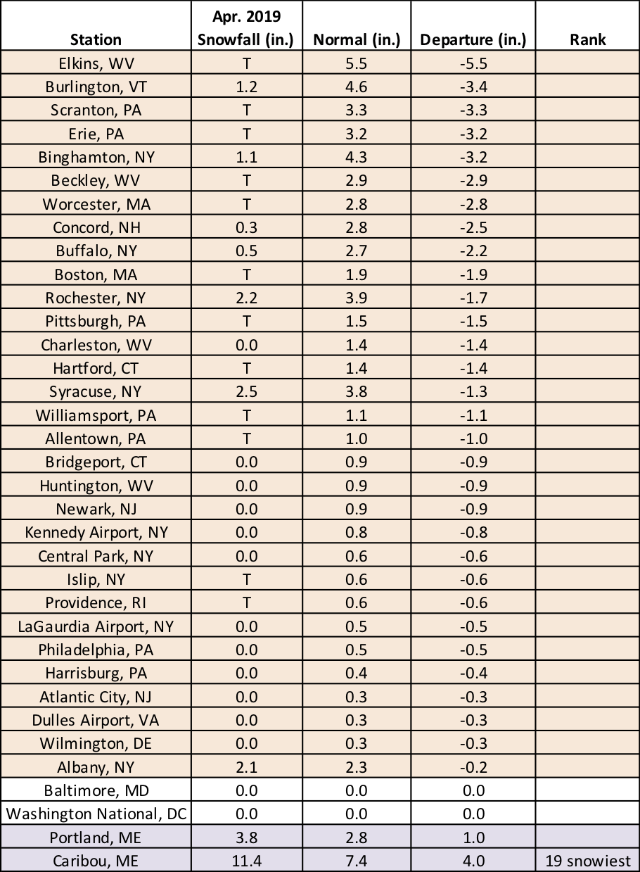
Thirty-one of the 35 major climate sites had below-normal April snowfall.
After two rounds of severe weather mid-month, a third round occurred on April 26. An EF-1 tornado touched down in Maryland, the state’s second tornado of the month, and strong thunderstorm winds caused damage in Pennsylvania and New Jersey. Golf ball-sized hail fell in Massachusetts making it only the third time since 1950 hail that size or larger has been reported in April in the state, the last being in 1969.
Warmer-than-normal temperatures are favored for May for most of the Northeast.
For May, there is a slight tilt towards wetter conditions in western areas.
NOAA’s Climate Prediction Center indicates above-normal temperatures are favored for May for most of the Northeast, with the greatest likelihood in southern parts of the region. However, equal chances of below-, near-, or above-normal temperatures were predicted for Maine. The May precipitation outlook shows a slight tilt towards wetter conditions in western parts of the region. Equal chances of below-, near-, or above-normal precipitation were predicted for the rest of the Northeast.